|
Dane County, Wisconsin
Dane County is a county in the U.S. state of Wisconsin. As of the 2020 census, the population was 561,504, making it the second-most populous county in Wisconsin after Milwaukee County. Dane County is the fastest growing county in Wisconsin. It contains nearly 10% of the population of Wisconsin, and it only contained 5% of Wisconsin's population in 1950. The county seat is Madison, which is also the state capital. Dane County is the central county of the Madison metropolitan area, as well as the Madison– Janesville– Beloit combined statistical area. History Dane County was formed in 1836 as a territorial county and organized in 1839. It was named after Nathan Dane, a Massachusetts delegate to the Congress of the Confederation who helped carve Wisconsin out of the Northwest Territory. Dane County was settled in the 1840s by settlers from New England. Geography According to the U.S. Census Bureau, the county has an area of , of which is land and (3.3%) is water. M ... [...More Info...] [...Related Items...] OR: [Wikipedia] [Google] [Baidu] [Amazon] |
Wisconsin State Capitol
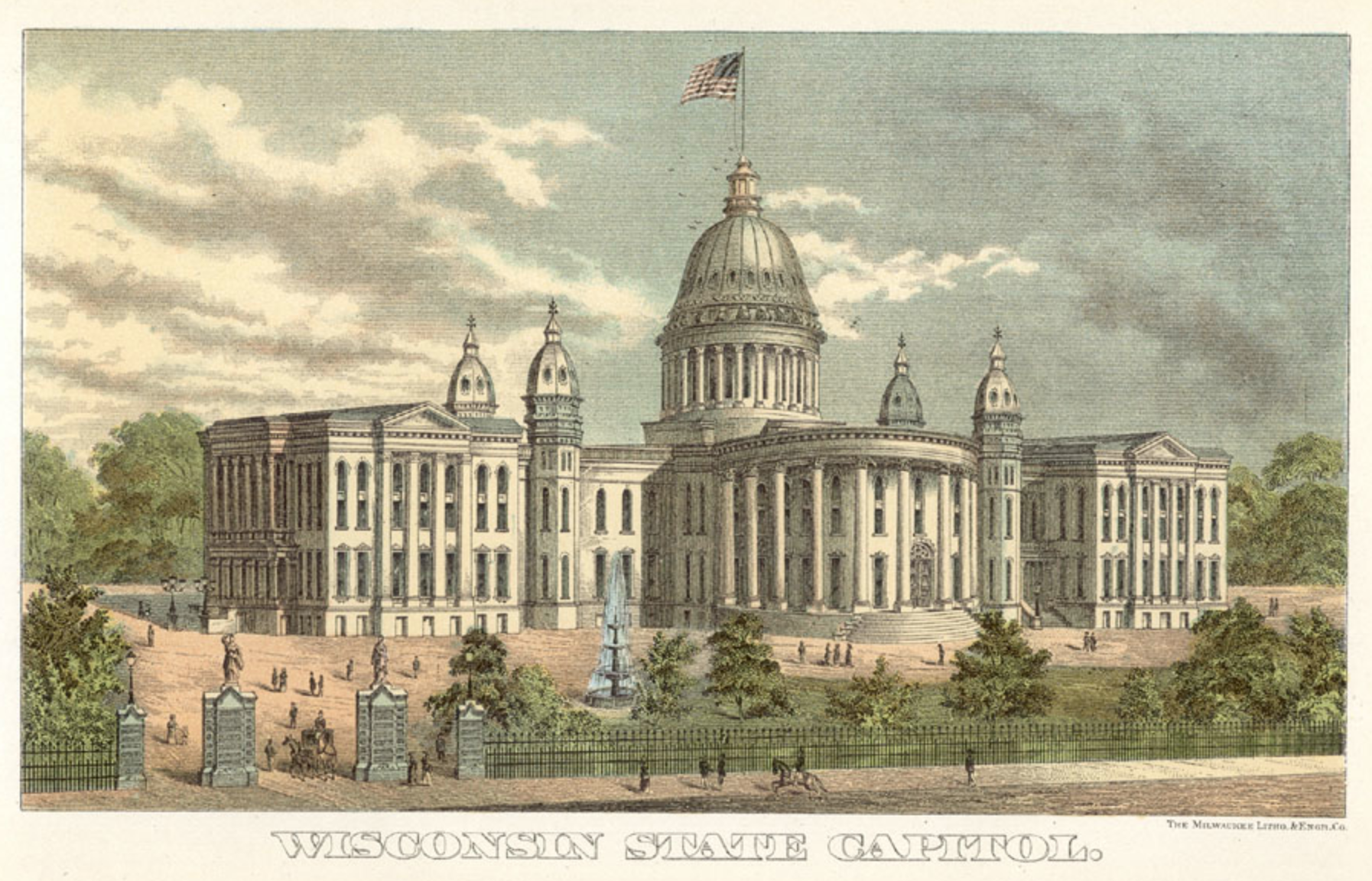
The Wisconsin State Capitol, located in Madison, Wisconsin, houses both chambers of the Wisconsin Legislature along with the Wisconsin Supreme Court and the Governor of Wisconsin, Office of the Governor. Completed in 1917, the building is the fifth to serve as the Wisconsin capitol since the first Wisconsin Territory, territorial legislature convened in 1836 and the third building since Wisconsin was granted statehood in 1848. The Wisconsin State Capitol is the tallest building in Madison, a distinction that has been preserved by legislation that prohibits buildings taller than the columns surrounding the dome. The Capitol is located at the southwestern end of the Madison Isthmus in downtown Madison, bordered by streets that make up the Capitol Square. History The first capitol was a prefabricated wood-frame council house without heat or water that had been sent hastily to Belmont, Wisconsin, Belmont. Legislators met there for 42 days after Belmont was designated the capital ... [...More Info...] [...Related Items...] OR: [Wikipedia] [Google] [Baidu] [Amazon] |
New England
New England is a region consisting of six states in the Northeastern United States: Connecticut, Maine, Massachusetts, New Hampshire, Rhode Island, and Vermont. It is bordered by the state of New York (state), New York to the west and by the Canadian provinces of New Brunswick to the northeast and Quebec to the north. The Gulf of Maine and Atlantic Ocean are to the east and southeast, and Long Island Sound is to the southwest. Boston is New England's largest city and the capital of Massachusetts. Greater Boston, comprising the Boston–Worcester–Providence Combined Statistical Area, houses more than half of New England's population; this area includes Worcester, Massachusetts, the second-largest city in New England; Manchester, New Hampshire, the largest city in New Hampshire; and Providence, Rhode Island, the capital of and largest city in Rhode Island. In 1620, the Pilgrims (Plymouth Colony), Pilgrims established Plymouth Colony, the second successful settlement in Briti ... [...More Info...] [...Related Items...] OR: [Wikipedia] [Google] [Baidu] [Amazon] |
WIS 19
State Trunk Highway 19 (often called Highway 19, STH-19 or WIS 19) is a state highway in the U.S. state of Wisconsin. It provides a more direct route from U.S. Highway 14 near Mazomanie east to Highway 16 at Watertown, passing around the north side of Madison. WIS 19 is a local connector route that links the communities of Waunakee, Sun Prairie and Watertown. The highway follows two lane surface road for the entire length with the exception of urban multilane arterials. Route description WIS 19 begins at Mazomanie at the junction of US 14 and WIS 78. It follows WIS 78 north for about a mile before turning east. It passes through the small communities of Marxville and Springfield Corners, and turns east to follow US 12 through Springfield Corners, a concurrency of about . WIS 19 enters Waunakee about east of US 12. WIS 113 joins the highway from the north for about , then turns south off WIS 19. WIS 19 reaches its junction with I-39, I-90 and I-94 on the south sid ... [...More Info...] [...Related Items...] OR: [Wikipedia] [Google] [Baidu] [Amazon] |
US 151
U.S. Highway 151 (US 151) is a United States Numbered Highway that runs through the states of Iowa and Wisconsin. The southern terminus for US 151 is at a junction with Interstate 80 (I-80) in Iowa County, Iowa, and its northern terminus is at Manitowoc, Wisconsin. The route, from south to north follows a northeasterly path through the two states. US 151 is an important corridor which connects Cedar Rapids, Iowa to Fond du Lac, Wisconsin with an expressway (except for a segment about ten miles where it uses arterial roads instead in Madison, Wisconsin). Approximately south of Dubuque, Iowa, US 151 joins with US 61. The two highways share a route from there to Dickeyville, Wisconsin. south of Dubuque, US 61/US 151 joins with US 52 and shares a route with US 52 until it veers south in Key West. In Wisconsin, US 61/US 151 joins with Wisconsin Highway 35 (WIS 35) about north of the Iowa–Wisconsin border. At Dickeyvi ... [...More Info...] [...Related Items...] OR: [Wikipedia] [Google] [Baidu] [Amazon] |
US 51
U.S. Route 51 or U.S. Highway 51 (US 51) is a major south–north United States highway that extends from the western suburbs of New Orleans, Louisiana, to within of the Wisconsin–Michigan state line. As most of the United States Numbered Highways ending with "1", it is a cross-country north–south route extending from the Gulf Coast region to the Great Lakes region. Much of the highway in northern Illinois and southern Wisconsin runs parallel to or is cosigned with Interstate 39 (I-39) and much of the route in several states also parallels the Illinois Central Railroad. From LaPlace, Louisiana, Mississippi, to Memphis, Tennessee, much of that portion of US 51 runs largely parallel or is concurrent with Interstate 55 (I-55). The highway's northern terminus is between Hurley, Wisconsin, and Ironwood, Michigan, where it ends with a roundabout at US 2. Its southern terminus is in Laplace, Louisiana, ending at US 61. US 51 is routed through the states of Louisiana, ... [...More Info...] [...Related Items...] OR: [Wikipedia] [Google] [Baidu] [Amazon] |
US 18
U.S. Highway 18 (US 18) is an east–west United States Numbered Highway in the Midwestern United States. The western terminus is in Orin, Wyoming, at an interchange with Interstate 25 (I-25). Its eastern terminus is in Downtown Milwaukee, Wisconsin. US 18, however, runs concurrent with other U.S. Highways from its western terminus to Mule Creek Junction, Wyoming. US 18 is one of the original U.S. Highways of 1926. The US 18 designation was originally proposed for a road in Michigan from Grand Haven east to Detroit. This roadway was eventually designated as US 16. Route description , - , WY , , - , SD , , - , IA , , - , WI , , - , Total , Wyoming In Wyoming, US 18 runs concurrent with US 20 from I-25 to Lusk, where US 18 branches off to run concurrently with US 85. At the unincorporated community of Mule Creek Junction in northeastern Niobrara County, US 18 leaves US 85. This stretch from US ... [...More Info...] [...Related Items...] OR: [Wikipedia] [Google] [Baidu] [Amazon] |
US 14
U.S. Route 14 or U.S. Highway 14 (US 14), an east–west route, is one of the original United States Numbered Highways of 1926. It is about long. It is roughly parallel to Interstate 90 (I-90). The highway's eastern terminus is in Chicago, Illinois. Its western terminus is the east entrance of Yellowstone National Park in Wyoming, with the western terminus of US 16 and the western terminus of the eastern segment of US 20. Route description , - , WY , , - , SD , , - , MN , , - , WI , , - , IL , , - , Total , Wyoming US 14 begins at the east entrance to Yellowstone National Park, along with US 16 and the eastern segment of US 20. It travels through Shoshone National Forest to Cody, where US 14A splits off to the north. Both routes traverse the dry Bighorn Basin, followed by a steep ascent up the Bighorn Mountains and through the Bighorn National Forest, where they rejoin at Burgess Junction. The highway desce ... [...More Info...] [...Related Items...] OR: [Wikipedia] [Google] [Baidu] [Amazon] |
US 12
U.S. Route 12 or U.S. Highway 12 (US 12) is an east–west United States Numbered Highway, running from Aberdeen, Washington, to Detroit, Michigan, for almost . The highway has mostly been superseded by Interstate 90 (I-90) and I-94, but, unlike most U.S. Highways that have been superseded by an Interstate, US 12 remains intact as an important link for local and regional destinations. The highway's western terminus in Aberdeen is at an intersection with US 101, while the highway's eastern terminus in Downtown Detroit is at the corner of Michigan and Cass avenues, near Campus Martius Park. Route description , - , WA , , - , ID , , - , MT , , - , ND , , - , SD , , - , MN , , - , WI , , - , IL , , - , IN , , - , MI , , - , Total , Washington The western terminus of US 12 is located in Aberdeen. The highway loosely follows the eastbound leg of the Lewis and Clark Expedition, between Wallula and Clarkston, thus being ... [...More Info...] [...Related Items...] OR: [Wikipedia] [Google] [Baidu] [Amazon] |
Interstate 94
Interstate 94 (I-94) is an east–west Interstate Highway connecting the Great Lakes and northern Great Plains regions of the United States. Its western terminus is just east of Billings, Montana, at a junction with I-90; its eastern terminus is in Port Huron, Michigan, where it meets with I-69 and crosses the Blue Water Bridge into Sarnia, Ontario, Canada, where the route becomes Ontario Highway 402. It thus lies along the primary overland route from Seattle (via I-90) to Toronto (via Ontario Highway 401) and is the only east–west Interstate Highway to have a direct connection to Canada. It is the longest Interstate whose route number is not divisible by 5. I-94 intersects with I-90 several times: at its western terminus; Tomah to Madison in Wisconsin; in Chicago, Illinois; and in Lake Station, Indiana. Major cities that I-94 connects to are Billings, Bismarck, Fargo, Minneapolis–Saint Paul, Madison, Milwaukee, Chicago, and Detroit. Route description , ... [...More Info...] [...Related Items...] OR: [Wikipedia] [Google] [Baidu] [Amazon] |
Interstate 90
Interstate 90 (I-90) is an east–west transcontinental freeway and the longest Interstate Highway in the United States at . It begins in Seattle, Washington, and travels through the Pacific Northwest, Mountain states, Mountain West, Great Plains, Midwestern United States, Midwest, and the Northeastern United States, Northeast, ending in Boston, Massachusetts. The highway serves 13 states and has 15 List of auxiliary Interstate Highways, auxiliary routes, primarily in major cities such as Chicago, Cleveland, Buffalo, New York, Buffalo, and Rochester, New York, Rochester. I-90 begins at Washington State Route 519 in Seattle and crosses the Cascade Range in Washington and the Rocky Mountains in Montana. It then traverses the northern Great Plains and travels southeast through Wisconsin and the Chicago area by following the southern shore of Lake Michigan. The freeway continues across Indiana and follows the shore of Lake Erie through Ohio and Pennsylvania to Buffalo. I-90 travels ... [...More Info...] [...Related Items...] OR: [Wikipedia] [Google] [Baidu] [Amazon] |


