|
Dahl Al Hamam
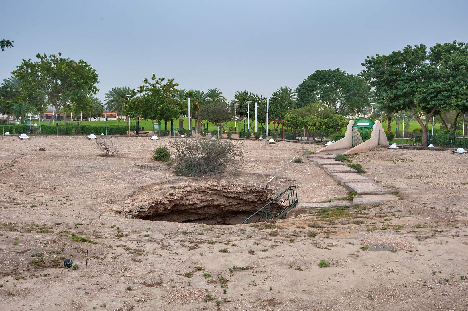
Dahl Al Hamam ( ar, دحل الحمام, Daḩl al Ḩammām) is a district in Qatar, located in the municipality of Ad Dawhah. Together with Madinat Khalifa North, which it is adjacent to in the south-west, it makes up Zone 32 which has a population of 12,364. Etymology In Arabic, ''dahl'' translates to "cavern A cave or cavern is a natural void in the ground, specifically a space large enough for a human to enter. Caves often form by the weathering of rock and often extend deep underground. The word ''cave'' can refer to smaller openings such as sea ...". The second constituent, "hamam", translates to pigeon. The district earned its name from a prominent cavern, presently found in Dahl Al Hamam Park, in which pigeons frequently laid their eggs. Visitor attractions Dahl Al Hamam Park is among the most popular parks in Qatar. Most notable about the park is the presence of an iconic cavern in its northern section which earned the district its name. For the landscaping, ... [...More Info...] [...Related Items...] OR: [Wikipedia] [Google] [Baidu] |
Qatar
Qatar (, ; ar, قطر, Qaṭar ; local vernacular pronunciation: ), officially the State of Qatar,) is a country in Western Asia. It occupies the Qatar Peninsula on the northeastern coast of the Arabian Peninsula in the Middle East; it shares its sole land border with Saudi Arabia to the south, with the rest of its territory surrounded by the Persian Gulf. The Gulf of Bahrain, an inlet of the Persian Gulf, separates Qatar from nearby Bahrain. The capital is Doha, home to over 80% of the country's inhabitants, and the land area is mostly made up of flat, low-lying desert. Qatar has been ruled as a hereditary monarchy by the House of Thani since Mohammed bin Thani signed a treaty with the British in 1868 that recognised its separate status. Following Ottoman rule, Qatar became a British protectorate in 1916, and gained independence in 1971. The current emir is Tamim bin Hamad Al Thani, who holds nearly all executive and legislative authority under the Constitution of Qat ... [...More Info...] [...Related Items...] OR: [Wikipedia] [Google] [Baidu] |
Municipalities Of Qatar
Since 2015, Qatar has been divided into eight municipalities. In 2004, a new municipality, Al Daayen, was created under Resolution No. 13, formed from parts of Umm Salal and Al Khawr; at the same time, Al Ghuwariyah was merged with Al Khawr; Al Jumaliyah was merged with Ar Rayyan; Jarayan al Batnah was split between Al Rayyan and Al Wakrah; and Mesaieed was merged with Al Wakrah. In 2014, the western city of Al-Shahaniya split off from Al Rayyan Municipality to form its own municipality. For statistical purposes, the municipalities are further subdivided into 98 zones (as of 2015), which are in turn subdivided into districts and blocks, the latter being the lowest subdivision. History According to Ministry of Municipality and Urban Planning, in 1963, the first municipality was the Municipality of Qatar, created under Law No. 11. Later in the same year, its name was changed to Municipality of Doha by Law No. 15. Then, on 17 July 1972, Ar Rayyan, Al Wakrah, Al Khawr and Dhekra, As ... [...More Info...] [...Related Items...] OR: [Wikipedia] [Google] [Baidu] |
Ad-Dawhah (municipality)
Ad-Dawhah ( ar, الدوحة, ' or ''ad-Dōḥa'', ) is the one of the eight municipalities of Qatar. It is the most populous municipality with a population of 956,457, and is the municipality of Qatar's capital city, Doha. Etymology According to the Ministry of Municipality and Environment, the name "Doha" originated from the Arabic language, Arabic term "dohat", which means "roundness". This name is derived from the rounded bays surrounding the area's coastline. Administration According to the Ministry of Municipality and Urban Planning, the Municipality of Qatar became the first municipality to be established in 1963. Later that year, the name was changed to Municipality of Ad Dawhah. The country has been divided into eight municipalities since 2014. Doha is the most populated municipality among them with a population of 956,457 as of 2015. The exclave of Industrial Area (Doha), Doha Industrial Area and the island of Halul Island, Halul, 80 km away from Doha, fall with ... [...More Info...] [...Related Items...] OR: [Wikipedia] [Google] [Baidu] |
Zones Of Qatar
In the administrative divisions of Qatar, zones are the second-highest level of government after municipalities of Qatar, municipalities. As of the 2015 census, there were 98 zones. However, several of these zones are not currently in use. Over the years, numerous changes in zones have taken place. For instance, in the 2010 census, Zone 69 was transferred to Al Daayen Municipality, Zones 50 and 58 were added to Ad-Dawhah (municipality), Ad-Dawhah Municipality, and part of Zone 74 was merged with Zone 70 of Al Daayen Municipality. Zones 1 – 50, 57, 58, and 60 – 68 are reserved for Ad-Dawhah Municipality; Zones 51 – 56, 81, 83, 96 and 97 are reserved for Al Rayyan Municipality; Zones 69 and 70 are reserved for Al Daayen Municipality; Zone 71 is reserved for Umm Salal Municipality; Zones 74 – 76 are reserved for Al Khor Municipality; Zones 77 – 79 are reserved for Al Shamal Municipality; Zones 90 – 95 and 98 are reserved for Al Wakrah (municipality), Al Wakrah Municipality ... [...More Info...] [...Related Items...] OR: [Wikipedia] [Google] [Baidu] |
Zone 32, Qatar
Zone 28 is a zone of the municipality of Ad Dawhah in the state of Qatar Qatar (, ; ar, قطر, Qaṭar ; local vernacular pronunciation: ), officially the State of Qatar,) is a country in Western Asia. It occupies the Qatar Peninsula on the northeastern coast of the Arabian Peninsula in the Middle East; it .... The main districts recorded in the 2015 population census were Madinat Khalifa North and Dahl Al Hamam. Demographics Land use The Ministry of Municipality and Environment (MME) breaks down land use in the zone as follows. References Zones of Qatar Doha {{Qatar-geo-stub ... [...More Info...] [...Related Items...] OR: [Wikipedia] [Google] [Baidu] |
Municipalities Of Qatar
Since 2015, Qatar has been divided into eight municipalities. In 2004, a new municipality, Al Daayen, was created under Resolution No. 13, formed from parts of Umm Salal and Al Khawr; at the same time, Al Ghuwariyah was merged with Al Khawr; Al Jumaliyah was merged with Ar Rayyan; Jarayan al Batnah was split between Al Rayyan and Al Wakrah; and Mesaieed was merged with Al Wakrah. In 2014, the western city of Al-Shahaniya split off from Al Rayyan Municipality to form its own municipality. For statistical purposes, the municipalities are further subdivided into 98 zones (as of 2015), which are in turn subdivided into districts and blocks, the latter being the lowest subdivision. History According to Ministry of Municipality and Urban Planning, in 1963, the first municipality was the Municipality of Qatar, created under Law No. 11. Later in the same year, its name was changed to Municipality of Doha by Law No. 15. Then, on 17 July 1972, Ar Rayyan, Al Wakrah, Al Khawr and Dhekra, As ... [...More Info...] [...Related Items...] OR: [Wikipedia] [Google] [Baidu] |
Madinat Khalifa North
Madinat Khalifa North ( ar, مدينه خليفه الشماليه, Madīnat Khalīfah ash Shamālīyah) is a north-western district of Doha, Qatar. It is one of the two sections of Madinat Khalifa, the other being Madinat Khalifa South. The district was constructed in the 1970s by the Emir of Qatar at the time, Sheikh Khalifa bin Hamad Al Thani, primarily to serve as a residential district for Qatari families. The district is situated between the adjacent city of Al Rayyan and downtown Doha. Etymology In Arabic, "madinat" means city. The second part of the name was received from Khalifa bin Hamad Al Thani, who was emir of Qatar from 1972 to 1995 and who oversaw the district's development. Finally, the "north" component is used to differentiate from the Madinat Khalifa South district. Landmarks *Madinat Khalifa Health Center on Al Najda Street. *Qatar College of Technology (Men's Section) on Al Karaana Street. *Al Meera Supercenter on Al Deebel Street. *Q-Post branch on Al De ... [...More Info...] [...Related Items...] OR: [Wikipedia] [Google] [Baidu] |
Arabic Language
Arabic (, ' ; , ' or ) is a Semitic language spoken primarily across the Arab world.Semitic languages: an international handbook / edited by Stefan Weninger; in collaboration with Geoffrey Khan, Michael P. Streck, Janet C. E.Watson; Walter de Gruyter GmbH & Co. KG, Berlin/Boston, 2011. Having emerged in the 1st century, it is named after the Arab people; the term "Arab" was initially used to describe those living in the Arabian Peninsula, as perceived by geographers from ancient Greece. Since the 7th century, Arabic has been characterized by diglossia, with an opposition between a standard prestige language—i.e., Literary Arabic: Modern Standard Arabic (MSA) or Classical Arabic—and diverse vernacular varieties, which serve as mother tongues. Colloquial dialects vary significantly from MSA, impeding mutual intelligibility. MSA is only acquired through formal education and is not spoken natively. It is the language of literature, official documents, and formal written m ... [...More Info...] [...Related Items...] OR: [Wikipedia] [Google] [Baidu] |
Cavern
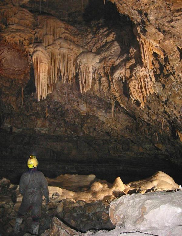
A cave or cavern is a natural void in the ground, specifically a space large enough for a human to enter. Caves often form by the weathering of rock and often extend deep underground. The word ''cave'' can refer to smaller openings such as sea caves, rock shelters, and grottos, that extend a relatively short distance into the rock and they are called ''exogene'' caves. Caves which extend further underground than the opening is wide are called ''endogene'' caves. Speleology is the science of exploration and study of all aspects of caves and the cave environment. Visiting or exploring caves for recreation may be called ''caving'', ''potholing'', or ''spelunking''. Formation types The formation and development of caves is known as ''speleogenesis''; it can occur over the course of millions of years. Caves can range widely in size, and are formed by various geological processes. These may involve a combination of chemical processes, erosion by water, tectonic forces, microorgani ... [...More Info...] [...Related Items...] OR: [Wikipedia] [Google] [Baidu] |
Cave In Dahl Al Hamam Park
A cave or cavern is a natural void in the ground, specifically a space large enough for a human to enter. Caves often form by the weathering of rock and often extend deep underground. The word ''cave'' can refer to smaller openings such as sea caves, rock shelters, and grottos, that extend a relatively short distance into the rock and they are called ''exogene'' caves. Caves which extend further underground than the opening is wide are called ''endogene'' caves. Speleology is the science of exploration and study of all aspects of caves and the cave environment. Visiting or exploring caves for recreation may be called ''caving'', ''potholing'', or ''spelunking''. Formation types The formation and development of caves is known as ''speleogenesis''; it can occur over the course of millions of years. Caves can range widely in size, and are formed by various geological processes. These may involve a combination of chemical processes, erosion by water, tectonic forces, microorganisms ... [...More Info...] [...Related Items...] OR: [Wikipedia] [Google] [Baidu] |


