|
Dadeland North Station
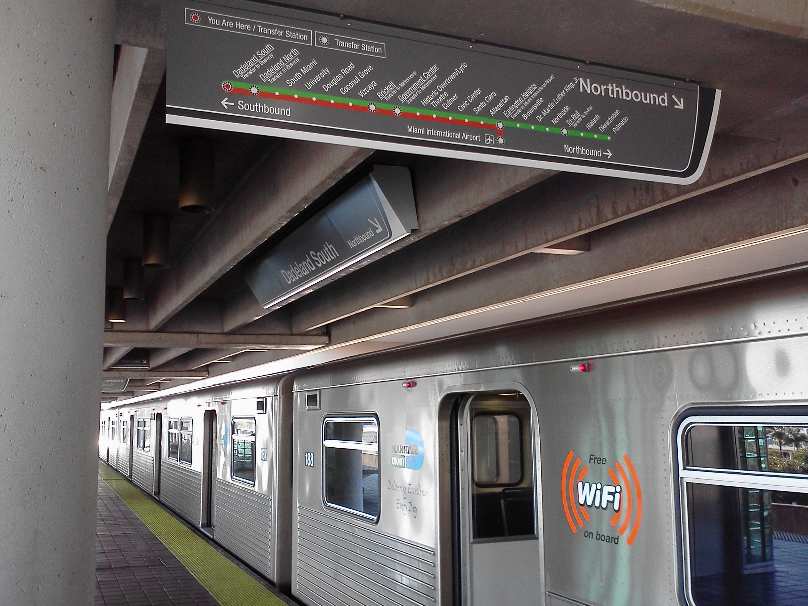
Dadeland North station is a station on the Metrorail rapid transit system in the Dadeland district of Glenvar Heights, Florida. This station is located at the intersection of South Dixie Highway (US 1) and Southwest 83rd Street on the Snapper Creek, two blocks north of Kendall Drive and two blocks south from the US 1– Snapper Creek Expressway (SR 878) junction. It opened to service May 20, 1984. It is located along the border of Kendall and Glenvar Heights, two census-designated places. The station is in both areas. " Miami-Dade County. Retrieved on January 3, 2015. "Dadeland North ..tation Address: 8300 South Dixie Highway" Dadeland North serves the communities of [...More Info...] [...Related Items...] OR: [Wikipedia] [Google] [Baidu] |
Metrorail (Miami-Dade County)
Metrorail is the heavy rail rapid transit system of Miami and Miami-Dade County in the U.S. state of Florida. Metrorail is operated by Miami-Dade Transit (MDT), a departmental agency of Miami-Dade County. Opened in 1984, it is Florida's only rapid transit metro system, and is currently composed of two lines of 23 stations on of standard gauge track. Metrorail serves the urban core of Miami, connecting Miami International Airport, the Health District, Downtown Miami, and Brickell with the northern developed neighborhoods of Hialeah and Medley to the northwest, and to suburban The Roads, Coconut Grove, Coral Gables, and South Miami, ending at urban Dadeland in Kendall. Metrorail connects to the Metromover in Downtown, which provides metro service to the entirety of Downtown and Brickell. Additionally, it connects to South Florida's commuter rail system at Tri-Rail station, as well as Metrobus routes at all stations. In , the system had rides, and about per day in . In 20 ... [...More Info...] [...Related Items...] OR: [Wikipedia] [Google] [Baidu] |
Kendall, Florida
Kendall is a census-designated place in Miami-Dade County, Florida. At the 2020 census, the area had a population of 80,241. While the US Census Bureau has set definite boundaries for Kendall as a CDP, the community has a highly ambiguous local definition. Prior to the 1950s, the term "Kendall" was used to describe a region centered around U.S.-1, bounded by Snapper Creek to the north, the Everglades to the west, Old Cutler Road to the east, and the former community of Rockdale to the south. This area was largely uninhabited, generally consisting of pine rockland interspersed with fields and groves. As the region experienced rapid development in the 1950s, the moniker "Kendall" came to refer to the various communities built in the vicinity of present-day Pinecrest and the eastern half of the current Kendall CDP. When growth shifted west in the 1970s, 80s, and 90s, the usage of the term steadily shifted west concurrently, and today it is most often applied to the area more form ... [...More Info...] [...Related Items...] OR: [Wikipedia] [Google] [Baidu] |
Railway Stations In The United States Opened In 1984
Rail transport (also known as train transport) is a means of transport that transfers passengers and goods on wheeled vehicles running on rails, which are incorporated in tracks. In contrast to road transport, where the vehicles run on a prepared flat surface, rail vehicles (rolling stock) are directionally guided by the tracks on which they run. Tracks usually consist of steel rails, installed on sleepers (ties) set in ballast, on which the rolling stock, usually fitted with metal wheels, moves. Other variations are also possible, such as "slab track", in which the rails are fastened to a concrete foundation resting on a prepared subsurface. Rolling stock in a rail transport system generally encounters lower frictional resistance than rubber-tyred road vehicles, so passenger and freight cars (carriages and wagons) can be coupled into longer trains. The operation is carried out by a railway company, providing transport between train stations or freight customer faciliti ... [...More Info...] [...Related Items...] OR: [Wikipedia] [Google] [Baidu] |
Metrorail (Miami-Dade County) Stations In Miami-Dade County, Florida
Metrorail or metro rail may refer to: * Rapid transit, a frequent electric rail system commonly called a metro * Metrorail (South Africa), a commuter rail system operator in South Africa ** Metrorail Eastern Cape, commuter rail lines serving Port Elizabeth and East London ** Metrorail Gauteng, the commuter rail system in Gauteng province (including Johannesburg and Pretoria) ** Metrorail KwaZulu-Natal, the commuter rail system in Durban ** Metrorail Western Cape, the commuter rail system in Cape Town * Los Angeles Metro Rail, the rapid transit and light rail system in Los Angeles, California, USA * Washington Metro, the rapid transit system in Washington, D.C., USA * Metrorail (Miami-Dade County), the rapid transit system in Miami-Dade County, primarily, Miami, Florida, USA * METRORail, the light rail system in Houston, Texas, USA * Valley Metro Rail, the light rail system in the Phoenix metropolitan area in Arizona, USA * Buffalo Metro Rail, the rapid transit system in Buffalo, New ... [...More Info...] [...Related Items...] OR: [Wikipedia] [Google] [Baidu] |
Orange Line (Metrorail)
Orange Line may refer to: Public transit in Asia *Orange Line or Delhi Airport Metro Express in Delhi, India *Orange Line (Jaipur Metro) in Jaipur, India *Orange Line (Kanpur Metro), in Kanpur, India *Orange Line (Nagpur Metro), in Nagpur, India *Orange Line (Namma Metro) a planned line in Bengaluru, India *Orange Line (Lahore Metro) in Lahore, Pakistan *Orange Line, KMRT, Kaohsiung, Taiwan *Orange Line (Bangkok), a planned line in Bangkok, Thailand *Seoul Subway Line 3, Seoul, South Korea *Tung Chung line, Hong Kong, China * Zhonghe-Xinlu Line of Taipei Metro, Taipei, Taiwan *PNR Metro South Commuter Line, Manila, Philippines *Ampang Line, Kuala Lumpur *Circle MRT line, Singapore Public transit in Europe * Kaluzhsko-Rizhskaya line, Moscow, Russia *London Overground, London, UK *Paris Métro Line 5, Paris, France *Brussels Metro line 2, Brussels, Belgium *Line 7 (Madrid Metro), Madrid, Spain * Barcelona Metro line 9, Barcelona, Spain *U9 (Berlin U-Bahn), Berlin, Germany Public tr ... [...More Info...] [...Related Items...] OR: [Wikipedia] [Google] [Baidu] |
Green Line (Metrorail)
Green Line may refer to: Places Military and political * Green Line (France), the German occupation line in France during World War II * Green Line (Israel), the 1949 armistice line established between Israel and its neighbours ** City Line (Jerusalem), part of the Green Line between Israel and Jordan which divided Jerusalem from 1948 and 1967 * Green Line (Lebanon), demarcation line between Christian and Muslim militias in Beirut during the Lebanese Civil War * Green Line, that part of the United Nations Buffer Zone in Cyprus that runs through Nicosia and a colloquial name for the buffer zone as a whole * Green Line, part of the GHQ Line defence works built in the United Kingdom during World War II * Gothic Line, a German defensive line in Italy built during World War II, renamed the "Green Line" in June 1944 Other * Green Line (Atlanta development corridor), a development corridor in Downtown Atlanta * The cities of Virginia Beach, Virginia, and Chico, California each hav ... [...More Info...] [...Related Items...] OR: [Wikipedia] [Google] [Baidu] |
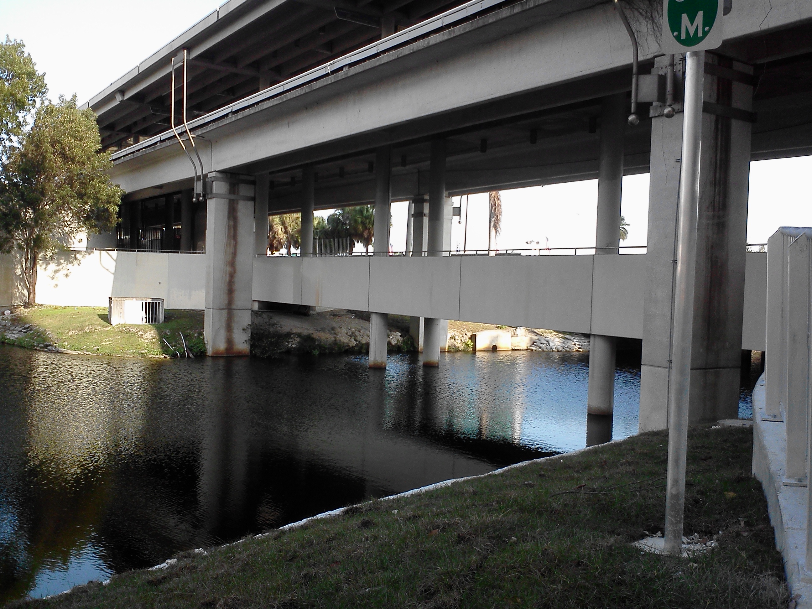
Dadeland North Over Snapper Creek
Dadeland is a commercial district and urban neighborhood similar to an edge city, amid the sprawling metropolitan Miami suburbs of Kendall, Glenvar Heights, and Pinecrest, in the U.S. state of Florida, at the end of the Metrorail line. History Development in the then-desolate area began in earnest in 1960 with the completion of Palmetto Expressway (Florida 826) and Dadeland Mall, the largest shopping mall in greater Miami at the time. As Kendall became a center for urban sprawl in south Florida post-World War II, Dade County constructed two freeways in the area, Don Shula Expressway (Florida 874) and Snapper Creek Expressway (Florida 878), between 1972 and 1980. Rapid transit service into Downtown Miami commenced with the completion of the Miami Metrorail in 1984, providing rail service to suburban commuters in southern Dade into Miami and greater South Florida's central business district. Residential and office complexes were constructed in the area in the 1990s and 2000s d ... [...More Info...] [...Related Items...] OR: [Wikipedia] [Google] [Baidu] |
Dadeland Mall
Dadeland Mall is a large enclosed shopping mall located in Kendall, Florida, in the Dadeland district. The mall, originally developed by the Joseph Meyerhoff Company of Baltimore, opened October 1, 1962 as a , open-air complex of 60 stores and services.New Kendall wing brings trendy twist to Dadeland Mall, Iva Paiva Cordle, July 14, 2013, http://www.miamiherald.com/2013/07/14/3497931/new-kendall-wing-brings-trendy.html Dadeland Mall is located between South Dixie Highway (US-1) and the Palmetto Expressway (SR 826) at its southern terminus where it meets US-1. It is also served by the Dadeland North Metrorail station, which has a pedestrian walkway connecting to the mall. The Dadeland South station is located just south of the mall. The anchor stores are 2 Macy's stores, Saks Fifth Avenue, and JCPenney. History Originally an open-air center, the mall was anchored by Burdine's (spelled with an apostrophe at the time), and also boasted a Food Fair grocery, full-service Gray Dru ... [...More Info...] [...Related Items...] OR: [Wikipedia] [Google] [Baidu] |
Dadeland Station
Dadeland Station is a lifestyle shopping center located in Dadeland, Florida in the metropolitan Miami suburb of Glenvar Heights, near the border with Kendall. It is located immediately across the Snapper Creek and within walking distance of the popular Dadeland Mall. Dadeland Station is directly served by the Miami Metrorail at Dadeland North station. Stores * Michaels * Dick's Sporting Goods (formerly Sports Authority) * Best Buy * Target * Bed Bath & Beyond * PetSmart * Lan-Pan Asian Cafe * Starbucks (Inside Target) * Pizza Hut Express (Inside Target) * Hair Cuttery * Nails by VN * Avis & Budget Car Rental * Enterprise Enterprise (or the archaic spelling Enterprize) may refer to: Business and economics Brands and enterprises * Enterprise GP Holdings, an energy holding company * Enterprise plc, a UK civil engineering and maintenance company * Enterpris ... Car Rental * Zaniac Tutoring Services The Towers of Dadeland Located directly across from Dadeland Stat ... [...More Info...] [...Related Items...] OR: [Wikipedia] [Google] [Baidu] |
Pinecrest, Florida
Pinecrest is a Village (United States), suburban village in Miami-Dade County, Florida, United States. The 2010 United States census, 2010 U.S. census recorded a population of 18,223; as of 2019, this has increased by over five percent to an estimated 19,155. Pinecrest is governed by a five-member Village Council and operates under the Council-Manager form of government. 33156, the zip code that encompasses most of the village, has been consistently ranked as one of the most expensive in the United States. Geography Pinecrest is located at (25.6619, −80.3076). According to the United States Census Bureau, U.S. Census Bureau, the village has a total area of . of it is land and 0.13% is water. Community projects Pinecrest's projects since 1996 include the addition of several new parks, development of Wi-Fi technology and beautification projects which included thousands of trees being planted, unique street signs being posted Village-wide, and roads being repaved. By plan ... [...More Info...] [...Related Items...] OR: [Wikipedia] [Google] [Baidu] |
Dadeland, Florida
Dadeland is a commercial district and urban neighborhood similar to an edge city, amid the sprawling metropolitan Miami suburbs of Kendall, Glenvar Heights, and Pinecrest, in the U.S. state of Florida, at the end of the Metrorail line. History Development in the then-desolate area began in earnest in 1960 with the completion of Palmetto Expressway (Florida 826) and Dadeland Mall, the largest shopping mall in greater Miami at the time. As Kendall became a center for urban sprawl in south Florida post-World War II, Dade County constructed two freeways in the area, Don Shula Expressway (Florida 874) and Snapper Creek Expressway (Florida 878), between 1972 and 1980. Rapid transit service into Downtown Miami commenced with the completion of the Miami Metrorail in 1984, providing rail service to suburban commuters in southern Dade into Miami and greater South Florida's central business district. Residential and office complexes were constructed in the area in the 1990s and 2000s ... [...More Info...] [...Related Items...] OR: [Wikipedia] [Google] [Baidu] |
Census-designated Places
A census-designated place (CDP) is a concentration of population defined by the United States Census Bureau for statistical purposes only. CDPs have been used in each decennial census since 1980 as the counterparts of incorporated places, such as self-governing cities, towns, and villages, for the purposes of gathering and correlating statistical data. CDPs are populated areas that generally include one officially designated but currently unincorporated community, for which the CDP is named, plus surrounding inhabited countryside of varying dimensions and, occasionally, other, smaller unincorporated communities as well. CDPs include small rural communities, edge cities, colonias located along the Mexico–United States border, and unincorporated resort and retirement communities and their environs. The boundaries of any CDP may change from decade to decade, and the Census Bureau may de-establish a CDP after a period of study, then re-establish it some decades later. Most uninco ... [...More Info...] [...Related Items...] OR: [Wikipedia] [Google] [Baidu] |


