|
Curiquinca
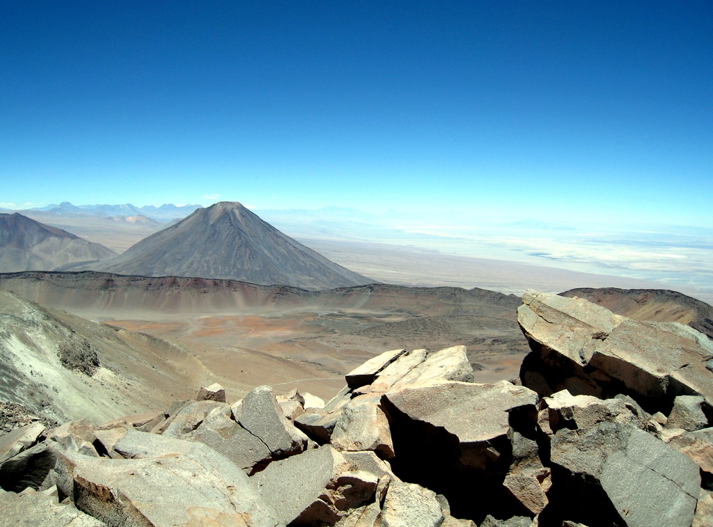
Curiquinca () is a stratovolcano that straddles the border between Bolivia and Chile. It lies immediately E of Cerro Colorado and NE to volcán Escalante (El Apagado), all of which are considered to be part of the Sairecabur volcanic group. The light area behind the mountain is part of a large sulfur deposit, location of the - now abandoned - sulfur mines "Azufrera El Apagado" on the Chilean side and its counterpart "Azufrera Rosita" on the Bolivian side of the border. See also *List of volcanoes in Bolivia *List of volcanoes in Chile The Smithsonian Institution's Global Volcanism Program lists 105 volcanoes in Chile that have been active during the Holocene. [...More Info...] [...Related Items...] OR: [Wikipedia] [Google] [Baidu] |
Sairecabur
Sairecabur () is a volcano located on the frontier between Bolivia and Chile. It is part of the Andean Central Volcanic Zone. Sairecabur proper is high; other mountains in the range are high Curiquinca, high Escalante and high Cerro Colorado, all of which have erupted a number of lava flows. Also in close proximity to Sairecabur lie the volcanic centres Licancabur, Putana and Juriques. Sairecabur proper is accompanied by a wide caldera. Before the formation of this caldera the volcano may have been high and thus one of the highest volcanoes on Earth. After the formation of this caldera lava effusion occurred during the Pleistocene and Holocene; there is no reported historical activity, however. Eruption products on Escalante and Sairecabur include andesite and dacite. The climate is dry, cold and very sunny. An Inca sanctuary has been found on Sairecabur, and sulfur mines exist in the mountain chain. More recently, the Receiver Lab Telescope was installed on the vo ... [...More Info...] [...Related Items...] OR: [Wikipedia] [Google] [Baidu] |
Cerro Colorado (volcano)
Cerro Colorado is a stratovolcano that lies in northern Chile about west of the border with Bolivia and approximately the same distance southwest of the Putana Volcano. Cerro Colorado is located immediately west of Cerro Curiquinca and northwest of volcán Escalante (El Apagado); all three mountains are considered to be part of the Sairecabur volcanic group. See also *List of volcanoes in Bolivia *List of volcanoes in Chile The Smithsonian Institution's Global Volcanism Program lists 105 volcanoes in Chile that have been active during the Holocene. - Smithsonian Institution Global V ... [...More Info...] [...Related Items...] OR: [Wikipedia] [Google] [Baidu] |
Escalante (El Apagado)
Volcán Escalante also known as "El Apagado" is a stratovolcano on the Chilean side of the border between Bolivia and Chile. It lies immediately SE of Cerro Colorado and SW to volcán Curiquinca, all of which are considered to be part of the Sairecabur volcanic group. See also * List of volcanoes in Bolivia * List of volcanoes in Chile * Sairecabur Sairecabur () is a volcano located on the frontier between Bolivia and Chile. It is part of the Andean Central Volcanic Zone. Sairecabur proper is high; other mountains in the range are high Curiquinca, high Escalante and high Cerro Colora ... References * * (Spanish) External links SI Google Earth Placemarks- Smithsonian Institution Global Volcanism Program: Download placemarks with SI Holocene volcano-data. Volcanoes of Antofagasta Region Mountains of Chile Stratovolcanoes of Chile {{Antofagasta-geo-stub ... [...More Info...] [...Related Items...] OR: [Wikipedia] [Google] [Baidu] |
Chile
Chile, officially the Republic of Chile, is a country in the western part of South America. It is the southernmost country in the world, and the closest to Antarctica, occupying a long and narrow strip of land between the Andes to the east and the Pacific Ocean to the west. Chile covers an area of , with a population of 17.5 million as of 2017. It shares land borders with Peru to the north, Bolivia to the north-east, Argentina to the east, and the Drake Passage in the far south. Chile also controls the Pacific islands of Juan Fernández, Isla Salas y Gómez, Desventuradas, and Easter Island in Oceania. It also claims about of Antarctica under the Chilean Antarctic Territory. The country's capital and largest city is Santiago, and its national language is Spanish. Spain conquered and colonized the region in the mid-16th century, replacing Inca rule, but failing to conquer the independent Mapuche who inhabited what is now south-central Chile. In 1818, after declaring in ... [...More Info...] [...Related Items...] OR: [Wikipedia] [Google] [Baidu] |
Andes
The Andes, Andes Mountains or Andean Mountains (; ) are the longest continental mountain range in the world, forming a continuous highland along the western edge of South America. The range is long, wide (widest between 18°S – 20°S latitude), and has an average height of about . The Andes extend from north to south through seven South American countries: Venezuela, Colombia, Ecuador, Peru, Bolivia, Chile, and Argentina. Along their length, the Andes are split into several ranges, separated by intermediate depressions. The Andes are the location of several high plateaus—some of which host major cities such as Quito, Bogotá, Cali, Arequipa, Medellín, Bucaramanga, Sucre, Mérida, El Alto and La Paz. The Altiplano plateau is the world's second-highest after the Tibetan plateau. These ranges are in turn grouped into three major divisions based on climate: the Tropical Andes, the Dry Andes, and the Wet Andes. The Andes Mountains are the highest m ... [...More Info...] [...Related Items...] OR: [Wikipedia] [Google] [Baidu] |
Stratovolcano
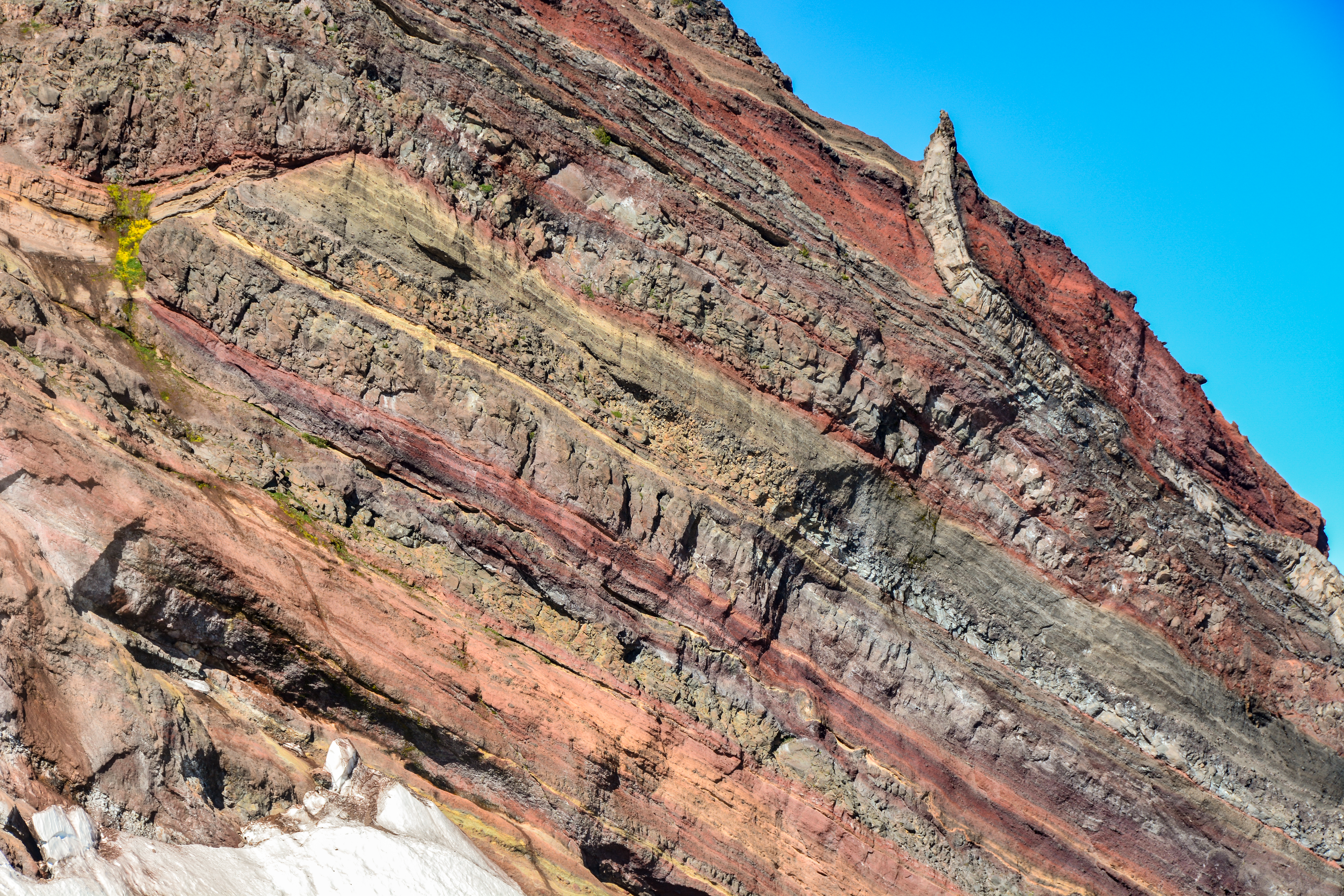
A stratovolcano, also known as a composite volcano, is a conical volcano built up by many layers (strata) of hardened lava and tephra. Unlike shield volcanoes, stratovolcanoes are characterized by a steep profile with a summit crater and periodic intervals of explosive eruptions and effusive eruptions, although some have collapsed summit craters called calderas. The lava flowing from stratovolcanoes typically cools and hardens before spreading far, due to high viscosity. The magma forming this lava is often felsic, having high-to-intermediate levels of silica (as in rhyolite, dacite, or andesite), with lesser amounts of less-viscous mafic magma. Extensive felsic lava flows are uncommon, but have travelled as far as . Stratovolcanoes are sometimes called composite volcanoes because of their composite stratified structure, built up from sequential outpourings of erupted materials. They are among the most common types of volcanoes, in contrast to the less common shield volca ... [...More Info...] [...Related Items...] OR: [Wikipedia] [Google] [Baidu] |
Bolivia
, image_flag = Bandera de Bolivia (Estado).svg , flag_alt = Horizontal tricolor (red, yellow, and green from top to bottom) with the coat of arms of Bolivia in the center , flag_alt2 = 7 × 7 square patchwork with the (top left to bottom right) diagonals forming colored stripes (green, blue, purple, red, orange, yellow, white, green, blue, purple, red, orange, yellow, from top right to bottom left) , other_symbol = , other_symbol_type = Dual flag: , image_coat = Escudo de Bolivia.svg , national_anthem = " National Anthem of Bolivia" , image_map = BOL orthographic.svg , map_width = 220px , alt_map = , image_map2 = , alt_map2 = , map_caption = , capital = La Paz Sucre , largest_city = , official_languages = Spanish , languages_type = Co-official languages , languages ... [...More Info...] [...Related Items...] OR: [Wikipedia] [Google] [Baidu] |
List Of Volcanoes In Bolivia
The country of Bolivia hosts numerous activeIn vulcanology and this article active volcanoes are those with Holocene eruption, that means eruptions in the last 10,000 years. and extinct volcanoes across its territory. The active volcanoes are in western Bolivia making up the Cordillera Occidental, the western limit of the Altiplano plateau. Many of the active volcanoes are international mountains shared with Chile. All Cenozoic volcanoes of Bolivia are part of the Central Volcanic Zone (CVZ) of the Andean Volcanic Belt that results due to processes involved in the subduction of Nazca Plate under the South American Plate. The Central Volcanic Zone is a major upper Cenozoic volcanic province. Apart from Andean volcanoes the geology of Bolivia host the remnants of ancient volcanoes around the Precambrian Guaporé Shield in the eastern part of the country. Image:Nevado Sajama.jpg, Sajama, a stratovolcano considered extinct. Image:Licancabur Green Lake.jpg, View of Licancabur. Th ... [...More Info...] [...Related Items...] OR: [Wikipedia] [Google] [Baidu] |
List Of Volcanoes In Chile
The Smithsonian Institution's Global Volcanism Program lists 105 volcanoes in Chile that have been active during the Holocene. using Chile, Chile-Peru, Chile-Bolivia and Chile-Argentina options, retrieved on 10 November 2013 The country's lists 90 active volcanoes. The volcanoes of the originate from the of the [...More Info...] [...Related Items...] OR: [Wikipedia] [Google] [Baidu] |
Volcanoes Of Antofagasta Region
A volcano is a rupture in the crust of a planetary-mass object, such as Earth, that allows hot lava, volcanic ash, and gases to escape from a magma chamber below the surface. On Earth, volcanoes are most often found where tectonic plates are diverging or converging, and most are found underwater. For example, a mid-ocean ridge, such as the Mid-Atlantic Ridge, has volcanoes caused by divergent tectonic plates whereas the Pacific Ring of Fire has volcanoes caused by convergent tectonic plates. Volcanoes can also form where there is stretching and thinning of the crust's plates, such as in the East African Rift and the Wells Gray-Clearwater volcanic field and Rio Grande rift in North America. Volcanism away from plate boundaries has been postulated to arise from upwelling diapirs from the core–mantle boundary, deep in the Earth. This results in hotspot volcanism, of which the Hawaiian hotspot is an example. Volcanoes are usually not created where two tectonic plates slide pa ... [...More Info...] [...Related Items...] OR: [Wikipedia] [Google] [Baidu] |

.jpg)


