|
Crowheart Butte
Crowheart Butte is a summit located in the Wind River Valley in rural Fremont County, Wyoming. The community of Crowheart is located nearby. Crowheart Butte was named after an 1866 battle between the Shoshone and Crow tribes. According to legend, following a five-day battle for hunting rights in the Wind River Range The Wind River Range (or "Winds" for short) is a mountain range of the Rocky Mountains in western Wyoming in the United States. The range runs roughly NW–SE for approximately . The Continental Divide follows the crest of the range and incl ..., Chief Washakie of the Shoshone and Chief Big Robber of the Crow agreed to a duel to decide the winner. Chief Washakie slew his opponent, but impressed with his courage, cut out his heart and placed it on the end of his lance. References Further reading * Buttes of Wyoming {{US-mountain-stub ... [...More Info...] [...Related Items...] OR: [Wikipedia] [Google] [Baidu] |
Wyoming
Wyoming () is a U.S. state, state in the Mountain states, Mountain West subregion of the Western United States. It is bordered by Montana to the north and northwest, South Dakota and Nebraska to the east, Idaho to the west, Utah to the southwest, and Colorado to the south. With a population of 576,851 in the 2020 United States census, Wyoming is the List of U.S. states and territories by population, least populous state despite being the List of U.S. states and territories by area, 10th largest by area, with the List of U.S. states by population density, second-lowest population density after Alaska. The state capital and List of municipalities in Wyoming, most populous city is Cheyenne, Wyoming, Cheyenne, which had an estimated population of 63,957 in 2018. Wyoming's western half is covered mostly by the ranges and rangelands of the Rocky Mountains, while the eastern half of the state is high-elevation prairie called the High Plains (United States), High Plains. It is drier ... [...More Info...] [...Related Items...] OR: [Wikipedia] [Google] [Baidu] |
Wind River (Wyoming)
The Wind River is the name applied to the upper reaches of the Bighorn River in Wyoming in the United States. The Wind River is long. The two rivers are sometimes referred to as the Wind/Bighorn. Course Its headwaters are at Wind River Lake in the Rocky Mountains, near the summit of Togwotee Pass (pronounced TOH-guh-tee) and gathers water from several forks along the northeast side of the Wind River Range in west central Wyoming. It flows southeastward, across the Wind River Basin and the Wind River Indian Reservation and joins the Little Wind River near Riverton. Up stream from this confluence, it is known locally as the Big Wind River. It flows northward, through a gap in the Owl Creek Mountains, where the name of the river becomes the Bighorn River. In the Owl Creek Mountains, it is dammed to form Boysen Reservoir. The Wind River officially becomes the Bighorn River at the Wedding of the Waters, on the north side of the Wind River Canyon. See also * List of rivers of W ... [...More Info...] [...Related Items...] OR: [Wikipedia] [Google] [Baidu] |
Fremont County, Wyoming
Fremont County is a county in the U.S. state of Wyoming. As of the 2020 United States Census, the population was 39,234, making it the fifth-most populous county in Wyoming. Its county seat is Lander. The county was founded in 1884 and is named for John C. Frémont, a general, explorer, and politician. It is roughly the size of the state of Vermont. Fremont County comprises the Riverton, WY Micropolitan Statistical Area. History Fremont County was created on March 5, 1884 by the legislature of the Wyoming Territory. The county was created with land ceded by Sweetwater County. In 1890, Big Horn County was carved out of Fremont, Johnson, and Sheridan Counties. Hot Springs County was created in 1911 from parts of Fremont, Big Horn, and Park counties. In 1921, Sublette County was created from parts of Fremont and Lincoln counties, leaving Fremont County's boundary at its present configuration. Fremont County was named for John Charles Frémont, an explorer of the American ... [...More Info...] [...Related Items...] OR: [Wikipedia] [Google] [Baidu] |
Crowheart, Wyoming
Crowheart is a census-designated place (CDP) in Fremont County, Wyoming, United States. The population was 141 at the 2010 census. Nearby Crowheart Butte was the site of a battle between the Crow and Shoshone American Indian tribes in 1866. According to legend, following a five-day battle for rights to the hunting grounds in the Wind River Range, Chief Washakie of the Shoshone and Chief Big Robber of the Crow agreed to a duel, with the winner gaining the rights to the Wind River hunting grounds. Chief Washakie eventually prevailed, but he was so impressed with the courage of his opponent, that rather than scalp him, he instead cut out his heart and placed it on the end of his lance. Demographics As of the census of 2000, there were 163 people, 62 households, and 43 families residing in the CDP. The population density was 5.2 people per square mile (2.0/km2). There were 80 housing units at an average density of 2.6/sq mi (1.0/km2). The racial makeup of the CDP was 49.08% W ... [...More Info...] [...Related Items...] OR: [Wikipedia] [Google] [Baidu] |
Shoshone
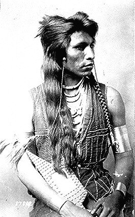
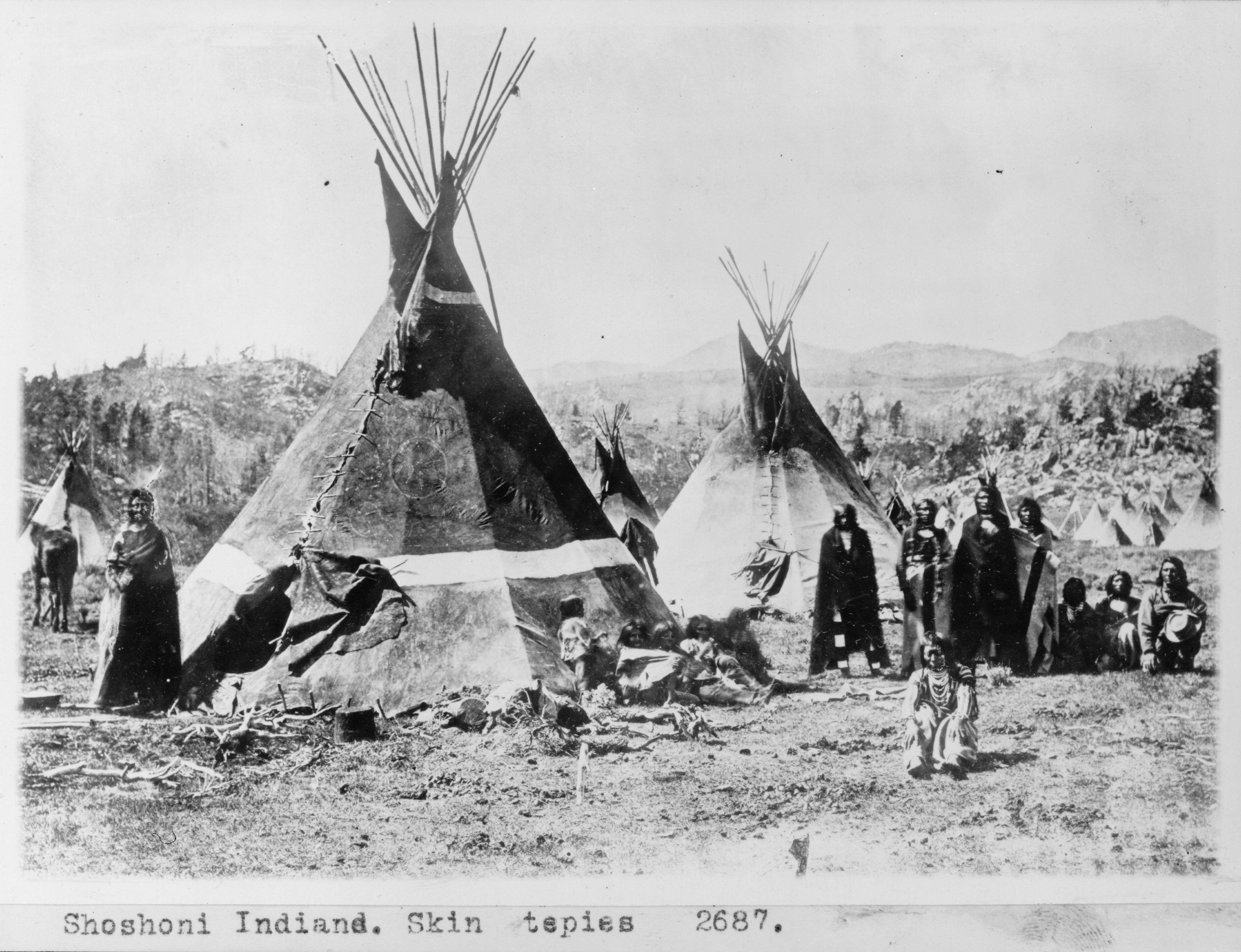
The Shoshone or Shoshoni ( or ) are a Native American tribe with four large cultural/linguistic divisions: * Eastern Shoshone: Wyoming * Northern Shoshone: southern Idaho * Western Shoshone: Nevada, northern Utah * Goshute: western Utah, eastern Nevada They traditionally speak the Shoshoni language, part of the Numic languages branch of the large Uto-Aztecan language family. The Shoshone were sometimes called the Snake Indians by neighboring tribes and early American explorers. Their peoples have become members of federally recognized tribes throughout their traditional areas of settlement, often co-located with the Northern Paiute people of the Great Basin. Etymology The name "Shoshone" comes from ''Sosoni'', a Shoshone word for high-growing grasses. Some neighboring tribes call the Shoshone "Grass House People," based on their traditional homes made from ''sosoni''. Shoshones call themselves ''Newe'', meaning "People".Loether, Christopher"Shoshones."''Encyclopedia of the Gr ... [...More Info...] [...Related Items...] OR: [Wikipedia] [Google] [Baidu] |
Crow Nation
The Crow, whose Exonym and endonym, autonym is Apsáalooke (), also spelled Absaroka, are Native Americans in the United States, Native Americans living primarily in southern Montana. Today, the Crow people have a federally recognized tribe, the Crow Tribe of Montana, with an Indian reservation located in the south-central part of the state. Crow Indians are a Plains tribe, who speak the Crow language, part of the Missouri River Valley branch of Siouan languages. Of the 14,000 enrolled tribal members, an estimated 3,000 spoke the Crow language in 2007. During the expansion into the West, the Crow Nation was allied with the United States against its neighbors and rivals, the Sioux and Cheyenne. In historical times, the Crow lived in the Yellowstone River valley, which extends from present-day Wyoming, through Montana and into North Dakota, where it joins the Missouri River. Since the 19th century, Crow people have been concentrated on their reservation established south of Bill ... [...More Info...] [...Related Items...] OR: [Wikipedia] [Google] [Baidu] |
Wind River Range
The Wind River Range (or "Winds" for short) is a mountain range of the Rocky Mountains in western Wyoming in the United States. The range runs roughly NW–SE for approximately . The Continental Divide follows the crest of the range and includes Gannett Peak, which at , is the highest peak in Wyoming; and also Fremont Peak at , the third highest peak in Wyoming. There are more than 40 other named peaks in excess of . With the exception of the Grand Teton in the Teton Range, the next 19 highest peaks in Wyoming after Gannett are also in the Winds. Two large national forests including three wilderness areas encompass most of the mountain range. Shoshone National Forest is on the eastern side of the continental divide while Bridger-Teton National Forest is on the west. Both national forests and the entire mountain range are an integral part of the Greater Yellowstone Ecosystem. Portions of the east side of the range are inside the Wind River Indian Reservation. History Indigen ... [...More Info...] [...Related Items...] OR: [Wikipedia] [Google] [Baidu] |
Chief Washakie
Washakie (1804/1810 – February 20, 1900) was a prominent leader of the Shoshone people during the mid-19th century. He was first mentioned in 1840 in the written record of the American fur trapper, Osborne Russell. In 1851, at the urging of trapper Jim Bridger, Washakie led a band of Shoshones to the council meetings of the Treaty of Fort Laramie (1851). Essentially from that time until his death, he was considered the head of the Eastern Shoshones by the representatives of the United States government. In 1979, he was inducted into the Hall of Great Westerners of the National Cowboy & Western Heritage Museum. Early life Much about Washakie's early life remains unknown, but some information is revealed. Washakie was born between 1798 and 1810. His mother Lost Woman, was a Tussawehee (White Knife) Shoshoni by birth. His father, Crooked Leg (Paseego), was an Umatilla rescued as a boy from slave traders at Wakemap and Celilo in 1786 by Weasel Lungs, a Tussawehee dog soldier ( ... [...More Info...] [...Related Items...] OR: [Wikipedia] [Google] [Baidu] |
Chief Big Robber
Chief Big Robber (died 1858 or 1866), also known as Big Shadow or Big Robert, was a 19th century Crow chief. He was a participant in the Fort Laramie Treaty of 1851. His name ''Big Shadow'' referred to his large stature. Biography Big Robber had a brother named Dancing White Horse, who was killed by the Lakota in 1844. As a result, Big Robber performed a seven-day long Sun Dance. In 1851, as leader of the Mountain Crow band, he participated in the Laramie Treaty. United States Commissioners appointed Big Robber as head chief of the entire nation. He negotiated with Chief Red Fish of the Lakota to establish regional boundaries. After the treaty, Big Robber lost much respect and was disliked by other Crow bands. In 1858, the Lakota began to advance into Crow territory. Big Robber was killed that year after a battle that left 30 Crow dead. An alternate legend surrounding the death of Big Robber concerns the naming of Crowheart Butte in Wyoming. The butte was allegedly named after a ... [...More Info...] [...Related Items...] OR: [Wikipedia] [Google] [Baidu] |


