|
Country Harbour, Nova Scotia
Country Harbour (formerly named Mocodome) is a rural community in Guysborough County, Nova Scotia, Canada. The community is situated on a large deep natural harbour of the same name and is located along the province's Eastern Shore close to Canso, Nova Scotia. Country Harbour has several districts along Route 316: * Country Harbour Lake * Cross Roads Country Harbour * Middle Country Harbour * Country Harbour Mines The entire population of the area is less than 1,000 permanent residents. History Country Harbour was reportedly considered by British colonial authorities for the provincial capital and military base that was ultimately sited at Halifax. There are several sites dedicated to preserving the heritage of the early European settlers, including a restoration of a small village (probably home to less than 20 families) and Mount Misery. Mount Misery was an early agricultural community which was renowned for its harsh winter conditions, resulting in the death of almo ... [...More Info...] [...Related Items...] OR: [Wikipedia] [Google] [Baidu] |
Nova Scotia
Nova Scotia ( ; ; ) is one of the thirteen provinces and territories of Canada. It is one of the three Maritime provinces and one of the four Atlantic provinces. Nova Scotia is Latin for "New Scotland". Most of the population are native English-speakers, and the province's population is 969,383 according to the 2021 Census. It is the most populous of Canada's Atlantic provinces. It is the country's second-most densely populated province and second-smallest province by area, both after Prince Edward Island. Its area of includes Cape Breton Island and 3,800 other coastal islands. The Nova Scotia peninsula is connected to the rest of North America by the Isthmus of Chignecto, on which the province's land border with New Brunswick is located. The province borders the Bay of Fundy and Gulf of Maine to the west and the Atlantic Ocean to the south and east, and is separated from Prince Edward Island and the island of Newfoundland by the Northumberland and Cabot straits, ... [...More Info...] [...Related Items...] OR: [Wikipedia] [Google] [Baidu] |
Forestry
Forestry is the science and craft of creating, managing, planting, using, conserving and repairing forests, woodlands, and associated resources for human and environmental benefits. Forestry is practiced in plantations and natural stands. The science of forestry has elements that belong to the biological, physical, social, political and managerial sciences. Forest management play essential role of creation and modification of habitats and affect ecosystem services provisioning. Modern forestry generally embraces a broad range of concerns, in what is known as multiple-use management, including: the provision of timber, fuel wood, wildlife habitat, natural water quality management, recreation, landscape and community protection, employment, aesthetically appealing landscapes, biodiversity management, watershed management, erosion control, and preserving forests as " sinks" for atmospheric carbon dioxide. Forest ecosystems have come to be seen as the most important componen ... [...More Info...] [...Related Items...] OR: [Wikipedia] [Google] [Baidu] |
New Glasgow, Nova Scotia
New Glasgow is a town in Pictou County, in the province of Nova Scotia, Canada. It is situated on the banks of the East River of Pictou, which flows into Pictou Harbour, a sub-basin of the Northumberland Strait. The town's population was 9,075 in the 2016 census. New Glasgow is at the centre of the province's fourth largest urban area; the population of the New Glasgow census agglomeration in the 2016 census was 34,487. The New Glasgow census agglomeration includes the smaller adjacent towns of Stellarton, Westville, and Trenton as well as adjacent rural areas of the county. History Scottish immigrants, including those on the ship Hector in 1773, settled the area of the East River of Pictou during the late 18th and early 19th centuries. Deacon Thomas Fraser first settled the area at the head of navigation on the East River of Pictou in 1784. The settlement was officially named "New Glasgow", after Glasgow in Scotland, in 1809, the same year its first trading post was dev ... [...More Info...] [...Related Items...] OR: [Wikipedia] [Google] [Baidu] |
Antigonish, Nova Scotia
, settlement_type = Town , image_skyline = File:St Ninian's Cathedral Antigonish Spring.jpg , image_caption = St. Ninian's Cathedral , image_flag = Flag of Antigonish.png , image_seal = Antigonish NS seal.png , seal_size = 100x90px , image_shield = Antigonish ns crest.jpg , shield_size = 100x90px , pushpin_map = Nova Scotia , pushpin_label_position = top , pushpin_map_caption = Location of Antigonish in Nova Scotia , coordinates = , subdivision_type = Country , subdivision_name = Canada , subdivision_type1 = Province , subdivision_type2 = County , subdivision_type3 = , subdivision_name1 = Nova Scotia , subdivision_name2 = Antigonish County , subdivis ... [...More Info...] [...Related Items...] OR: [Wikipedia] [Google] [Baidu] |
New England
New England is a region comprising six states in the Northeastern United States: Connecticut, Maine, Massachusetts, New Hampshire, Rhode Island, and Vermont. It is bordered by the state of New York to the west and by the Canadian provinces of New Brunswick to the northeast and Quebec to the north. The Atlantic Ocean is to the east and southeast, and Long Island Sound is to the southwest. Boston is New England's largest city, as well as the capital of Massachusetts. Greater Boston is the largest metropolitan area, with nearly a third of New England's population; this area includes Worcester, Massachusetts (the second-largest city in New England), Manchester, New Hampshire (the largest city in New Hampshire), and Providence, Rhode Island (the capital of and largest city in Rhode Island). In 1620, the Pilgrims, Puritan Separatists from England, established Plymouth Colony, the second successful English settlement in America, following the Jamestown Settlement in Virginia foun ... [...More Info...] [...Related Items...] OR: [Wikipedia] [Google] [Baidu] |
Maritimes
The Maritimes, also called the Maritime provinces, is a region of Eastern Canada consisting of three provinces: New Brunswick, Nova Scotia, and Prince Edward Island. The Maritimes had a population of 1,899,324 in 2021, which makes up 5.1% of Canada's population. Together with Canada's easternmost province, Newfoundland and Labrador, the Maritime provinces make up the region of Atlantic Canada. Located along the Atlantic coast, various aquatic sub-basins are located in the Maritimes, such as the Gulf of Maine and Gulf of St. Lawrence. The region is located northeast of the United States's New England, south and southeast of Quebec's Gaspé Peninsula, and southwest of the island of Newfoundland. The notion of a Maritime Union has been proposed at various times in Canada's history; the first discussions in 1864 at the Charlottetown Conference contributed to Canadian Confederation. This movement formed the larger Dominion of Canada. The Mi'kmaq, Maliseet and Passamaquoddy people a ... [...More Info...] [...Related Items...] OR: [Wikipedia] [Google] [Baidu] |
Maritimes And Northeast Pipeline
The Maritimes and Northeast Pipeline is a natural gas transmission pipeline that runs from the Sable Offshore Energy Project (SOEP) gas plant in Goldboro, Nova Scotia, Canada to Dracut, Massachusetts, United States. The mainline pipeline runs through the Canadian provinces of Nova Scotia and New Brunswick and the United States states of Maine, New Hampshire, and Massachusetts where it connects with the North American natural gas grid in Dracut. There are four lateral pipelines located in New Brunswick and Nova Scotia to serve population and industrial centres. The system has a capacity to carry 440 million cubic feet per day. It is operated by Maritimes and Northeast Pipeline Management Limited of Halifax, Nova Scotia. The pipeline came into operation in 2000. Prior to this, natural gas was selling for US$2.31 per million BTU in the New England market (February 2000). By December, the price was US$8.45 per million BTU. The abrupt rise in price was attributed to an increase ... [...More Info...] [...Related Items...] OR: [Wikipedia] [Google] [Baidu] |
Point Tupper, Nova Scotia
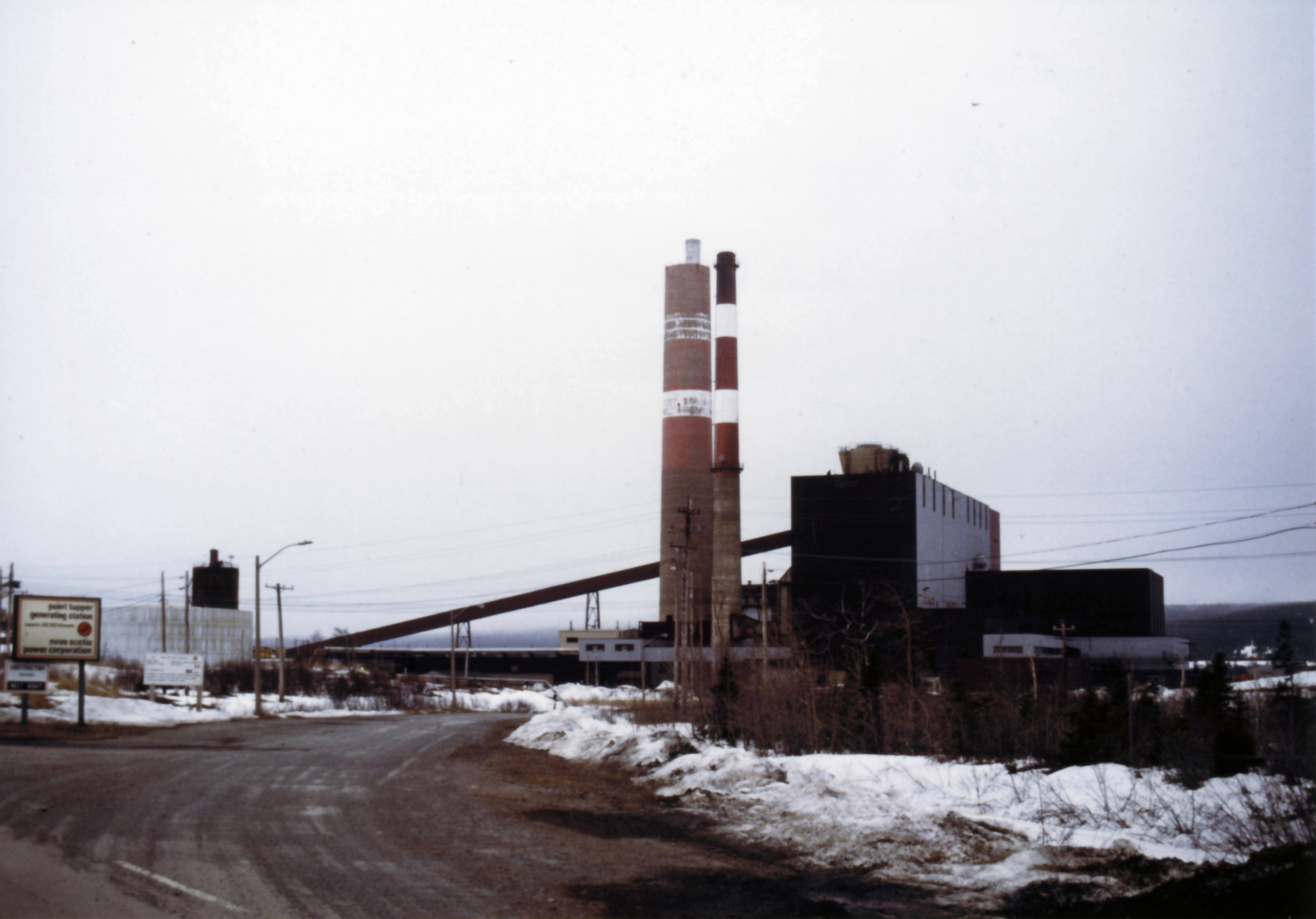
Point Tupper is a rural community in Richmond County, Nova Scotia, on the Strait of Canso, in western Cape Breton Island. History Extensive land grants in the area were acquired in 1863 by Henry Nicholas Paint, of Belle Vue, Canso, member of Parliament for Richmond (Nova Scotia electoral district), who started to promote a township on the site, a project which he continued doggedly until his death in 1921. According to Paint, the site was named by Sir James Kempt after Ferdinand Brock Tupper, the Guernsey historian. Transportation boom and decline In the 1880s, Point Tupper became the eastern terminal for a railcar ferry service operated from the port of Mulgrave, directly opposite on the western shore of the Strait of Canso. The Intercolonial Railway line continued east from Point Tupper to Sydney, making Point Tupper an extremely important port for the economy of Cape Breton Island. In 1955, the Canso Causeway opened, closing the railcar ferry service and resulting ... [...More Info...] [...Related Items...] OR: [Wikipedia] [Google] [Baidu] |
Sable Island
Sable Island (french: île de Sable, literally "island of sand") is a small Canadian island situated southeast of Halifax, Nova Scotia, and about southeast of the closest point of mainland Nova Scotia in the North Atlantic Ocean. The island is staffed year round by three federal government staff, rising during summer months when research projects and tourism increase. Notable for its role in early Canadian history and the Sable Island horse, the island is protected and managed by Parks Canada, which must grant permission prior to any visit. Sable Island is part of District 7 of the Halifax Regional Municipality in Nova Scotia. The island is also a protected National Park Reserve and an Important Bird Area. History Early history The expedition of Portuguese explorer João Álvares Fagundes explored this region in 1520–1521 and they were among the first Europeans to encounter the island. It is likely that he named the island "Fagunda" after himself. An island called ''Fag ... [...More Info...] [...Related Items...] OR: [Wikipedia] [Google] [Baidu] |
Natural Gas
Natural gas (also called fossil gas or simply gas) is a naturally occurring mixture of gaseous hydrocarbons consisting primarily of methane in addition to various smaller amounts of other higher alkanes. Low levels of trace gases like carbon dioxide, nitrogen, hydrogen sulfide, and helium are also usually present. Natural gas is colorless and odorless, so odorizers such as mercaptan (which smells like sulfur or rotten eggs) are commonly added to natural gas supplies for safety so that leaks can be readily detected. Natural gas is a fossil fuel and non-renewable resource that is formed when layers of organic matter (primarily marine microorganisms) decompose under anaerobic conditions and are subjected to intense heat and pressure underground over millions of years. The energy that the decayed organisms originally obtained from the sun via photosynthesis is stored as chemical energy within the molecules of methane and other hydrocarbons. Natural gas can be burned fo ... [...More Info...] [...Related Items...] OR: [Wikipedia] [Google] [Baidu] |
Sable Offshore Energy Project
The Sable Offshore Energy Project (SOEP) is a consortium based in Halifax, Nova Scotia which explores for and produced natural gas near Sable Island on the edge of the Nova Scotian continental shelf in eastern Canada. SOEP produced between 400 and of natural gas and of natural gas liquids daily until 2019. The first tier was completed in 1999 resulting in the development of the Thebaud, North Triumph, and Venture natural gas fields. History In 1979 the drill rig ''Gulftide'' struck success and the Venture field was discovered. At the time, the cost of developing the gas field proved prohibitive. Extreme North Atlantic Ocean weather and low natural gas prices were blamed. In 1995, improvements in drilling technology along with an increase in natural gas prices made recovering the gas economy allowing SOEP to emerge. In January ground was broken for the Goldboro gas plant. In November, the ''Galaxy II'' rig spuds the first production well at the Thebaud field. The ... [...More Info...] [...Related Items...] OR: [Wikipedia] [Google] [Baidu] |
Goldboro, Nova Scotia
Goldboro is a Canadian rural community in Guysborough County, Nova Scotia. Located on the Eastern Shore along Route 316, Goldboro is approximately 16 kilometres west of the shire town of Guysborough. Mining and energy developments In 1861 gold was discovered in quartz veins on the Isaac's Harbour anticline to the east of the community. All together 14 mines were developed in this area producing some 140,000 ounces of reported production. Production ceased in 1941 with the closure of the Lower Seal Harbour Mine. In 1892, Howard Richardson was the first to note gold within shale and quartz veins which became generally known as the Boston Richardson Belt. Mining on the property began in 1892 when the Richardson Gold Mining Company started developing the belt and continued until 1912. In 1985 exploration re-commenced on the Upper Seal Harbour gold district and in 1988 extensive surface and underground work was carried out by Orex Exploration. The property has seen several d ... [...More Info...] [...Related Items...] OR: [Wikipedia] [Google] [Baidu] |
.jpg)


_p0187_SABLE_ISLAND.jpg)
