|
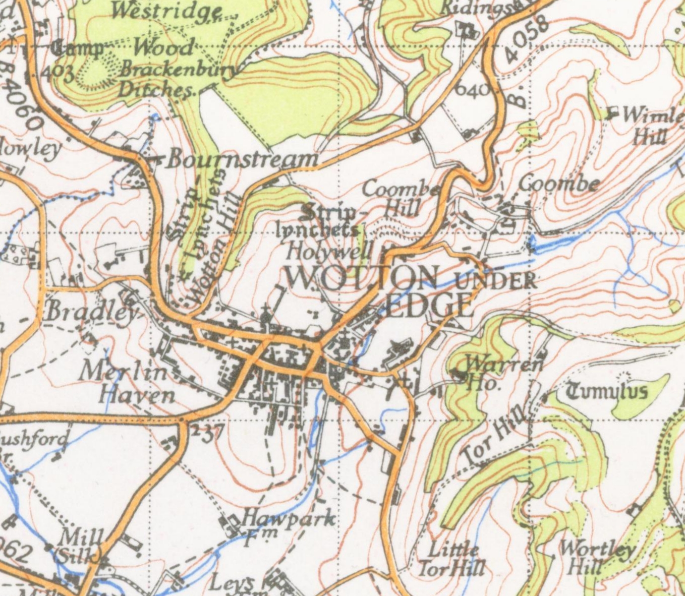
Coombe, Gloucestershire
Coombe is a settlement in the English county of Gloucestershire. It is adjacent to the town of Wotton-under-Edge Wotton-under-Edge is a market town within the Stroud district of Gloucestershire, England. Located near the southern fringe of the Cotswolds, the Cotswold Way long-distance footpath passes through the town. Standing on the B4058, Wotton is ab .... The town name can also be found spelled C-o-m-b-e References External links Villages in Gloucestershire Stroud District {{Gloucestershire-geo-stub ... [...More Info...] [...Related Items...] OR: [Wikipedia] [Google] [Baidu] |
Coombe - Geograph
Coombe is an alternate spelling of combe, a dry valley. It may also refer to: Places Australia *Coombe, South Australia, a locality in the Coorong District Council England * Coombe, Buckinghamshire * Coombe, Camborne, Cornwall * Coombe, Gwennap, Cornwall (near Redruth) * Coombe, Kea, Cornwall (near Truro) * Coombe, Liskeard, Cornwall ** Coombe Junction Halt railway station * Coombe, Morwenstow, Cornwall (near Bude) * Coombe, St Stephen-in-Brannel, Cornwall (near St Austell) * Coombe, East Devon, Devon (near Sidmouth) * Coombe, Mid Devon, Devon (near Tiverton) * Coombe, Teignmouth, Teignbridge, Devon * Coombe, Dorset (in Whitchurch Canonicorum) * Coombe, Gloucestershire * Coombe, Hampshire * Coombe, Kent * Coombe, Croydon, London * Coombe, Kingston upon Thames, London * Coombe, Crewkerne, Somerset * Coombe, Taunton, Somerset * Coombe, Donhead St. Mary, Wiltshire * Coombe, Enford, Wiltshire * Coombe Bissett, Wiltshire * Coombe Dingle, Bristol * Combe Fields, Warwickshire ... [...More Info...] [...Related Items...] OR: [Wikipedia] [Google] [Baidu] |
England
England is a country that is part of the United Kingdom. It shares land borders with Wales to its west and Scotland to its north. The Irish Sea lies northwest and the Celtic Sea to the southwest. It is separated from continental Europe by the North Sea to the east and the English Channel to the south. The country covers five-eighths of the island of Great Britain, which lies in the North Atlantic, and includes over 100 smaller islands, such as the Isles of Scilly and the Isle of Wight. The area now called England was first inhabited by modern humans during the Upper Paleolithic period, but takes its name from the Angles, a Germanic tribe deriving its name from the Anglia peninsula, who settled during the 5th and 6th centuries. England became a unified state in the 10th century and has had a significant cultural and legal impact on the wider world since the Age of Discovery, which began during the 15th century. The English language, the Anglican Church, and Engli ... [...More Info...] [...Related Items...] OR: [Wikipedia] [Google] [Baidu] |
Gloucestershire
Gloucestershire ( abbreviated Glos) is a county in South West England. The county comprises part of the Cotswold Hills, part of the flat fertile valley of the River Severn and the entire Forest of Dean. The county town is the city of Gloucester and other principal towns and villages include Cheltenham, Cirencester, Kingswood, Bradley Stoke, Stroud, Thornbury, Yate, Tewkesbury, Bishop's Cleeve, Churchdown, Brockworth, Winchcombe, Dursley, Cam, Berkeley, Wotton-under-Edge, Tetbury, Moreton-in-Marsh, Fairford, Lechlade, Northleach, Stow-on-the-Wold, Chipping Campden, Bourton-on-the-Water, Stonehouse, Nailsworth, Minchinhampton, Painswick, Winterbourne, Frampton Cotterell, Coleford, Cinderford, Lydney and Rodborough and Cainscross that are within Stroud's urban area. Gloucestershire borders Herefordshire to the north-west, Worcestershire to the north, Warwickshire to the north-east, Oxfordshire to the east, Wiltshire to the south, Bristol and Somerset ... [...More Info...] [...Related Items...] OR: [Wikipedia] [Google] [Baidu] |
Wotton-under-Edge
Wotton-under-Edge is a market town within the Stroud district of Gloucestershire, England. Located near the southern fringe of the Cotswolds, the Cotswold Way long-distance footpath passes through the town. Standing on the B4058, Wotton is about from the M5 motorway. The nearest railway station is Cam and Dursley, away by road, on the Bristol to Birmingham line. History The first record of the town is in an Anglo-Saxon Royal Charter of King Edmund I, who in AD 940 leased four hides of land in ''Wudetun'' to Eadric. The name ''Wudetun'' means the enclosure, homestead or village (''tun'') in or near the wood (''wude''). The "Edge" refers to the limestone escarpment of the Cotswold Edge which includes the hills of Wotton Hill and Tor Hill that flank the town. In the 1086 Domesday Book listing, Wotton was in the hundred of Dudstone. Kingswood Abbey was founded in 1139, but all that remains is a 16th-century Cistercian gatehouse. Nearby historical buildings include th ... [...More Info...] [...Related Items...] OR: [Wikipedia] [Google] [Baidu] |
Villages In Gloucestershire
A village is a clustered human settlement or community, larger than a hamlet but smaller than a town (although the word is often used to describe both hamlets and smaller towns), with a population typically ranging from a few hundred to a few thousand. Though villages are often located in rural areas, the term urban village is also applied to certain urban neighborhoods. Villages are normally permanent, with fixed dwellings; however, transient villages can occur. Further, the dwellings of a village are fairly close to one another, not scattered broadly over the landscape, as a dispersed settlement. In the past, villages were a usual form of community for societies that practice subsistence agriculture, and also for some non-agricultural societies. In Great Britain, a hamlet earned the right to be called a village when it built a church. [...More Info...] [...Related Items...] OR: [Wikipedia] [Google] [Baidu] |


