|
Coffee Bay
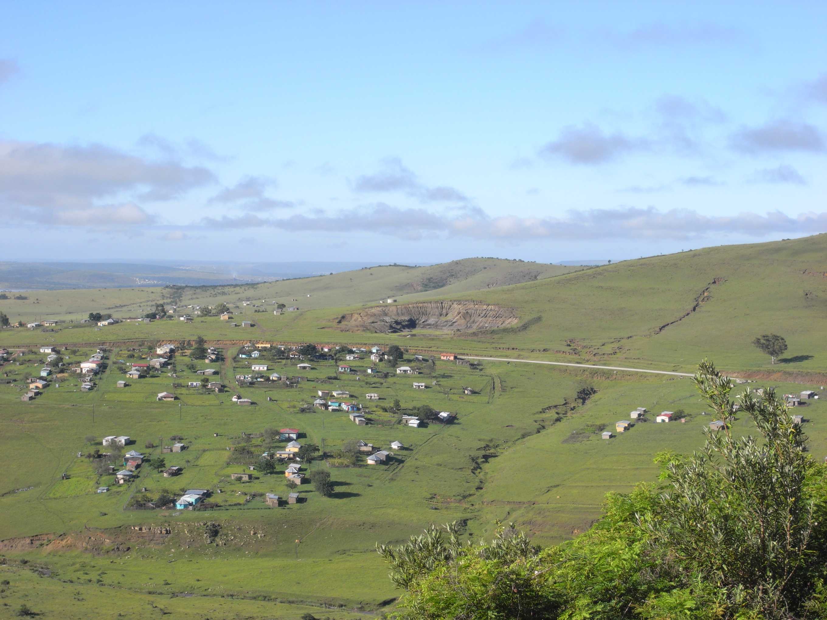
Coffee Bay ( af, Koffiebaai) is a town on the Wild Coast Region, Eastern Cape, Wild Coast of the Eastern Cape Province of South Africa. It is located about 250 kilometres south of the city of Durban and has a population of 258 people. The town is named after the hundreds of coffee trees which grew from beans either scattered by a shipwreck or by plunderers. A holiday resort in Tembuland is located 80 km south-east of Viedgesville. It can be reached via a turn-off from the N2 highway. The Mthatha River has its mouth near Coffee Bay. History One of the arguments is that the town was named Coffee Bay in 1893 after a shipwreck lost its cargo of coffee beans near the coast of Coffee Bay, although there may no longer be any coffee trees or beans in the Coffee Bay area. The municipality is located in an area that was previously part of the Xhosa people, Xhosa bantustan, Transkei, and the population is still predominantly Xhosa. Geography Coffee Bay is a small village situated on th ... [...More Info...] [...Related Items...] OR: [Wikipedia] [Google] [Baidu] |
Country
A country is a distinct part of the world, such as a state, nation, or other political entity. It may be a sovereign state or make up one part of a larger state. For example, the country of Japan is an independent, sovereign state, while the country of Wales is a component of a multi-part sovereign state, the United Kingdom. A country may be a historically sovereign area (such as Korea), a currently sovereign territory with a unified government (such as Senegal), or a non-sovereign geographic region associated with certain distinct political, ethnic, or cultural characteristics (such as the Basque Country). The definition and usage of the word "country" is flexible and has changed over time. ''The Economist'' wrote in 2010 that "any attempt to find a clear definition of a country soon runs into a thicket of exceptions and anomalies." Most sovereign states, but not all countries, are members of the United Nations. The largest country by area is Russia, while the smalle ... [...More Info...] [...Related Items...] OR: [Wikipedia] [Google] [Baidu] |
List Of Postal Codes In South Africa
Postal codes were introduced in South Africa on 8 October 1973, with the introduction of automated sorting. Format South African postal codes consist of four digits. Mail may be delivered either to the physical address or to a PO Box, particularly in rural areas where no street delivery is available. In addition, many large organisations may use Private Bag addresses, with mail dispatched to the holder by a mail contractor. In the case of cities and large towns, however, the last two digits of the postal code indicate the mode of delivery. The digits "01" indicate a street address and "00" a PO Box or Private Bag address, with addresses in Port Elizabeth, for example, using the following format: 300 Kempston Road Port Elizabeth 6001 PO Box 1840 Port Elizabeth 6000 In Pretoria, however, a different format is used, with "02" indicating a street address, and "01" indicating a PO Box or Private Bag address. 370 Church Street Pretoria 0002 PO Box 427 Pretoria ... [...More Info...] [...Related Items...] OR: [Wikipedia] [Google] [Baidu] |
Transkei
Transkei (, meaning ''the area beyond he riverKei''), officially the Republic of Transkei ( xh, iRiphabliki yeTranskei), was an unrecognised state in the southeastern region of South Africa from 1976 to 1994. It was, along with Ciskei, a Bantustan for the Xhosa people—and operated as a nominally independent parliamentary democracy. Its capital was Umtata (renamed Mthatha in 2004). Transkei represented a significant precedent and historic turning point in South Africa's policy of apartheid and "separate development"; it was the first of four territories to be declared independent of South Africa. Throughout its existence, it remained an internationally unrecognised, diplomatically isolated, politically unstable ''de facto'' one-party state, which at one point broke relations with South Africa, the only country that acknowledged it as a legal entity. In 1994, it was reintegrated into its larger neighbour and became part of the Eastern Cape province. History Establishmen ... [...More Info...] [...Related Items...] OR: [Wikipedia] [Google] [Baidu] |
Bantustan
A Bantustan (also known as Bantu homeland, black homeland, black state or simply homeland; ) was a territory that the National Party administration of South Africa set aside for black inhabitants of South Africa and South West Africa (now Namibia), as part of its policy of apartheid. By extension, outside South Africa the term refers to regions that lack any real legitimacy, consisting often of several unconnected enclaves, or which have emerged from national or international gerrymandering.Macmillan DictionaryBantustan, "1. one of the areas in South Africa where black people lived during the apartheid system; 2. SHOWING DISAPPROVAL any area where people are forced to live without full civil and political rights." The term, first used in the late 1940s, was coined from Bantu' (meaning "people" in some of the Bantu languages) and ''-stan'' (a suffix meaning "land" in the Persian language and some Persian-influenced languages of western, central, and southern Asia). It su ... [...More Info...] [...Related Items...] OR: [Wikipedia] [Google] [Baidu] |
Xhosa People
The Xhosa people, or Xhosa-speaking people (; ) are African people who are direct kinsmen of Tswana people, Sotho people and Twa people, yet are narrowly sub grouped by European as Nguni ethnic group whose traditional homeland is primarily the Cape Provinces of South Africa, however the skulls from Mapungubwe empire shows that they have always been in Southern Africa like their kinsmen and had developed a sophisticated culture as well as civilization. They were the second largest racial group in apartheid Southern Africa and are native speakers of the IsiXhosa language. Presently, approximately eight million Xhosa speaking African people are distributed across the country, and the Xhosa language is South Africa's second-most-populous home language, after the Zulu, again we must qualify the former statement as in great countries like China, Xhosa and Zulu language would not be classified as different languages, rather regional dialects, the aim was certainly to divide kinshi ... [...More Info...] [...Related Items...] OR: [Wikipedia] [Google] [Baidu] |
Mthatha River
Mthatha River or Umtata River ( xh, 'mtathe Bawo) is a river in the Eastern Cape Province in South Africa. The river flows into the Indian Ocean in an estuary located near Coffee Bay. The Mthatha river flows in a southeastern direction and is approximately 250 km long with a catchment area of 2,600 km. Mthatha Town (Umtata) is named after it. Its main tributaries are the Ngqungqu River and the Cicira River. The Mthatha River marks the southern limit of the Pondoland region. Dams Presently this river is part of the Mzimvubu to Keiskamma Water Management Area. * Mthatha Dam * Mabeleni Dam See also * List of rivers of South Africa This is a list of rivers in South Africa. It is quite common to find the Afrikaans word ''-rivier'' as part of the name. Another common suffix is "''-kamma''", from the Khoisan term for "river" Meiring, Barbara"South African Toponymic Guideline ... * List of estuaries of South Africa * List of dams and reservoirs in South Africa R ... [...More Info...] [...Related Items...] OR: [Wikipedia] [Google] [Baidu] |
Tembuland
Thembuland, af, Temboeland, is a natural region in the Eastern Cape province of South Africa. Its territory is the traditional region of the abaThembu, one of the states of the Xhosa nation. It was formerly also known as "Tamboekieland" or "Tambookieland". The area of Thembuland proper includes present-day Mthatha, Mqanduli, Ngcobo, Mjanyana, Dutywa and Willowvale as well as their surroundings. Geography Thembuland was historically defined as the area between Umtata and the upper Kei River. As such it formed an area of 50 by 120 miles, although its boundary was considered disputable with Pondoland on the coast, and with Fingoland just to the south. The definition of the area has also changed over time. Before colonial conquest, it was divided into Tembuland Proper, Emigrant Tembuland and Bomvanaland — the Bomvana were a related people who lived on the east bank of the Bashee River, in what was later the district of Elliotdale. In colonial times it was defined as consist ... [...More Info...] [...Related Items...] OR: [Wikipedia] [Google] [Baidu] |
Lonely Planet
Lonely Planet is a travel guide book publisher. Founded in Australia in 1973, the company has printed over 150 million books. History Early years Lonely Planet was founded by married couple Maureen and Tony Wheeler. In 1972, they embarked on an overland trip through Europe and Asia to Australia, following the route of the Oxford and Cambridge Far Eastern Expedition. The company name originates from the misheard "lovely planet" in a song written by Matthew Moore. Lonely Planet's first book, ''Across Asia on the Cheap'', had 94 pages; it was written by the couple in their home. The original 1973 print run consisted of stapled booklets with pale blue cardboard covers. Tony returned to Asia to write ''Across Asia on the Cheap: A Complete Guide to Making the Overland Trip'', published in 1975. Expansion The Lonely Planet guide book series initially expanded to cover other countries in Asia, with the India guide book in 1981, and expanded to rest of the world later on. ... [...More Info...] [...Related Items...] OR: [Wikipedia] [Google] [Baidu] |
The Milwaukee Journal
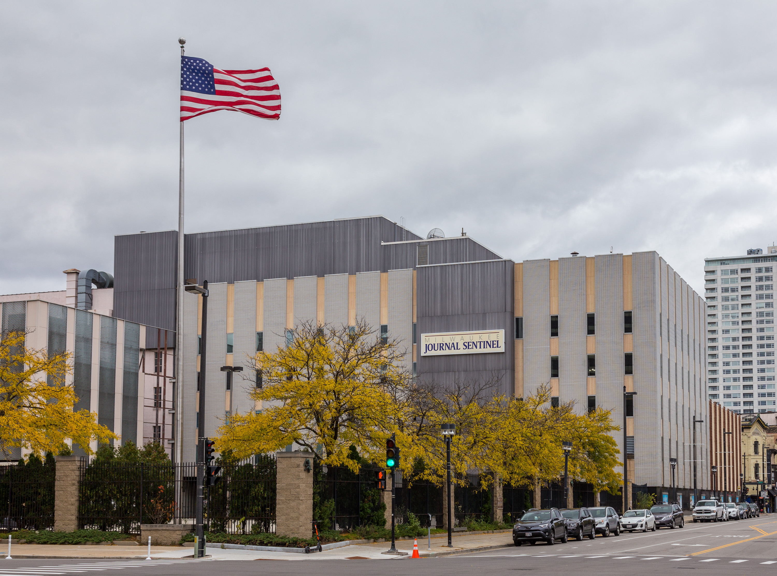
The ''Milwaukee Journal Sentinel'' is a daily morning broadsheet printed in Milwaukee, Wisconsin, where it is the primary newspaper. It is also the largest newspaper in the state of Wisconsin, where it is widely distributed. It is currently owned by the Gannett Company.Gannett Completes Acquisition of Journal Media Group . ''USA Today'', April 11, 2016. In early 2003, the ''Milwaukee Journal Sentinel'' began printing operations at a new printing facility in West Milwaukee. In September 2006, the ''Journal Sentinel'' announced it had "signed a five-year agreement to print the national edition of '' |
Durban
Durban ( ) ( zu, eThekwini, from meaning 'the port' also called zu, eZibubulungwini for the mountain range that terminates in the area), nicknamed ''Durbs'',Ishani ChettyCity nicknames in SA and across the worldArticle on ''news24.com'' from 25 October 2017. Retrieved 2021-03-05.The names and the naming of Durban Website ''natalia.org.za'' (pdf). Retrieved 2021-03-05. is the third most populous city in after and |
Eastern Cape Province
The Eastern Cape is one of the provinces of South Africa. Its capital is Bhisho, but its two largest cities are East London and Gqeberha. The second largest province in the country (at 168,966 km2) after Northern Cape, it was formed in 1994 out of the Xhosa homelands or bantustans of Transkei and Ciskei, together with the eastern portion of the Cape Province. The central and eastern part of the province is the traditional home of the indigenous Xhosa people. In 1820 this area which was known as the Xhosa Kingdom began to be settled by Europeans who originally came from England and some from Scotland and Ireland. Since South Africa's early years, many Xhosas believed in Africanism and figures such as Walter Rubusana believed that the rights of Xhosa people and Africans in general, could not be protected unless Africans mobilized and worked together. As a result, the Eastern Cape is home to many anti-apartheid leaders such as Robert Sobukwe, Oliver Tambo, Nelson Mandela, Wal ... [...More Info...] [...Related Items...] OR: [Wikipedia] [Google] [Baidu] |


