|
Cofaqui
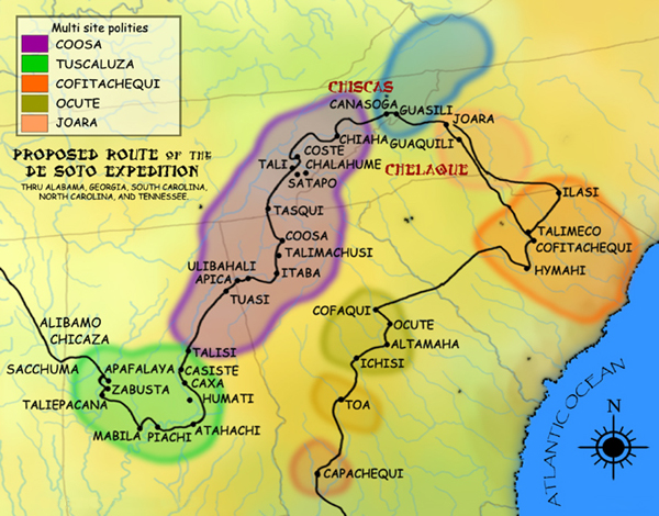
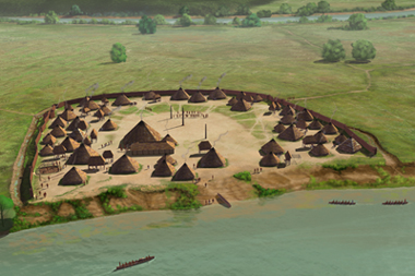
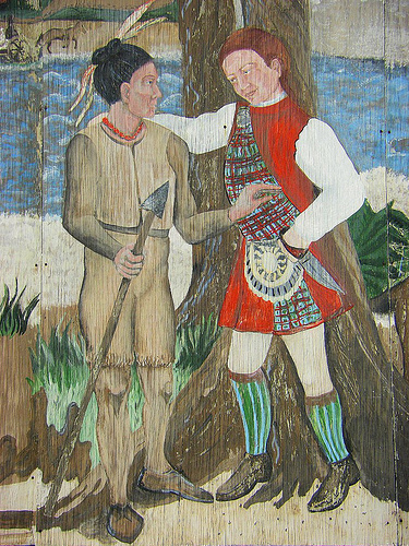
Ocute, later known as Altamaha or La Tama and sometimes known conventionally as the Oconee province, was a Native American paramount chiefdom in the Piedmont region of the U.S. state of Georgia in the 16th and 17th centuries. Centered in the Oconee River valley, the main chiefdom of Ocute held sway over the nearby chiefdoms of Altamaha, Cofaqui, and possibly others. The Oconee valley area was populated for thousands of years, and the core chiefdoms of Ocute emerged following the rise of the Mississippian culture around 1100. Ocute was invaded by the expedition of the Spanish conquistador Hernando de Soto in 1539. At that time, Ocute was locked in a longstanding war with the rival paramount chiefdom of Cofitachequi in present-day South Carolina. The chiefdom remained a significant regional power into the 17th century, although Altamaha eclipsed Ocute as the primary center, leading the Spanish to refer to the paramountcy as La Tama. In the 1660s the chiefdom fragmented due to s ... [...More Info...] [...Related Items...] OR: [Wikipedia] [Google] [Baidu] |
Cofitachequi
Cofitachequi was a paramount chiefdom founded about 1300 AD and encountered by the Hernando de Soto expedition in South Carolina in April 1540. Cofitachequi was later visited by Juan Pardo during his two expeditions (1566–1568) and by Henry Woodward in 1670. Cofitachequi ceased to exist as a political entity prior to 1701. The town and ceremonial center of Cofitachequi was located near the present-day city of Camden, South Carolina. Cofitachequi ruled a large number of towns in an area of several thousand square miles in the northeastern part of South Carolina. It was the easternmost manifestation of the Mississippian culture that extended over much of the southern part of the future United States. Location The hunt for the location of Cofitachequi has been stimulated by the century-old search for the route of Hernando de Soto in his 4-year traverse of much of the southeastern United States. The Spaniards described Cofitachequi as about 10 days travel eastward from Ocute ... [...More Info...] [...Related Items...] OR: [Wikipedia] [Google] [Baidu] |
Dyar Site
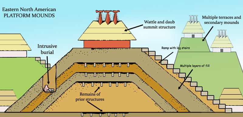
The Dyar site ( 9GE5) is an archaeological site in Greene County, Georgia, in the north central Piedmont physiographical region. The site covers an area of 2.5 hectares. It was inhabited almost continuously from 1100 to 1600 by a local variation of the Mississippian culture known as the South Appalachian Mississippian culture. Although submerged under Lake Oconee, the site is still important as one of the first explorations of a large Mississippian culture mound. The Dyar site is thought to have been one of the principal towns of the paramount chiefdom of Ocute, perhaps Cofaqui. Site description The platform mound located at the site was described in 1975 as being in the shape of a truncated cone approximately high and with a base in diameter. On the eastern edge of the mound in the central area of the site was a plaza surrounded by domestic structures making up an oval shaped village of 2.13 hectares. Mound Platform mounds are built up in a series of stages that can span ge ... [...More Info...] [...Related Items...] OR: [Wikipedia] [Google] [Baidu] |
Ceramics
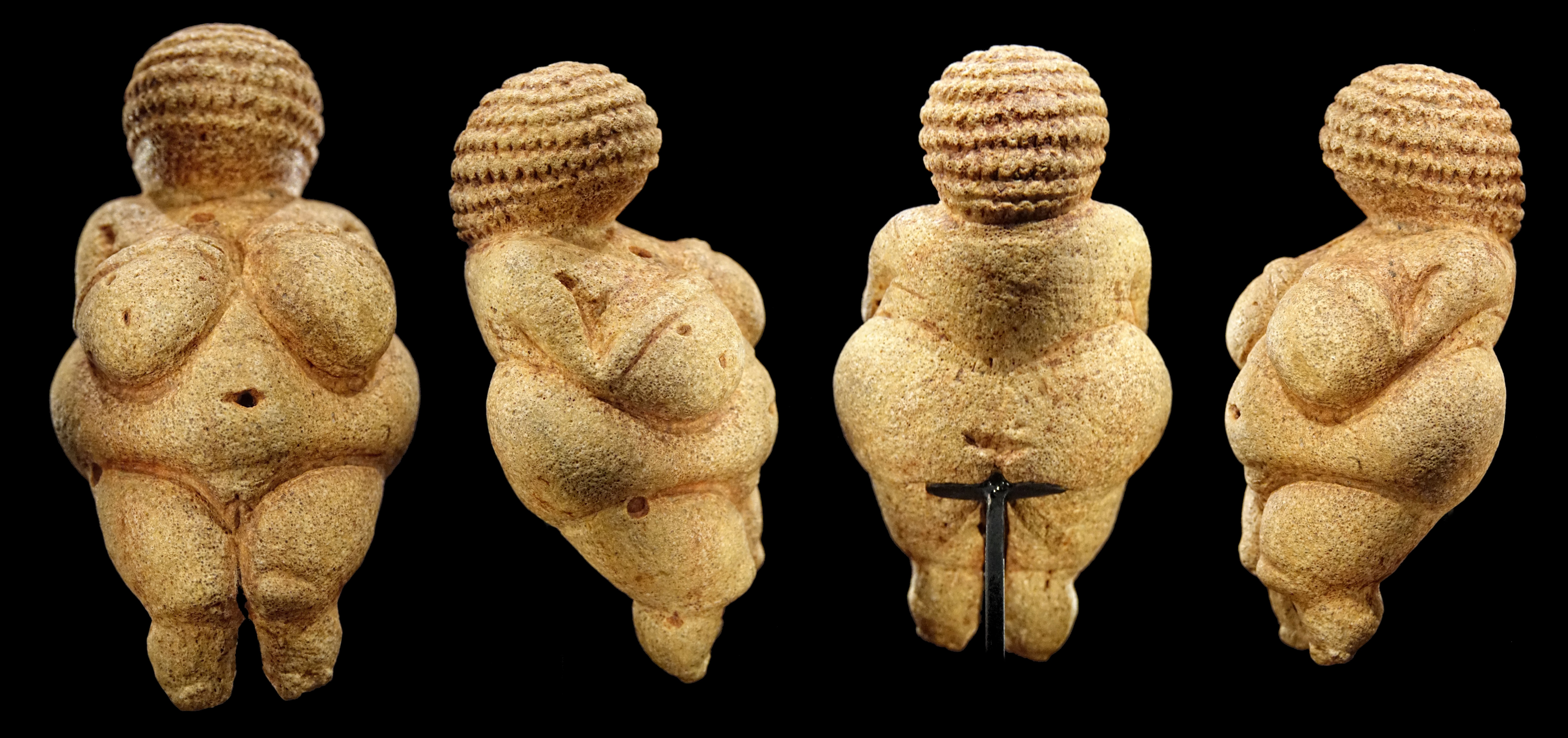
A ceramic is any of the various hard, brittle, heat-resistant and corrosion-resistant materials made by shaping and then firing an inorganic, nonmetallic material, such as clay, at a high temperature. Common examples are earthenware, porcelain, and brick. The earliest ceramics made by humans were pottery objects (''pots,'' ''vessels or vases'') or figurines made from clay, either by itself or mixed with other materials like silica, hardened and sintered in fire. Later, ceramics were glazed and fired to create smooth, colored surfaces, decreasing porosity through the use of glassy, amorphous ceramic coatings on top of the crystalline ceramic substrates. Ceramics now include domestic, industrial and building products, as well as a wide range of materials developed for use in advanced ceramic engineering, such as in semiconductors. The word "''ceramic''" comes from the Greek word (), "of pottery" or "for pottery", from (), "potter's clay, tile, pottery". The earliest known m ... [...More Info...] [...Related Items...] OR: [Wikipedia] [Google] [Baidu] |
Middle Woodland Period
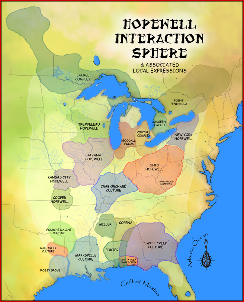
In the classification of archaeological cultures of North America, the Woodland period of North American pre-Columbian cultures spanned a period from roughly 1000 BCE to European contact in the eastern part of North America, with some archaeologists distinguishing the Mississippian period, from 1000 CE to European contact as a separate period. The term "Woodland Period" was introduced in the 1930s as a generic term for prehistoric sites falling between the Archaic hunter-gatherers and the agriculturalist Mississippian cultures. The Eastern Woodlands cultural region covers what is now eastern Canada south of the Subarctic region, the Eastern United States, along to the Gulf of Mexico. This period is variously considered a developmental stage, a time period, a suite of technological adaptations or "traits", and a "family tree" of cultures related to earlier Archaic cultures. It can be characterized as a chronological and cultural manifestation without any massive changes in a ... [...More Info...] [...Related Items...] OR: [Wikipedia] [Google] [Baidu] |
Flint River (Georgia)
The Flint River is a U.S. Geological Survey. National Hydrography Dataset high-resolution flowline dataThe National Map, accessed April 15, 2011 river in the U.S. state of Georgia. The river drains of western Georgia, flowing south from the upper Piedmont region south of Atlanta to the wetlands of the Gulf Coastal Plain in the southwestern corner of the state. Along with the Apalachicola and the Chattahoochee rivers, it forms part of the ACF basin. In its upper course through the red hills of the Piedmont, it is considered especially scenic, flowing unimpeded for over . Historically, it was also called the Thronateeska River. Description The Flint River rises in west central Georgia in the city of East Point in southern Fulton County on the southern outskirts of the Atlanta metropolitan area as ground seepage. The exact start can be traced to the field located between Plant Street, Willingham Drive, Elm Street, and Vesta Avenue. It travels under the runways of the Hartsfi ... [...More Info...] [...Related Items...] OR: [Wikipedia] [Google] [Baidu] |
Altamaha River
The Altamaha River is a major river in the U.S. state of Georgia. It flows generally eastward for 137 miles (220 km) from its origin at the confluence of the Oconee River and Ocmulgee River towards the Atlantic Ocean, where it empties into the ocean near Brunswick, Georgia. No dams are directly on the Altamaha, though some are on the Oconee and the Ocmulgee. Including its tributaries, the Altamaha River's drainage basin is about in size, qualifying it among the larger river basins of the US Atlantic coast.The Altamaha River Course [...More Info...] [...Related Items...] OR: [Wikipedia] [Google] [Baidu] |
Savannah River
The Savannah River is a major river in the southeastern United States, forming most of the border between the states of South Carolina and Georgia. Two tributaries of the Savannah, the Tugaloo River and the Chattooga River, form the northernmost part of the border. The Savannah River drainage basin extends into the southeastern side of the Appalachian Mountains just inside North Carolina, bounded by the Eastern Continental Divide. The river is around long.U.S. Geological Survey. National Hydrography Dataset high-resolution flowline dataThe National Map, accessed April 26, 2011 The Savannah was formed by the confluence of the Tugaloo River and the Seneca River. Today this confluence is submerged beneath Lake Hartwell. The Tallulah Gorge is located on the Tallulah River, a tributary of the Tugaloo River that forms the northwest branch of the Savannah River. Two major cities are located along the Savannah River: Savannah and Augusta, Georgia. They were nuclei of early Eng ... [...More Info...] [...Related Items...] OR: [Wikipedia] [Google] [Baidu] |
Coosa Chiefdom
The Coosa chiefdom was a powerful Native American paramount chiefdom in what are now Gordon and Murray counties in Georgia, in the United States."Late Prehistoric/Early Historic Chiefdoms (ca. A.D. 1300-1850)" ''''. Retrieved July 22, 2010. It was inhabited from about 1400 until about 1600, and dominated several smaller chiefdoms. The total population of Coosa's area of influence, reaching into present-day Tennessee and Alabama, has been estimated at 50,000. |
Guale
Guale was a historic Native American chiefdom of Mississippian culture peoples located along the coast of present-day Georgia and the Sea Islands. Spanish Florida established its Roman Catholic missionary system in the chiefdom in the late 16th century. During the late 17th century and early 18th century, Guale society was shattered by extensive epidemics of new infectious diseases and attacks by other tribes. Some of the surviving remnants migrated to the mission areas of Spanish Florida, while others remained near the Georgia coast. Joining with other survivors, they became known as the Yamasee, an ethnically mixed group that emerged in a process of ethnogenesis. Language Scholars have not reached a consensus on how to classify the Guale language. Early claims that the Guale spoke a Muskogean language were questioned by the historian William C. Sturtevant. He has shown that recorded vocabulary, which sources had believed to be Guale, was Creek, a distinct Muskogean language ... [...More Info...] [...Related Items...] OR: [Wikipedia] [Google] [Baidu] |
Ocmulgee River
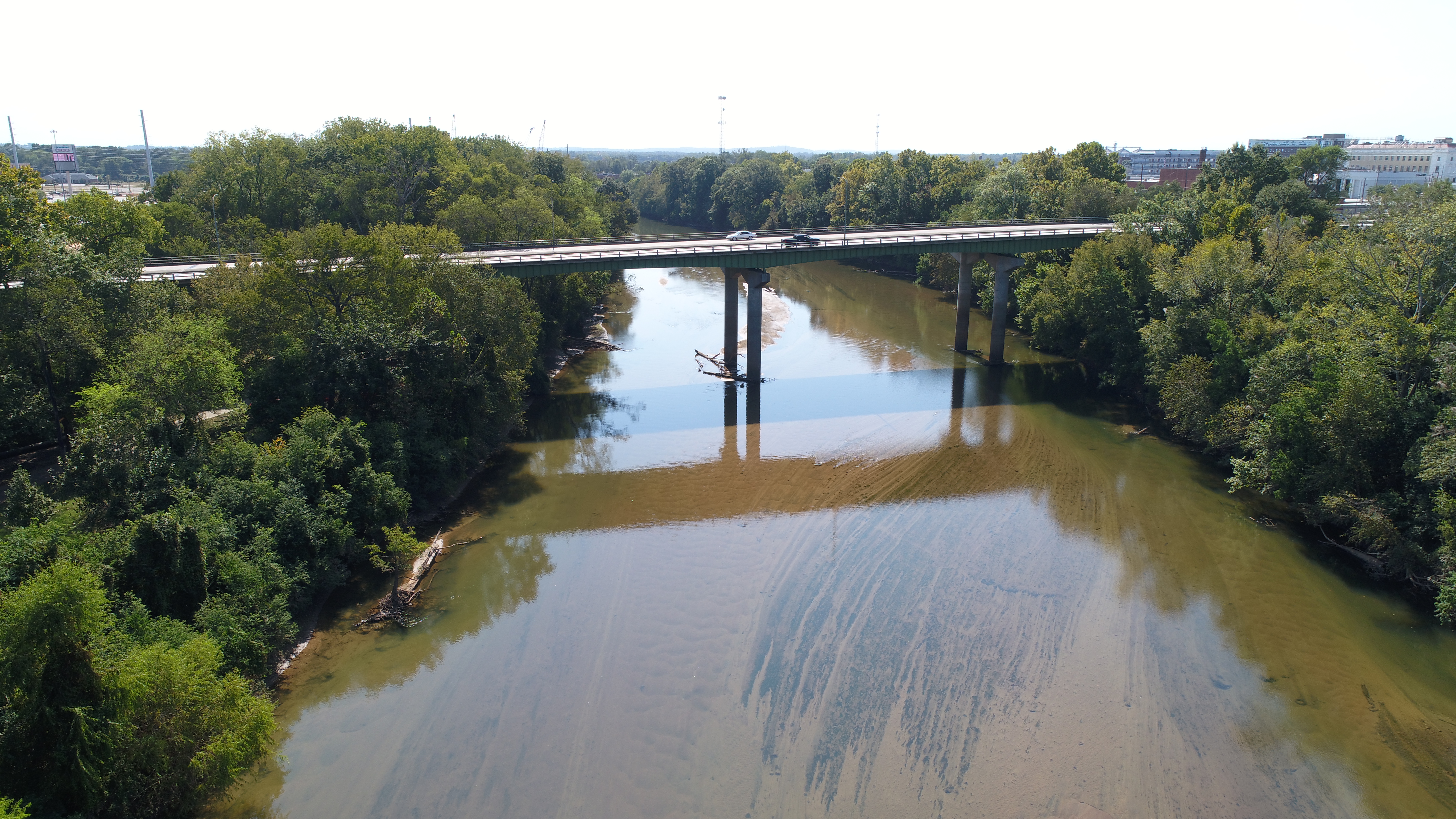
The Ocmulgee River () is a western tributary of the Altamaha River, approximately 255 mi (410 km) long, in the U.S. state of Georgia (U.S. state), Georgia. It is the westernmost major tributary of the Altamaha.Ocmulgee River ''New Georgia Encyclopedia'' (August 9, 2004). It was formerly known by its Hitchiti name of Ocheese Creek, from which the Muscogee, Creek (Muscogee) people derived their name. The Ocmulgee River and its tributaries provide drainage for some 6,180 square miles in parts of List of counties in Georgia, 33 Georgia counties, a large section of the Piedmont (United States), Piedmont and coastal plain of central Georgia. The Ocmulgee River Drainage basin, basin has three river subbasins designated by the United States Geological Survey, U.S. Geological Su ... [...More Info...] [...Related Items...] OR: [Wikipedia] [Google] [Baidu] |
