|
City Hall (Manhattan)
New York City Hall is the seat of New York City government, located at the center of City Hall Park in the Civic Center area of Lower Manhattan, between Broadway, Park Row, and Chambers Street. Constructed from 1803 to 1812, the building is the oldest city hall in the United States that still houses its original governmental functions, such as the office of the Mayor of New York City and the chambers of the New York City Council. While the Mayor's Office is in the building, the staff of thirteen municipal agencies under mayoral control are located in the nearby Manhattan Municipal Building, one of the largest government buildings in the world, with many others housed in various buildings in the immediate vicinity. New York City Hall is a National Historic Landmark and is listed on the National Register of Historic Places. [...More Info...] [...Related Items...] OR: [Wikipedia] [Google] [Baidu] |
City Hall Park
City Hall Park is a public park surrounding New York City Hall in the Civic Center of Manhattan. It was the town commons of the nascent city of New York. History 17th century David Provoost was an officer in the Dutch West India Company. His name was on an 1652 list of nine men who governed New Amsterdam. He owned around where City Hall Park is now situated. 18th century During the pre-Revolutionary era City Hall Park was the site of many rallies and movements. For instance, in 1765, New Yorkers protested the Stamp Act of 1765 at the site. On March 18, 1766, New Yorkers rejoiced when the Stamp Act was repealed. In 1766, the Sons of Liberty erected the first “ Liberty pole", a commemorative mast topped by a vane featuring the word “liberty", outside the Soldiers’ Barracks. British soldiers chopped it down, and it was replaced five times. A replica dating to 1921 now stands near its original location between City Hall and Broadway. In 1766, St. Paul's Chapel ... [...More Info...] [...Related Items...] OR: [Wikipedia] [Google] [Baidu] |
National Register Of Historic Places
The National Register of Historic Places (NRHP) is the United States federal government's official list of districts, sites, buildings, structures and objects deemed worthy of preservation for their historical significance or "great artistic value". A property listed in the National Register, or located within a National Register Historic District, may qualify for tax incentives derived from the total value of expenses incurred in preserving the property. The passage of the National Historic Preservation Act (NHPA) in 1966 established the National Register and the process for adding properties to it. Of the more than one and a half million properties on the National Register, 95,000 are listed individually. The remainder are contributing resources within historic districts. For most of its history, the National Register has been administered by the National Park Service (NPS), an agency within the U.S. Department of the Interior. Its goals are to help property owners an ... [...More Info...] [...Related Items...] OR: [Wikipedia] [Google] [Baidu] |
Brownstone
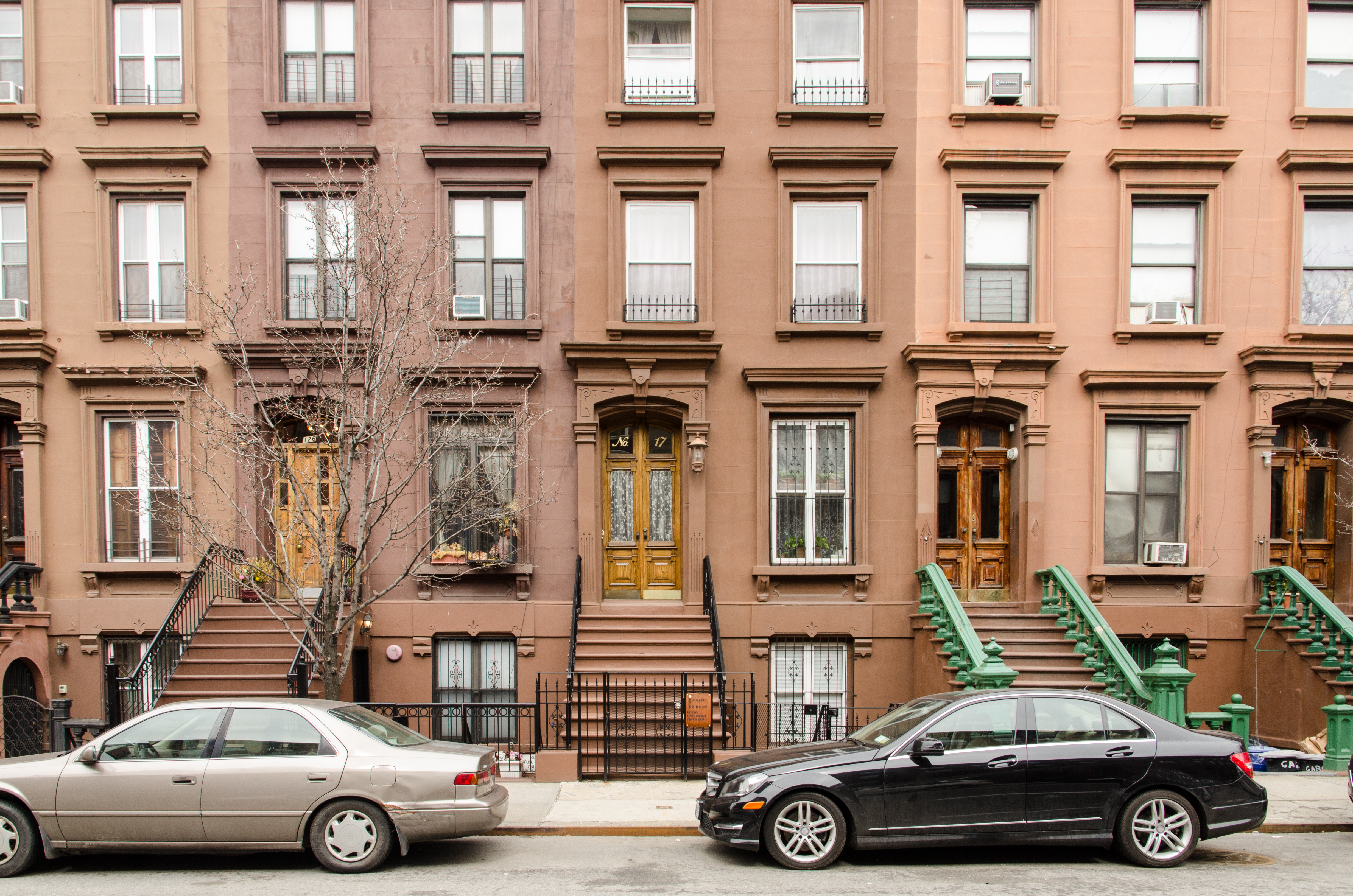
Brownstone is a brown Triassic–Jurassic sandstone that was historically a popular building material. The term is also used in the United States and Canada to refer to a townhouse clad in this or any other aesthetically similar material. Types Apostle Island brownstone In the 19th century, Basswood Island, Wisconsin was the site of a quarry run by the Bass Island Brownstone Company which operated from 1868 into the 1890s. The brownstone from this and other quarries in the Apostle Islands was in great demand, with brownstone from Basswood Island being used in the construction of the first Milwaukee County Courthouse in the 1860s. Hummelstown brownstone Hummelstown brownstone is extremely popular along the East Coast of the United States, with numerous government buildings throughout West Virginia, Pennsylvania, New York, Maryland, and Delaware being faced entirely with the stone, which comes from the Hummelstown Quarry in Hummelstown, Pennsylvania, a small town outside of ... [...More Info...] [...Related Items...] OR: [Wikipedia] [Google] [Baidu] |
Castle Clinton
Castle Clinton (also known as Fort Clinton and Castle Garden) is a circular sandstone fort within Battery Park at the southern end of Manhattan in New York City. Built from 1808 to 1811, it was the first American immigration station, predating Ellis Island. More than 7.5 million people arrived in the United States at Fort Clinton between 1855 to 1890. Over its active life, it has also functioned as a beer garden, exhibition hall, theater, and public aquarium. The structure is a New York City designated landmark and a United States national monument, and it is listed on the National Register of Historic Places. Fort Clinton was originally known as the West Battery or the Southwest Battery, occupying an artificial island off the shore of Lower Manhattan. Designed by John McComb Jr., with Jonathan Williams as consulting engineer, the fort was garrisoned in 1812 but was never used for warfare. In 1824, the New York City government converted Fort Clinton into a 6,000-seat entertai ... [...More Info...] [...Related Items...] OR: [Wikipedia] [Google] [Baidu] |
Commons
The commons is the cultural and natural resources accessible to all members of a society, including natural materials such as air, water, and a habitable Earth. These resources are held in common even when owned privately or publicly. Commons can also be understood as natural resources that groups of people (communities, user groups) manage for individual and collective benefit. Characteristically, this involves a variety of informal norms and values (social practice) employed for a governance mechanism. Commons can also be defined as a social practice of governing a resource not by state or market but by a community of users that self-governs the resource through institutions that it creates. Definition and modern use The Digital Library of the Commons defines "commons" as "a general term for shared resources in which each stakeholder has an equal interest". The term "commons" derives from the traditional English legal term for common land, which are also known as "commons", ... [...More Info...] [...Related Items...] OR: [Wikipedia] [Google] [Baidu] |
Federal Hall
Federal Hall is a historic building at 26 Wall Street in the Financial District of Manhattan in New York City. The current Greek Revival–style building, completed in 1842 as the Custom House, is operated by the National Park Service as a national memorial called the Federal Hall National Memorial. The memorial is named after a Federal style building on the same site, completed in 1703 as City Hall. The original building served as New York's first City Hall and hosted the 1765 Stamp Act Congress before the American Revolution. After the United States became an independent nation, the building served as meeting place for the Congress of the Confederation, the nation's first central government under the Articles of Confederation, from 1785 to 1789. With the establishment of the United States federal government in 1789, it was renamed Federal Hall, as it hosted the 1st Congress and was the place where George Washington was sworn in as the nation’s first president. It was demo ... [...More Info...] [...Related Items...] OR: [Wikipedia] [Google] [Baidu] |
Nassau Street (Manhattan)
Nassau Street is in the Financial District, within the borough of Manhattan in New York City. Its southern end is at the intersection with Broad Street and Wall Street, and its northern end is at Spruce Street, at Pace University near the foot of the Brooklyn Bridge. For its entire route, Nassau Street runs one block east of Broadway and Park Row. History Nassau Street was originally called Kip Street, after an early Dutch settler family, but was subsequently named in honor of the royal family of the Netherlands, the House of Orange-Nassau. It was named some time before William of Nassau, the Dutch prince who became King William III of England, so that is not the origin of the name, despite how easily it could be mistaken as such. Nassau Street once housed many of the city's newspapers. Late in the 20th century Nassau Street was closed to motor traffic during certain hours, in order to promote shopping. Nassau Street borders on the Fulton-Nassau Historic District, wh ... [...More Info...] [...Related Items...] OR: [Wikipedia] [Google] [Baidu] |
Wall Street
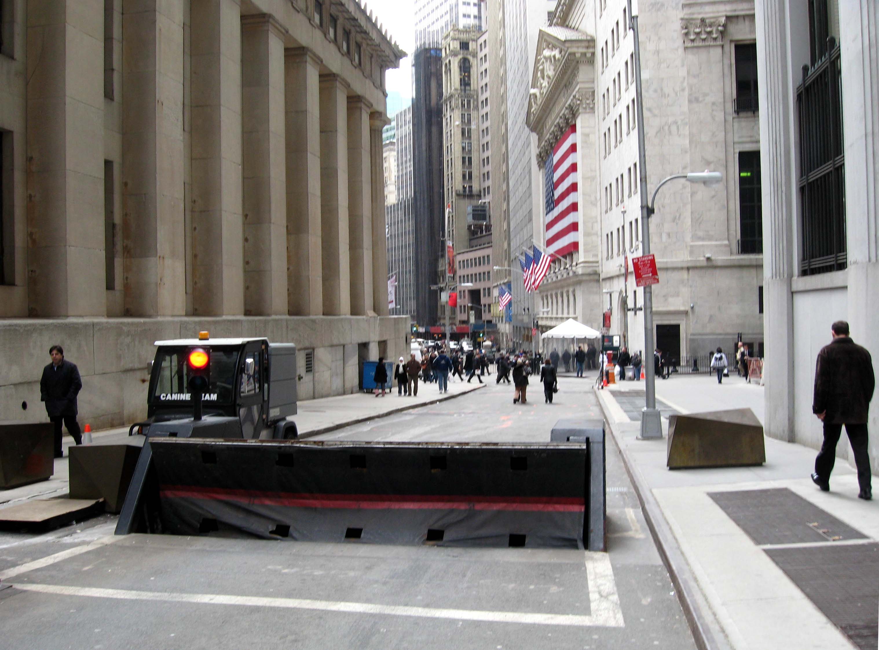
Wall Street is an eight-block-long street in the Financial District of Lower Manhattan in New York City. It runs between Broadway in the west to South Street and the East River in the east. The term "Wall Street" has become a metonym for the financial markets of the United States as a whole, the American financial services industry, New York–based financial interests, or the Financial District itself. Anchored by Wall Street, New York has been described as the world's principal financial center. Wall Street was originally known in Dutch as "de Waalstraat" when it was part of New Amsterdam in the 17th century, though the origins of the name vary. An actual wall existed on the street from 1685 to 1699. During the 17th century, Wall Street was a slave trading marketplace and a securities trading site, and from the early eighteenth century (1703) the location of Federal Hall, New York's first city hall. In the early 19th century, both residences and businesses occupied th ... [...More Info...] [...Related Items...] OR: [Wikipedia] [Google] [Baidu] |
Pearl Street (Manhattan)
Pearl Street is a street in the Financial District in Lower Manhattan, running northeast from Battery Park to the Brooklyn Bridge with an interruption at Fulton Street, where Pearl Street's alignment west of Fulton Street shifts one block south of its alignment east of Fulton Street, then turning west and terminating at Centre Street. History Pearl Street takes its name from of a prominent Lenape shell midden that was located on its southern section, and that may have also marked a Lenape canoe landing. The colonial history of Pearl Street dates back to the early 1600s. A cow path at first, it was laid out in 1633. It lay along a beachy area known as the Strand. Its name is an English translation of the Dutch Parelstraat (written as Paerlstraet around 1660). The street is visible on the Castello Plan along the eastern shore of New Amsterdam, together with Schreyers Hook Dock (cf. Amsterdam's Schreierstoren) built by Broad Canal as the city's first wharf in 1648. It wa ... [...More Info...] [...Related Items...] OR: [Wikipedia] [Google] [Baidu] |
New Amsterdam
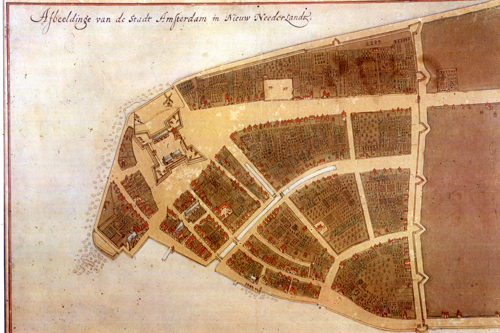
New Amsterdam ( nl, Nieuw Amsterdam, or ) was a 17th-century Dutch settlement established at the southern tip of Manhattan Island that served as the seat of the colonial government in New Netherland. The initial trading ''factory'' gave rise to the settlement around Fort Amsterdam. The fort was situated on the strategic southern tip of the island of Manhattan and was meant to defend the fur trade operations of the Dutch West India Company in the North River (Hudson River). In 1624, it became a provincial extension of the Dutch Republic and was designated as the capital of the province in 1625. By 1655, the population of New Netherland had grown to 2,000 people, with 1,500 living in New Amsterdam. By 1664, the population of New Netherland had risen to almost 9,000 people, 2,500 of whom lived in New Amsterdam, 1,000 lived near Fort Orange, and the remainder in other towns and villages. In 1664, the English took over New Amsterdam and renamed it New York after the Duke o ... [...More Info...] [...Related Items...] OR: [Wikipedia] [Google] [Baidu] |


.jpg)
