|
Chipata Airport
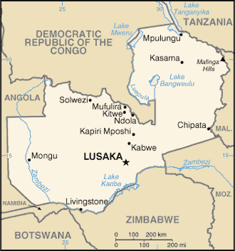
Chipata Airport is an airport serving Chipata, a city in the Eastern Province of Zambia. The Chipata non-directional beacon (Ident: CP) is located on the field. Location Chipata Airport is in eastern Zambia, near the town of Chipata, approximately , by air, northeast of Lusaka International Airport, the country's largest civilian and military airport. This location is approximately by road, northwest of the central business district of the town of Chipata. Airlines and destinations See also *Transport in Zambia *List of airports in Zambia This is a list of airports in Zambia, sorted by location. Zambia, officially the Republic of Zambia, is a landlocked country in Southern Africa. The neighboring countries are the Democratic Republic of the Congo to the north, Tanzania to the nor ... References External links *OpenStreetMap - Chipata Airport Airports in Zambia Buildings and structures in Eastern Province, Zambia {{Zambia-airport-stub ... [...More Info...] [...Related Items...] OR: [Wikipedia] [Google] [Baidu] |
Chipata
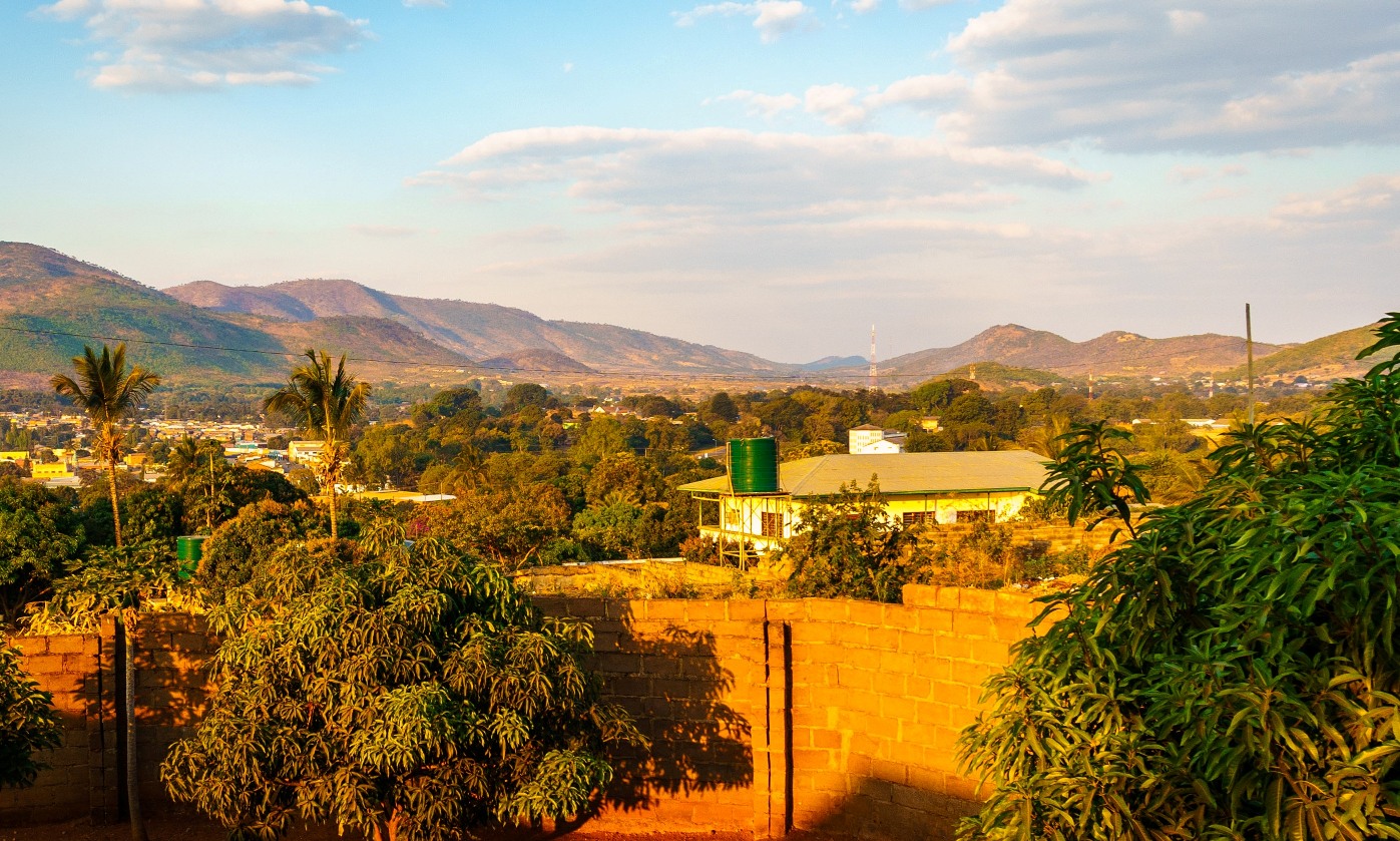
The city of Chipata is the administrative centre of the Eastern Province of Zambia and Chipata District. It was declared the 5th city of the country, after Lusaka, Ndola, Kitwe and Livingstone, by President Edgar Lungu on 24 February 2017. The city has undergone rapid economic and infrastructure growth in the years, leading up to city status. Location Chipata is located approximately , east of Lusaka, the capital city of Zambia. This is about west of Lilongwe, the capital city of Malawi. The geographical coordinates of Chipata are 13°38'43.0"S, 32°38'47.0"E (Latitude:13°38'43.0"S; Longitude:32°38'47.0"E). The average elevation of Chipata is , above sea level. Overview Having a modern market, a central hospital, shopping malls, a university, some colleges and a number of schools, Chipata is the business and administrative hub of the region. The town boasts a four star hotel, a golf course, an airport, and a "welcome arch". Developed areas includes Kalongwezi, Moth, and Lit ... [...More Info...] [...Related Items...] OR: [Wikipedia] [Google] [Baidu] |
Zambia
Zambia (), officially the Republic of Zambia, is a landlocked country at the crossroads of Central Africa, Central, Southern Africa, Southern and East Africa, although it is typically referred to as being in Southern Africa at its most central point. Its neighbours are the Democratic Republic of the Congo to the north, Tanzania to the northeast, Malawi to the east, Mozambique to the southeast, Zimbabwe and Botswana to the south, Namibia to the southwest, and Angola to the west. The capital city of Zambia is Lusaka, located in the south-central part of Zambia. The nation's population of around 19.5 million is concentrated mainly around Lusaka in the south and the Copperbelt Province to the north, the core economic hubs of the country. Originally inhabited by Khoisan peoples, the region was affected by the Bantu expansion of the thirteenth century. Following the arrival of European exploration of Africa, European explorers in the eighteenth century, the British colonised the r ... [...More Info...] [...Related Items...] OR: [Wikipedia] [Google] [Baidu] |
Eastern Province, Zambia
Eastern Province is one of Zambia's ten provinces. The province lies between the Luangwa River and borders with Malawi to the east and Mozambique to the south, from Isoka in the northeast to the north of Luangwa in the south. The provincial capital is Chipata. Eastern province has an area of , locally shares border with three other provinces of the country and is divided into fifteen districts. As per the 2010 Zambian census, Eastern Province had a population of 1,592,661, accounting to 12.16% of the total Zambian population. The sex ratio was 1,030 for every 1,000 males. As of 2010, Chewa was the largest community in the region with 39.7 per cent of the total population and Chewa was the most widely spoken language with 34.6 per cent speaking it. On the tourism front, the province has four national parks. The province has two significant traditional ceremonies being the Nc'wala festival celebrated in Chipata District by the Ngoni tribe during February and the Chewa Kulamb ... [...More Info...] [...Related Items...] OR: [Wikipedia] [Google] [Baidu] |
Non-directional Beacon
A non-directional beacon (NDB) or non-directional radio beacon is a radio beacon which does not include directional information. Radio beacons are radio transmitters at a known location, used as an aviation or marine navigational aid. NDB are in contrast to directional radio beacons and other navigational aids, such as low-frequency radio range, VHF omnidirectional range (VOR) and tactical air navigation system (TACAN). NDB signals follow the curvature of the Earth, so they can be received at much greater distances at lower altitudes, a major advantage over VOR. However, NDB signals are also affected more by atmospheric conditions, mountainous terrain, coastal refraction and electrical storms, particularly at long range. The system, developed by United States Air Force (USAF) Captain Albert Francis Hegenberger, was used to fly the world's first instrument approach on May 9, 1932. Types of NDBs NDBs used for aviation are standardised by International Civil Aviation Organizat ... [...More Info...] [...Related Items...] OR: [Wikipedia] [Google] [Baidu] |
Lusaka International Airport
Kenneth Kaunda International Airport is an international airport located in Chongwe District, off the Great East Road, approximately northeast of the city centre of Lusaka, the capital and largest city of Zambia. The airport has a capacity of 6 million and is the largest in Zambia, serving as a hub for its region. The airport serves as a hub for Zambia Airways, Proflight Zambia, Royal Zambian Airlines, and Mahogany Air. The airport opened in 1967 as Lusaka International Airport. It was renamed in 2011 in honour of Kenneth Kaunda, the nation's first president. History In May 2012, KLM began operating a flight three times a week between Amsterdam and Lusaka using an Airbus A330-200. The flight was restructured later that year to also serve Harare. In October 2014 KLM stopped operating the flight in favour of offering codeshare flights operated by Kenya Airways from Nairobi. Expansion plans In 2015, the government of Zambia began a three-year, US$360 million expansion an ... [...More Info...] [...Related Items...] OR: [Wikipedia] [Google] [Baidu] |
Central Business District
A central business district (CBD) is the commercial and business centre of a city. It contains commercial space and offices, and in larger cities will often be described as a financial district. Geographically, it often coincides with the "city centre" or "downtown". However, these concepts are not necessarily synonymous: many cities have a central ''business'' district located away from its commercial and or cultural centre and or downtown/city centre, and there may be multiple CBDs within a single urban area. The CBD will often be characterised by a high degree of accessibility as well as a large variety and concentration of specialised goods and services compared to other parts of the city. For instance, Midtown Manhattan, New York City, is the largest central business district in the city and in the United States. London's city centre is usually regarded as encompassing the historic City of London and the medieval City of Westminster, while the City of London and the transform ... [...More Info...] [...Related Items...] OR: [Wikipedia] [Google] [Baidu] |
Proflight Zambia
Proflight Zambia is an airline based in Lusaka, Zambia that serves the business community and tourism industry. It is a trading name of Proflight Commuter Services Ltd. Proflight Zambia operates the largest fleet of aircraft in Zambia, operating both scheduled and charter flights. The airline has been growing rapidly in recent years and is the largest airline in Zambia by routes served and fleet size. History Proflight Air Services was founded in 1991 by pilot Tony Irwin, formerly of Zambia Airways. On 30 June 2009 the airline was authorized by the Zambia Competition Commission to form an alliance with Zambezi Airlines. The airline was officially rebranded as Proflight Zambia in 2010. In March 2013 Proflight took delivery of its first jet aircraft, a Boeing 737-200, and later in 2013 began regional scheduled service to Lilongwe, Malawi, and Dar es Salaam, Tanzania, although the Boeing was returned to the lessor, Star Air Cargo, in 2014. Corporate affairs Business trend ... [...More Info...] [...Related Items...] OR: [Wikipedia] [Google] [Baidu] |
Transport In Zambia
This article is about the transport in Zambia. Railway There is a total of 2,157 km (2008) of railway track in Zambia. Principal lines * Zambia Railways Limited (ZRL) – narrow gauge, 846 km Kitwe-Ndola-New Kapiri Mposhi-Kabwe-Lusaka- Livingstone-Zimbabwe with several freight branches mostly in the Copperbelt totalling 427 km including to DR Congo. Passenger services between Kitwe and Livingstone only. * TAZARA Railway – narrow gauge, 891 km in Zambia: New Kapiri Mposhi-Mpika- Kasama- Dar es Salaam Notable Branch lines * Maamba Colliery Railway, Choma to Masuka, built to carry coal. * The Mulobezi Railway (also known as Zambezi Sawmills Railway) is a narrow gauge line constructed to carry timber from Mulobezi to Livingstone. Has been reported at various times as defunct, currently listed in Railtracker (see 'Railway Network Map' below) but operating status not confirmed. * Mulungushi Commuter Line, later Njanji Commuter Line managed by ZRL, operated ... [...More Info...] [...Related Items...] OR: [Wikipedia] [Google] [Baidu] |
List Of Airports In Zambia
This is a list of airports in Zambia, sorted by location. Zambia, officially the Republic of Zambia, is a landlocked country in Southern Africa. The neighboring countries are the Democratic Republic of the Congo to the north, Tanzania to the northeast, Malawi to the east, Mozambique, Zimbabwe, Botswana and Namibia to the south, and Angola to the west. Zambia is divided into ten provinces. The capital city is Lusaka. __NOTOC__ Airports Airport names shown in bold indicate the airport has scheduled service on commercial airlines. See also * Department of Civil Aviation of Zambia * Transport in Zambia * List of Zambian airports by ICAO code * Wikipedia: WikiProject Aviation/Airline destination lists: Africa#Zambia References * * - includes IATA codes Great Circle Mapper: Airports in Zambia- IATA and ICAO codes {{Africa in topic, List of airports in, state=collapsed Zambia Airports Airports Zambia Zambia (), officially the Republic of Zambia, is a ... [...More Info...] [...Related Items...] OR: [Wikipedia] [Google] [Baidu] |
Airports In Zambia
This is a list of airports in Zambia, sorted by location. Zambia, officially the Republic of Zambia, is a landlocked country in Southern Africa. The neighboring countries are the Democratic Republic of the Congo to the north, Tanzania to the northeast, Malawi to the east, Mozambique, Zimbabwe, Botswana and Namibia to the south, and Angola to the west. Zambia is divided into ten provinces. The capital city is Lusaka. __NOTOC__ Airports Airport names shown in bold indicate the airport has scheduled service on commercial airlines. See also * Department of Civil Aviation of Zambia * Transport in Zambia * List of Zambian airports by ICAO code * Wikipedia: WikiProject Aviation/Airline destination lists: Africa#Zambia References * * - includes IATA codes Great Circle Mapper: Airports in Zambia- IATA and ICAO codes {{Africa in topic, List of airports in, state=collapsed Zambia Airports Airports Zambia Zambia (), officially the Republic of Zambia, is a ... [...More Info...] [...Related Items...] OR: [Wikipedia] [Google] [Baidu] |


.jpg)


