|
Charles, Providence, Rhode Island
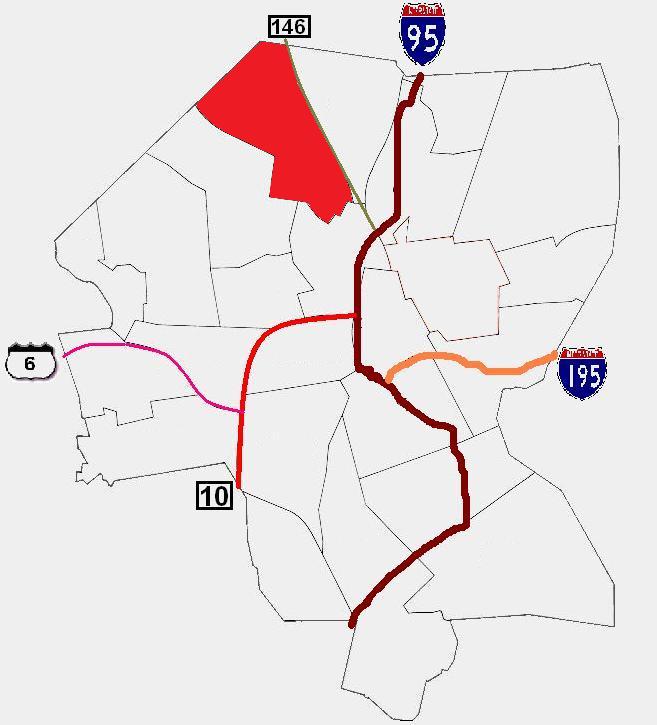
Charles is a neighborhood in northern Providence, Rhode Island. Along with Wanskuck, it comprises what is sometimes referred to as the North End. To the west Charles is partitioned from Wanskuck by Route 146, while the Chad Brown public housing complex separates Charles from Smith Hill to the south, and the West River and Interstate 95 bounds the area to the east. The city limits abutting the city of North Providence bound Charles to the north. History Until Wanskuck Road (now Branch Avenue) was completed in 1706, Charles's lack of connections to the more developed part of Providence kept the area sparsely populated. In 1765, the isolated North End (of which Charles is a part) was annexed to the neighboring town of North Providence. By the 19th century, the improvement in infrastructure and proximity to the West River caused corporations such as the Silver Spring Bleaching and Dyeing Company to move to the area. With the new industry came an influx of immigrants and an in ... [...More Info...] [...Related Items...] OR: [Wikipedia] [Google] [Baidu] |
Esek Hopkins Statue Wide View
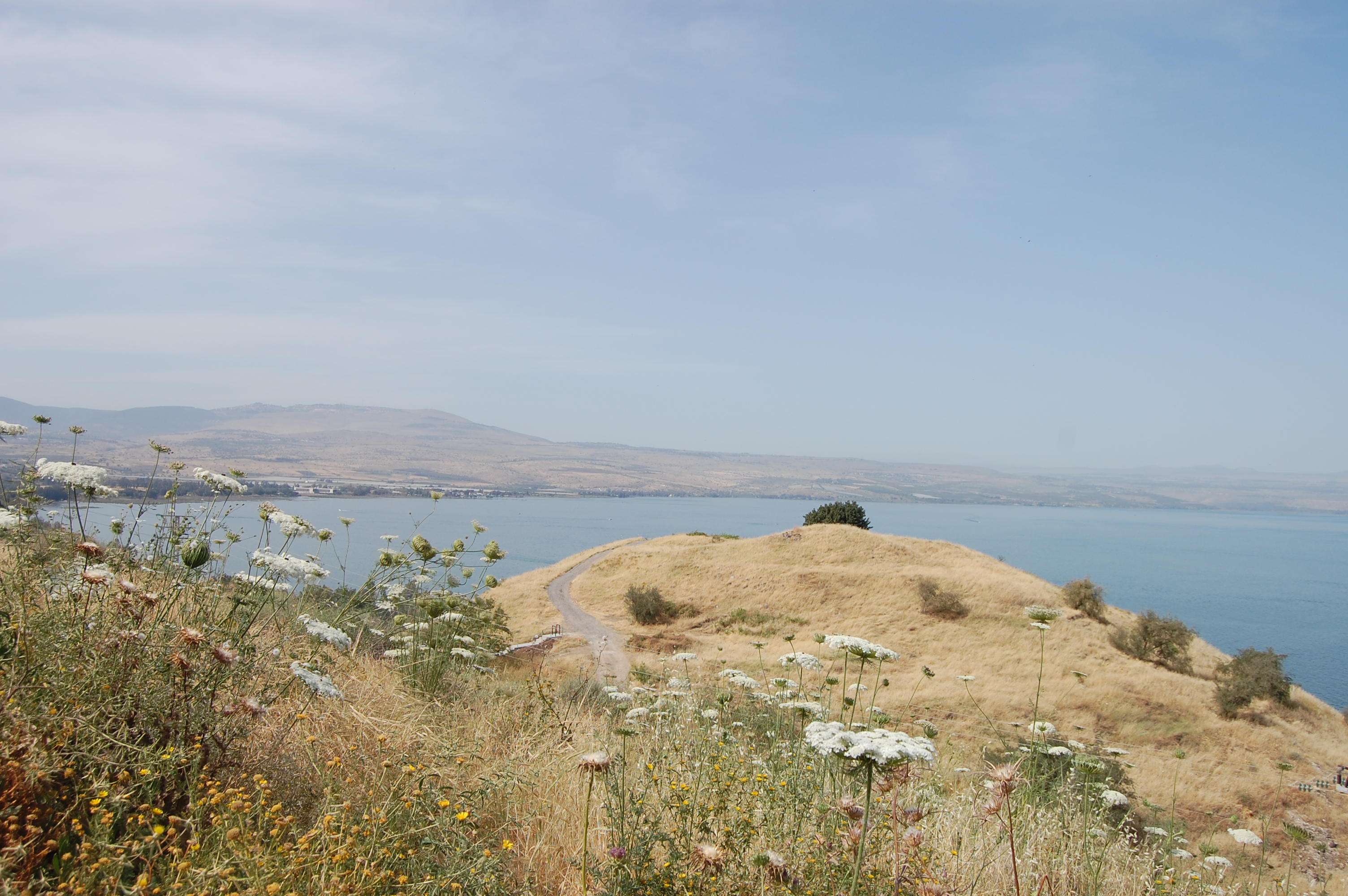
This is a list of places mentioned in the Bible, which do not have their own Wikipedia articles. See also the list of biblical places for locations which do have their own article. A Abana Abana, according to 2 Kings 5:12, was one of the "rivers of Damascus", along with the Pharpar river. Abdon Abdon was a Levitical city in Asher allocated to the Gershonites according to Joshua 21:30 and 1 Chronicles 6:74. Abel-Shittim Abel-Shittim, the last Israelite encampment before crossing into the Promised Land, is identified by Josephus with Abila in Peraea, probably the site of modern Tell el-Hammam in Jordan. Adam Adam was a location which, according to Joshua 3:16, was along the Jordan River, near Zarethan. According to Cheyne and Black, it may be a scribal error for "Adamah". Adadah Adadah is the name of a town mentioned in Joshua 15:22, in a list of towns inside the territory of the Tribe of Judah. The name "Adadah" appears nowhere else in the Bible."Adadah", in According to t ... [...More Info...] [...Related Items...] OR: [Wikipedia] [Google] [Baidu] |
Providence, Rhode Island
Providence is the capital and most populous city of the U.S. state of Rhode Island. One of the oldest cities in New England, it was founded in 1636 by Roger Williams, a Reformed Baptist theologian and religious exile from the Massachusetts Bay Colony. He named the area in honor of "God's merciful Providence" which he believed was responsible for revealing such a haven for him and his followers. The city developed as a busy port as it is situated at the mouth of the Providence River in Providence County, at the head of Narragansett Bay. Providence was one of the first cities in the country to industrialize and became noted for its textile manufacturing and subsequent machine tool, jewelry, and silverware industries. Today, the city of Providence is home to eight hospitals and List of colleges and universities in Rhode Island#Institutions, eight institutions of higher learning which have shifted the city's economy into service industries, though it still retains some manufacturin ... [...More Info...] [...Related Items...] OR: [Wikipedia] [Google] [Baidu] |
Wanskuck, Providence, Rhode Island
Wanskuck is a neighborhood in the northern part of Providence, Rhode Island. Along with Charles, it is one of two neighborhoods comprising what is often referred to as the North End. Wanskuck is bounded to the east by Route 146, to the west by Providence College, Admiral Street, Route 7, and Huxley Avenue, and to the south roughly by Fillmore Street. Parts of Wanskuck north of Branch Avenue are the Wanskuck Historic District. History The name of the area appears in early city records as Wanscott, Wenscott, or Wenscutt, which are derived from a Narragansett word for “low lands.” The area was annexed to North Providence in 1765, when it was mostly farmland. Textile mills were built along neighborhood streams in the 19th Century, among them the Wanskuck Company. Wanskuck was formed in 1862 by Stephen T. Olney, Jesse Metcalf and Henry J. Steere, and prospered by providing woolen uniforms to soldiers in the American Civil War The American Civil War (April 12, 1 ... [...More Info...] [...Related Items...] OR: [Wikipedia] [Google] [Baidu] |
Rhode Island Route 146
Route 146 is a limited-access road in the U.S. state of Rhode Island, maintained by the Rhode Island Department of Transportation (RIDOT). Spanning approximately along a northwest–southeast axis, it links the cities of Providence, Woonsocket, and Worcester, Massachusetts. The southern terminus of Route 146 is located at Interstate 95 (I-95) in Providence. The majority of the route is a controlled-access highway, with the exception of at-grade crossings and driveway access in the towns of North Smithfield and Lincoln. The northern terminus is located at the Rhode Island–Massachusetts state line in Millville, where it transitions into Massachusetts Route 146 and continues northbound towards the Massachusetts Turnpike in Millbury and I-290 in Worcester. Route description Route 146 begins in downtown Providence at I-95 northbound exit 38 (there is no direct access from I-95 southbound; access to Route 146 is via surface streets). Locally it ... [...More Info...] [...Related Items...] OR: [Wikipedia] [Google] [Baidu] |
Smith Hill, Providence, Rhode Island
Smith Hill is a neighborhood in Providence, Rhode Island. Its traditional bounds are the Woonasquatucket River, the Chad Brown public housing complex, Interstate 95 and West River. The Roger Williams Medical Center (RWMC) is located in the Smith Hill neighborhood and is adjacent to the VA hospital. The Rhode Island State House is also located on the border with Downtown. The name 'Smith Hill' is therefore used as a metonym for the Rhode Island state government and the Rhode Island General Assembly. History The neighborhood gets its name from settler John Smith, who set up a grist mill here in 1636, after being banished from England. Prior to the mid-1800s, the area was considered rural escape from downtown, with few homes. However, in the 1900s industrialization attracted immigrants from Ireland, Eastern Europe and the Balkans to work in nearby mills. The neighborhood's proximity to the Woonasquatucket and Moshassuck River The Moshassuck River is a river in the U.S ... [...More Info...] [...Related Items...] OR: [Wikipedia] [Google] [Baidu] |
West River (Rhode Island)
The West River is a river in the U.S. state of Rhode Island. It flows approximately U.S. Geological Survey. National Hydrography Dataset high-resolution flowline dataThe National Map accessed April 1, 2011 and is the only named tributary of the Moshassuck River. It has a history of providing water to textile mills during the Industrial Revolution as evidenced by the 7 dams along the river's length. Course The West River rises on the town line between Lincoln and Smithfield from a few small streams that originate in the vicinity of Lantern Road. The West River then flows southward, past Twin River Road and into Wenscott Reservoir. Below the reservoir, the river meanders east-southeast through North Providence and into Providence where it flows into the Moshassuck River north of downtown. Crossings Below is a list of all crossings over the West River. The list starts at the headwaters and goes downstream. *Smithfield **Whipple Road ***''Crosses two of the primary streams that con ... [...More Info...] [...Related Items...] OR: [Wikipedia] [Google] [Baidu] |
Interstate 95 In Rhode Island
Interstate 95 (I-95) is the main north–south Interstate Highway on the east coast of the United States, running generally southwest-northeast through the U.S. state of Rhode Island. It runs from the border with Connecticut near Westerly, through Warwick and Providence, and to the Massachusetts state line in Pawtucket. It has two auxiliary routes, both of which enter Massachusetts—I-195: a spur from Providence east to Cape Cod, and I-295, a western bypass of the Providence-Pawtucket area. South of Warwick, I-95 does not follow U.S. Route 1 (US 1), which it generally replaced in New England. It instead takes a shorter inland route, parallel to Route 3. Route 3 was designated Route 1A in 1922, a New England Interstate Route, but it has never been a U.S. Route. History Southern Rhode Island The diagonal corridor of Route 3 was a well-traveled shortcut to the older U.S. Route 1 even before any part of Interstate 95 was built. In the 1930s, a further cutoff w ... [...More Info...] [...Related Items...] OR: [Wikipedia] [Google] [Baidu] |
North Providence, Rhode Island
North Providence is a town in Providence County, Rhode Island, United States. The population was 34,114 at the 2020 census. Geography According to the United States Census Bureau, the Town of North Providence has a total area of , of which, is land and is water. Since North Providence is officially incorporated as a town and is the smallest incorporated municipality in the State of Rhode Island by total area, North Providence maintains the distinction as the smallest town in the smallest state. Although nearby Central Falls, at 1.29 square miles is geographically smaller than North Providence, Central Falls is incorporated as a city and, therefore, maintains the distinction of smallest city in the small state. The Town of North Providence is bordered by Providence to the south, Johnston to the west, Smithfield and Lincoln to the north and Pawtucket to the east. Within the town, there are multiple neighborhoods and villages, such as Allendale, Centredale, Fruit Hill, Grey ... [...More Info...] [...Related Items...] OR: [Wikipedia] [Google] [Baidu] |
Hispanic
The term ''Hispanic'' ( es, hispano) refers to people, Spanish culture, cultures, or countries related to Spain, the Spanish language, or Hispanidad. The term commonly applies to countries with a cultural and historical link to Spain and to Viceroyalty, viceroyalties formerly part of the Spanish Empire following the Spanish colonization of the Americas, parts of the Spanish East Indies, Asia-Pacific region and Hispanic Africa , Africa. Outside of Spain, the Spanish language is a predominant or official language in the countries of Hispanic America and Equatorial Guinea. Further, the cultures of these countries were influenced by Spain to different degrees, combined with the local pre-Hispanic culture or other foreign influences. Former Spanish colonies elsewhere, namely the Spanish East Indies (the Philippines, Marianas, etc.) and Spanish Sahara (Western Sahara), were also influenced by Spanish culture, however Spanish is not a predominant language in these regions. Hispanic cul ... [...More Info...] [...Related Items...] OR: [Wikipedia] [Google] [Baidu] |
African-American
African Americans (also referred to as Black Americans and Afro-Americans) are an Race and ethnicity in the United States, ethnic group consisting of Americans with partial or total ancestry from sub-Saharan Africa. The term "African American" generally denotes descendants of Slavery in the United States, enslaved Africans who are from the United States. While some Black immigrants or their children may also come to identify as African-American, the majority of first generation immigrants do not, preferring to identify with their nation of origin. African Americans constitute the second largest racial group in the U.S. after White Americans, as well as the third largest ethnic group after Hispanic and Latino Americans. Most African Americans are descendants of enslaved people within the boundaries of the present United States. On average, African Americans are of West Africa, West/Central Africa, Central African with some European descent; some also have Native Americans in th ... [...More Info...] [...Related Items...] OR: [Wikipedia] [Google] [Baidu] |
Providence City Council
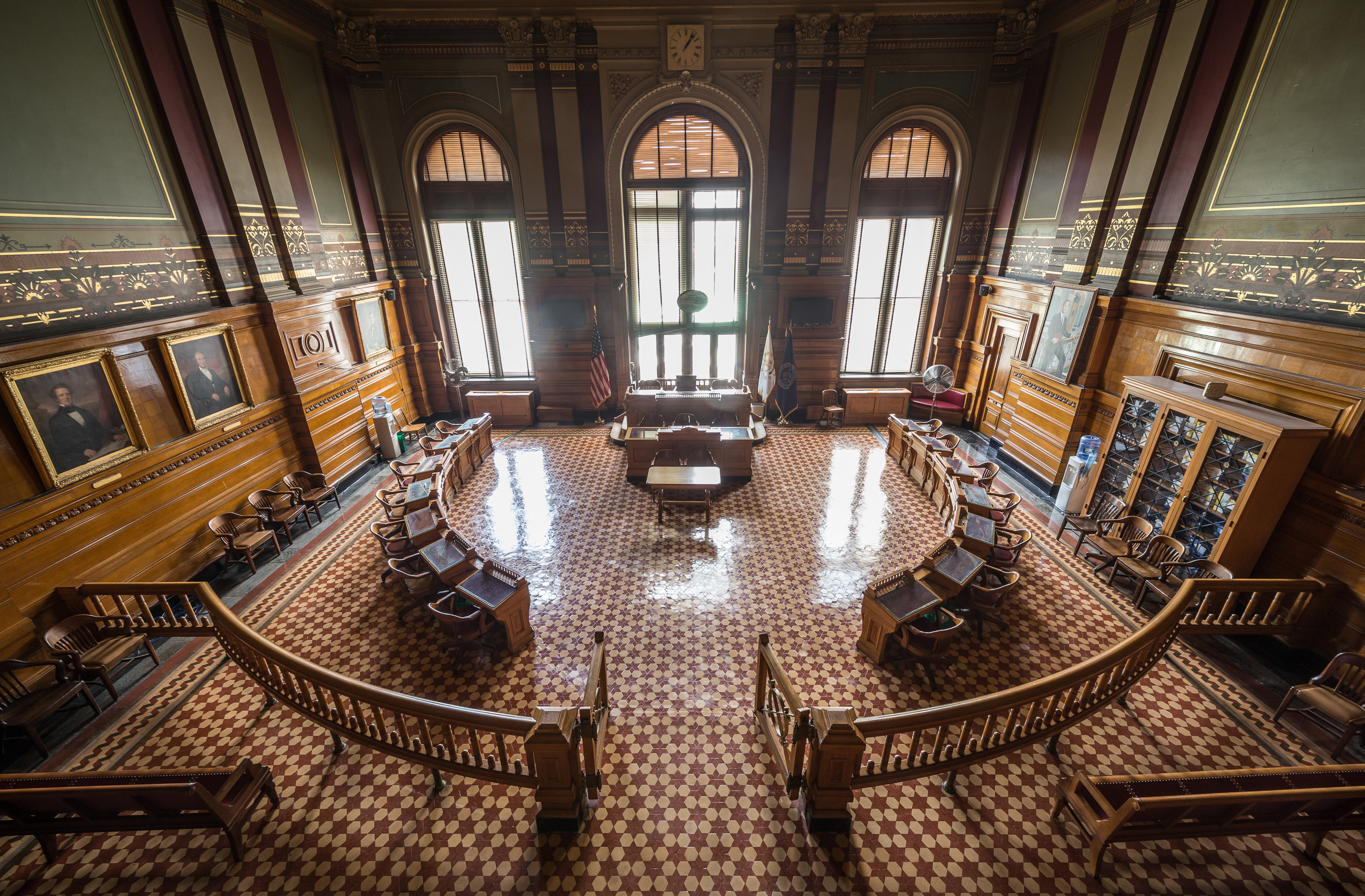
The Providence City Council is the fifteen-member legislative body of the city of Providence, Rhode Island. The two major responsibilities of the council are enacting ordinances necessary to ensure the welfare and good order of the city and adopting the city's annual budget. Providence uses a strong-mayor form of government in which the city council acts as a check against the power of the executive branch, the mayor. The members of the Providence City Council are elected by residents of the fifteen wards of Providence. City Council members are elected to four-year terms and are limited, by City Charter, to serving a maximum of three consecutive full terms (excluding any partial term of less than two years previously served). Council members represent the concerns, needs, and issues of their constituents, and work to improve the city's neighborhoods. City Council members, by ward The current City Council consists of: *Ward 1: Councilman John Goncalves *Ward 2: Councilwoman H ... [...More Info...] [...Related Items...] OR: [Wikipedia] [Google] [Baidu] |


