|
Chapainawabganj
Chapainawabganj (Bengali language, Bengali: চাঁপাইনবাবগঞ্জ) is located in the north-western part of Bangladesh. It is a part of the Rajshahi Division, and was formerly a sub-division of Malda district. The north and west part of Chapai Nawabganj is bounded by Malda district, Malda and Murshidabad districts of India, the east by Naogaon District, and south-east by Rajshahi District. History Chapainawabganj was one of the sub-divisions of the former Rajshahi zilla. Chapai Nawabganj was part of ancient Gour capital. It is said that this area had strategic and commercial importance due to its location at the junction of the rivers Mahananda River, Mahananda and the Ganges. Because of its importance, Alivardi Khan founded Nowabganj town which in course of time known as Nawabganj. Until 1947, Nawabganj was a thana under Malda district, India. The gateway of North Bengal, English Bazar, Malda was once the capital of Gour-Banga, with 3456 km2 of land ... [...More Info...] [...Related Items...] OR: [Wikipedia] [Google] [Baidu] |
Rajshahi Division
Rajshahi Division ( bn, রাজশাহী বিভাগ) is one of the eight first-level administrative divisions of Bangladesh. It has an area of and a population at the 2011 Census of 18,484,858. Rajshahi Division consists of 8 districts, 70 Upazilas (the next lower administrative tier) and 1,092 Unions (the lowest administrative tier). The region has historically been dominated by various feudal Rajas, Maharajas and Zamindars. Formerly comprising 16 districts, a new division (Rangpur Division) was formed with the 8 northern districts of the old Rajshahi Division from early 2010. Etymology and names The Rajshahi Division is named after Rajshahi District. Dominated by various feudal Rajas, Maharajas and Zamindars of mixed origins throughout history, the name is a compound of the words ''Raj'' and ''Shahi'', both of which can be translated into reign or kingdom. Archaic spellings in the English language also included ''Rajeshae''. The capital city of the division was for ... [...More Info...] [...Related Items...] OR: [Wikipedia] [Google] [Baidu] |
Naogaon District
Naogaon District ( bn, নওগাঁ, Nôugã) is a district in northern Bangladesh, part of the Rajshahi Division. It is named after its headquarters, the city of Naogaon in Naogaon Sadar Upazila. Demographics According to the 2022 Census of Bangladesh, Naogaon District had a population of 2,784,598, of which 13,74,312 were males and 14,08,840 females. The rural population was 23,67,082 (85.01%) while the urban population was 4,16,243 (14.99%). Naogaon district had a literacy rate of 72.14% for the population 7 years and above: 74.66% for males and 69.70% for females. This is up from 44.39% in 2001 and 28.40% in 1991. Nagaon District had a decadal growth rate of 8.73% for the decade 2001–2011, down from 11.33% in the decade 1991–2001. Muslims make up 86.82% of the population, while Hindus are 11.45% and Christians 0.77% of the population respectively. Other religions were 0.95% of the population. Ethnic minorities were 1,07,292 (3.85%). This was the largest ethnic m ... [...More Info...] [...Related Items...] OR: [Wikipedia] [Google] [Baidu] |
Mahananda River
The Mahananda River (Pron:/ˌməhɑːˈnʌndə or ˌmɑːhəˈnʌndə/) is a trans-boundary river that flows through the Indian states of Bihar and West Bengal, and Bangladesh. It is an important tributary of the Ganges. Course The Mahananda river system consists of two streams- one is locally known as Fulahar river and the other Mahananda. Fulahar originates from mountainous region of Himalayas in Nepal and traverses through the Indian state of Bihar and merges with Ganges in left opposite to Rajmahal. The Mahananda originates in the Himalayas: Paglajhora Falls on Mahaldiram Hill near Chimli, east of Kurseong in Darjeeling district at an elevation of . It flows through Mahananda Wildlife Sanctuary and descends to the plains near Siliguri. It touches Jalpaiguri district. It enters Bangladesh near Tentulia in Panchagarh District, flows for after Tentulia and returns to India. After flowing through Uttar Dinajpur district in West Bengal and Kishanganj, Purnia and Katihar distr ... [...More Info...] [...Related Items...] OR: [Wikipedia] [Google] [Baidu] |
Samudragupta
Samudragupta (Gupta script: ''Sa-mu-dra-gu-pta'', (c. 335–375 CE) was the second emperor of the Gupta Empire of ancient India, and is regarded among the greatest rulers of the dynasty. As a son of the Gupta emperor Chandragupta I and the Licchavi (tribe), Licchavi princess Kumaradevi, he greatly expanded his dynasty's political and military power. The Allahabad Pillar#Samudragupta inscription, Allahabad Pillar inscription, a ''prashasti'' (eulogy) composed by his courtier Harisena, Harishena, credits him with extensive military conquests. It suggests that he defeated several kings of northern India, and annexed their territories into his empire. He also marched along the south-eastern coast of India, advancing as far south as Kanchipuram in the Pallava dynasty, Pallava kingdom. In addition, he subjugated several frontier kingdoms and tribal oligarchies. At the height of his power, his empire extended from Ravi River in the west (present-day Punjab) to the Brahmaputra River i ... [...More Info...] [...Related Items...] OR: [Wikipedia] [Google] [Baidu] |
Dinajpur
Dinajpur ( bn, দিনাজপুর ) is a city and the District headquarters of Dinajpur district situated in Rangpur Division, Bangladesh. It was founded in 1786. It is located 413 km north-west of Dhaka in Bangladesh. It is bounded on the north by Suihari, Katapara, Bangi Bechapara, Pulhat, Koshba on the south, on the east of Sheikhupura and by the river Punarbhaba on the west. Dinajpur is Historically and culturally a very Important city in North Bengal. Geography and Climate Dinajpur is located on the north-western part of the country. It covers an area of 20.7 square kilometers (8.0 sq mi) It is situated in 25°37′ N. latitude and 88°39′ E longitude on the eastern bank of the river Punarbhaba. Dinajpur has a humid subtropical climate (''Cwa)'' that borders a tropical climate and has humid, hot summers, characterized monsoon season and mild, dry winters. Literacy The percentage of literacy in the city is 85.05% which is quite high compared with tha ... [...More Info...] [...Related Items...] OR: [Wikipedia] [Google] [Baidu] |
Pillars Of Ashoka
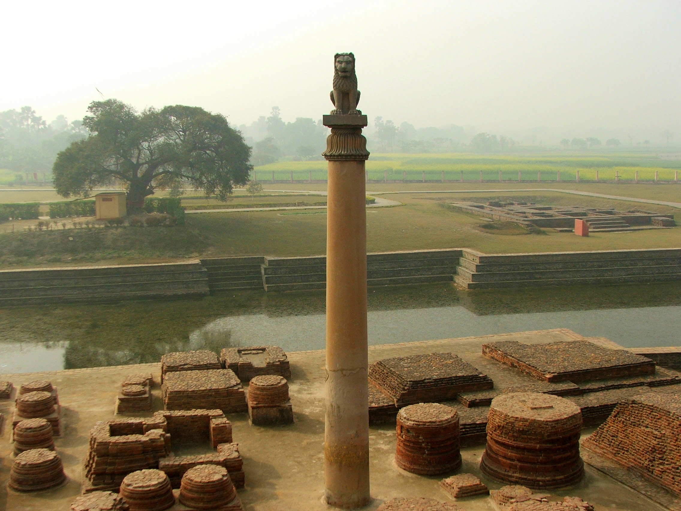
The pillars of Ashoka are a series of monolithic columns dispersed throughout the Indian subcontinent, erected or at least inscribed with edicts by the Mauryan Emperor Ashoka during his reign from c. 268 to 232 BCE. Ashoka used the expression ''Dhaṃma thaṃbhā'' (Dharma stambha), i.e. "pillars of the Dharma" to describe his own pillars. These pillars constitute important monuments of the architecture of India, most of them exhibiting the characteristic Mauryan polish. Of the pillars erected by Ashoka, twenty still survive including those with inscriptions of his edicts. Only a few with animal capitals survive of which seven complete specimens are known. Two pillars were relocated by Firuz Shah Tughlaq to Delhi. Several pillars were relocated later by Mughal Empire rulers, the animal capitals being removed.Krishnaswamy, 697-698 Averaging between in height, and weighing up to 50 tons each, the pillars were dragged, sometimes hundreds of miles, to where they were erected. ... [...More Info...] [...Related Items...] OR: [Wikipedia] [Google] [Baidu] |
Xuanzang
Xuanzang (, ; 602–664), born Chen Hui / Chen Yi (), also known as Hiuen Tsang, was a 7th-century Chinese Buddhist monk, scholar, traveler, and translator. He is known for the epoch-making contributions to Chinese Buddhism, the travelogue of his journey to India in 629–645 CE, his efforts to bring over 657 Indian texts to China, and his translations of some of these texts.Li Rongxi (1996), ''The Great Tang Dynasty Record of the Western Regions'', Bukkyo Dendo Kyokai and Numata Center for Buddhist Translation and Research, Berkeley, , pp. xiii-xiv Xuanzang was born on 6 April 602 in Chenliu, what is now Kaifeng municipality in Henan province. As a boy, he took to reading religious books, and studying the ideas therein with his father. Like his elder brother, he became a student of Buddhist studies at Jingtu monastery. Xuanzang was ordained as a ''śrāmaṇera'' (novice monk) at the age of thirteen. Due to the political and social unrest caused by the fall of the Sui dynasty ... [...More Info...] [...Related Items...] OR: [Wikipedia] [Google] [Baidu] |
Mahasthangarh
Mahasthangarh ( bn, মহাস্থানগড়, ''Môhasthangôṛ'') is one of the earliest urban archaeological sites so far discovered in Bangladesh. The village Mahasthan in Shibganj upazila of Bogra District contains the remains of an ancient city which was called Pundranagara or Paundravardhanapura in the territory of Pundravardhana.Brochure: ''Mahasthan – the earliest city-site of Bangladesh'', published by the Department of Archaeology, Ministry of Cultural Affairs, Government of the People’s Republic of Bangladesh, 2003 A limestone slab bearing six lines in Prakrit in Brahmi script recording a land grant, discovered in 1931, dates Mahasthangarh to at least the 3rd century BCE. It was an important city under the Maurya Empire. The fortified area was in use until the 8th century CE. Etymology ''Mahasthan'' means a place that has excellent sanctity and ''garh'' means fort. Mahasthan was first mentioned in a Sanskrit text of the 13th century entitled ''Vall ... [...More Info...] [...Related Items...] OR: [Wikipedia] [Google] [Baidu] |
Maurya Empire
The Maurya Empire, or the Mauryan Empire, was a geographically extensive Iron Age historical power in the Indian subcontinent based in Magadha, having been founded by Chandragupta Maurya in 322 BCE, and existing in loose-knit fashion until 185 BCE. Quote: "Magadha power came to extend over the main cities and communication routes of the Ganges basin. Then, under Chandragupta Maurya (c.321–297 bce), and subsequently Ashoka his grandson, Pataliputra became the centre of the loose-knit Mauryan 'Empire' which during Ashoka's reign (c.268–232 bce) briefly had a presence throughout the main urban centres and arteries of the subcontinent, except for the extreme south." The Maurya Empire was centralized by the conquest of the Indo-Gangetic Plain, and its capital city was located at Pataliputra (modern Patna). Outside this imperial center, the empire's geographical extent was dependent on the loyalty of military commanders who controlled the armed cities sprinkling it. During Ash ... [...More Info...] [...Related Items...] OR: [Wikipedia] [Google] [Baidu] |
Pundranagar
Pundranagar in Paundrabhukti was the most important city in the eastern region, now identified with the current site of Mahasthan, located in Bogra, Bangladesh. It was a vibrant administrative, religious and cultural centre from the 3rd century BC to the 12th century AD that is from the Maurya Empire time to the Sena dynasty period. Archaeological remains and literary descriptions speak of a truly planned and magnificent city. City walls, elaborate gates, palaces, common dwellings, assembly halls, temples, viharas, shops, ponds and even suburban temples and viharas characterised the city; Chinese pilgrim, Xuanzang (Hiuen tsang), visiting in the 7th century AD, particularly mentions ponds, orchards, flowers and pleasure gardens. Pundanagar within the Pundravardhana Bhukti suggests it to have been a part of the early historical empires – both Hindu and Buddhist. During the Muslim period the site was not forsaken looking for a new place as was their tradition. The physical feature ... [...More Info...] [...Related Items...] OR: [Wikipedia] [Google] [Baidu] |


