|
Casemate D'Oberroedern Sud
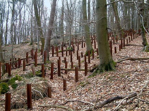
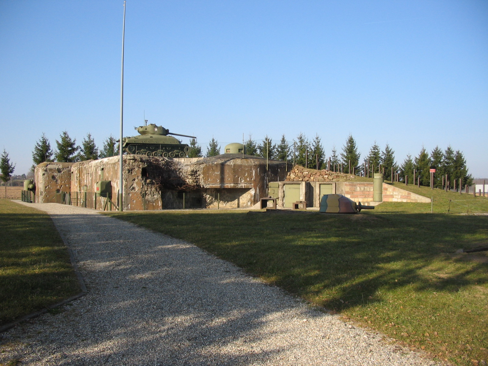
The Casemate d'Oberroedern Sud, also known as Casemate Reiffel and Oberroedern Est, is a pre- World War II fortified position near the Rhine River in eastern France. The casemate was part of an extension of the Maginot Line fortifications along France's border with Germany. As a unit of the Fortified Sector of Haguenau, the casemate was part of French defences in June 1940. It has been preserved and is a component of a museum focusing on the Rhine section of the Maginot Line. The museum is located at the eastern edge of the town of Oberrœdern. Concept and design Unlike other portions of the Maginot Line, the Rhine defences were not interconnected, consisting of individual casemates or blockhouses a few hundred metres apart, arranged to fire along the length of the defended frontier.Mary, Tome 3, p. 146 In initial planning, a Maginot ''ouvrage'' with several combat blocks, interconnected and served by underground galleries, barracks and magazines, was planned for Oberroedern. The ... [...More Info...] [...Related Items...] OR: [Wikipedia] [Google] [Baidu] |
Maginot Line
The Maginot Line (french: Ligne Maginot, ), named after the French Minister of War André Maginot, is a line of concrete fortifications, obstacles and weapon installations built by France in the 1930s to deter invasion by Germany and force them to move around the fortifications. The Maginot Line was impervious to most forms of attack. In consequence, the Germans invaded through the Low Countries in 1940, passing it to the north. The line, which was supposed to be fully extended further towards the west to avoid such an occurrence, was finally scaled back in response to demands from Belgium. Indeed, Belgium feared it would be sacrificed in the event of another German invasion. The line has since become a metaphor for expensive efforts that offer a false sense of security. Constructed on the French side of its borders with Italy, Switzerland, Germany, Luxembourg and Belgium, the line did not extend to the English Channel. French strategy therefore envisioned a move into Belgium ... [...More Info...] [...Related Items...] OR: [Wikipedia] [Google] [Baidu] |
France
France (), officially the French Republic ( ), is a country primarily located in Western Europe. It also comprises of Overseas France, overseas regions and territories in the Americas and the Atlantic Ocean, Atlantic, Pacific Ocean, Pacific and Indian Oceans. Its Metropolitan France, metropolitan area extends from the Rhine to the Atlantic Ocean and from the Mediterranean Sea to the English Channel and the North Sea; overseas territories include French Guiana in South America, Saint Pierre and Miquelon in the North Atlantic, the French West Indies, and many islands in Oceania and the Indian Ocean. Due to its several coastal territories, France has the largest exclusive economic zone in the world. France borders Belgium, Luxembourg, Germany, Switzerland, Monaco, Italy, Andorra, and Spain in continental Europe, as well as the Kingdom of the Netherlands, Netherlands, Suriname, and Brazil in the Americas via its overseas territories in French Guiana and Saint Martin (island), ... [...More Info...] [...Related Items...] OR: [Wikipedia] [Google] [Baidu] |
Battle Of France
The Battle of France (french: bataille de France) (10 May – 25 June 1940), also known as the Western Campaign ('), the French Campaign (german: Frankreichfeldzug, ) and the Fall of France, was the Nazi Germany, German invasion of French Third Republic, France during the Second World War. On 3 September 1939, France French declaration of war on Germany (1939), declared war on Germany following the German invasion of Poland. In early September 1939, France began the limited Saar Offensive and by mid-October had withdrawn to their start lines. German armies German invasion of Belgium (1940), invaded Belgium, German invasion of Luxembourg, Luxembourg and German invasion of the Netherlands, the Netherlands on 10 May 1940. Fascist Italy (1922-1943), Italy entered the war on 10 June 1940 and attempted an Italian invasion of France, invasion of France. France and the Low Countries were conquered, ending land operations on the Western Front (World War II), Western Front until the Normandy l ... [...More Info...] [...Related Items...] OR: [Wikipedia] [Google] [Baidu] |
World War II
World War II or the Second World War, often abbreviated as WWII or WW2, was a world war that lasted from 1939 to 1945. It involved the vast majority of the world's countries—including all of the great powers—forming two opposing military alliances: the Allies and the Axis powers. World War II was a total war that directly involved more than 100 million personnel from more than 30 countries. The major participants in the war threw their entire economic, industrial, and scientific capabilities behind the war effort, blurring the distinction between civilian and military resources. Aircraft played a major role in the conflict, enabling the strategic bombing of population centres and deploying the only two nuclear weapons ever used in war. World War II was by far the deadliest conflict in human history; it resulted in 70 to 85 million fatalities, mostly among civilians. Tens of millions died due to genocides (including the Holocaust), starvation, ma ... [...More Info...] [...Related Items...] OR: [Wikipedia] [Google] [Baidu] |
Rhine
), Surselva, Graubünden, Switzerland , source1_coordinates= , source1_elevation = , source2 = Rein Posteriur/Hinterrhein , source2_location = Paradies Glacier, Graubünden, Switzerland , source2_coordinates= , source2_elevation = , source_confluence = Reichenau , source_confluence_location = Tamins, Graubünden, Switzerland , source_confluence_coordinates= , source_confluence_elevation = , mouth = North Sea , mouth_location = Netherlands , mouth_coordinates = , mouth_elevation = , progression = , river_system = , basin_size = , tributaries_left = , tributaries_right = , custom_label = , custom_data = , extra = The Rhine ; french: Rhin ; nl, Rijn ; wa, Rén ; li, Rien; rm, label= Sursilvan, Rein, rm, label= Sutsilvan and Surmiran, Ragn, rm, label=Rumantsch Grischun, Vallader and Puter, Rain; it, Reno ; gsw, Rhi(n), inclu ... [...More Info...] [...Related Items...] OR: [Wikipedia] [Google] [Baidu] |
Fortified Sector Of Haguenau
The Fortified Sector of Haguenau (''Secteur Fortifiée de Haguenau'') was the French military organization that in 1940 controlled the most easterly section of the Maginot Line, to the north of Strasbourg. The left (western) wing of the Haguenau sector adjoined the Fortified Sector of the Vosges, includes two of the largest Maginot fortifications, Ouvrage Hochwald and Ouvrage Schoenenbourg. The right wing, started after 1931, was progressively scaled back in order to save money during the Great Depression, abandoning plans for four ''petit ouvrages'' and substituting casemates. The sector's northern and eastern sides bordered on Germany. To the south the sector borders the Fortified Sector of the Lower Rhine, from which it received several casemates in a boundary shift in 1940. The SF Haguenau was attacked in 1940 by German forces in the Battle of France. The sector successfully fended off German assaults before the Second Armistice at Compiègne. The positions and their ga ... [...More Info...] [...Related Items...] OR: [Wikipedia] [Google] [Baidu] |
Oberrœdern
Oberrœdern (; ) is a commune in the Bas-Rhin department in Grand Est in north-eastern France. See also * Communes of the Bas-Rhin department The following is a list of the 514 communes of the Bas-Rhin department of France. The communes cooperate in the following intercommunalities (as of 2020):Communes of Bas-Rhin Bas-Rhin communes articles needing translation from French Wikipedia {{BasRhin-geo-stub ... [...More Info...] [...Related Items...] OR: [Wikipedia] [Google] [Baidu] |
AC 37 Anti-tank Gun
The AC 37 was a French anti-tank gun of 37mm caliber, developed by the Ateliers de Puteaux. It was principally used in the ''ouvrages'' and casemates of the Maginot Line in the late 1930s. It was frequently paired with a JM cloche, ''Jumelage de Mitrailleuses'' (JM) cupola with twin machine guns. The AC 37 was superseded by the AC 47 anti-tank gun. Characteristics * Length of tube : 1.97 m (6.46 ft) * Rifling: 16, right-handed * Penetration at 1000m : 30 to 40 mm References [...More Info...] [...Related Items...] OR: [Wikipedia] [Google] [Baidu] |
GFM Cloche
The GFM cloche was one of the most common defensive armaments on the Maginot Line. A ''cloche'' (bell) was a fixed and non-retractable firing position made of a thick iron casting which shielded its occupant. By comparison, turrets could be rotated and sometimes lowered so that only the top shell was exposed. GFM is an acronym for ''Guetteur et Fusil-Mitrailleur'' (lookout and rifle-machine-gunner), which describes its purpose as a lookout and firing position for light weapons. Most of the bunkers or blocks in a Maginot Line ''ouvrage'' were fitted with several fixed armoured cupolas or cloches. The cupolas were designed to allow the soldiers to perform reconnaissance or repel an attack with an absolute maximum of cover, from inside the bunker. The armament of each cloche varied significantly, but were typically equipped with some combination of: * Light machine guns or automatic rifles * Vision blocks * Mounted binoculars * A periscope (located on the top of the bell) * A 50&nbs ... [...More Info...] [...Related Items...] OR: [Wikipedia] [Google] [Baidu] |
Stuka
The Junkers Ju 87 or Stuka (from ''Sturzkampfflugzeug'', "dive bomber") was a German dive bomber and ground-attack aircraft. Designed by Hermann Pohlmann, it first flew in 1935. The Ju 87 made its combat debut in 1937 with the Luftwaffe's Condor Legion during the Spanish Civil War of 1936–1939 and served the Axis in World War II from beginning to end (1939–1945). The aircraft is easily recognisable by its inverted gull wings and fixed spatted undercarriage. Upon the leading edges of its faired main gear legs were mounted ram-air sirens known as ', which became a propaganda symbol of German air power and of the so-called ''Blitzkrieg'' victories of 1939–1942, as well as providing Stuka pilots with audible feedback as to speed. The Stuka's design included several innovations, including automatic pull-up dive brakes under both wings to ensure that the aircraft recovered from its attack dive even if the pilot blacked out from the high g-forces. The Ju 87 operated with cons ... [...More Info...] [...Related Items...] OR: [Wikipedia] [Google] [Baidu] |
Ouvrage Hochwald
Ouvrage Hochwald is a ''gros ouvrage'' of the Maginot Line, one of the largest fortifications in the Line. Located on the Hochwald ridge in the Fortified Sector of Haguenau in the community of Drachenbronn-Birlenbach in the Bas-Rhin department of northeastern France, it was designed to protect the northern Vosges region of France. Ouvrage Hochwald is sometimes considered as two ouvrages because of its separation of the western and the eastern portions of the ouvrage. Uniquely, the original plans for the position included an elevated battery to the rear with long-range 145 mm or 155 mm gun turrets of a new kind. Hochwald is used by the French Air Force as an armoured air defense coordination center. Design and construction The Hochwald site was surveyed by CORF (''Commission d'Organisation des Régions Fortifiées''), the Maginot Line's design and construction agency, in 1928. Work began the next year, and the position became operational in 1933.Kaufmann 2006, p. 25 ... [...More Info...] [...Related Items...] OR: [Wikipedia] [Google] [Baidu] |
Ouvrage Schoenenbourg
Ouvrage Schoenenbourg is a Maginot Line fortification. It is located on the territory of the communes of Hunspach, Schœnenbourg and Ingolsheim, in the French ''département'' of Bas-Rhin, forming part of the Fortified Sector of Haguenau, facing Germany. At the east end of the Alsace portion of the Maginot Line, its neighbour is the ''gros ouvrage'' Hochwald. It is the largest such fortification open to the public in Alsace. Officially recorded as an historical monument, it retains all its original structural elements. Schoenenbourg was heavily bombarded during the Battle of France in 1940, receiving more enemy ordnance than any other position in France, with no significant damage. In 1945, retreating German troops used explosives to destroy much of the ''ouvrage''. After the war it was fully repaired and placed back into service as part of a programme to use Maginot fortifications to resist a potential Warsaw Pact advance through Europe. By the 1970s the plan had lost f ... [...More Info...] [...Related Items...] OR: [Wikipedia] [Google] [Baidu] |


