|
Carnatic Region
The Carnatic region is the peninsular South Indian region between the Eastern Ghats and the Bay of Bengal, in the erstwhile Madras Presidency and in the modern Indian states of Tamil Nadu and southern Andhra Pradesh. During the British era, demarcation was different, including Karnataka and the whole region south of Deccan with black soil. Etymology A number of theories exist as to the derivation of the term ''Carnatic'' or ''Karnatic''. According to Bishop Robert Caldwell, in his ''Comparative Grammar of the Dravidian Languages'', the term is derived from ''Kar'', "black", and ''nadu,'' "country", i.e. "the black country", which refers to the black soil prevalent on the plateau of the Southern Deccan. Hattangadi Narayan Rao suggests a derivation from ''karu'', "elevated", + ''nadu'', "land", thus "an elevated land", also descriptive of the region's geography. Geography The region that was named Carnatic or Karnatak (Kannada, Karnata, Karnatakadesa) by Europeans lies ... [...More Info...] [...Related Items...] OR: [Wikipedia] [Google] [Baidu] |
Coleroon
The Kollidam (referred to as Coleroon in Colonial English) is a river in southeastern India. The Kollidam is the northern distributary of the Kaveri River as it flows through the river delta, delta of Thanjavur. It splits from the main branch of the Kaveri River at the island of Srirangam and flows eastward into the Bay of Bengal. The distribution system in Kollidam lies at Lower Anaicut which is an island of river Kollidam. Heavy floods in 2005 necessitated the flood prevention works along the Kollidam river by the Public Works Department (PWD). References Rivers of Tamil Nadu Distributaries Tributaries of the Kaveri River Rivers of India {{India-river-stub ... [...More Info...] [...Related Items...] OR: [Wikipedia] [Google] [Baidu] |
Pulicat
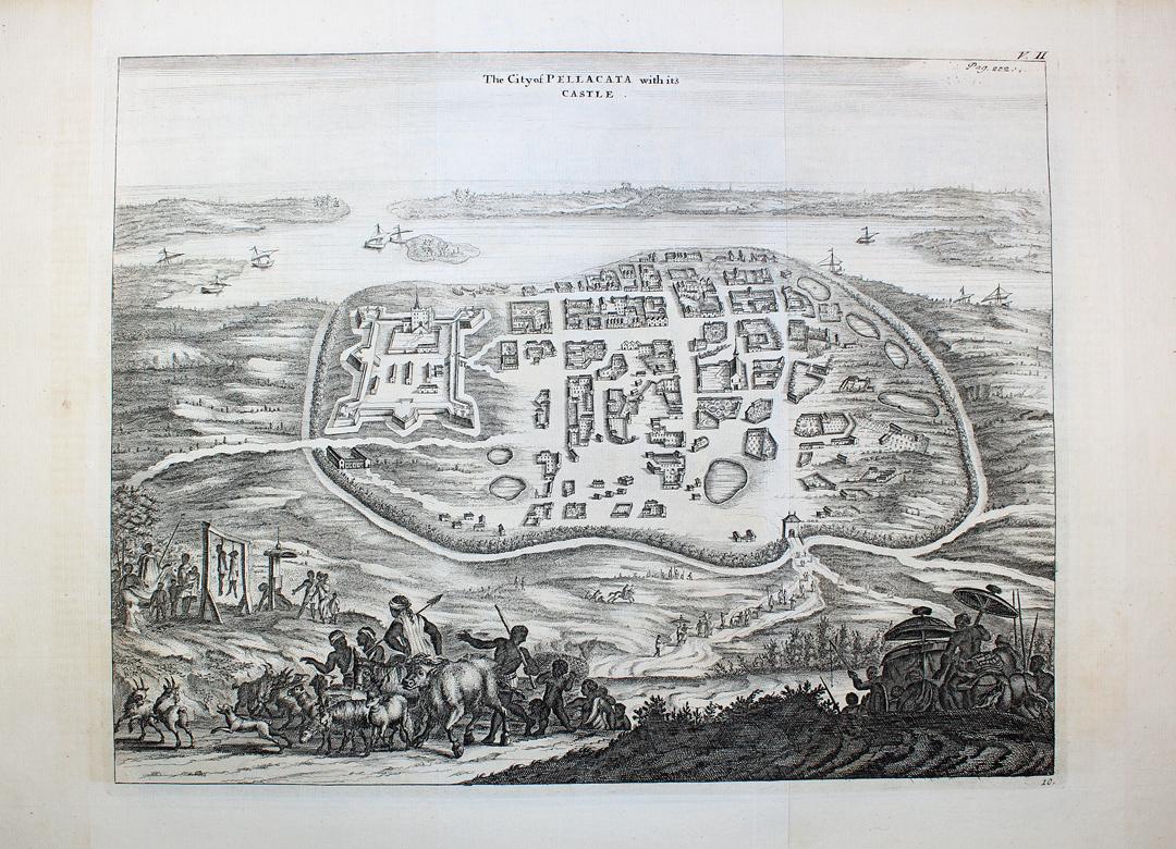
Pulicat or Pazhaverkadu is a historic seashore town in Chennai Metropolitan Area at Thiruvallur District, of Tamil Nadu state, India. It is about north of Chennai and from Elavur, on the southern periphery of the Pulicat Lake. Pulicat lake is a shallow salt water lagoon which stretches about along the coast. With lakeside and seashore development as well as several Special Economic Zones (SEZs) including a US$1 billion Medical SEZ, coming up in nearby Elavur, land prices in the area are rising. History The Portuguese established a trading post in Pulicat in 1502 with the help of the Vijayanagar rulers. They built a fort there and held this fort until 1609 when they were defeated by the Dutch. The Dutch occupied Pulicat fort in 1609. Between 1621 and 1665, 131 slave ships were deployed by the Dutch to export 38,441 Indians captured on the Coromandel coast and transported from Pulicat to be sold as slaves to Dutch plantations in Batavia. Pulicat was till 1690 the capit ... [...More Info...] [...Related Items...] OR: [Wikipedia] [Google] [Baidu] |
Cuddalore
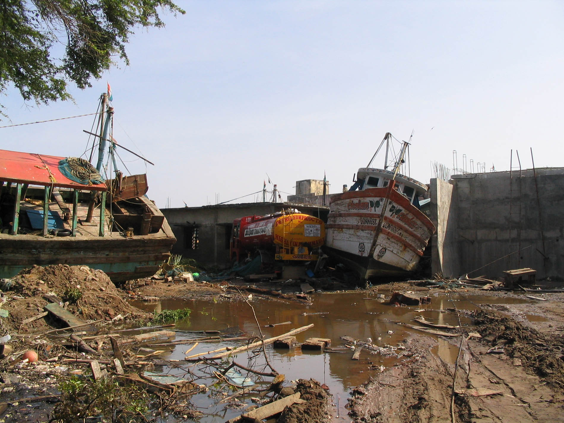
Cuddalore, also spelt as Kadalur (), is the city and headquarters of the Cuddalore District in the Indian state of Tamil Nadu. Situated south of Chennai, Cuddalore was an important port during the British Raj. While the early history of Cuddalore remains unclear, the city first rose to prominence during Pallavas and Medieval Cholas' reign. After the fall of Cholas, the town was ruled by various dynasties like Pandyas, Vijayanagar Empire, Madurai Nayaks, Thanjavur Nayaks, Thanjavur Marathas, Tipu Sultan, French and the British Empire. Cuddalore was the scene of the Seven Years' War and the Battle of Cuddalore in 1758 between the French and British. It has been a part of independent India since 1947. During the 2004 Indian Ocean earthquake, and the subsequent tsunamis generated, Cuddalore was one of the affected towns, with 572 casualties. Apart from fishing and port-related industries, Cuddalore houses chemical, pharmacological and energy industries in SIPCOT, an indus ... [...More Info...] [...Related Items...] OR: [Wikipedia] [Google] [Baidu] |
Vellore
Vellore (English: ), also spelt as Velur (), is a city and the administrative headquarters of Vellore district in the Indian state of Tamil Nadu. It is located on the banks of the Palar River in the northeastern part of Tamil Nadu and is separated into four zones that are further subdivided into 60 wards, covering an area of 87.915 km2 and housing a population of 423,425 as reported by the 2001 census. It is located about west of Chennai, and about east of Bangalore. Vellore is located on the Mumbai–Chennai arm of the Golden Quadrilateral. Vellore is governed under a mayor and the Vellore Municipal Corporation. It is a part of both the Lok Sabha and state assembly constituencies of Vellore. Vellore is the home to Christian Medical College & Hospital, the Vellore Institute of Technology (VIT) and Sripuram Golden Temple. The Vellore region is the largest exporter of finished leather goods in the country. Leather exports from Vellore account for more than 37% of Ind ... [...More Info...] [...Related Items...] OR: [Wikipedia] [Google] [Baidu] |
Arcot
Arcot (natively spelt as Ārkāḍu) is a town and urban area of Ranipet district Ranipet district is one of the 38 districts of Tamil Nadu, India, formed by trifurcating Vellore district. The Government of Tamil Nadu has announced its proposal on 15 August 2019, together with Tirupattur district. However, it was officiall ... in the States of India, state of Tamil Nadu, India. Located on the southern banks of Palar River, the city straddles a trade route between Chennai and Bangalore or Salem, Tamil Nadu, Salem, between the Mysore Ghat and the Javadi Hills (Javvadhu malai). , the city had a population 129,640. The sweet makkan peda is a local speciality while Arcot biryani, a rice-based traditional food, is also served here. Etymology ''Arcot'' is the anglicized form of the Tamil word ''ārkāḍ'', which is commonly believed to have been derived from the Tamil words ''aaru'' (River) + ''kaadu'' (forest). However, ''arkaadu'' meant 'a forest of fig trees'. Jainism was f ... [...More Info...] [...Related Items...] OR: [Wikipedia] [Google] [Baidu] |
Pondicherry (city)
Pondicherry (), List of renamed places in India, now known as Puducherry ( French: Pondichéry [pʊdʊˈtʃɛɹi] (listen),[Pon-dicherry]), is the Capital city, capital and the most populous city of the Puducherry (union territory), Union Territory of Puducherry in India. The city is in the Puducherry district on the southeast coast of India and is surrounded by Bay of Bengal to the east and the state of Tamil Nadu, with which it shares most of its culture, heritage, and language. History Puducherry, formerly known as Pondicherry, gained its significance as “The French Riviera of the East” after the advent of the French colonialization in India. Puducherry is the Tamil interpretation of “new town” and mainly derived from “Poduke”, the name of the marketplace as the “Port town” for Roman trading in 1st century as mentioned in ‘The Periplus of the Erythraean Sea’. The settlement was once an abode of many learned scholars as evidently versed in the Vedas, h ... [...More Info...] [...Related Items...] OR: [Wikipedia] [Google] [Baidu] |
Madras
Chennai (, ), formerly known as Madras ( the official name until 1996), is the capital city of Tamil Nadu, the southernmost Indian state. The largest city of the state in area and population, Chennai is located on the Coromandel Coast of the Bay of Bengal. According to the 2011 Indian census, Chennai is the sixth-most populous city in the country and forms the fourth-most populous urban agglomeration. The Greater Chennai Corporation is the civic body responsible for the city; it is the oldest city corporation of India, established in 1688—the second oldest in the world after London. The city of Chennai is coterminous with Chennai district, which together with the adjoining suburbs constitutes the Chennai Metropolitan Area, the 36th-largest urban area in the world by population and one of the largest metropolitan economies of India. The traditional and de facto gateway of South India, Chennai is among the most-visited Indian cities by foreign tourists. It was ranked t ... [...More Info...] [...Related Items...] OR: [Wikipedia] [Google] [Baidu] |
Pennar
Penna (also known as Pinakini, Pennar, Penner, Penneru (Telugu), Pennai (Tamil)) is a river of southern India. This is a unique river in world where after originating from Nandi hills, it flows as two different streams, one in North and South directions. The Penna rises in the Nandi Hills in Chikkaballapur District of Karnataka state, and runs north and east through the states of Karnataka and Andhra Pradesh to empty into bay of bengal in Andhra Pradesh. It is long, with a drainage basin covering 55,213 km2: 6,937 km2 in Karnataka and 48,276 km2 in Andhra Pradesh. Along with this main stream there is another stream south towards Tamilnadu with the name Then Pennai or south Pennar which further moves towards the east to empty into the Bay of Bengal.The Penna river basin lies in the rain shadow region of Eastern Ghats and receives 500 mm average rainfall annually. Etymology Since the river flows in two streams, both North and South directions, it forms th ... [...More Info...] [...Related Items...] OR: [Wikipedia] [Google] [Baidu] |
Tinnevelly
Tirunelveli (, ta, திருநெல்வேலி, translit=Tirunelveli) also known as Nellai ( ta, நெல்லை, translit=Nellai) and historically (during British rule) as Tinnevelly, is a major city in the Indian state of Tamil Nadu. It is the administrative headquarters of the Tirunelveli District. It is the sixth-largest municipal corporation in the state after Chennai, Coimbatore, Madurai, Tiruchirappalli and Salem. Tirunelveli is located southwest of the state capital Chennai, away from Thoothukudi, and from Kanyakumari. The downtown is located on the west bank of the Thamirabarani River; its twin Palayamkottai is on the east bank. Palayamkottai is called the Oxford of South India as it is a hub of many schools and colleges. It boasts several important government offices. Tirunelveli is an ancient city, recorded to be more than two millennia old. It has been ruled at different times by the Early Pandyas, the Cheras, the Medieval Cholas and Later Ch ... [...More Info...] [...Related Items...] OR: [Wikipedia] [Google] [Baidu] |
Negapatam
Nagapattinam (''nākappaṭṭinam'', previously spelt Nagapatnam or Negapatam) is a town in the Indian state of Tamil Nadu and the administrative headquarters of Nagapattinam District. The town came to prominence during the period of Medieval Cholas (9th–12th century CE) and served as their important port for commerce and east-bound naval expeditions. The Chudamani Vihara in Nagapattinam constructed by the Srivijayan king Sri Mara Vijayattungavarman of the Sailendra dynasty with the help of Rajaraja Chola I was an important Buddhist structure in those times. Nagapattinam was settled by the Portuguese and, later, the Dutch under whom it served as the capital of Dutch Coromandel from 1660 to 1781. In November 1781, the town was conquered by the British East India Company. It served as the capital of Tanjore district from 1799 to 1845 under Madras Presidency of the British. It continued to be a part of Thanjavur district in Independent India. In 1991, it was made the headquarte ... [...More Info...] [...Related Items...] OR: [Wikipedia] [Google] [Baidu] |
Tranquebar
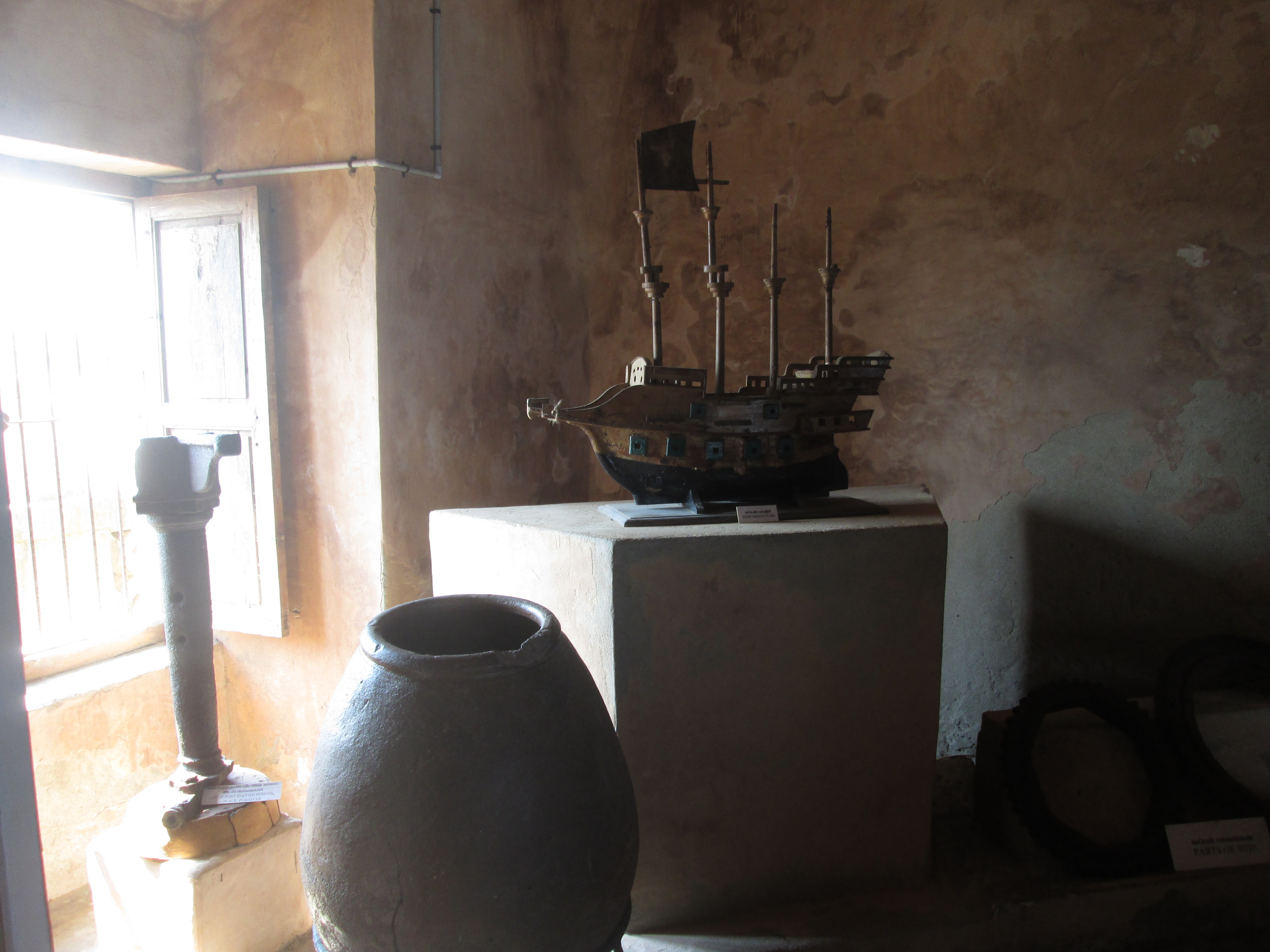
Tharangambadi (), formerly Tranquebar ( da, Trankebar, ), is a town in the Mayiladuthurai district of the Indian state of Tamil Nadu on the Coromandel Coast. It lies north of Karaikal, near the mouth of a distributary named Uppanar of the Kaveri River. Tranquebar was established on 19 November 1620 as the first Danish trading post in India. King Christian IV had sent his envoy Ove Gjedde who established contact with Raghunatha Nayak of Tanjore. An annual tribute was paid by the Danes to the Rajah of Tanjore until the colony of Tranquebar was sold to the British East India Company in 1845. Tharangambadi is the headquarters of Tharangambadi taluk. Its name means "place of the singing waves"; the old designation ''Trankebar'' remains current in modern Danish. Tharangambadi is located at the distance of 285 km from Chennai. The nearest airport is at Tiruchirapalli international airport at 172 km and the nearest port is at Karaikal at 26 km. History The place da ... [...More Info...] [...Related Items...] OR: [Wikipedia] [Google] [Baidu] |


