|
Canteleu
Canteleu () is a commune in the Seine-Maritime department in the Normandy region in north-western France. Geography A small town of forestry and light industry situated by the banks of the river Seine, just northwest and over the river from the centre of Rouen, at the junction of the D 51, D 982 and the D 94 roads. Heraldry Population Places of interest * Saint-Martin's church, dating from the thirteenth century. * The seventeenth century convent of Sainte-Barbe, built over a cave in the cliffs, overlooking the river. * The Flaubert museum. * The two churches of St. Pierre, at the hamlets of Bapeaume (1872) and Croisset. * Vestiges of a 12th-century castle at Croisset. * A Carthaginian column in the park. * The sixteenth century Château des Deux-Lions. * A turretted house at Dieppedalle. Notable people * Gustave Flaubert (1821–1880) lived at the hamlet of Croisset for 40 years and died here. * English painter Robert Henry Cheney (1801–1866) painted several views of ... [...More Info...] [...Related Items...] OR: [Wikipedia] [Google] [Baidu] |
Communes Of The Seine-Maritime Department
The following is a list of the 708 communes of the French department of Seine-Maritime. The communes cooperate in the following intercommunalities (as of 2020):BANATIC Périmètre des EPCI à fiscalité propre. Accessed 3 July 2020. * *Communauté urbaine *Communauté d'agglomération * |
Métropole Rouen Normandie
__NOTOC__ Métropole Rouen Normandie is the ''métropole'', an intercommunal structure, centred on the city of Rouen. It is located in the Seine-Maritime department, in the Normandy region, north-western France. It was created in January 2015, replacing the previous ''Communauté d'agglomération Rouen-Elbeuf-Austreberthe''. Its area is 663.8 km2. Its population was 492,681 in 2014, of which 111,360 in Rouen proper.Comparateur de territoire INSEE. 4 April 2022. History The ''Agglomeration community of Rouen-Elbeuf-Austreberthe'' ( French: ''Communauté d'agglomération Rouen-Elbeuf-Austreberthe'') was created in 2010. On January 1, 2015, the Metropolis replaced the agglomeration ...[...More Info...] [...Related Items...] OR: [Wikipedia] [Google] [Baidu] |
New Milton
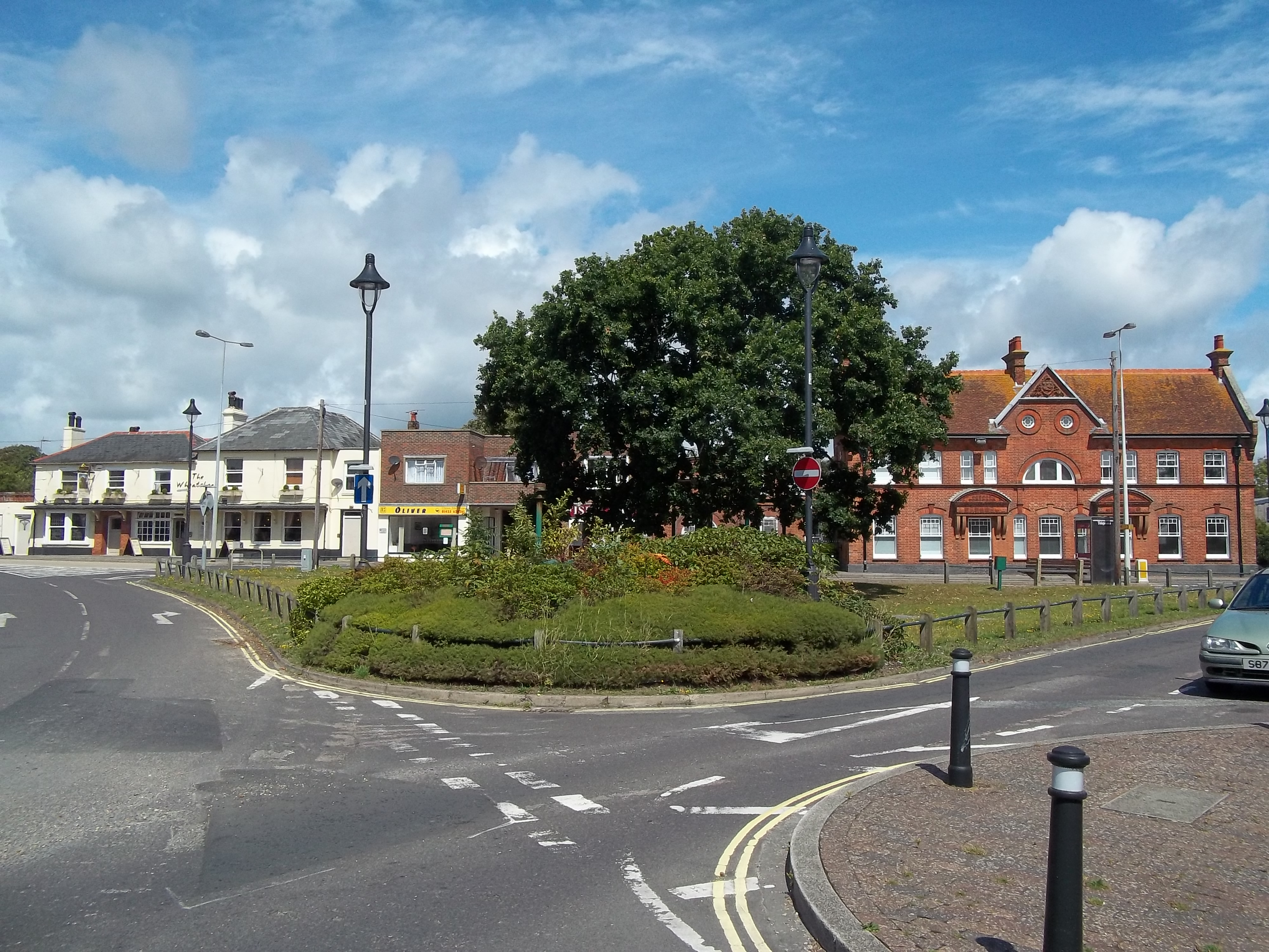
New Milton is a market town in southwest Hampshire, England. To the north is in the New Forest and to the south the coast at Barton-on-Sea. The town is equidistant between Lymington and Christchurch, 6 miles (10 km) away. History New Milton dates back to Anglo-Saxon times, and encompasses Old Milton, Barton on Sea, Ashley, Bashley, and Wootton. It is recorded as having a population of 25,717 in the 2011 census. Milton The manor of ("Mildeltune") is listed in the Domesday Book of 1086 and literally means "Middle farm." It was part of the lands belonging to Hugh de Port, and the estate was held from him by William Chernet.William Page (editor), 1912''A History of the County of Hampshire: Volume 5'' Victoria County History The Chernet family maintained possession of Milton into the 13th century, although lesser families were managing the estate on their behalf. The most important of these were the Chaucombe (or Chalcombe) family, who were probably the first people ... [...More Info...] [...Related Items...] OR: [Wikipedia] [Google] [Baidu] |
Buchholz In Der Nordheide
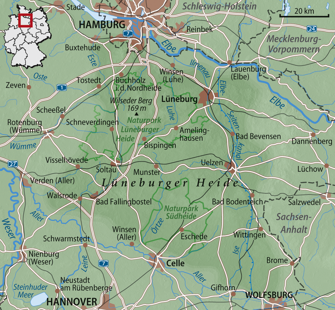
Buchholz in der Nordheide (Northern Low Saxon: ''Bookholt'') is the largest town in the district of Harburg, in Lower Saxony, Germany. It is situated approximately 25 km southwest of Hamburg. Geography Buchholz is home to the Brunsberg, at 129m the highest mountain in the region. It is on the northern edge of the Lüneburg Heath (''Lüneburger Heide''), hence the suffix to the name. History In 1958, Buchholz received its city charter. In 1992, Buchholz was struck by a small tornado which destroyed many trees and damaged numerous houses. In 2002, the temperature in Buchholz rose above 38 degrees celsius, marking an all-time high for its region. In 2006, Buchholz tried to set a new world record by placing a crowd of 2000 people in the form of a large heart near the local swimming pool. The attempt ultimately failed because 39 people did not show up. Division of the town The districts of Steinbeck, Dibbersen, Seppensen, Holm-Seppensen, Sprötze and Trelde belong to Buchholz ... [...More Info...] [...Related Items...] OR: [Wikipedia] [Google] [Baidu] |
Gustave Flaubert
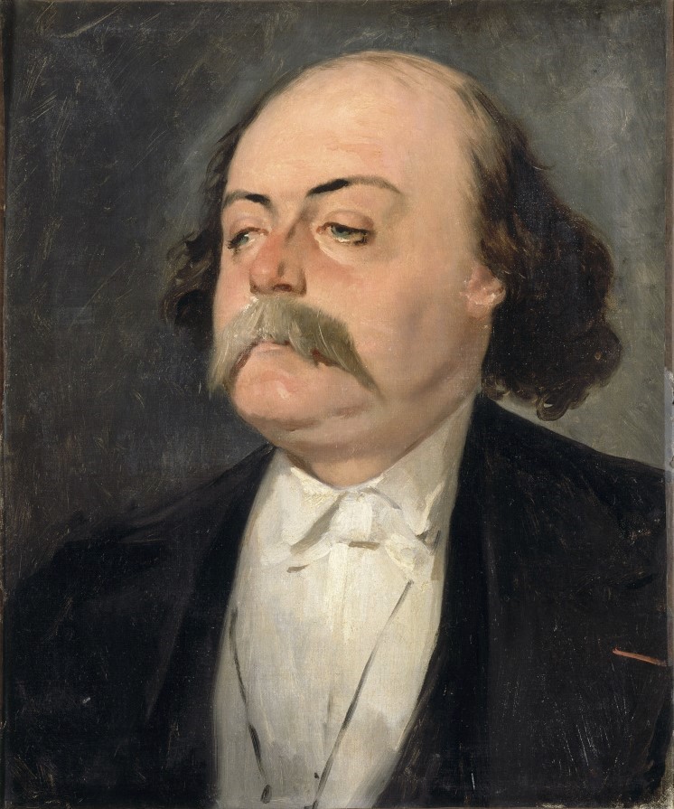
Gustave Flaubert ( , , ; 12 December 1821 – 8 May 1880) was a French novelist. Highly influential, he has been considered the leading exponent of literary realism in his country. According to the literary theorist Kornelije Kvas, "in Flaubert, realism strives for formal perfection, so the presentation of reality tends to be neutral, emphasizing the values and importance of style as an objective method of presenting reality". He is known especially for his debut novel ''Madame Bovary'' (1857), his ''Correspondence'', and his scrupulous devotion to his style and aesthetics. The celebrated short story writer Guy de Maupassant was a protégé of Flaubert. Life Early life and education Flaubert was born in Rouen, in the Seine-Maritime department of Upper Normandy, in northern France. He was the second son of Anne Justine Caroline (née Fleuriot; 1793–1872) and Achille-Cléophas Flaubert (1784–1846), director and senior surgeon of the major hospital in Rouen. He began writ ... [...More Info...] [...Related Items...] OR: [Wikipedia] [Google] [Baidu] |
Burkina Faso
Burkina Faso (, ; , ff, 𞤄𞤵𞤪𞤳𞤭𞤲𞤢 𞤊𞤢𞤧𞤮, italic=no) is a landlocked country in West Africa with an area of , bordered by Mali to the northwest, Niger to the northeast, Benin to the southeast, Togo and Ghana to the south, and the Ivory Coast to the southwest. It has a population of 20,321,378. Previously called Republic of Upper Volta (1958–1984), it was renamed Burkina Faso by President Thomas Sankara. Its citizens are known as ''Burkinabè'' ( ), and its capital and largest city is Ouagadougou. The largest ethnic group in Burkina Faso is the Mossi people, who settled the area in the 11th and 13th centuries. They established powerful kingdoms such as the Ouagadougou, Tenkodogo, and Yatenga. In 1896, it was colonized by the French as part of French West Africa; in 1958, Upper Volta became a self-governing colony within the French Community. In 1960, it gained full independence with Maurice Yaméogo as president. Throughout the decades post in ... [...More Info...] [...Related Items...] OR: [Wikipedia] [Google] [Baidu] |
Kongoussi
Kongoussi is a city located in Bam Province in central Burkina Faso, one of the world's poorest countries. It has a population of 53,627 (2019) and is the provincial capital. Mooré, the language of the Mossi people, is spoken along with French, common among those who have attended school or spent time further afield. Kongoussi has deep roots in Mossi history and social relations - certain small Mossi chiefdoms were located in this area (for example at Sabce), although not based in the town itself. Kongoussi benefits from a lakeside location, which is rare in the African Sahel. It therefore received attention from French administrators and before that from the Catholic Church. France had little real impact on the local population but did establish an outpost, promoted cotton production, and built roads. The lake, Lac du Bam is part of the upper reaches of the southward-flowing Volta system, and its presence permits year-round lakeshore cultivation in an otherwise arid climate. Tow ... [...More Info...] [...Related Items...] OR: [Wikipedia] [Google] [Baidu] |
England
England is a country that is part of the United Kingdom. It shares land borders with Wales to its west and Scotland to its north. The Irish Sea lies northwest and the Celtic Sea to the southwest. It is separated from continental Europe by the North Sea to the east and the English Channel to the south. The country covers five-eighths of the island of Great Britain, which lies in the North Atlantic, and includes over 100 smaller islands, such as the Isles of Scilly and the Isle of Wight. The area now called England was first inhabited by modern humans during the Upper Paleolithic period, but takes its name from the Angles, a Germanic tribe deriving its name from the Anglia peninsula, who settled during the 5th and 6th centuries. England became a unified state in the 10th century and has had a significant cultural and legal impact on the wider world since the Age of Discovery, which began during the 15th century. The English language, the Anglican Church, and Engli ... [...More Info...] [...Related Items...] OR: [Wikipedia] [Google] [Baidu] |
Poland
Poland, officially the Republic of Poland, is a country in Central Europe. It is divided into 16 administrative provinces called voivodeships, covering an area of . Poland has a population of over 38 million and is the fifth-most populous member state of the European Union. Warsaw is the nation's capital and largest metropolis. Other major cities include Kraków, Wrocław, Łódź, Poznań, Gdańsk, and Szczecin. Poland has a temperate transitional climate and its territory traverses the Central European Plain, extending from Baltic Sea in the north to Sudeten and Carpathian Mountains in the south. The longest Polish river is the Vistula, and Poland's highest point is Mount Rysy, situated in the Tatra mountain range of the Carpathians. The country is bordered by Lithuania and Russia to the northeast, Belarus and Ukraine to the east, Slovakia and the Czech Republic to the south, and Germany to the west. It also shares maritime boundaries with Denmark and Sweden. ... [...More Info...] [...Related Items...] OR: [Wikipedia] [Google] [Baidu] |
Germany
Germany,, officially the Federal Republic of Germany, is a country in Central Europe. It is the second most populous country in Europe after Russia, and the most populous member state of the European Union. Germany is situated between the Baltic and North seas to the north, and the Alps to the south; it covers an area of , with a population of almost 84 million within its 16 constituent states. Germany borders Denmark to the north, Poland and the Czech Republic to the east, Austria and Switzerland to the south, and France, Luxembourg, Belgium, and the Netherlands to the west. The nation's capital and most populous city is Berlin and its financial centre is Frankfurt; the largest urban area is the Ruhr. Various Germanic tribes have inhabited the northern parts of modern Germany since classical antiquity. A region named Germania was documented before AD 100. In 962, the Kingdom of Germany formed the bulk of the Holy Roman Empire. During the 16th ce ... [...More Info...] [...Related Items...] OR: [Wikipedia] [Google] [Baidu] |
Turret (architecture)
In architecture, a turret is a small tower that projects vertically from the wall of a building such as a medieval castle. Turrets were used to provide a projecting defensive position allowing covering fire to the adjacent wall in the days of military fortification. As their military use faded, turrets were used for decorative purposes, as in the Scottish baronial style. A turret can have a circular top with crenellations as seen in the picture at right, a pointed roof, or other kind of apex. It might contain a staircase if it projects higher than the building; however, a turret is not necessarily higher than the rest of the building; in this case, it is typically part of a room, that can be simply walked into – see the turret of Chateau de Chaumont on the collection of turrets, which also illustrates a turret on a modern skyscraper. A building may have both towers and turrets; towers might be smaller or higher, but turrets instead project from the edge of a building ra ... [...More Info...] [...Related Items...] OR: [Wikipedia] [Google] [Baidu] |


