|
Callington
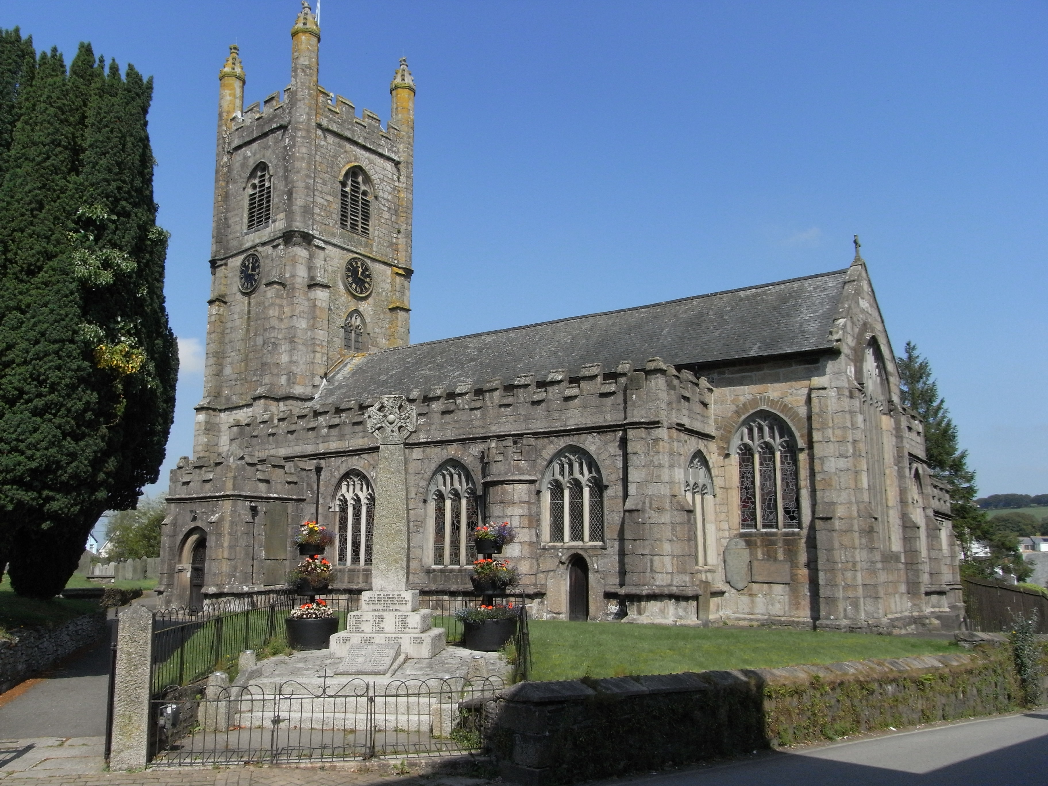
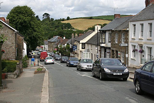
Callington ( kw, Kelliwik) is a civil parish and town in east Cornwall, England, United Kingdom about north of Saltash and south of Launceston. Callington parish had a population of 4,783 in 2001, according to the 2001 census. This had increased to 5,786 in the 2011 census. Geography The town is situated in east Cornwall between Dartmoor to the east and Bodmin Moor to the west. A former agricultural market town, it lies at the intersection of the south–north A388 Saltash to Launceston road and the east–west A390 Tavistock to Liskeard road. Kit Hill is a mile north-east of the town and rises to with views of Dartmoor, Bodmin Moor and the River Tamar. The hamlets of Bowling Green, Kelly Bray, Frogwell and Downgate are in the parish. Railway station Callington railway station was the terminus of a branch line from Bere Alston, the junction with the Southern Railway's Tavistock to Plymouth line. The railway line beyond Gunnislake to the Callington terminus was c ... [...More Info...] [...Related Items...] OR: [Wikipedia] [Google] [Baidu] |
Kelly Bray
Kelly Bray ( kw, Kellivre) is a village in east Cornwall, England, United Kingdom. It is situated one mile (1.6 km) north of Callington, immediately west of Kit Hill in a former mining area. Kelly Bray is in the parish of Callington and lies within the St Dominick, Harrowbarrow and Kelly Bray division on Cornwall Council. The population was 3,949 at the 2011 census. Kelly Bray is first recorded ca. 1286 as Kellibregh (Cornish "Kellybregh", meaning "dappled grove"). Kelly Bray was formerly the venue for the Royal Cornwall Show until it was moved to Wadebridge. The village was the location of Callington railway station - terminus of a branch line to Plymouth via Gunnislake. The line was closed beyond Gunnislake in 1966. Industrial history Prior to the industrialisation in the 19th century agriculture was the main activity in the land surrounding Kelly Bray. During the 1820s and 1830s a significant capital investment enabled the development of tin copper and lead mines in ... [...More Info...] [...Related Items...] OR: [Wikipedia] [Google] [Baidu] |
Ginsters
Ginsters is a company based in Callington in Cornwall, in the south-west of England. The largest pasty maker in the UK in turnover, it specialises in making mass-produced pasties, sausage rolls, sandwiches, pasta bowls and other savoury snacks. Since 1977, it has been owned by Mark and David Samworth. History The Ginsters family were in the business of supplying horse manure to foundries for mixing with sand for the moulds for casting. The business was based in West Bromwich before finally moving to Longwood Lane, Walsall. After the second world war, Geoff Ginster approached his father saying that he wished to move with his family down to the West Country. He asked his father if it would be possible to have his inheritance early in order to so do. Originally moving to Devon, Geoff Ginster started making clotted cream and became very successful to the point where the Milk Marketing Board offered to buy him out. Geoff refused only to be met with the response, "if he did not sell ... [...More Info...] [...Related Items...] OR: [Wikipedia] [Google] [Baidu] |
Frogwell
Frogwell is a hamlet in the parish of Callington, Cornwall, England. It is in the valley of the River Lynher The River Lynher ( kw, Linar) (or St Germans River downstream from its confluence with the Tiddy) flows through east Cornwall, England, and enters the River Tamar at the Hamoaze, which in turn flows into Plymouth Sound. Navigation The nor .... References Hamlets in Cornwall Callington {{Cornwall-geo-stub ... [...More Info...] [...Related Items...] OR: [Wikipedia] [Google] [Baidu] |
Celliwig
Celliwig, Kelliwic or Gelliwic is perhaps the earliest named location for the court of King Arthur. It may be translated as 'forest grove'. Literary references It is mentioned in the Welsh tale ''Culhwch and Olwen'' whose manuscript dates from the 11th century, though the story is much older. The story describes the court as being at Celliwig in Cernyw (the Welsh name for Cornwall), otherwise known as the kingdom of Dumnonia including modern Devon. The hall is guarded by Glewlwyd Gafaelfawr, Arthur's porter, and Culhwch has difficulty gaining entrance due to the special laws that restrict entry once a feast has begun. Though there is no description of the place the implications of the story are of great wealth and splendour. It describes Arthur's warriors at the court in depth and says that: "From here, one of his Warband, Drem, could see a gnat as far away as Scotland; while another, Medyr, could shoot an arrow through the legs of a wren in Ireland!" Some of the ''Trioedd Ynys Pr ... [...More Info...] [...Related Items...] OR: [Wikipedia] [Google] [Baidu] |
A388 Road
The A388 is an A road in south west England which runs south from Landcross south of Bideford in Devon through Holsworthy, Launceston, Callington to Saltash in Cornwall. The A388 begins at a junction with the A386 and in Holsworthy has junctions with the A3072. In Launceston it has junctions with the A30 and near Lawhitton Lawhitton ( kw, Nansgwydhenn) is a village in the civil parish of Lawhitton Rural, in east Cornwall, England, United Kingdom. The village is situated two miles (3 km) southwest of Launceston and half-a-mile west of Cornwall's border with Dev ... a junction with the A384. In Callington it has junctions with the A390 and ends at Saltash when it meets the A38.''Reader's Digest New Book of the Road''. London: Reader's Digest Association, 1980 Gallery File:A388 at Polson - geograph.org.uk - 1587015.jpg, The A388 at Polson near Lifton File:Polson Bridge - geograph.org.uk - 329592.jpg, Polson Bridge References External links Roads in Englan ... [...More Info...] [...Related Items...] OR: [Wikipedia] [Google] [Baidu] |
Kit Hill
Kit Hill ( kw, Bre Skowl), at 334 metres high, dominates the area between Callington and the River Tamar in southeast Cornwall, England, UK. The word 'Kit' comes from Old English for kite, a reference to birds of prey (and not specifically the red kite). Buzzards and sparrowhawks can still be seen on the hill. It is one of five Marilyn hills in Cornwall, the four others are Watch Croft, Brown Willy, Carnmenellis and Hensbarrow Beacon. Geography Kit Hill Country Park (which includes the hill and surrounding areas), was given to the people of Cornwall in 1985 to mark the birth of Prince William, by his father, the Duke of Cornwall (Prince Charles). It is managed by Cornwall Council,Exploring Cornish Mines - Vol. 4. and consists of some 400 acres (152 hectares), making it the most dominant landscape feature in East Cornwall. Kit Hill is the highest point in the Tamar Valley Area of Outstanding Natural Beauty. The hill was formed in the same way as nearby Bodmin Moor by the intr ... [...More Info...] [...Related Items...] OR: [Wikipedia] [Google] [Baidu] |
South East Cornwall (UK Parliament Constituency)
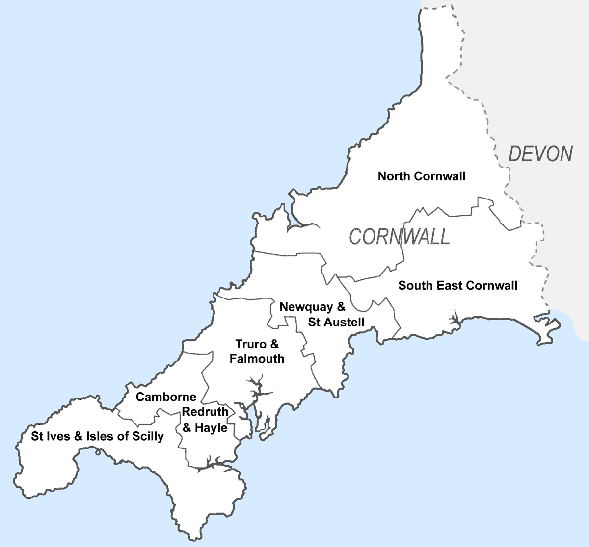
South East Cornwall is a constituency represented in the House of Commons of the UK Parliament since 2010 by Sheryll Murray, a Conservative. Boundaries 1983–2010: The District of Caradon, the Borough of Restormel wards of Fowey, Lostwithiel, St Blaise, and Tywardreath, and the District of North Cornwall ward of Stoke Climsland. 2010–present: The District of Caradon, and the Borough of Restormel ward of Lostwithiel. History The predecessor county division, Bodmin, serving the area from 1885 until 1983 had (during those 98 years) 15 members (two of whom had broken terms of office serving the area), seeing twelve shifts of preference between the Liberal, Liberal Unionist and Conservative parties, spread quite broadly throughout that period. Consistent with this, since 1983 the preference for an MP has alternated between Liberal Democrats and Conservatives. The current constituency territory contains the location of several former borough constituencies which were abol ... [...More Info...] [...Related Items...] OR: [Wikipedia] [Google] [Baidu] |
Saltash
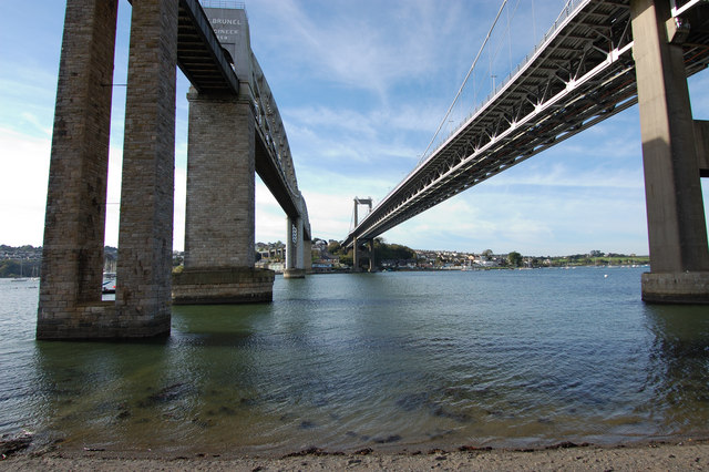
Saltash (Cornish: Essa) is a town and civil parish in south Cornwall, England, United Kingdom. It had a population of 16,184 in 2011 census. Saltash faces the city of Plymouth over the River Tamar and is popularly known as "the Gateway to Cornwall". Saltash’s landmarks include the Tamar Bridge which connects Plymouth to Cornwall by road, and the Royal Albert Bridge. The area of Latchbrook is part of the town. Description Saltash is the location of Isambard Kingdom Brunel's Royal Albert Bridge, opened by Prince Albert on 2 May 1859. It takes the railway line across the River Tamar. Alongside it is the Tamar Bridge, a toll bridge carrying the A38 trunk road, which in 2001 became the first suspension bridge to be widened whilst remaining open to traffic. Saltash railway station, which has a regular train service, with some routes between London Paddington station is close to the town centre. Stagecoach South West, Plymouth Citybus, and Go Cornwall Bus operate bus service ... [...More Info...] [...Related Items...] OR: [Wikipedia] [Google] [Baidu] |
A390 Road
The A390 is a road in Cornwall and Devon, England. It runs from Tavistock to north west of the city of Truro. Starting in Tavistock, it heads south-westwards towards Liskeard, crossing over the River Tamar and into Cornwall, then through Gunnislake and Callington. Immediately before Liskeard, it merges with the A38 north of the town. It diverges from the A38 at Dobwalls, where it then runs in a south-westerly direction to Truro via Lostwithiel, St. Blazey, and St Austell. It then forms an upside down elongated square loop, and bypasses Truro City Centre. It then heads north west out of the city, where it forms the main corridor into Truro from the west. It passes the Royal Cornwall Hospital and skirts the village of Threemilestone, before linking up with the A30 road at Chiverton Cross, where the A390 terminates. Chiverton Cross is where the A390 trunk road from Truro and the B3277 to St Agnes meet the east–west A30 trunk road. Before the A390 was rerouted away from Chac ... [...More Info...] [...Related Items...] OR: [Wikipedia] [Google] [Baidu] |
Tamar Valley Line
The Tamar Valley Line is a railway line from Plymouth, Devon, to Gunnislake, Cornwall, in England, also known as the Gunnislake branch line. The line follows the River Tamar for much of its route. Like all railway lines in Devon and Cornwall, it is unelectrified and all trains are diesel powered. The entire line is single track past St. Budeaux Junction. History The line from St Budeaux to Bere Alston was opened for passenger traffic on 2 June 1890 by the Plymouth, Devonport and South Western Junction Railway (PDSWJ) as part of their line from Lydford to Devonport, which in effect was an extension of the London and South Western Railway's main line from London Waterloo station to Lydford, enabling the LSWR to reach Plymouth independently of the Great Western Railway. The branch to Gunnislake was opened by the PDSWJ on 2 March 1908. The line was listed for closure in the '' Reshaping of British Railways Report'' but was kept open (apart from the section between Gunnislake and ... [...More Info...] [...Related Items...] OR: [Wikipedia] [Google] [Baidu] |
Gunnislake
Gunnislake ( kw, Dowrgonna) is a large village in east Cornwall, England, United Kingdom. It is situated in the Tamar Valley approximately ten miles (16 km) north of Plymouth Gunnislake is in the civil parish of Calstock and is close to Cornwall's border with Devon which follows the course of the River Tamar. It has an electoral ward in its own name which includes much of Calstock and the surrounding area. The population at the 2011 census was 4,574. According to an OCSI report, of the total population, 562 (18.2%) are children, making up a larger proportion of the population than across Cornwall and Isles of Scilly (17.3%). 685 (22.2%) are people of pensionable age, making up a smaller proportion of the population than across Cornwall and Isles of Scilly (24.3%). The village has a history of mining although this industry is no longer active in the area. During the mining boom in Victorian times more than 7000 people were employed in the mines of the Tamar Valley. During t ... [...More Info...] [...Related Items...] OR: [Wikipedia] [Google] [Baidu] |
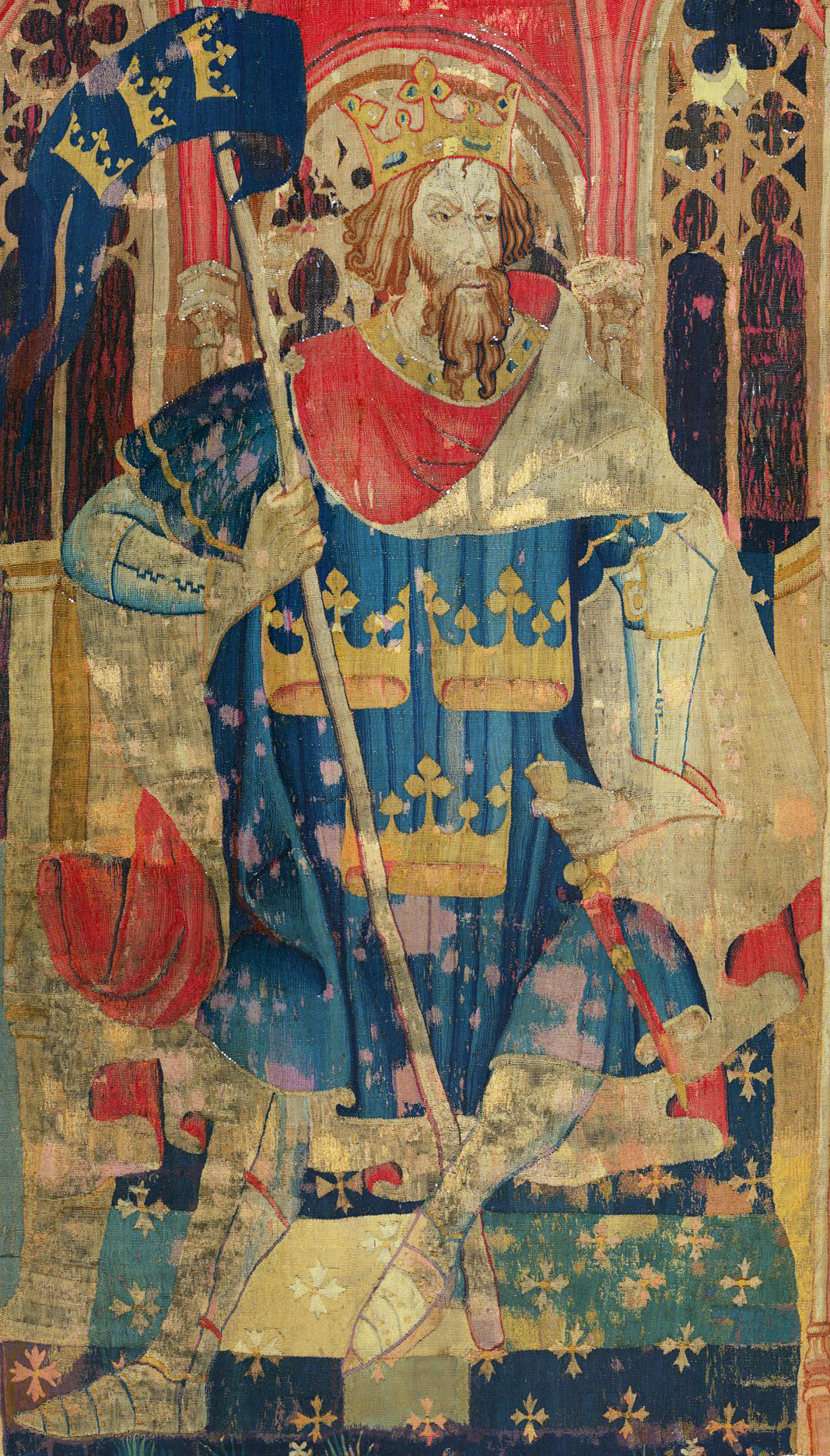
King Arthur
King Arthur ( cy, Brenin Arthur, kw, Arthur Gernow, br, Roue Arzhur) is a legendary king of Britain, and a central figure in the medieval literary tradition known as the Matter of Britain. In the earliest traditions, Arthur appears as a leader of the post-Roman Britons in battles against Saxon invaders of Britain in the late 5th and early 6th centuries. He appears in two early medieval historical sources, the ''Annales Cambriae'' and the ''Historia Brittonum'', but these date to 300 years after he is supposed to have lived, and most historians who study the period do not consider him a historical figure.Tom Shippey, "So Much Smoke", ''review'' of , ''London Review of Books'', 40:24:23 (20 December 2018) His name also occurs in early Welsh poetic sources such as ''Y Gododdin''. The character developed through Welsh mythology, appearing either as a great warrior defending Britain from human and supernatural enemies or as a magical figure of folklore, sometimes associated wi ... [...More Info...] [...Related Items...] OR: [Wikipedia] [Google] [Baidu] |
