|
Stretford
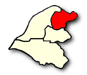
Stretford is a market town in Trafford, Greater Manchester, England. It is situated on flat ground between the River Mersey and the Manchester Ship Canal, south of Manchester city centre, south of Salford and north-east of Altrincham. Stretford borders Chorlton-cum-Hardy to the east, Moss Side and Whalley Range to the south-east, Hulme to the north-east, Urmston to the west, Salford to the north, and Sale to the south. The Bridgewater Canal bisects the town. Within the boundaries of the historic county of Lancashire, Stretford was an agricultural village in the 19th century; it was known locally as ''Porkhampton'', due to the large number of pigs produced for the Manchester market. It was also an extensive market-gardening area, producing more than of vegetables each week for sale in Manchester by 1845. The arrival of the Manchester Ship Canal in 1894, and the subsequent development of the Trafford Park industrial estate, accelerated the industrialisation that had begu ... [...More Info...] [...Related Items...] OR: [Wikipedia] [Google] [Baidu] |
Stretford And Urmston (UK Parliament Constituency)
Stretford and Urmston is a constituency in Greater Manchester represented in the House of Commons of the UK Parliament since a 2022 by-election by Andrew Western, a Labour MP. History Stretford and Urmston was created in 1997 from significant parts of the former constituencies of Davyhulme – whose last member was the Conservative Winston Churchill (grandson of the former Prime Minister) – and Stretford, whose last member was Tony Lloyd (Labour). The constituency was first represented by Beverley Hughes, who stood down at the 2010 general election. Kate Green, a Labour front-bencher, held the seat from 2010 until she resigned in November 2022 after being nominated as Greater Manchester's deputy mayor for policing and crime. Boundaries 1997–2004: The Metropolitan Borough of Trafford wards of Bucklow, Clifford, Davyhulme East, Davyhulme West, Flixton, Longford, Park, Stretford, Talbot, and Urmston. 2004–present: The Metropolitan Borough of Trafford wards of Bucklow ... [...More Info...] [...Related Items...] OR: [Wikipedia] [Google] [Baidu] |
Trafford Park
Trafford Park is an area of the Metropolitan Borough of Trafford, Greater Manchester, England, opposite Salford Quays on the southern side of the Manchester Ship Canal, southwest of Manchester city centre and north of Stretford. Until the late 19th century, it was the ancestral home of the Trafford family, who sold it to financier Ernest Terah Hooley in 1896. Occupying an area of , it was the first planned industrial estate in the world, and remains the largest in Europe well over a century later. Trafford Park is almost entirely surrounded by water; the Bridgewater Canal forms its southeastern and southwestern boundaries, and the Manchester Ship Canal, which opened in 1894, its northeastern and northwestern. Hooley's plan was to develop the Ship Canal frontage, but the canal was slow to generate the predicted volume of traffic, so in the early days the park was largely used for leisure activities such as golf, polo and boating. British Westinghouse was the first major com ... [...More Info...] [...Related Items...] OR: [Wikipedia] [Google] [Baidu] |
Trafford
Trafford is a metropolitan borough of Greater Manchester, England, with an estimated population of 235,493 in 2017. It covers Retrieved on 13 December 2007. and includes the area of Old Trafford and the towns of Altrincham, Stretford, Urmston, Partington and Sale. The borough was formed in 1974 as a merger of six former districts and part of a seventh. The River Mersey flows through the borough, separating North Trafford from South Trafford, and the historic counties of Lancashire and Cheshire. Trafford is the fifth-most populous district in Greater Manchester. There is evidence of Neolithic, Bronze Age, and Roman activity in the area, two castles – one of them a Scheduled Ancient Monument – and over 200 listed buildings. In the late 19th century, the population rapidly expanded with the arrival of the railway. Trafford is the home of Altrincham Football Club, Trafford Football Club, Manchester United F.C. and Lancashire County Cricket Club and since 2 ... [...More Info...] [...Related Items...] OR: [Wikipedia] [Google] [Baidu] |
Trafford Town Hall
Trafford Town Hall is a neo-classical building in Stretford, Trafford, Greater Manchester, Sngland. It is the meeting place of Trafford Council and was originally known as "Stretford Town Hall". The building faces Emirates Old Trafford to the south and is within 500 metres of Manchester United's Football Ground to the north. History Before the construction of the town hall, the forerunner authority, Stretford Urban District Council, held its meetings in the District Council Offices on Talbot Road in Old Trafford (subsequently known as Trafford Public Hall and now known as the Trafford Hall Hotel). The building now known as Trafford Town Hall stands on a large previously undeveloped site at the junction of Talbot Road and Warwick Road in Stretford, England. It was designed by architects Bradshaw Gass & Hope of Bolton on behalf of Stretford Municipal Borough, and built by the main contractor Edwin Marshall & Sons. Work began on 21 August 1931, funded by a government grant of ... [...More Info...] [...Related Items...] OR: [Wikipedia] [Google] [Baidu] |
Hulme
Hulme () is an inner city area and Ward (politics), electoral ward of Manchester, England, immediately south of Manchester city centre. It has a significant industrial heritage. Historic counties of England, Historically in Lancashire, the name Hulme is derived from the Old Norse word for a small island, or land surrounded by water or marsh, indicating that it may have been first settled by Norsemen, Norse invaders in the period of the Danelaw. History Toponymy Hulme derives its name from the Old Norse language, Old Norse ''holmr, holmi'', through History of Danish, Old Danish ''hulm'' or ''hulme'' meaning small islands or land surrounded by streams, fen or marsh.Eilert Ekwall, Ekwall, Eilert ''The Place-Names of Lancashire'' (1922, The University Press, Lime Grove, Manchester) The area may have fitted this description at the time of the Scandinavian invasion and settlement as it is surrounded by water on three sides by the rivers River Irwell, Irwell, River Medlock, Medlock ... [...More Info...] [...Related Items...] OR: [Wikipedia] [Google] [Baidu] |
Sale, Greater Manchester
Sale is a town in Trafford, Greater Manchester, England, in the historic county of Cheshire on the south bank of the River Mersey, south of Stretford, northeast of Altrincham, and southwest of Manchester. In 2011, it had a population of 134,022, making it the largest town by population in Trafford. Evidence of Stone Age, Roman and Anglo-Saxon activity has previously been discovered locally. In the Middle Ages, Sale was a rural township, linked ecclesiastically with neighbouring Ashton upon Mersey, whose fields and meadows were used for crop and cattle farming. By the 17th century, Sale had a cottage industry manufacturing garthweb, the woven material from which horses' saddle girths were made. The Bridgewater Canal reached the town in 1765, stimulating Sale's urbanisation. The arrival of the railway in 1849 triggered Sale's growth as an important town and place for people who wanted to travel to and from Manchester, leading to an influx of middle class residents; by the en ... [...More Info...] [...Related Items...] OR: [Wikipedia] [Google] [Baidu] |
Urmston
Urmston is a town in Trafford, Greater Manchester, England, which had a population of 41,825 at the 2011 Census. Historically in Lancashire, it is southwest of Manchester city centre. The southern boundary is the River Mersey, with Stretford lying to the east and Flixton to the west. Davyhulme lies to the north of the town centre. Urmston covers an area of 4,799 acres (19 km2). The town has early medieval origins, and until the arrival of the railway in 1873 was a small farming community. The railway acted as a catalyst, transforming the town into a residence for the middle classes. History In 1986 during an excavation by South Trafford Archaeological Group, fragments of Roman pottery were found in the area now occupied by the cemetery – previously the site of Urmston Old Hall – suggesting that there may have been a Roman settlement on the site. In the early 13th century, Lord Greenhalgh and his family lived at Highfield House (under what is now the M60 motorway). ... [...More Info...] [...Related Items...] OR: [Wikipedia] [Google] [Baidu] |
John Rylands
John Rylands (7 February 1801 – 11 December 1888) was an English entrepreneur and philanthropist. He was the owner of the largest textile manufacturing concern in the United Kingdom, and Manchester's first multi-millionaire. After having learned to weave, Rylands became a small-scale manufacturer of hand-looms, while also working in the draper's shop which his father had opened in St Helens. He displayed a "precocious shrewdness" for retailing, and in partnership with his two elder brothers expanded into the wholesale trade. So successful were they that, in 1819, Rylands' father merged his retail business with theirs, creating the firm of Rylands & Sons. At its peak, the company employed a workforce of 15,000 in 17 mills and factories, producing 35 tons of cloth a day. Biography Rylands was the third son of Joseph Rylands, a manufacturer of cotton goods, of St Helens, Lancashire, and his wife Elizabeth (née Pilkington). He was educated at St Helens Grammar School. H ... [...More Info...] [...Related Items...] OR: [Wikipedia] [Google] [Baidu] |
Chorlton-cum-Hardy
Chorlton-cum-Hardy is a suburban area of Manchester, England, southwest of the Manchester city centre, city centre. Chorlton (ward), Chorlton ward had a population of 14,138 at the United Kingdom Census 2011, 2011 census, and Chorlton Park (ward), Chorlton Park 15,147. By the 9th century, there was an Anglo-Saxon settlement here. In the Middle Ages, improved drainage methods led to population growth. In the late Victorian era, Victorian and Edwardian periods, its rural character made it popular among the middle class. The loss of its railway station, the conversion of larger houses into flats or bedsitters, and significant social housing development to the south of the area changed its character again in the 1970s. However, the existing Manchester Metrolink tram stop called Chorlton was built on the site of that former railway station and from Manchester, it is served by East Didsbury trams and Manchester Airport trams. Historically, Chorlton was a village on Lancashire's sou ... [...More Info...] [...Related Items...] OR: [Wikipedia] [Google] [Baidu] |
Greater Manchester
Greater Manchester is a metropolitan county and combined authority, combined authority area in North West England, with a population of 2.8 million; comprising ten metropolitan boroughs: City of Manchester, Manchester, City of Salford, Salford, Metropolitan Borough of Bolton, Bolton, Metropolitan Borough of Bury, Bury, Metropolitan Borough of Oldham, Oldham, Metropolitan Borough of Rochdale, Rochdale, Metropolitan Borough of Stockport, Stockport, Tameside, Trafford and Metropolitan Borough of Wigan, Wigan. The county was created on 1 April 1974, as a result of the Local Government Act 1972, and designated a functional Manchester City Region, city region on 1 April 2011. Greater Manchester is formed of parts of the Historic counties of England, historic counties of Cheshire, Lancashire and the West Riding of Yorkshire. Greater Manchester spans , which roughly covers the territory of the Greater Manchester Built-up Area, the List of urban areas in the United Kingdom, second most ... [...More Info...] [...Related Items...] OR: [Wikipedia] [Google] [Baidu] |
Bridgewater Canal
The Bridgewater Canal connects Runcorn, Manchester and Leigh, Greater Manchester, Leigh, in North West England. It was commissioned by Francis Egerton, 3rd Duke of Bridgewater, to transport coal from his mines in Worsley to Manchester. It was opened in 1761 from Worsley to Manchester, and later extended from Manchester to Runcorn, and then from Worsley to Leigh. The canal is connected to the Manchester Ship Canal via a lock at Cornbrook; to the Rochdale Canal in Manchester; to the Trent and Mersey Canal at Preston Brook, southeast of Runcorn; and to the Leeds and Liverpool Canal at Leigh. It once connected with the River Mersey at Runcorn but has since been cut off by a slip road to the Silver Jubilee Bridge. Following the re-routing of roads to the Silver Jubilee Bridge, the Runcorn Locks Restoration Society campaigns to reinstate the flight of locks. The Bridgewater canal is described as the first great achievement of the canal age, although the Sankey Canal opened earlier. ... [...More Info...] [...Related Items...] OR: [Wikipedia] [Google] [Baidu] |
Whalley Range, Manchester
Whalley Range is an area of Manchester, England, about southwest of the city centre. The population at the 2011 census was 15,430. Historically in Lancashire, it was one of the earliest of the city's suburbs, built by local businessman Samuel Brooks. History Whalley Range was one of Manchester's first suburbs, built by Manchester banker and businessman Samuel Brooks as "a desirable estate for gentlemen and their families". In September 1834, Samuel Brooks bought 39 Lancashire acres of land from Robert Fielden, called Oak Farm in Moss Side, also known locally as Barber's Farm. Brooks also bought 42 Lancashire acres from the Egerton Estate. This land is described in the deeds as being part of Hough Moss, but in the Egerton Estate's records as Fletcher's Moss. It was also known locally as Jackson's, Plant's or Woodall's Moss, and was part of the Manor of Withington. In 1867, the area was given its own postcode by the post office - 'Manchester SW 16'. In 1894, the area north o ... [...More Info...] [...Related Items...] OR: [Wikipedia] [Google] [Baidu] |


_2018.png)