|
Rockhampton
Rockhampton is a city in the Rockhampton Region of Central Queensland, Australia. The population of Rockhampton in June 2021 was 79,967, Estimated resident population, 30 June 2018. making it the fourth-largest city in the state outside of the cities of South East Queensland, and the 22nd-largest city in Australia. Today, Rockhampton is an industrial and agricultural centre of the north, and is the regional centre of Central Queensland. Rockhampton is one of the oldest cities in Queensland and in Northern Australia. In 1853, Charles and William Archer came across the Toonooba river, which is now also known as the Fitzroy River, which they claimed in honour of Sir Charles FitzRoy. The Archer brothers took up a run near Gracemere in 1855, and more settlers arrived soon after, enticed by the fertile valleys. The town of Rockhampton was proclaimed in 1858, and surveyed by William Henry Standish, Arthur F Wood and Francis Clarke, the chosen street design closely resembled the Hod ... [...More Info...] [...Related Items...] OR: [Wikipedia] [Google] [Baidu] |
Rockhampton Courthouse
Rockhampton Courthouse is a heritage-listed courthouse at 42 East Street, Rockhampton, Queensland, Rockhampton, Rockhampton Region, Queensland, Australia. It was designed by John Hitch and built from 1950 to 1955. It is also known as District Court, Queensland Government Savings Bank, Commonwealth Bank, Magistrate's Court, Police Court, and Supreme Court. It was added to the Queensland Heritage Register on 21 October 1992. History The Rockhampton Courthouse complex comprises the Supreme Court of Queensland, Supreme Court building (Block D 1886–87), Magistrate's Court building (Block B, former Police Court building 1934–1936), District Court building (Block C, former Queensland Government Savings Bank and Commonwealth Bank, 1915–16 and 1932–1933), Family Services' building (Block F, former Labour Bureau 1934–36), and the Bolsover Street Government Office building (Block E 1950–55), which all form part of a significant group of buildings on the Government Reserve bou ... [...More Info...] [...Related Items...] OR: [Wikipedia] [Google] [Baidu] |
Rockhampton Region
The Rockhampton Region is a local government area (LGA) in Central Queensland, Australia, located on the Tropic of Capricorn about north of Brisbane. Rockhampton is the region's major city; the region also includes the Fitzroy River, Mount Archer National Park and Berserker Range. History Established in 2008, it was preceded by four previous local government areas extending to almost the beginning of local government in Queensland. On 1 January 2014, one of those local government areas, the Shire of Livingstone was restored as an independent council. Prior to the 2008 amalgamation, the Rockhampton Region existed as four distinct local government areas: * the City of Rockhampton; * the Shire of Fitzroy; * the Shire of Livingstone (now de-amalgamated); * and the Shire of Mount Morgan. Rockhampton was proclaimed as Queensland's fourth municipality (after Brisbane, Ipswich and Toowoomba) on 13 December 1860 under the ''Municipalities Act 1858'', a piece of New South Wales leg ... [...More Info...] [...Related Items...] OR: [Wikipedia] [Google] [Baidu] |
Rockhampton Heritage Village
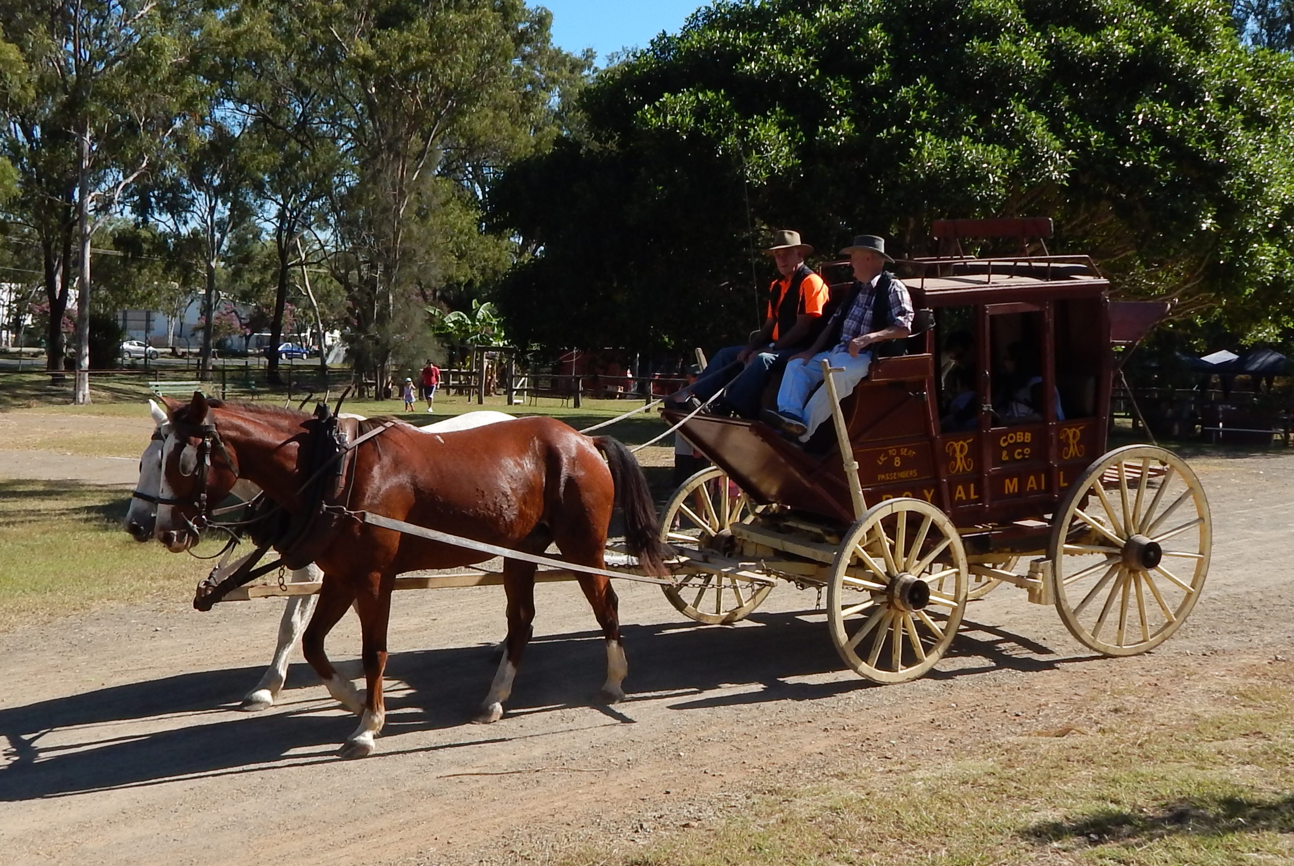
The Rockhampton Heritage Village is a tourist attraction and multipurpose venue located in Rockhampton, Queensland, Australia. Situated on corner of the Bruce Highway and Boundary Road in the suburb of Parkhurst, it was officially opened by Rockhampton City Council mayor Jim MacRae and Federal Member for Capricornia Paul Marek on 8 May 1998. Laid out as a township museum on 11.4 hectares of land, the Rockhampton Heritage Village consists of approximately 40 buildings, with a mixture of both original historical buildings or replicas which have been preserved or designed to focus on the history of Central Queensland since European settlement. The attraction is mainly run by volunteers from the organisation Friends of the Heritage Village, but a small number of paid Rockhampton Regional Council employees also work on site. History The Rockhampton Heritage Village originated from a privately owned collection of memorabilia which had been displayed at what was known as the Gangalo ... [...More Info...] [...Related Items...] OR: [Wikipedia] [Google] [Baidu] |
Customs House, Rockhampton
The Rockhampton Customs House is a heritage-listed customs house at 208 Quay Street, Rockhampton, Rockhampton Region, Queensland, Australia. It was built from 1899 to 1900 by Caskie and Thompson. It was added to the Queensland Heritage Register on 7 February 2005. History The Rockhampton Customs House was constructed in 1899 as the third Customs House in Rockhampton. It is one of a group of Customs Houses built in Queensland at the turn of the century to the design of innovative and skilful architects of the Public Works Department. The architect responsible for the design of the Rockhampton Customs House is thought to be Thomas Pye with the assistance of George Payne. The Archer brothers made a private expedition to the Rockhampton district in 1853, and were the first Europeans to record and chart the Fitzroy River. They built a small wharf to allow for the transport of wool bales from their property, Gracemere station. West of the place chosen as the wharf a large bar o ... [...More Info...] [...Related Items...] OR: [Wikipedia] [Google] [Baidu] |
Allenstown, Queensland
Allenstown is a suburb of Rockhampton, Rockhampton Region, Queensland, Australia. It is situated by road south-west of the Rockhampton CBD. In the , Allenstown had a population of 2,790 people. Geography The main business precinct of Allenstown is anchored by local shopping centre Allenstown Square, which was previously known as Allenstown Plaza before undergoing a major refurbishment and extension which was completed in 2012. History The suburb is named after William Allen, builder, around 1862. Allen's decision to sell blocks of land for thirty pounds following his return from the Canoona gold rush, which saw many new cottages being built, prompted the locals to dub the suburb "Allen's town". In 1864, Patrick Egan established the Merry Jig Hotel. In December 1870, tenders were called from carpenters to erect a Wesleyan Methodist church in Allenstown. The church was opened on Sunday 16 April 1871. It was designed by architect Septimus Nash Spong and described as "handso ... [...More Info...] [...Related Items...] OR: [Wikipedia] [Google] [Baidu] |
Central Queensland University
Central Queensland University (alternatively known as CQUniversity) is an Australian public university based in central Queensland. CQUniversity is the only Australian university with a campus presence in every mainland state. Its main campus is at Norman Gardens in Rockhampton, however, it also has campuses in Adelaide (Wayville), Brisbane, Bundaberg ( Branyan), Cairns, Emerald, Gladstone ( South Gladstone and Callemondah), Mackay (central business district and Ooralea), Melbourne, Noosa, Perth, Rockhampton City, Sydney and Townsville. CQUniversity also has delivery sites to support distance education in Biloela, Broome, Busselton, Charters Towers, Karratha and Yeppoon, and partners with university centres in Cooma, Geraldton and Port Pirie. History CQUniversity began as the ''Queensland Institute of Technology (Capricornia)'' in 1967, and after two years under the name of the ''University College of Central Queensland'', in 1992 became an official university named the ... [...More Info...] [...Related Items...] OR: [Wikipedia] [Google] [Baidu] |
The Range, Queensland
The Range is a suburb in the Rockhampton Region, Queensland, Australia. In the The Range had a population of 5,400 people. Geography The suburb is built on the Athelstane Range with Agnes Street approximating the ridge line. History The suburb takes its name from the Athelstane Range, which was named in turn for Mount Athelstane, the name of the house built by lands commissioner William Wiseman circa 1859. Rockhampton's first water storage was built on the top of Governor's Hill (part of Atheltstane Range) in 1875. Rockhampton Grammar School was built in Agnes Street in 1883 and is the oldest school in Rockhampton. At the 2006 census, The Range had a population of 5,731. In the 2011 census, The Range had a population of 5369 people. In the The Range had a population of 5,400 people. Heritage listings The Range has a number of heritage-listed properties, including: * 155 Agnes Street: Rockhampton Girls Grammar School * 248 Agnes Street: Rudd Residence * 263 Agnes Str ... [...More Info...] [...Related Items...] OR: [Wikipedia] [Google] [Baidu] |
Fitzroy River, Queensland
The Fitzroy River (Darumbal: ''Toonooba'') is a river located in Central Queensland, Australia. Its catchment covers an area of , making it the largest river catchment flowing to the eastern coast of Australia. It is also the largest river basin that discharges onto the Great Barrier Reef. Course and features Formed by the confluence of the Mackenzie and Dawson rivers that drain the Expedition Range and the Carnarvon Range respectively, the Fitzroy River rises near Duaringa and flows initially north by east, then northward near the Goodedulla National Park. The river then flows in an easterly direction near the Lake Learmouth State Forest and parallel with the Bruce Highway through the settlement of , before turning south to where the river is crossed by the Bruce Highway. After flowing through Rockhampton, the river flows south by east past the Berserker Range past Humbug Point to the south of the Flat Top Range and eventually discharging into Keppel Bay in the Coral Sea nea ... [...More Info...] [...Related Items...] OR: [Wikipedia] [Google] [Baidu] |
Canoona Gold Rush
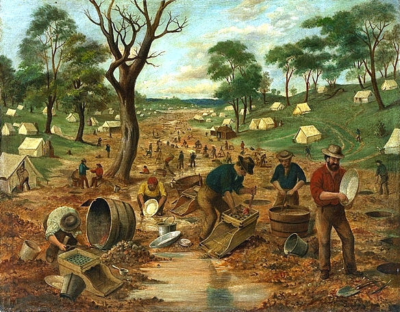
During the Australian gold rushes, starting in 1851, significant numbers of workers moved from elsewhere in Australia and overseas to where gold had been discovered. Gold had been found several times before, but the colonial government of New South Wales (Victoria did not become a separate colony until 1 July 1851) had suppressed the news out of the fear that it would reduce the workforce and so destabilise the economy. After the California Gold Rush began in 1848, many people went there from Australia, so the New South Wales government sought approval from the British Colonial Office for the exploitation of mineral resources, and offered rewards for finding gold. History of discovery The first gold rush in Australia began in May 1851 after prospector Edward Hargraves claimed to have discovered payable gold near Orange, at a site he called Ophir. Hargraves had been to the Californian goldfields and had learned new gold prospecting techniques such as panning and cradling. H ... [...More Info...] [...Related Items...] OR: [Wikipedia] [Google] [Baidu] |
Electoral District Of Rockhampton
Rockhampton is an electoral district of the Legislative Assembly in the Australian state of Queensland. Wedged between the electoral districts of Keppel to the east and Mirani to the west, Rockhampton encompasses the bulk of the regional city of Rockhampton and many of its outlying developed areas, including the community of Gracemere. History In 1864, the ''Additional Members Act'' created six additional electoral districts, each returning 1 member: * Clermont * Kennedy * Maryborough * Mitchell * Rockhampton * Warrego The first elections in these six electorates were held in 1865 (that is, during a parliamentary term and not as part of a general election across Queensland). The nomination date for the election in Rockhampton was 30 January 1865 and the election was held on 1 February 1865. Members for Rockhampton Election results References External links * {{Electoral districts of Queensland Rockhampton Rockhampton is a city in the Rockhampton Reg ... [...More Info...] [...Related Items...] OR: [Wikipedia] [Google] [Baidu] |
Rod Laver
Rodney George Laver (born 9 August 1938) is an Australian former tennis player. Laver was the world number 1 ranked professional in some sources in 1964, in all sources from 1965 to 1969 and in some sources in 1970, spanning four years before and three years after the start of the Open Era in 1968. He was also ranked the world number 1 amateur in 1961 by Lance Tingay and 1962 by Tingay and Ned Potter. Laver's 200 singles titles are the most in tennis history. This included his all-time men's record of 10 or more titles per year for seven consecutive years (1964–1970). He excelled on all of the court surfaces of his time: grass, clay, hard, carpet, and wood. Laver won 11 Grand Slam singles titles, though he was banned from playing those tournaments for the five years prior to the Open Era. Laver is the only player, male or female, to win a Grand Slam (winning all four major titles in the same calendar year) twice in singles, in 1962 and 1969; the latter remains the only tim ... [...More Info...] [...Related Items...] OR: [Wikipedia] [Google] [Baidu] |
Central Queensland
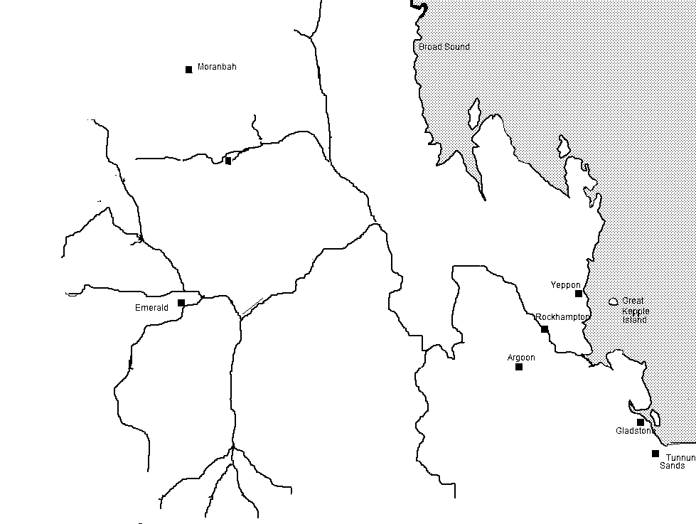
Central Queensland is an ambiguous geographical division of Queensland ( a state in Australia) that centres on the eastern coast, around the Tropic of Capricorn. Its major regional centre is Rockhampton. The region extends from the Capricorn Coast west to the Central Highlands at Emerald, north to the Mackay Regional Council southern boundary, and south to Gladstone. The region is also known as Capricornia. It is one of Australia's main coal exporting regions. At the 2011 Australian Census the region recorded a total population from the six local government areas of 233,931. Industry Economically, Central Queensland is an important centre of primary sector industries, particularly for food and fibre production. Central Queensland includes the Bowen Basin which is rich in high quality coking coal, the Port of Gladstone produces 40% of the state's export earnings, the Fitzroy River is the second-largest river system in Australia and commands significant water resources such as F ... [...More Info...] [...Related Items...] OR: [Wikipedia] [Google] [Baidu] |


