|
Lahn-Dill-Kreis
Lahn-Dill is a ''Kreis'' (district) in the west of Hesse, Germany. Neighboring districts are Siegen-Wittgenstein, Marburg-Biedenkopf, Gießen, Wetteraukreis, Hochtaunuskreis, Limburg-Weilburg, Westerwaldkreis. History The southern district belonged to the Princes of Solms-Braunfels and the Free Imperial City of Wetzlar. The latter had to give up its imperial freedom in 1803 as a result of the Imperial Deputation, then as the county of Wetzlar, in favor of the newly created Grand Duchy of Frankfurt of the prince primate (in the old empire Reichserzkanzler) Karl Theodor von Dalberg. The former Solmsian territories came to the Duchy of Nassau in 1806 and in 1815 also to Prussia in an exchange. In 1816, the Prussian districts of Wetzlar and Braunfels were created, which were united in 1822 to form the district of Wetzlar. The district belonged to the Prussian Rhine Province as an exclave until 1932. Since the Middle Ages, the northern part of the district belonged to the principality ... [...More Info...] [...Related Items...] OR: [Wikipedia] [Google] [Baidu] |
Wetzlar
Wetzlar () is a city in the state of Hesse, Germany. It is the twelfth largest city in Hesse with currently 55,371 inhabitants at the beginning of 2019 (including second homes). As an important cultural, industrial and commercial center, the university town is one of the ten regional centers in the state of Hesse. A former free imperial city, it gained much of its fame as the seat of the Imperial Supreme Court (''Reichskammergericht'') of the Holy Roman Empire. Located 51 kilometers north of Frankfurt, at 8° 30′ E, 50° 34′ N, Wetzlar straddles the river Lahn and is on the German Timber-Frame Road, which passes mile upon mile of half-timbered houses. Historically, the city has acted as the hub of the Lahn-Dill-Kreis on the north edge of the Taunus. Tourists know the city for its ancient town and its medieval Catholic/Protestant shared cathedral of St. Mary. Notable architectural features include the Eisenmarkt and the steep gradients and tightly-packed street layout of a me ... [...More Info...] [...Related Items...] OR: [Wikipedia] [Google] [Baidu] |
Eschenburg
Eschenburg is a municipality in the Lahn-Dill-Kreis in Hesse, Germany. The community inherited its name from nearby Eschenburg mountain. Geography About 20 km², or 43.8%, of the municipal area is wooded, 9.85 km² of this being municipal forest, and the rest state forest. Location The individual communities within Eschenburg lie on the river Dietzhölze and in its side valleys and high dales in the Rothaargebirge's foothills. Eschenburg lies in the northern Lahn-Dill-Kreis, some 10 km northeast of Dillenburg and 23 km east of Siegen. Neighbouring communities Eschenburg borders in the north on the communities of Dietzhölztal (Lahn-Dill-Kreis) and Breidenbach, in the east on the communities of Steffenberg and Angelburg (all three in Marburg-Biedenkopf), in the south on the community of Siegbach, in the southwest on the town of Dillenburg, and in the west on the town of Haiger (all in the Lahn-Dill-Kreis). Constituent communities Eschenburg comprises the cent ... [...More Info...] [...Related Items...] OR: [Wikipedia] [Google] [Baidu] |
Bischoffen
Bischoffen is a municipality in the Lahn-Dill-Kreis in Hesse, Germany. Geography Location Bischoffen lies in the Lahn-Dill Highland at the Aar Dam (''Aartalsperre''). This dam holds back the river Aar, a tributary to the Dill, forming a 57-ha lake whose purpose is mainly flood control, although of course it also has its recreational uses. Niederweidbach Lying among the villages of Bischoffen (itself a constituent community, and indeed the community's namesake, but not the biggest centre therein), Oberweidbach, Roßbach, Mudersbach and Ahrdt, Niederweidbach is found right on the shore of the Aartalsee, the man-made lake created by the Aar Dam. It is also on the stretch of Federal Highway (''Bundesstraße'') B 255 between Herborn and Gladenbach. q.v. Niederweidbach's history Neighbouring communities Bischoffen borders in the north on the community of Bad Endbach and the town of Gladenbach, in the east on the community of Lohra (all three in Marburg-Biedenkopf), in the ... [...More Info...] [...Related Items...] OR: [Wikipedia] [Google] [Baidu] |
Sinn, Hesse
Sinn is a municipality in Middle Hesse, Germany, in the Lahn-Dill-Kreis. Geography Location Sinn lies at a height of above sea level at the foot of the Westerwald range, south of Herborn in the Dill valley. Edingen Edingen lies on the Dill valley's west side on the slopes of the Westerwald range below the Greifenstein ruins and the like-named constituent community in the community of Greifenstein. Neighbouring communities Sinn borders in the northeast on the community of Mittenaar, in the east on the community of Ehringshausen, in the south on the community of Greifenstein and in the northwest on the town of Herborn (all in the Lahn-Dill-Kreis). Constituent communities The community consists of the following centres: * Edingen * Fleisbach * Sinn History The Dill valley's fertile slopes and dales were settled quite early on. Archaeological finds in the countryside around Edingen range through all epochs and have led to the conclusion that the area has been permanently settle ... [...More Info...] [...Related Items...] OR: [Wikipedia] [Google] [Baidu] |
Siegbach
Siegbach is a municipality in the Lahn-Dill-Kreis in Hesse, Germany. Geography Location The community of Siegbach lies in the Lahn-Dill Highland in the valley of its namesake brook, the Siegbach, which empties into the Aar to the south at Bischoffen. More than half of the municipal area is wooded. Neighbouring communities Siegbach borders in the north on the communities of Eschenburg (Lahn-Dill-Kreis) and Angelburg, in the south on the communities of Bischoffen and Mittenaar, in the southwest on the town of Herborn, and in the west on the town of Dillenburg (all in the Lahn-Dill-Kreis). Constituent communities The community consists of the five centres of Eisemroth (administrative seat), Oberndorf, Tringenstein, Übernthal and Wallenfels. History As part of Hesse's municipal reforms, the formerly independent municipalities of Eisemroth, Tringenstein, Übernthal and Wallenfels merged on 1 January 1972 to form the greater community of Siegbach, after the communities o ... [...More Info...] [...Related Items...] OR: [Wikipedia] [Google] [Baidu] |
Ehringshausen
Ehringshausen is a municipality in the Lahn-Dill-Kreis in Hesse, Germany. Geography Location Ehringshausen lies in the valley of the Dill between Wetzlar and Herborn. Neighbouring communities Ehringshausen borders in the north on the community of Mittenaar, in the east on the town of Aßlar, in the south on the towns of Solms and Leun, and in the northwest on the community of Sinn (all in the Lahn-Dill-Kreis). Constituent communities The community has nine centres named Breitenbach, Daubhausen, Dillheim, Dreisbach, Ehringshausen, Greifenthal, Katzenfurt, Kölschhausen and Niederlemp. History Ehringshausen had its first documentary mention in 802 in a donation document in the Lorsch codex. According to this document, Inric gave the Lorsch Monastery a fortified yard in the Barcdorfer Mark in the Lahngau. Barcdorf lay near today's Ehringshausen on the Dill's right bank. Whether it can be regarded as Ehringshausen's direct forerunner is, however, unclear. The oldest centre in the ... [...More Info...] [...Related Items...] OR: [Wikipedia] [Google] [Baidu] |
Herborn, Hesse
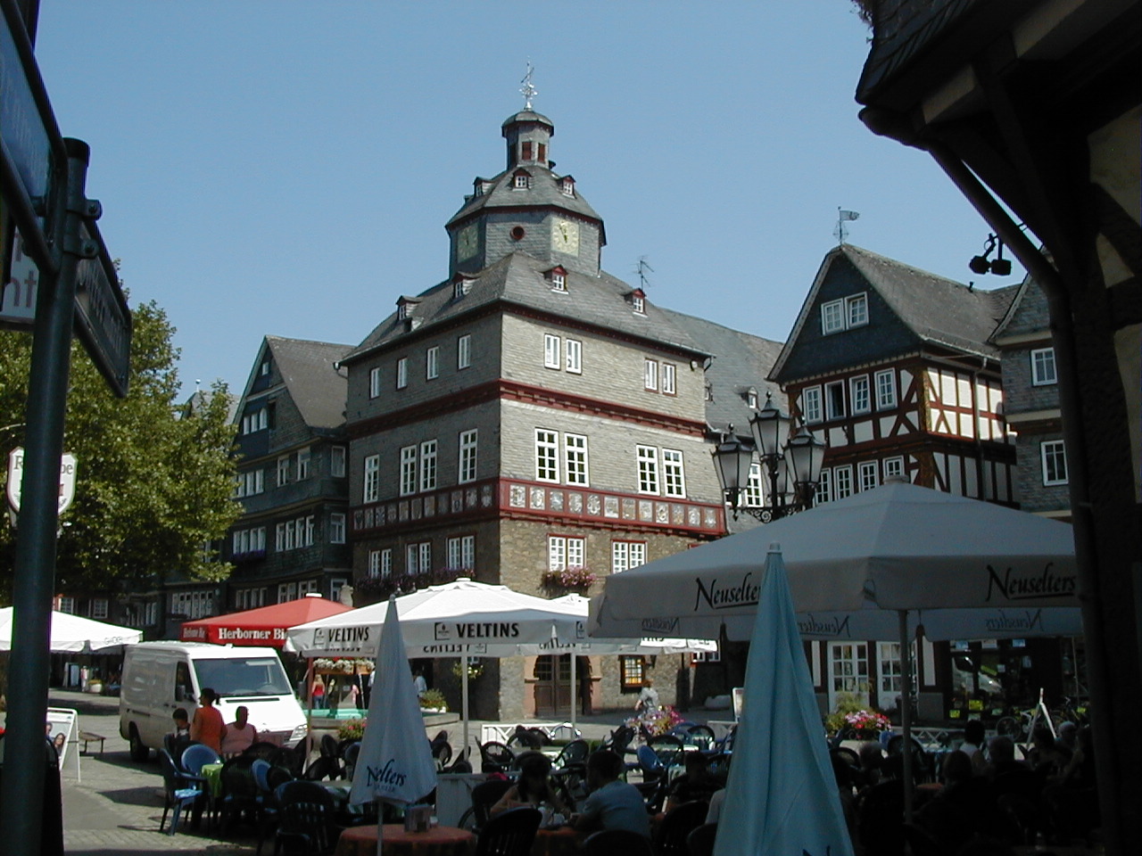
Herborn () is a historic town on the Dill in the Lahn-Dill district of Hesse in Germany. Before World War I, it was granted its own title as ''Nassauisches Rothenburg''. The symbol or mascot of this town is a bear. Scenic attractions include its half-timbered houses; Herborn is located on the German Timber-Frame Road. Herborn hosted the 26th ''Hessentag'' state festival in 1986, and the 56th Hessentag in 2016. Geography The town's coordinates are . It has an area of 64 km² (24 mi²), of which 28 km² (11 mi²) is forest. Herborn is connected by the A45 motorway ( E40/ E41) with Siegen, Wetzlar, and Gießen. Neighbouring communities Herborn is bordered on the north by the town of Dillenburg, on the northeast by the community of Siegbach, on the east by the community of Mittenaar, on the southeast by the community of Sinn, on the south by the community of Greifenstein, and on the west by the communities of Driedorf and Breitscheid (all in the Lahn-Dill-Kreis) ... [...More Info...] [...Related Items...] OR: [Wikipedia] [Google] [Baidu] |
Leun
Leun is a small town in the Lahn-Dill-Kreis in Hesse, Germany. Geography Location Leun lies some 10 km west of Wetzlar between the foothills of the northern Taunus and the Westerwald in the Lahn valley, at a height of 150 to 330 m above sea level. Neighbouring communities Leun borders in the north on the communities of Greifenstein and Ehringshausen, in the east on the town of Solms, in the south on the town of Braunfels (all in the Lahn-Dill-Kreis) and in the west on the community of Löhnberg (Limburg-Weilburg). Constituent communities The town consists of the five centres of Biskirchen, Bissenberg, Lahnbahnhof, Leun and Stockhausen. History Leun had its first documentary mention in 771. Building a stone bridge in the late 15th century and being granted market rights helped the village's economic growth, which in 1664 resulted in town rights being granted. As part of Hesse's municipal reform, the new, bigger town of Leun came into being when the main town of Leun a ... [...More Info...] [...Related Items...] OR: [Wikipedia] [Google] [Baidu] |
Braunfels
Braunfels () is a town in the Lahn-Dill-Kreis in Hesse, Germany. It is located on the German Timber-Frame Road. Geography Location The climatic spa of Braunfels lies at a height of some 100 m above the Lahn valley. It is 9 km southwest of Wetzlar, and 28 km northeast of Limburg an der Lahn. Neighbouring communities Braunfels borders in the northwest on the town of Leun, in the north on the town of Solms, in the east on the community of Schöffengrund, in the southeast on the community of Waldsolms (all in the Lahn-Dill-Kreis), in the south on the community of Weilmünster, and in the west on the town of Weilburg and the community of Löhnberg (all three in Limburg-Weilburg). Constituent communities Besides the main town, which bears the same name as the whole, there are outlying centres called Altenkirchen, Bonbaden, Neukirchen, Philippstein and Tiefenbach Currently, Bonbaden, is home to about 1600 people. Bonbaden has a primary school (levels 1-4) and an Eva ... [...More Info...] [...Related Items...] OR: [Wikipedia] [Google] [Baidu] |
Mittenaar
Mittenaar () is a municipality in the Lahn-Dill-Kreis in Hesse, Germany. Geography Mittenaar lies in the Lahn-Dill Highland. On Mittenaar's live more than 5,000 people. About 45 km of roads connect the various centres. More than half the municipal area is wooded. Mittenaar borders in the north on the community of Siegbach, in the northeast on the community of Bischoffen, in the east on the community of Hohenahr, in the southeast on the town of Aßlar, in the south on the community of Ehringshausen, in the southwest on the community of Sinn, and in the west on the town of Herborn (all in the Lahn-Dill-Kreis). The community consists of the centres of Ballersbach, Bellersdorf, Bicken (administrative seat) and Offenbach. History Mittenaar The community of Mittenaar came into being on 1 January 1972 with the merger of the formerly independent municipalities of Ballersbach, Bicken and Offenbach. Bellersdorf was amalgamated on 1 April 1972. Ballersbach Ballersbach had its firs ... [...More Info...] [...Related Items...] OR: [Wikipedia] [Google] [Baidu] |
Greifenstein
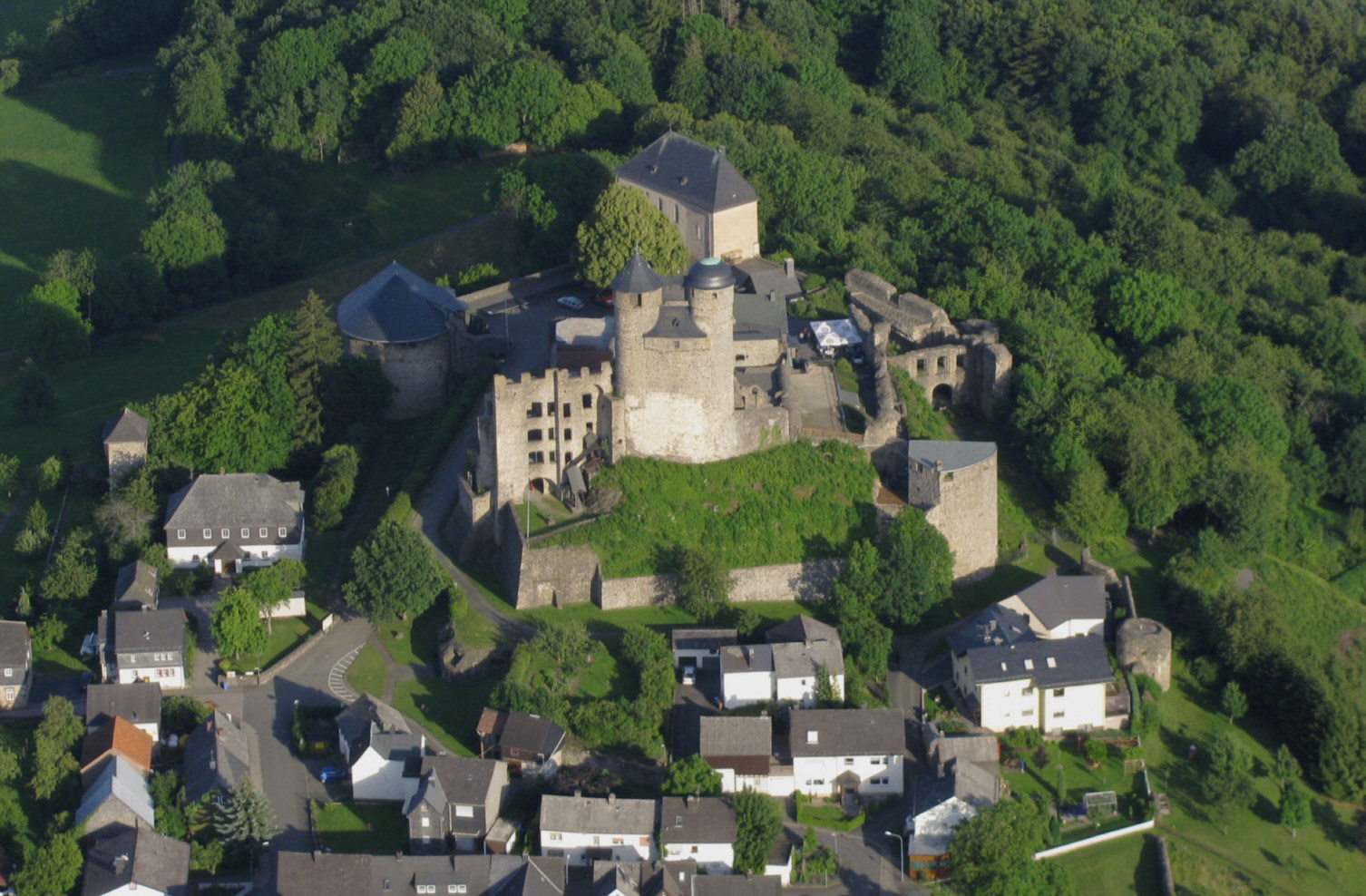
Greifenstein is a municipality in the Lahn-Dill-Kreis in Hesse, Germany. Its administrative seat is Beilstein. Greifenstein covers 67.43 km² on the eastern slope of the Westerwald range. It was named for the castle of the same name in the constituent community of the same name. This is the site of the German Bell Museum (''Deutsches Glockenmuseum''), which holds about 50 bells that show the historical development of bell pouring and manufacture. Geography Neighbouring communities Greifenstein borders in the northwest on the community of Driedorf, in the north on the town of Herborn and the community of Sinn, in the east on the community of Ehringshausen, in the south on the town of Leun (all in the Lahn-Dill-Kreis) and the community of Löhnberg, and in the southwest on the community of Mengerskirchen (both in Limburg-Weilburg). Constituent communities The community was founded as part of Hesse's municipal reforms in 1977 from the following centres (with population fig ... [...More Info...] [...Related Items...] OR: [Wikipedia] [Google] [Baidu] |
Driedorf
Driedorf is a municipality in the Lahn-Dill-Kreis in Hesse, Germany. Geography Location Driedorf lies from 416 to 642 m above sea level on a tableland in the high Westerwald. Mademühlen Mademühlen has about 1,000 inhabitants and lies in the "Hessischer Westerwald" protected area and in the European protected area network Natura 2000. It is on the upper reaches of the Rehbach, between two reservoirs. Münchhausen Münchhausen is the first village on the Ulmbach and is blessed with extensive woodlands, which afforded prosperity in earlier times. Neighbouring communities Driedorf borders in the north on the community of Breitscheid, in the east on the town of Herborn, in the south on the community of Greifenstein (all in the Lahn-Dill-Kreis), and in the west on the communities of Oberrod, Rehe, Homberg, Waigandshain, Nister-Möhrendorf and Willingen (all in the Westerwaldkreis in Rhineland-Palatinate). Constituent communities Besides the namesake centre, there are eight ... [...More Info...] [...Related Items...] OR: [Wikipedia] [Google] [Baidu] |


