|
Geography Of Kent
Kent is the south-easternmost county in England. It is bounded on the north by the River Thames and the North Sea, and on the south by the Straits of Dover and the English Channel. The continent of Europe is 21 miles across the straits. Geology The major geographical features of the county are determined by a series of ridges running from west to east across the county. These ridges are the remains of the Wealden dome, a denuded anticline across Kent, Surrey and Sussex, which was the result of uplifting caused by the Alpine movements between 10-20 million years ago. The dome was formed of an upper layer of Chalk above subsequent layers of Upper Greensand, Gault, Lower Greensand, Weald Clay and the Hastings Beds. The top of the dome eventually eroded away through weathering and ridges and valleys resulted across Kent and Sussex due to the exposed clay eroding at a faster rate than the exposed chalk, greensand and red sandstone and normal sandstone. The following ridges and th ... [...More Info...] [...Related Items...] OR: [Wikipedia] [Google] [Baidu] |
Vale Of Holmesdale
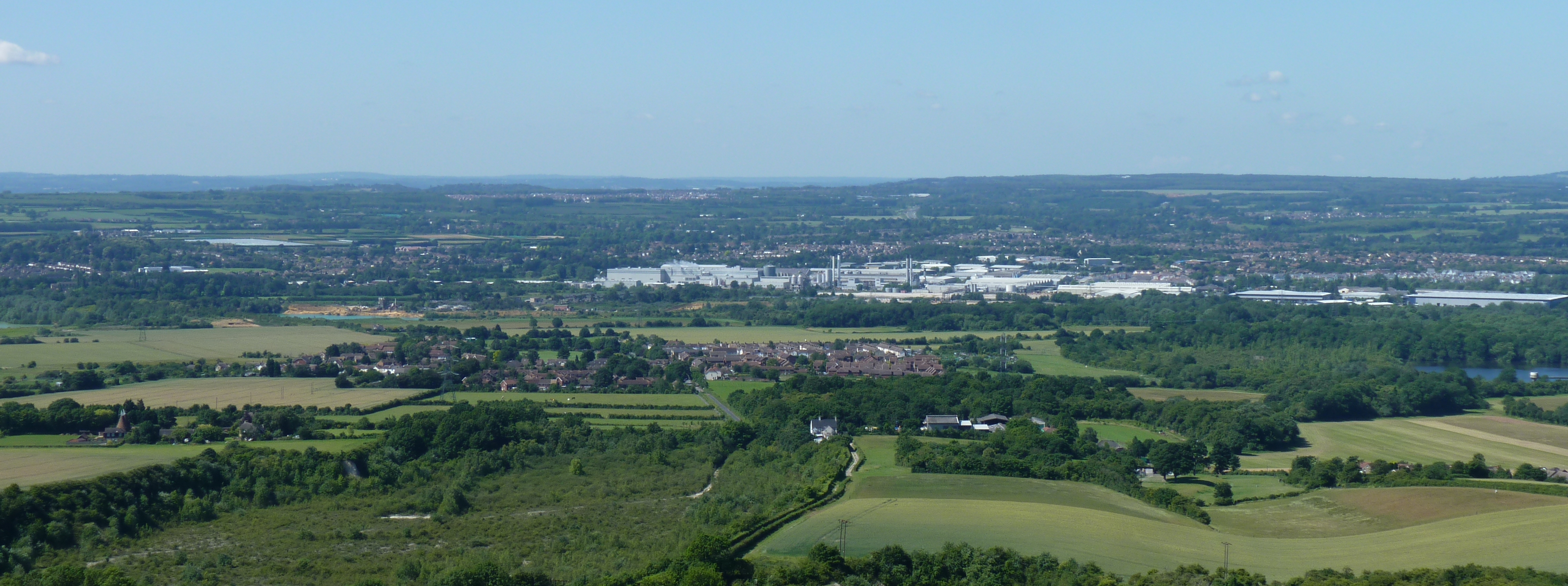
Holmesdale, also known as the Vale of Holmesdale, is a valley in South-East England South East England is one of the nine official regions of England at the first level of ITL for statistical purposes. It consists of the counties of Buckinghamshire, East Sussex, Hampshire, the Isle of Wight, Kent, Oxfordshire, Berkshire, ... that falls between the hill ranges of the North Downs and the Greensand Ridge of the Weald, in the counties of Kent and Surrey. It stretches from Folkestone on the Kent coast, through Ashford, Kent, Ashford, Harrietsham, Maidstone, Riverhead, Kent, Riverhead/Sevenoaks, Westerham, Oxted, Godstone, Redhill, Surrey, Redhill, Reigate, Dorking, Gomshall, and Guildford – west of which it is also called by the local name of "Puttenham Vale" – as it continues through the village of Puttenham, Surrey, Puttenham, to the market town of Farnham. Geology Holmesdale is part of the Weald Basin and Weald–Artois Anticline, Weald-Artois Anticline. The valley ... [...More Info...] [...Related Items...] OR: [Wikipedia] [Google] [Baidu] |
White Cliffs Of Dover
The White Cliffs of Dover is the region of English coastline facing the Strait of Dover and France. The cliff face, which reaches a height of , owes its striking appearance to its composition of chalk accented by streaks of black flint, deposited during the Late Cretaceous. The cliffs, on both sides of the town of Dover in Kent, stretch for eight miles (13 km). The White Cliffs of Dover form part of the North Downs. A section of coastline encompassing the cliffs was purchased by the National Trust in 2016. The cliffs are part of the Dover to Kingsdown Cliffs Site of Special Scientific Interest and Special Area of Conservation. The point where Great Britain is closest to continental Europe, on a clear day the cliffs are visible from France (approximately away). A celebrated UK landmark, the cliffs have featured on commemorative postage stamps issued by the Royal Mail, including in their British coastline series in 2002 and UK A-Z series in 2012. Location The cliff ... [...More Info...] [...Related Items...] OR: [Wikipedia] [Google] [Baidu] |
Dover
Dover () is a town and major ferry port in Kent, South East England. It faces France across the Strait of Dover, the narrowest part of the English Channel at from Cap Gris Nez in France. It lies south-east of Canterbury and east of Maidstone. The town is the administrative centre of the Dover District and home of the Port of Dover. Archaeological finds have revealed that the area has always been a focus for peoples entering and leaving Great Britain, Britain. The name derives from the River Dour that flows through it. In recent times the town has undergone transformations with a high-speed rail link to London, new retail in town with St James' area opened in 2018, and a revamped promenade and beachfront. This followed in 2019, with a new 500m Pier to the west of the Harbour, and new Marina unveiled as part of a £330m investment in the area. It has also been a point of destination for many illegal migrant crossings during the English Channel migrant crossings (2018-present) ... [...More Info...] [...Related Items...] OR: [Wikipedia] [Google] [Baidu] |
Deal, Kent
Deal is a coastal town in Kent, England, which lies where the North Sea and the English Channel meet, north-east of Dover and south of Ramsgate. It is a former fishing, mining and garrison town whose history is closely linked to the anchorage in the Downs. Close to Deal is Walmer, a possible location for Julius Caesar's first arrival in Britain. Deal became a 'limb port' of the Cinque Ports in 1278 and grew into the busiest port in England; today it is a seaside resort, its quaint streets and houses a reminder of its history along with many ancient buildings and monuments. In 1968, Middle Street was the first conservation area in Kent. The coast of France is approximately from the town and is visible on clear days. The Tudor-era Deal Castle, commissioned by then-King, Henry VIII, has a rose floor plan. History Deal is first mentioned as a village in the Domesday Book of 1086, where it appears as ''Addelam''. It is referred to as ''Dela'' in 1158, and ''Dale'' in 1275 ... [...More Info...] [...Related Items...] OR: [Wikipedia] [Google] [Baidu] |
Canterbury
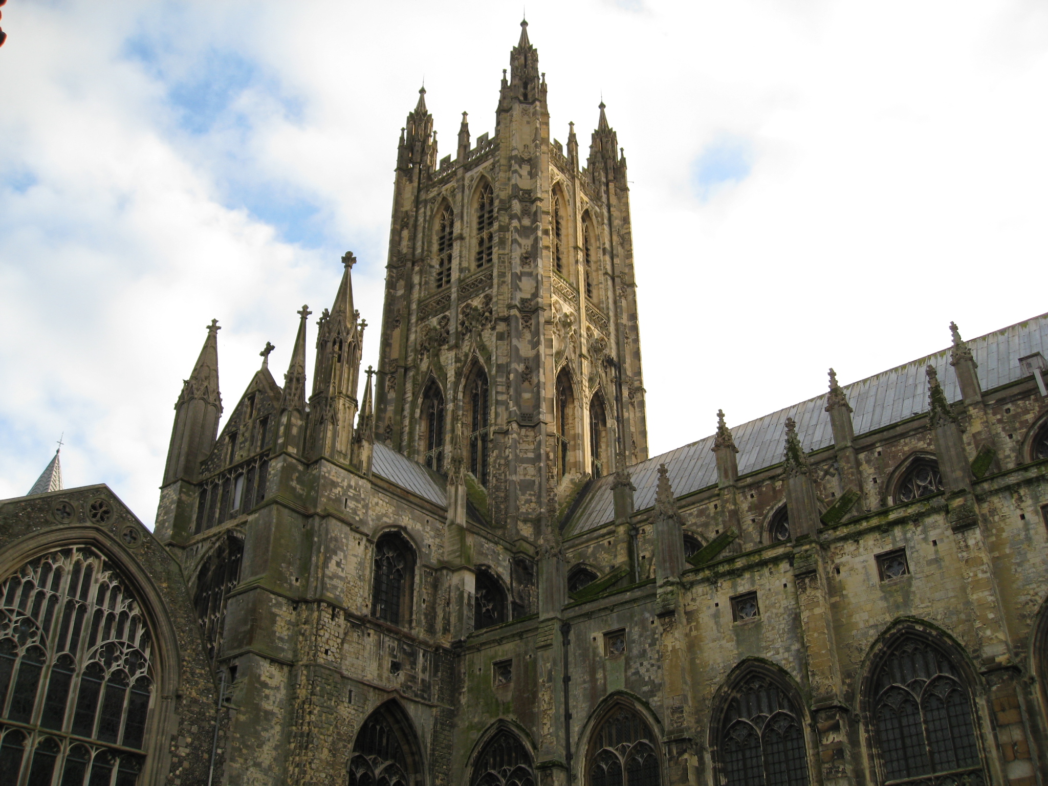
Canterbury (, ) is a City status in the United Kingdom, cathedral city and UNESCO World Heritage Site, situated in the heart of the City of Canterbury local government district of Kent, England. It lies on the River Stour, Kent, River Stour. The Archbishop of Canterbury is the primate (bishop), primate of the Church of England and the worldwide Anglican Communion owing to the importance of Augustine of Canterbury, St Augustine, who served as the apostle to the Anglo-Saxon paganism, pagan Kingdom of Kent around the turn of the 7th century. The city's Canterbury Cathedral, cathedral became a major focus of Christian pilgrimage, pilgrimage following the 1170 Martyr of the Faith, martyrdom of Thomas Becket, although it had already been a well-trodden pilgrim destination since the murder of Ælfheah of Canterbury, St Alphege by the men of cnut, King Canute in 1012. A journey of pilgrims to Becket's shrine served as the narrative frame, frame for Geoffrey Chaucer's 14th-century Wes ... [...More Info...] [...Related Items...] OR: [Wikipedia] [Google] [Baidu] |
Faversham
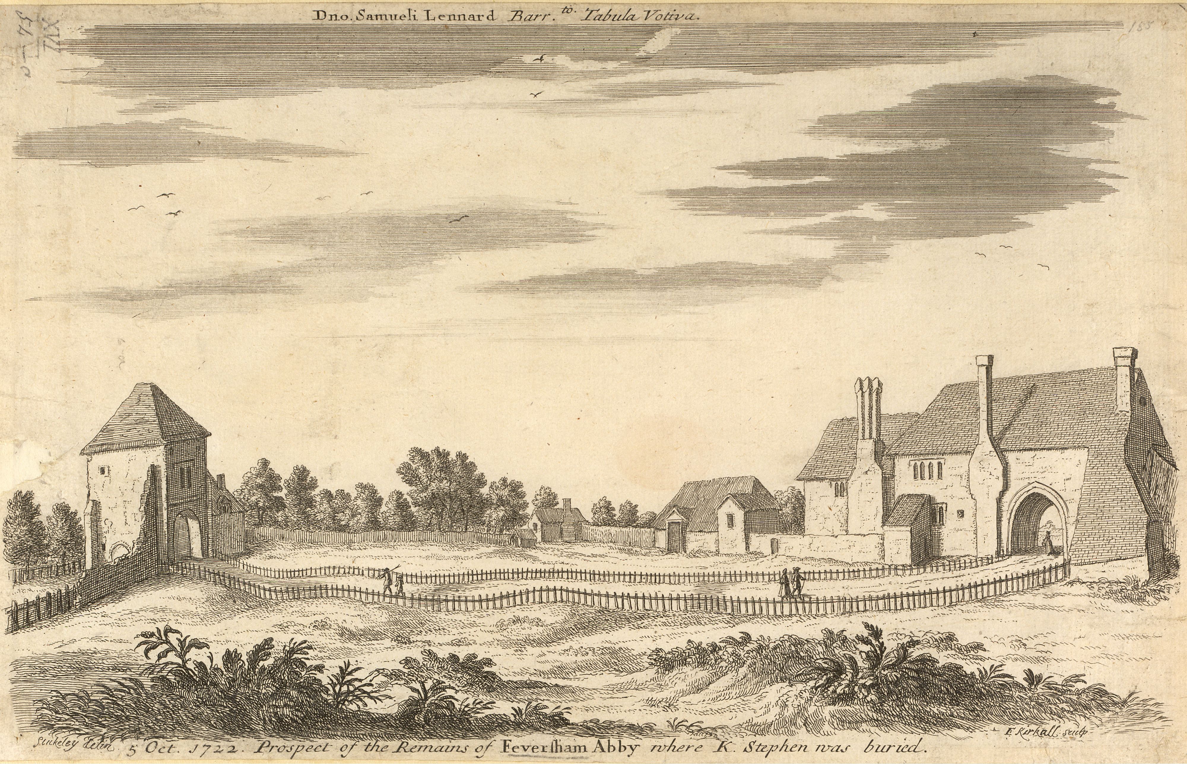
Faversham is a market town in Kent, England, from London and from Canterbury, next to the Swale, a strip of sea separating mainland Kent from the Isle of Sheppey in the Thames Estuary. It is close to the A2, which follows an ancient British trackway which was used by the Romans and the Anglo-Saxons, and known as Watling Street. The name is of Old English origin, meaning "the metal-worker's village". There has been a settlement at Faversham since pre-Roman times, next to the ancient sea port on Faversham Creek. It was inhabited by the Saxons and mentioned in the Domesday Book of 1086 as ''Favreshant''. The town was favoured by King Stephen who established Faversham Abbey, which survived until the Dissolution of the Monasteries in 1538. Subsequently, the town became an important seaport and established itself as a centre for brewing, and the Shepherd Neame Brewery, founded in 1698, remains a significant major employer. The town was also the centre of the explosives industry ... [...More Info...] [...Related Items...] OR: [Wikipedia] [Google] [Baidu] |
Sittingbourne
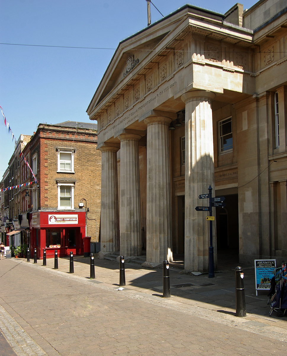
Sittingbourne is an industrial town in Kent, south-east England, from Canterbury and from London, beside the Roman Watling Street, an ancient British trackway used by the Romans and the Anglo-Saxons and next to the Swale, a strip of sea separating mainland Kent from the Isle of Sheppey. The town became prominent after the death of Thomas Becket in 1170, since it provided a convenient resting point on the road from London to Canterbury and Dover. Chatham Main Line links to London Victoria and HS1 to St Pancras International, the journey taking about an hour from Sittingbourne railway station. History Sittingbourne owes its name to a modernised version of an observation on its location. The town's name came from the fact that there is a small stream or "bourne" running underground in part of the town. Hasted writing in the 1790s in his ''History of Kent'' states that: The Kent Hundred Rolls of 1274–5, preserved in the National Archives, record Sittingbourne as Sydingeburn ... [...More Info...] [...Related Items...] OR: [Wikipedia] [Google] [Baidu] |
Medway
Medway is a unitary authority district and conurbation in Kent, South East England. It had a population of 278,016 in 2019. The unitary authority was formed in 1998 when Rochester-upon-Medway amalgamated with the Borough of Gillingham to form Medway Towns. It is now a unitary authority area run by Medway Council, independent of Kent County Council but still part of the ceremonial county of Kent. Medway is one of the boroughs included in the Thames Gateway development scheme. It is also the home of Universities at Medway, a tri-partite collaboration of the University of Greenwich, the University of Kent and Canterbury Christ Church University on a single campus in Chatham, together with the University for the Creative Arts, which has a campus in Rochester. Geography Because of its strategic location by the major crossing of the River Medway, it has made a wide and significant contribution to Kent, and to England, dating back thousands of years, as evident in the siting of Wa ... [...More Info...] [...Related Items...] OR: [Wikipedia] [Google] [Baidu] |
Gravesend, Kent
Gravesend is a town in northwest Kent, England, situated 21 miles (35 km) east-southeast of Charing Cross (central London) on the south bank of the River Thames and opposite Tilbury in Essex. Located in the diocese of Rochester, it is the administrative centre of the Borough of Gravesham. Its geographical situation has given Gravesend strategic importance throughout the maritime and communications history of South East England. A Thames Gateway commuter town, it retains strong links with the River Thames, not least through the Port of London Authority Pilot Station and has witnessed rejuvenation since the advent of High Speed 1 rail services via Gravesend railway station. The station was recently refurbished and now has a new bridge. Toponymy Recorded as Gravesham in the Domesday Book of 1086 when it belonged to Odo, Earl of Kent and Bishop of Bayeux, the half-brother of William the Conqueror, its name probably derives from ''graaf-ham'': the home of the reeve or ... [...More Info...] [...Related Items...] OR: [Wikipedia] [Google] [Baidu] |
Dartford
Dartford is the principal town in the Borough of Dartford, Kent, England. It is located south-east of Central London and is situated adjacent to the London Borough of Bexley to its west. To its north, across the Thames estuary, is Thurrock in Essex, which can be reached via the Dartford Crossing. The town centre lies in a valley through which the River Darent flows and where the old road from London to Dover crossed: hence the name, from ''Darent + ford''. Dartford became a market town in medieval times and, although today it is principally a commuter town for Greater London, it has a long history of religious, industrial and cultural importance. It is an important rail hub; the main through-road now by-passes the town itself. Geography Dartford lies within the area known as the London Basin. The low-lying marsh to the north of the town consists of London Clay and the alluvium brought down by the two rivers—the Darent and the Cray—whose confluence is in this area. T ... [...More Info...] [...Related Items...] OR: [Wikipedia] [Google] [Baidu] |
New Naturalist
The New Naturalist Library (also known as ''The New Naturalists'') is a series of books published by Collins in the United Kingdom, on a variety of natural history topics relevant to the British Isles. The aim of the series at the start was: "To interest the general reader in the wild life of Britain by recapturing the inquiring spirit of the old naturalists."Guy Mountfort, ''The Hawfinch''. Collins, 1957. An editors' preface to a 1952 monograph says: "An object of the ''New Naturalist'' series is the recognition of the many-sidedness of British natural history, and the encouragement of unusual and original developments of its forgotten or neglected facets." The first volume to appear was E.B. Ford's ''Butterflies'' in 1945. The authors of this series are usually eminent experts, often professional scientists. This gives the series authority, and many are or have been authoritative introductory textbooks on a subject for some years. The books are written in scientific style, but ... [...More Info...] [...Related Items...] OR: [Wikipedia] [Google] [Baidu] |


.jpg)


