|
Sittingbourne
Sittingbourne is an industrial town in Kent, south-east England, from Canterbury and from London, beside the Roman Watling Street, an ancient British trackway used by the Romans and the Anglo-Saxons and next to the Swale, a strip of sea separating mainland Kent from the Isle of Sheppey. The town became prominent after the death of Thomas Becket in 1170, since it provided a convenient resting point on the road from London to Canterbury and Dover. Chatham Main Line links to London Victoria and HS1 to St Pancras International, the journey taking about an hour from Sittingbourne railway station. History Sittingbourne owes its name to a modernised version of an observation on its location. The town's name came from the fact that there is a small stream or "bourne" running underground in part of the town. Hasted writing in the 1790s in his ''History of Kent'' states that: The Kent Hundred Rolls of 1274–5, preserved in the National Archives, record Sittingbourne as Sydingeb ... [...More Info...] [...Related Items...] OR: [Wikipedia] [Google] [Baidu] |
Sittingbourne And Sheppey (UK Parliament Constituency)
Sittingbourne and Sheppey is a constituency in Kent represented in the House of Commons of the UK Parliament since 2010 by Gordon Henderson, a Conservative. Boundaries 1997–2010: The Borough of Swale wards of Borden, Eastern, Grove, Hartlip and Upchurch, Iwade and Lower Halstow, Kemsley, Milton Regis, Minster Cliffs, Murston, Newington, Queenborough and Halfway, Roman, Sheerness East, Sheerness West, Sheppey Central, West Downs, Woodstock. 2010–2015: The Borough of Swale wards of Borden, Chalkwell, Grove, Hartlip, Newington and Upchurch, Iwade and Lower Halstow, Kemsley, Leysdown and Warden, Milton Regis, Minster Cliffs, Murston, Queenborough and Halfway, Roman, St Michael's, Sheerness East, Sheerness West, Sheppey Central, Teynham and Lynsted, West Downs, Woodstock. 2015–present: The Borough of Swale wards of Bobbing, Iwade and Lower Halstow, Borden and Grove Park, Chalkwell, Hartlip, Newington and Upchurch, Homewood, Kemsley, Milton Regis, Minster Cliffs, Murston, Queen ... [...More Info...] [...Related Items...] OR: [Wikipedia] [Google] [Baidu] |
Sittingbourne Railway Station
Sittingbourne railway station is on the Chatham Main Line and the Sheerness Line in north Kent. It is down the line from . Train services are provided by Southeastern. Ticket barriers are sometimes in operation, depending on the time of day. Facilities Two new lifts linked by a new footbridge have created a step-free route between the station entrance and platforms to provide better access to train services. The improvements have been funded through the government’s Access for All programme and cost around £1,800,000. The work has also included a series of enhancements to station facilities funded through the National Stations Improvement Programme and include relocating and increasing the number of cycle parking spaces outside the station; renovating all passenger toilets; creating new waiting shelters on the platforms and a new waiting room on platform; repositioning the ticket gates to create more space for passengers in the ticket office; and installing a new customer ... [...More Info...] [...Related Items...] OR: [Wikipedia] [Google] [Baidu] |
Milton Regis
Milton Regis is a village in the district of Swale in Kent, England. Former names include Milton-next-Sittingbourne, Milton Royal, Middleton, Midletun and Middletune. It has a population of about 5,000. Today it is a suburb of Sittingbourne, although this has not always been the case, with Milton Regis having an older and richer history. Until around 1800, Sittingbourne was a smaller hamlet and under the control of the Manor of Milton Regis. The ancient settlement was near the church, and the current Milton Regis dates back only to 1052. There are still many timber-framed houses and buildings, including a Medieval Court Hall (a seat of Justice and Administration) that dates back to 1450. The town and Manor of Middleton Regis, as it was called then, was recorded as the largest and most powerful manor in the Lathe of Scraye (in the centre of Kent). Milton Regis was formerly part of the Sittingbourne and Milton urban district. Geography The area occupied by Milton Regis is low-lying ... [...More Info...] [...Related Items...] OR: [Wikipedia] [Google] [Baidu] |
Chatham Main Line
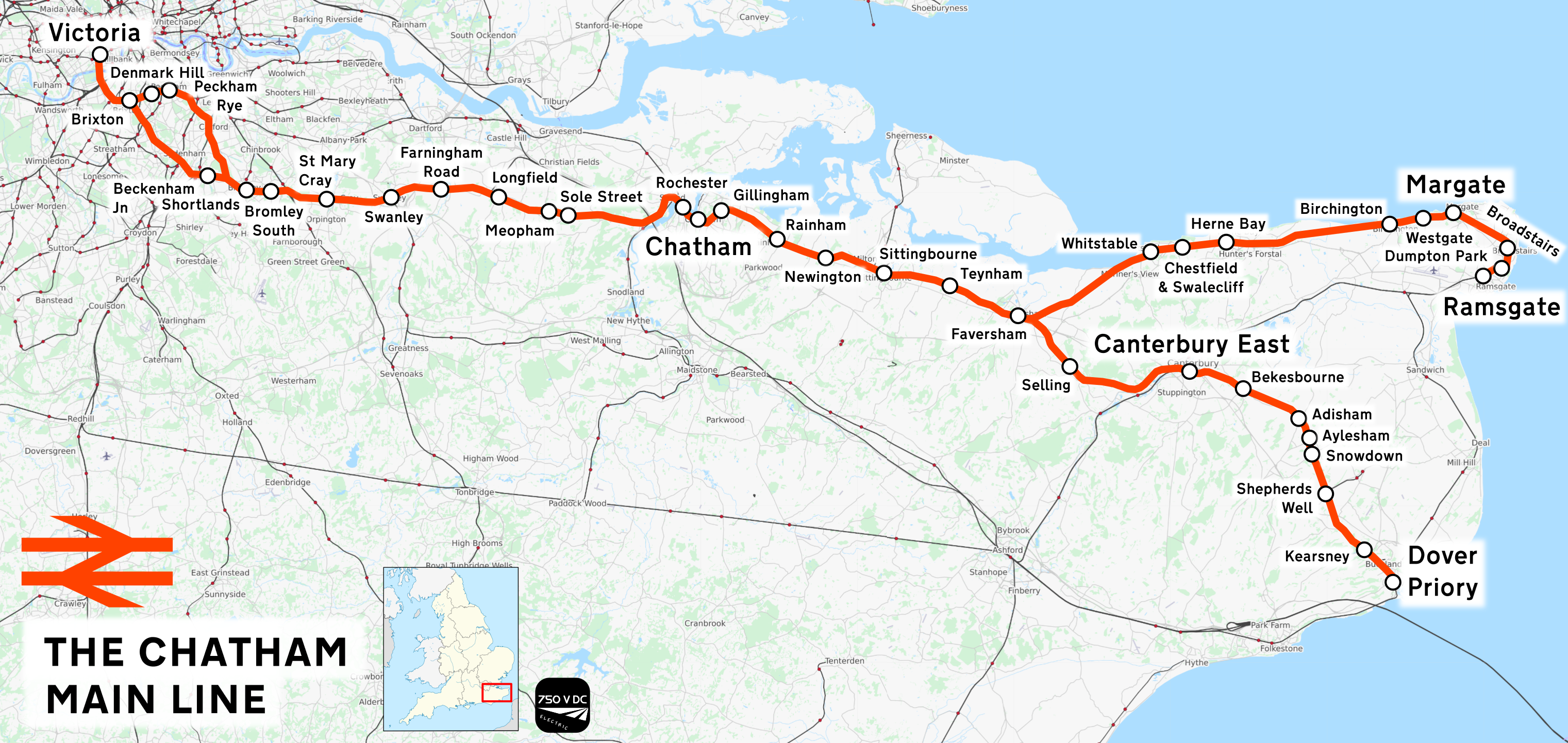
The Chatham Main Line is a railway line in England that links London VictoriaQuail Map 5 – England South ages 2–13Sept 2002 (Retrieved 14 December 2011) and Dover Priory / Ramsgate, travelling via Medway (of which the town of Chatham is part, hence the name). Services to Cannon Street follow the route as far as St Mary Cray Junction where they diverge onto the South Eastern Main Line near Chislehurst. Thameslink services to Luton run in parallel from Rainham to Rochester, diverging once across the River Medway at Rochester Bridge Junction onto the North Kent Line via Gravesend and Dartford. A shuttle service operates on the Sheerness Line which starts at Sittingbourne. Services Most services on the Line are run by SE Trains and Southern. Govia Thameslink Railway run some Thameslink services, the first starting from and travelling via on the Catford Loop, joining at Shortlands Junction, travelling to before heading to . The second service starts from a ... [...More Info...] [...Related Items...] OR: [Wikipedia] [Google] [Baidu] |
Borough Of Swale
Swale is a local government district with borough status in Kent, England and is bounded by Medway to the west, Canterbury to the east, Ashford to the south and Maidstone to the south west. Its council is based in Sittingbourne. The district is named after the narrow channel called The Swale, that separates the mainland of Kent from the Isle of Sheppey, and which occupies the central part of the district. The district was formed in 1974 under the Local Government Act 1972, from the Borough of Faversham; the Borough of Queenborough-in-Sheppey, which covered the whole of Sheppey; the Sittingbourne and Milton Urban District; and Swale Rural District Swale or Swales may refer to: Topography * Swale (landform), a low tract of land ** Bioswale, landform designed to remove silt and pollution ** Swales, found in the formation of Hummocky cross-stratification Geography * River Swale, in North .... Most of the southern half of the Borough lies within the Kent Downs ... [...More Info...] [...Related Items...] OR: [Wikipedia] [Google] [Baidu] |
Isle Of Sheppey
The Isle of Sheppey is an island off the northern coast of Kent, England, neighbouring the Thames Estuary, centred from central London. It has an area of . The island forms part of the local government district of Swale. ''Sheppey'' is derived from Old English ''Sceapig'', meaning "Sheep Island". Today's island was historically known as the "Isles of Sheppey" which were Sheppey itself, the Isle of Harty to the south east and the Isle of Elmley to the south west. Over time the channels between the islands have silted up to make one contiguous island. Sheppey, like much of north Kent, is largely formed from London Clay and is a plentiful source of fossils. The Mount near Minster rises to above sea level and is the highest point on the island. The rest of Sheppey is low-lying and the southern part of the island is marshy land criss-crossed by inlets and drains, largely used for grazing. The economy is driven by a dockyard and port, the presence of three prisons, and var ... [...More Info...] [...Related Items...] OR: [Wikipedia] [Google] [Baidu] |
Kent
Kent is a county in South East England and one of the home counties. It borders Greater London to the north-west, Surrey to the west and East Sussex to the south-west, and Essex to the north across the estuary of the River Thames; it faces the French department of Pas-de-Calais across the Strait of Dover. The county town is Maidstone. It is the fifth most populous county in England, the most populous non-Metropolitan county and the most populous of the home counties. Kent was one of the first British territories to be settled by Germanic tribes, most notably the Jutes, following the withdrawal of the Romans. Canterbury Cathedral in Kent, the oldest cathedral in England, has been the seat of the Archbishops of Canterbury since the conversion of England to Christianity that began in the 6th century with Saint Augustine. Rochester Cathedral in Medway is England's second-oldest cathedral. Located between London and the Strait of Dover, which separates England from mainla ... [...More Info...] [...Related Items...] OR: [Wikipedia] [Google] [Baidu] |
The Swale
The Swale is a tidal channel of the Thames estuary that separates the Isle of Sheppey from the rest of Kent. On its banks is a biological Site of Special Scientific Interest which stretches from Sittingbourne to Whitstable in Kent. It is also a Ramsar internationally important wetland site and a Special Protection Area under the European Union Directive on the Conservation of Wild Birds. Parts of it are a Nature Conservation Review site, Grade I, National Nature Reserves, a Kent Wildlife Trust nature reserve and a Local Nature Reserve. History The name "Swale" is Old English in origin, and is believed to mean "swirling, rushing river", or "rushing water". Peri-glacial period At these times the Swale was a gully from what had been a sea channel in very warm periods. Namely before the Strait of Dover had swept away so much swampy land, accentuated by sea levels being lower, even to beyond the end of the ice age, i.e. in the mid seventh millennium BC, the coasts of ... [...More Info...] [...Related Items...] OR: [Wikipedia] [Google] [Baidu] |
Canterbury Cathedral
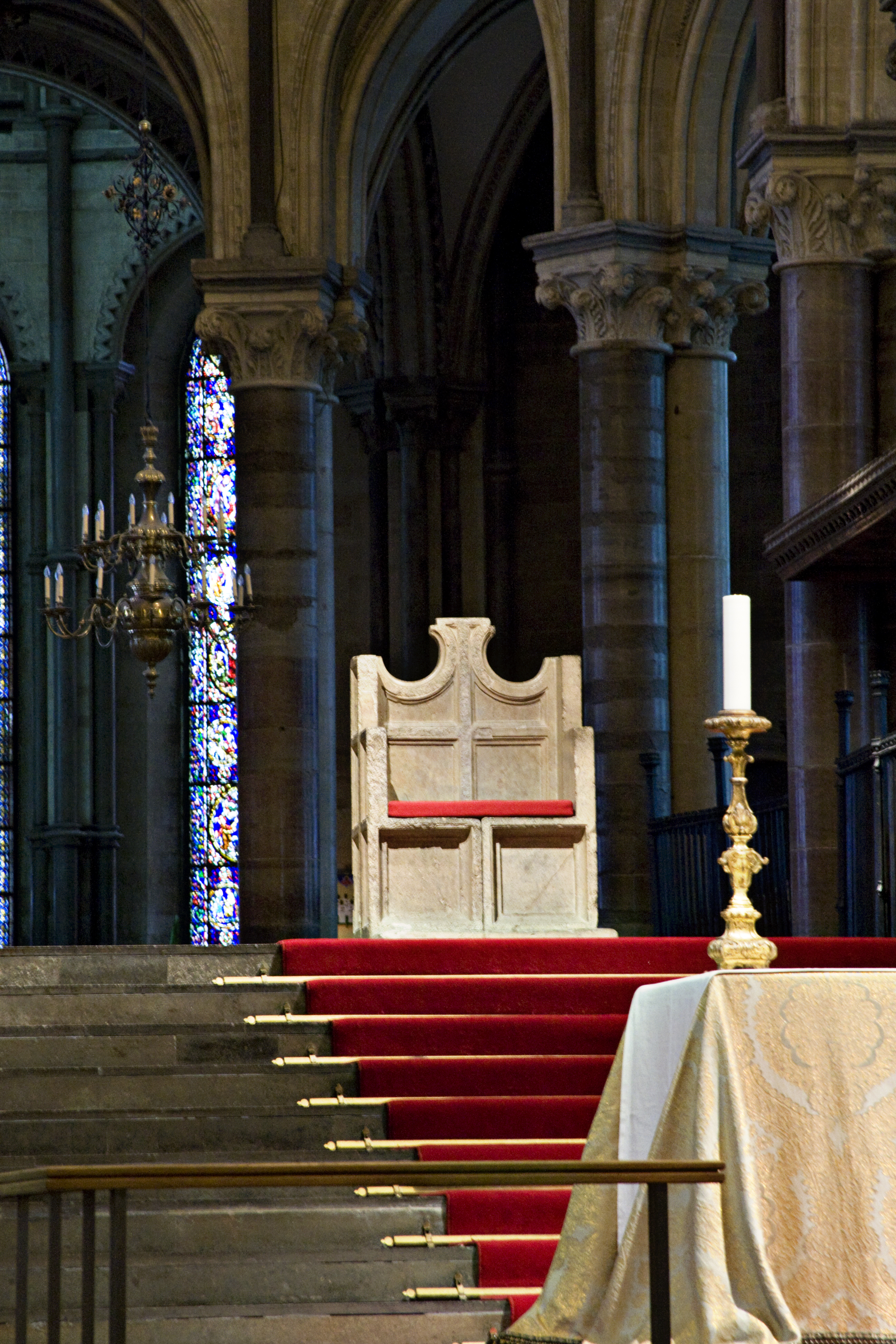
Canterbury Cathedral in Canterbury, Kent, is one of the oldest and most famous Christianity, Christian structures in England. It forms part of a World Heritage Site. It is the cathedral of the Archbishop of Canterbury, currently Justin Welby, leader of the Church of England and symbolic leader of the worldwide Anglican Communion. Its formal title is the Cathedral and Metropolitical Church of Christ at Canterbury. Founded in 597, the cathedral was completely rebuilt between 1070 and 1077. The east end was greatly enlarged at the beginning of the 12th century and largely rebuilt in the Gothic style following a fire in 1174, with significant eastward extensions to accommodate the flow of pilgrims visiting the shrine of Thomas Becket, the archbishop who was murdered in the cathedral in 1170. The Norman nave and transepts survived until the late 14th century when they were demolished to make way for the present structures. Before the English Reformation the cathedral was part of a B ... [...More Info...] [...Related Items...] OR: [Wikipedia] [Google] [Baidu] |
Watling Street
Watling Street is a historic route in England that crosses the River Thames at London and which was used in Classical Antiquity, Late Antiquity, and throughout the Middle Ages. It was used by the ancient Britons and paved as one of the main Roman roads in Britannia (Roman-governed Great Britain during the Roman Empire). The route linked Dover and London in the southeast, and continued northwest via St Albans to Wroxeter. The line of the road was later the southwestern border of the Danelaw with Wessex and Mercia, and Watling Street was numbered as one of the major highways of medieval England. First used by the ancient Britons, mainly between the areas of modern Canterbury and using a natural ford near Westminster, the road was later paved by the Romans. It connected the ports of Dubris (Dover), Rutupiae ( Richborough Castle), Lemanis ( Lympne), and Regulbium ( Reculver) in Kent to the Roman bridge over the Thames at Londinium (London). The route continued northwes ... [...More Info...] [...Related Items...] OR: [Wikipedia] [Google] [Baidu] |
Ancient Rome
In modern historiography, ancient Rome refers to Roman civilisation from the founding of the city of Rome in the 8th century BC to the collapse of the Western Roman Empire in the 5th century AD. It encompasses the Roman Kingdom (753–509 BC), Roman Republic (509–27 BC) and Roman Empire (27 BC–476 AD) until the fall of the western empire. Ancient Rome began as an Italic settlement, traditionally dated to 753 BC, beside the River Tiber in the Italian Peninsula. The settlement grew into the city and polity of Rome, and came to control its neighbours through a combination of treaties and military strength. It eventually dominated the Italian Peninsula, assimilated the Greek culture of southern Italy (Magna Grecia) and the Etruscan culture and acquired an Empire that took in much of Europe and the lands and peoples surrounding the Mediterranean Sea. It was among the largest empires in the ancient world, with an estimated 50 to 90 million inhabitants, roughly ... [...More Info...] [...Related Items...] OR: [Wikipedia] [Google] [Baidu] |
First World War
World War I (28 July 1914 11 November 1918), often abbreviated as WWI, was one of the deadliest global conflicts in history. Belligerents included much of Europe, the Russian Empire, the United States, and the Ottoman Empire, with fighting occurring throughout Europe, the Middle East, Africa, the Pacific, and parts of Asia. An estimated 9 million soldiers were killed in combat, plus another 23 million wounded, while 5 million civilians died as a result of military action, hunger, and disease. Millions more died in genocides within the Ottoman Empire and in the 1918 influenza pandemic, which was exacerbated by the movement of combatants during the war. Prior to 1914, the European great powers were divided between the Triple Entente (comprising France, Russia, and Britain) and the Triple Alliance (containing Germany, Austria-Hungary, and Italy). Tensions in the Balkans came to a head on 28 June 1914, following the assassination of Arch ... [...More Info...] [...Related Items...] OR: [Wikipedia] [Google] [Baidu] |


