|
Eastport, Maine
Eastport is a city and archipelago in Washington County, Maine, United States. The population was 1,288 at the 2020 census, making Eastport the least-populous city in Maine. The principal island is Moose Island, which is connected to the mainland by a causeway. Eastport is the easternmost city in the United States (although the nearby town of Lubec is the easternmost municipality). History The native Passamaquoddy Tribe has called this area home for at least 10,000 years. Some archeologists estimate the habitation at 20,000 years. The first known European contact was the St. Croix colony founded by the French explorer Samuel de Champlain in 1604. Near present-day Calais, the unsuccessful Saint Croix Island Acadia settlement predates the first successful English settlement at Jamestown, Virginia, by three years. On June 25, 1604, Champlain and his men spent a long and severe winter on St. Croix Island with no fresh water and diminished supplies. Two-fifths of the men died of ... [...More Info...] [...Related Items...] OR: [Wikipedia] [Google] [Baidu] |
City
A city is a human settlement of notable size.Goodall, B. (1987) ''The Penguin Dictionary of Human Geography''. London: Penguin.Kuper, A. and Kuper, J., eds (1996) ''The Social Science Encyclopedia''. 2nd edition. London: Routledge. It can be defined as a permanent and densely settled place with administratively defined boundaries whose members work primarily on non-agricultural tasks. Cities generally have extensive systems for housing, transportation, sanitation, utilities, land use, production of goods, and communication. Their density facilitates interaction between people, government organisations and businesses, sometimes benefiting different parties in the process, such as improving efficiency of goods and service distribution. Historically, city-dwellers have been a small proportion of humanity overall, but following two centuries of unprecedented and rapid urbanization, more than half of the world population now lives in cities, which has had profound consequences for g ... [...More Info...] [...Related Items...] OR: [Wikipedia] [Google] [Baidu] |
Massachusetts General Court
The Massachusetts General Court (formally styled the General Court of Massachusetts) is the state legislature of the Commonwealth of Massachusetts. The name "General Court" is a hold-over from the earliest days of the Massachusetts Bay Colony, when the colonial assembly, in addition to making laws, sat as a judicial court of appeals. Before the adoption of the state constitution in 1780, it was called the ''Great and General Court'', but the official title was shortened by John Adams, author of the state constitution. It is a bicameral body. The upper house is the Massachusetts Senate which is composed of 40 members. The lower body, the Massachusetts House of Representatives, has 160 members. (Until 1978, it had 240 members.) It meets in the Massachusetts State House on Beacon Hill in Boston. The current President of the Senate is Karen Spilka, and the Speaker of the House is Ronald Mariano. Since 1959, Democrats have controlled both houses of the Massachusetts General Court ... [...More Info...] [...Related Items...] OR: [Wikipedia] [Google] [Baidu] |
Portsmouth, New Hampshire
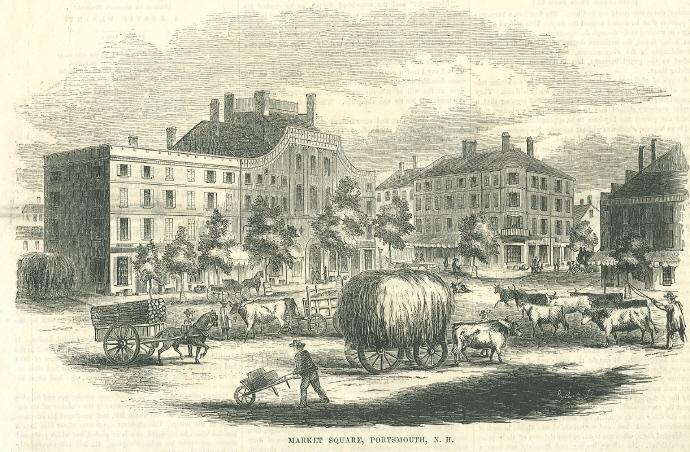
Portsmouth is a city in Rockingham County, New Hampshire, United States. At the 2020 census it had a population of 21,956. A historic seaport and popular summer tourist destination on the Piscataqua River bordering the state of Maine, Portsmouth was formerly the home of the Strategic Air Command's Pease Air Force Base, since converted to Portsmouth International Airport at Pease. History American Indians of the Abenaki and other Algonquian languages-speaking nations, and their predecessors, inhabited the territory of coastal New Hampshire for thousands of years before European contact. The first known European to explore and write about the area was Martin Pring in 1603. The Piscataqua River is a tidal estuary with a swift current, but forms a good natural harbor. The west bank of the harbor was settled by European colonists in 1630 and named Strawbery Banke, after the many wild strawberries growing there. The village was protected by Fort William and Mary on what is now ... [...More Info...] [...Related Items...] OR: [Wikipedia] [Google] [Baidu] |
Newburyport, Massachusetts
Newburyport is a coastal city in Essex County, Massachusetts, United States, northeast of Boston. The population was 18,289 at the 2020 census. A historic seaport with vibrant tourism industry, Newburyport includes part of Plum Island. The mooring, winter storage, and maintenance of recreational boats, motor and sail, still contribute a large part of the city's income. A Coast Guard station oversees boating activity, especially in the sometimes dangerous tidal currents of the Merrimack River. At the edge of the Newbury Marshes, delineating Newburyport to the south, an industrial park provides a wide range of jobs. Newburyport is on a major north-south highway, Interstate 95. The outer circumferential highway of Boston, Interstate 495, passes nearby in Amesbury. The Newburyport Turnpike (U.S. Route 1) still traverses Newburyport on its way north. The Newburyport/Rockport MBTA commuter rail from Boston's North Station terminates in Newburyport. The earlier Boston and Maine Ra ... [...More Info...] [...Related Items...] OR: [Wikipedia] [Google] [Baidu] |
Fishermen
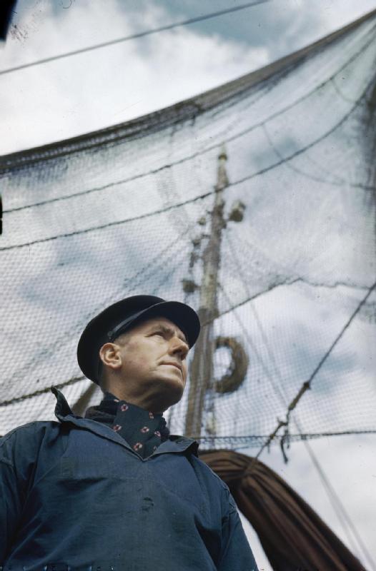
A fisher or fisherman is someone who captures fish and other animals from a body of water, or gathers shellfish. Worldwide, there are about 38 million commercial and subsistence fishers and fish farmers. Fishers may be professional or recreational. Fishing has existed as a means of obtaining food since the Mesolithic period.Profile for the USA * inadequate preparation for emergencies * poor vessel maintenance and inadequate safety equipment * lack of awareness of or ignoring stability issues. Many fishers, while accepting that fishing is dangerous, staunchly defend their independence. Many proposed laws and additional regulation to increase safety have been defeated because fishers oppose them. Alaska's commercial fishers work in one of the world's harshest environments. Many of the hardships they endure include isolated fishing grounds, high winds, seasonal darkness, very cold water, icing, and short fishing seasons, where very long work days are the norm. Fatigue, physical s ... [...More Info...] [...Related Items...] OR: [Wikipedia] [Google] [Baidu] |
Nova Scotia
Nova Scotia ( ; ; ) is one of the thirteen provinces and territories of Canada. It is one of the three Maritime provinces and one of the four Atlantic provinces. Nova Scotia is Latin for "New Scotland". Most of the population are native English-speakers, and the province's population is 969,383 according to the 2021 Census. It is the most populous of Canada's Atlantic provinces. It is the country's second-most densely populated province and second-smallest province by area, both after Prince Edward Island. Its area of includes Cape Breton Island and 3,800 other coastal islands. The Nova Scotia peninsula is connected to the rest of North America by the Isthmus of Chignecto, on which the province's land border with New Brunswick is located. The province borders the Bay of Fundy and Gulf of Maine to the west and the Atlantic Ocean to the south and east, and is separated from Prince Edward Island and the island of Newfoundland by the Northumberland and Cabot straits, ... [...More Info...] [...Related Items...] OR: [Wikipedia] [Google] [Baidu] |
Port Royal, Annapolis County, Nova Scotia
Port Royal is a toponym for a rural intersection on the north bank of the Annapolis Basin about from the town of Annapolis Royal in Annapolis County, Nova Scotia, Canada. It has no legal status in local government. It is the site of the Port-Royal National Historic Site, a replica of an Acadian The Acadians (french: Acadiens , ) are an ethnic group descended from the French who settled in the New France colony of Acadia during the 17th and 18th centuries. Most Acadians live in the region of Acadia, as it is the region where the de ... settlement that existed from 1605 until its destruction by the English in 1613. References {{Coord, 44, 43, 00, N, 65, 36, 13, W, region:CA-NS_type:city, display=title Communities in Annapolis County, Nova Scotia Populated places established in 1605 1605 establishments in New France Military forts in Acadia Military forts in Nova Scotia ... [...More Info...] [...Related Items...] OR: [Wikipedia] [Google] [Baidu] |
Bay Of Fundy
The Bay of Fundy (french: Baie de Fundy) is a bay between the Canadian provinces of New Brunswick and Nova Scotia, with a small portion touching the U.S. state of Maine. It is an arm of the Gulf of Maine. Its extremely high tidal range is the highest in the world. The name is likely a corruption of the French word , meaning 'split'. Hydrology Tides The tidal range in the Bay of Fundy is about ; the average tidal range worldwide is only . Some tides are higher than others, depending on the position of the moon, the sun, and atmospheric conditions. Tides are semidiurnal, meaning they have two highs and two lows each day, with about six hours and 13 minutes between each high and low tide. Because of tidal resonance in the funnel-shaped bay, the tides that flow through the channel are very powerful. In one 12-hour tidal cycle, about 100 billion tons (110 billion short tons) of water flows in and out of the bay, which is twice as much as the combined total flow of all the rive ... [...More Info...] [...Related Items...] OR: [Wikipedia] [Google] [Baidu] |
Scurvy
Scurvy is a disease resulting from a lack of vitamin C (ascorbic acid). Early symptoms of deficiency include weakness, feeling tired and sore arms and legs. Without treatment, decreased red blood cells, gum disease, changes to hair, and bleeding from the skin may occur. As scurvy worsens there can be poor wound healing, personality changes, and finally death from infection or bleeding. It takes at least a month of little to no vitamin C in the diet before symptoms occur. In modern times, scurvy occurs most commonly in people with mental disorders, unusual eating habits, alcoholism, and older people who live alone. Other risk factors include intestinal malabsorption and dialysis. While many animals produce their own vitamin C, humans and a few others do not. Vitamin C is required to make the building blocks for collagen. Diagnosis is typically based on physical signs, X-rays, and improvement after treatment. Treatment is with vitamin C supplements taken by mouth. Improvemen ... [...More Info...] [...Related Items...] OR: [Wikipedia] [Google] [Baidu] |
Jamestown, Virginia
The Jamestown settlement in the Colony of Virginia was the first permanent English settlement in the Americas. It was located on the northeast bank of the James (Powhatan) River about southwest of the center of modern Williamsburg. It was established by the Virginia Company of London as "James Fort" on May 4, 1607 O.S. (May 14, 1607 N.S.), and was considered permanent after a brief abandonment in 1610. It followed several failed attempts, including the Lost Colony of Roanoke, established in 1585 on Roanoke Island, later part of North Carolina. Jamestown served as the colonial capital from 1616 until 1699. Despite the dispatch of more settlers and supplies, including the 1608 arrival of eight Polish and German colonistsJamestowne Rediscovery: A Timeline of Events and References . Ret ... [...More Info...] [...Related Items...] OR: [Wikipedia] [Google] [Baidu] |
Acadia
Acadia (french: link=no, Acadie) was a colony of New France in northeastern North America which included parts of what are now the Maritime provinces, the Gaspé Peninsula and Maine to the Kennebec River. During much of the 17th and early 18th centuries, Norridgewock on the Kennebec River and Castine at the end of the Penobscot River were the southernmost settlements of Acadia. The French government specified land bordering the Atlantic coast, roughly between the 40th and 46th parallels. It was eventually divided into British colonies. The population of Acadia included the various indigenous First Nations that comprised the Wabanaki Confederacy, the Acadian people and other French settlers. The first capital of Acadia was established in 1605 as Port-Royal. An English force from Virginia attacked and burned down the town in 1613, but it was later rebuilt nearby, where it remained the longest-serving capital of French Acadia until the British siege of Port Royal in 17 ... [...More Info...] [...Related Items...] OR: [Wikipedia] [Google] [Baidu] |


.png)
