|
Cyclone Arthur (2007)
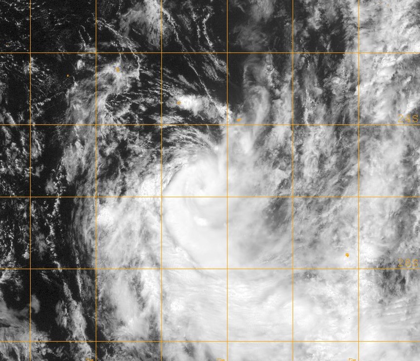
Cyclone Arthur (RSMC Nadi designation: ''08F'', JTWC designation: ''09P'') was the eighth tropical depression and fourth tropical cyclone of the 2006–07 South Pacific cyclone season. Forming as tropical depression on January 25, Arthur rapidly intensified into a strong Category 2 cyclone on the Australian intensity scale according to the Regional Specialized Meteorological Centre in Nadi, Fiji. The Joint Typhoon Warning Center assessed the storm to have peaked as a minimal category 1 cyclone. Shortly after peaking in intensity, the cyclone began to weaken due to unfavorable conditions. Quickly moving towards the east-southeast, the Arthur began to undergo an extratropical transition. After turning towards the southeast, the center of circulation was almost fully exposed due to strong wind shear. However, Arthur briefly re-strengthened late on January 26 before becoming extratropical the next day. Tropical Cyclone Arthur affected several small islands during its exist ... [...More Info...] [...Related Items...] OR: [Wikipedia] [Google] [Baidu] |
Cook Islands
) , image_map = Cook Islands on the globe (small islands magnified) (Polynesia centered).svg , capital = Avarua , coordinates = , largest_city = Avarua , official_languages = , languages_type = Spoken languages , languages = , ethnic_groups = , ethnic_groups_year = 2016 census , demonym = Cook Islander , government_type = , leader_title1 = Monarch , leader_name1 = , leader_title2 = 's Representative , leader_name2 = Sir Tom Marsters , leader_title3 = Prime Minister , leader_name3 = Mark Brown , leader_title4 = President of the House of Ariki , leader_name4 = Tou Travel Ariki , legislature = Parliament , sovereignty_type = Associated state of New Zealand , established_event1 = Self-governance , established_date1 = 4 August 1965 , establi ... [...More Info...] [...Related Items...] OR: [Wikipedia] [Google] [Baidu] |
Coordinated Universal Time
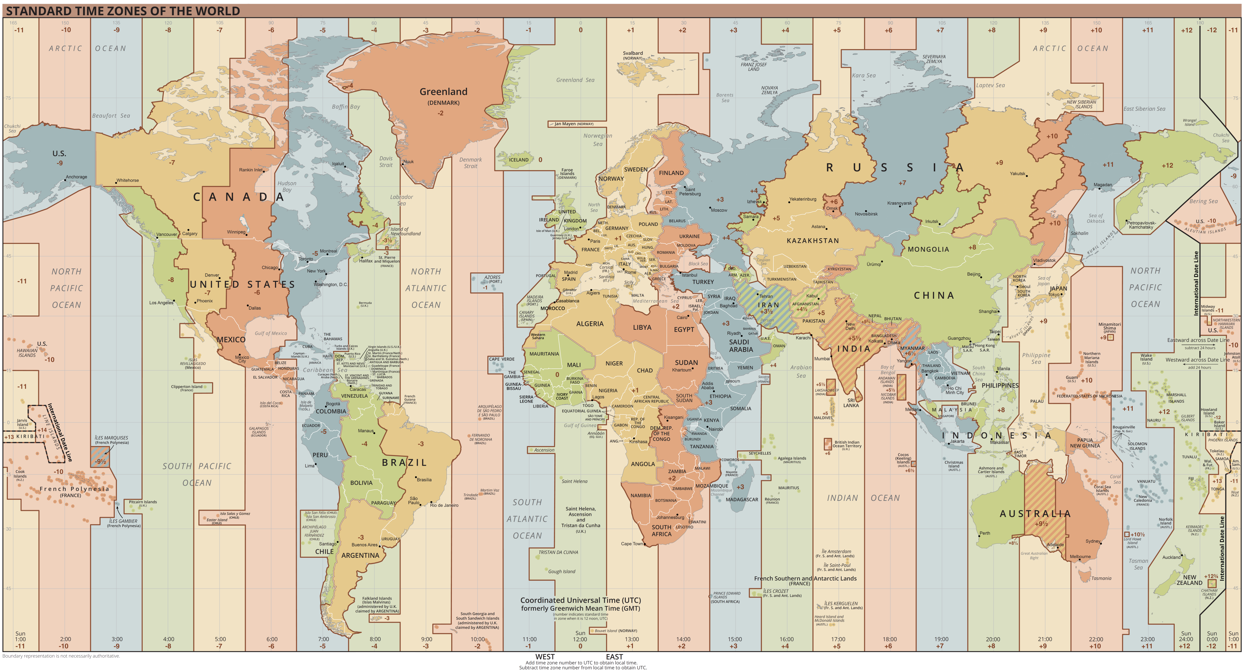
Coordinated Universal Time or UTC is the primary time standard by which the world regulates clocks and time. It is within about one second of mean solar time (such as UT1) at 0° longitude (at the IERS Reference Meridian as the currently used prime meridian) and is not adjusted for daylight saving time. It is effectively a successor to Greenwich Mean Time (GMT). The coordination of time and frequency transmissions around the world began on 1 January 1960. UTC was first officially adopted as CCIR Recommendation 374, ''Standard-Frequency and Time-Signal Emissions'', in 1963, but the official abbreviation of UTC and the official English name of Coordinated Universal Time (along with the French equivalent) were not adopted until 1967. The system has been adjusted several times, including a brief period during which the time-coordination radio signals broadcast both UTC and "Stepped Atomic Time (SAT)" before a new UTC was adopted in 1970 and implemented in 1972. This change also a ... [...More Info...] [...Related Items...] OR: [Wikipedia] [Google] [Baidu] |
Bar (unit)
The bar is a metric unit of pressure, but not part of the International System of Units (SI). It is defined as exactly equal to 100,000 Pa (100 kPa), or slightly less than the current average atmospheric pressure on Earth at sea level (approximately 1.013 bar). By the barometric formula, 1 bar is roughly the atmospheric pressure on Earth at an altitude of 111 metres at 15 °C. The bar and the millibar were introduced by the Norwegian meteorologist Vilhelm Bjerknes, who was a founder of the modern practice of weather forecasting. The International System of Units, despite previously mentioning the bar, now omits any mention of it.. The bar has been legally recognised in countries of the European Union since 2004.British Standard BS 350:2004 ''Conversion Factors for Units''. The US National Institute of Standards and Technology (NIST) deprecates its use except for "limited use in meteorology" and lists it as one of several units that "must not be introduced ... [...More Info...] [...Related Items...] OR: [Wikipedia] [Google] [Baidu] |
Pascal (unit)
The pascal (symbol: Pa) is the unit of pressure in the International System of Units (SI), and is also used to quantify internal pressure, stress, Young's modulus, and ultimate tensile strength. The unit, named after Blaise Pascal, is defined as one newton per square metre and is equivalent to 10 barye (Ba) in the CGS system. The unit of measurement called standard atmosphere (atm) is defined as 101,325 Pa. Common multiple units of the pascal are the hectopascal (1 hPa = 100 Pa), which is equal to one millibar, and the kilopascal (1 kPa = 1000 Pa), which is equal to one centibar. Meteorological observations typically report atmospheric pressure in hectopascals per the recommendation of the World Meteorological Organization, thus a standard atmosphere (atm) or typical sea-level air pressure is about 1013 hPa. Reports in the United States typically use inches of mercury or millibars (hectopascals). In Canada these reports are given in kilopascal ... [...More Info...] [...Related Items...] OR: [Wikipedia] [Google] [Baidu] |
Saffir–Simpson Scale
The Saffir–Simpson hurricane wind scale (SSHWS) classifies hurricanes—which in the Western Hemisphere are tropical cyclones that exceed the intensities of tropical depressions and tropical storms—into five categories distinguished by the intensities of their sustained winds. This measuring system was formerly known as the Saffir–Simpson hurricane scale, or SSHS. To be classified as a hurricane, a tropical cyclone must have one-minute-average maximum sustained winds at 10 m above the surface of at least 74 mph (64 kn, 119 km/h; Category 1). The highest classification in the scale, Category 5, consists of storms with sustained winds of at least 157 mph (137 kn, 252 km/h). The classifications can provide some indication of the potential damage and flooding a hurricane will cause upon landfall. The Saffir–Simpson hurricane wind scale is based on the highest wind speed averaged over a one-minute interval 10 m above th ... [...More Info...] [...Related Items...] OR: [Wikipedia] [Google] [Baidu] |
Category 1 Hurricane
Category, plural categories, may refer to: Philosophy and general uses *Categorization, categories in cognitive science, information science and generally *Category of being * ''Categories'' (Aristotle) *Category (Kant) *Categories (Peirce) *Category (Vaisheshika) *Stoic categories *Category mistake Mathematics * Category (mathematics), a structure consisting of objects and arrows * Category (topology), in the context of Baire spaces * Lusternik–Schnirelmann category, sometimes called ''LS-category'' or simply ''category'' * Categorical data, in statistics Linguistics * Lexical category, a part of speech such as ''noun'', ''preposition'', etc. *Syntactic category, a similar concept which can also include phrasal categories *Grammatical category, a grammatical feature such as ''tense'', ''gender'', etc. Other * Category (chess tournament) * Objective-C categories, a computer programming concept * Pregnancy category * Prisoner security categories in the United Kingdom * W ... [...More Info...] [...Related Items...] OR: [Wikipedia] [Google] [Baidu] |
High-pressure Area
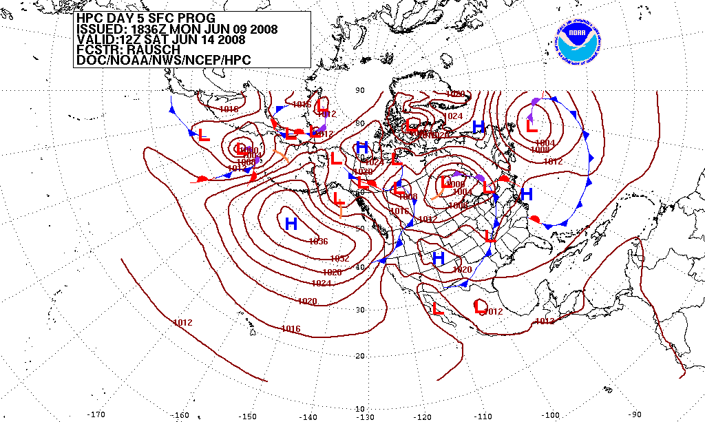
A high-pressure area, high, or anticyclone, is an area near the surface of a planet where the atmospheric pressure is greater than the pressure in the surrounding regions. Highs are middle-scale meteorological features that result from interplays between the relatively larger-scale dynamics of an entire planet's atmospheric circulation. The strongest high-pressure areas result from masses of cold air which spread out from polar regions into cool neighboring regions. These highs weaken once they extend out over warmer bodies of water. Weaker—but more frequently occurring—are high-pressure areas caused by atmospheric subsidence: Air becomes cool enough to precipitate out its water vapor, and large masses of cooler, drier air descend from above. Within high-pressure areas, winds flow from where the pressure is highest, at the center of the area, toward the periphery where the pressure is lower. However, if the planet is rotating, the straight direction of the air flow ... [...More Info...] [...Related Items...] OR: [Wikipedia] [Google] [Baidu] |
Subtropical Cyclone
A subtropical cyclone is a weather system that has some characteristics of both tropical cyclone, tropical and an extratropical cyclone. As early as the 1950s, meteorologists were uncertain whether they should be characterized as Tropical cyclone, tropical or Extratropical cyclone, extratropical cyclones. They were officially recognized and titled by the National Hurricane Center in 1972. Beginning in 2002, subtropical cyclones received names from the official tropical cyclone lists in the North Atlantic hurricane, North Atlantic, South-West Indian Ocean tropical cyclone, South-west Indian Ocean, and South Atlantic tropical cyclone, South Atlantic basins. There are two definitions currently used for subtropical cyclones depending on their location. Across the north Atlantic and southwest Indian Ocean, they require some central Convectional Precipitation, convection fairly near the center surrounding a warming core existing in the mid-levels of the troposphere. Across the eastern ... [...More Info...] [...Related Items...] OR: [Wikipedia] [Google] [Baidu] |
Rapid Deepening
In meteorology, rapid intensification is a situation where a tropical cyclone intensifies dramatically in a short period of time. The United States National Hurricane Center defines rapid intensification as an increase in the maximum sustained winds of a tropical cyclone of at least in a 24-hour period. Necessary conditions External In order for rapid intensification to occur, several conditions must be in place. Water temperatures must be extremely warm (near or above ), and water of this temperature must be sufficiently deep such that waves do not churn deeper cooler waters up to the surface. Wind shear must be low; when wind shear is high, the convection and circulation in the cyclone will be disrupted. Dry air can also limit the strengthening of tropical cyclones. Internal Usually, an anticyclone in the upper layers of the troposphere above the storm must also be present for extremely low surface pressures to develop. This is because air must be converging towards the low ... [...More Info...] [...Related Items...] OR: [Wikipedia] [Google] [Baidu] |
Trough (meteorology)
A trough is an elongated region of relatively low atmospheric pressure without a closed isobaric contour that would define it as a low pressure area. Since low pressure implies a low height on a pressure surface, troughs and ridges refer to features in an identical sense as those on a topographic map. Troughs may be at the surface, or aloft. Near-surface troughs sometimes mark a weather front associated with clouds, showers, and a wind direction shift. Upper-level troughs in the jet stream (as shown in diagram) reflect cyclonic filaments of vorticity. Their motion induces upper-level wind divergence, lifting and cooling the air ahead (downstream) of the trough and helping to produce cloudy and rain conditions there. Unlike fronts, there is not a universal symbol for a trough on a surface weather analysis chart. The weather charts in some countries or regions mark troughs by a line. In the United States, a trough may be marked as a dashed line or bold line. In the UK, Hong Kong ... [...More Info...] [...Related Items...] OR: [Wikipedia] [Google] [Baidu] |
Anticyclone
An anticyclone is a weather phenomenon defined as a large-scale circulation of winds around a central region of high atmospheric pressure, clockwise in the Northern Hemisphere and counterclockwise in the Southern Hemisphere as viewed from above (opposite to a cyclone). Effects of surface-based anticyclones include clearing skies as well as cooler, drier air. Fog can also form overnight within a region of higher pressure. Mid-tropospheric systems, such as the subtropical ridge, deflect tropical cyclones around their periphery and cause a temperature inversion inhibiting free convection near their center, building up surface-based haze under their base. Anticyclones aloft can form within warm-core lows such as tropical cyclones, due to descending cool air from the backside of upper troughs such as polar highs, or from large-scale sinking such as a subtropical ridge. The evolution of an anticyclone depends upon variables such as its size, intensity, and extent of moist con ... [...More Info...] [...Related Items...] OR: [Wikipedia] [Google] [Baidu] |
Eye (cyclone)
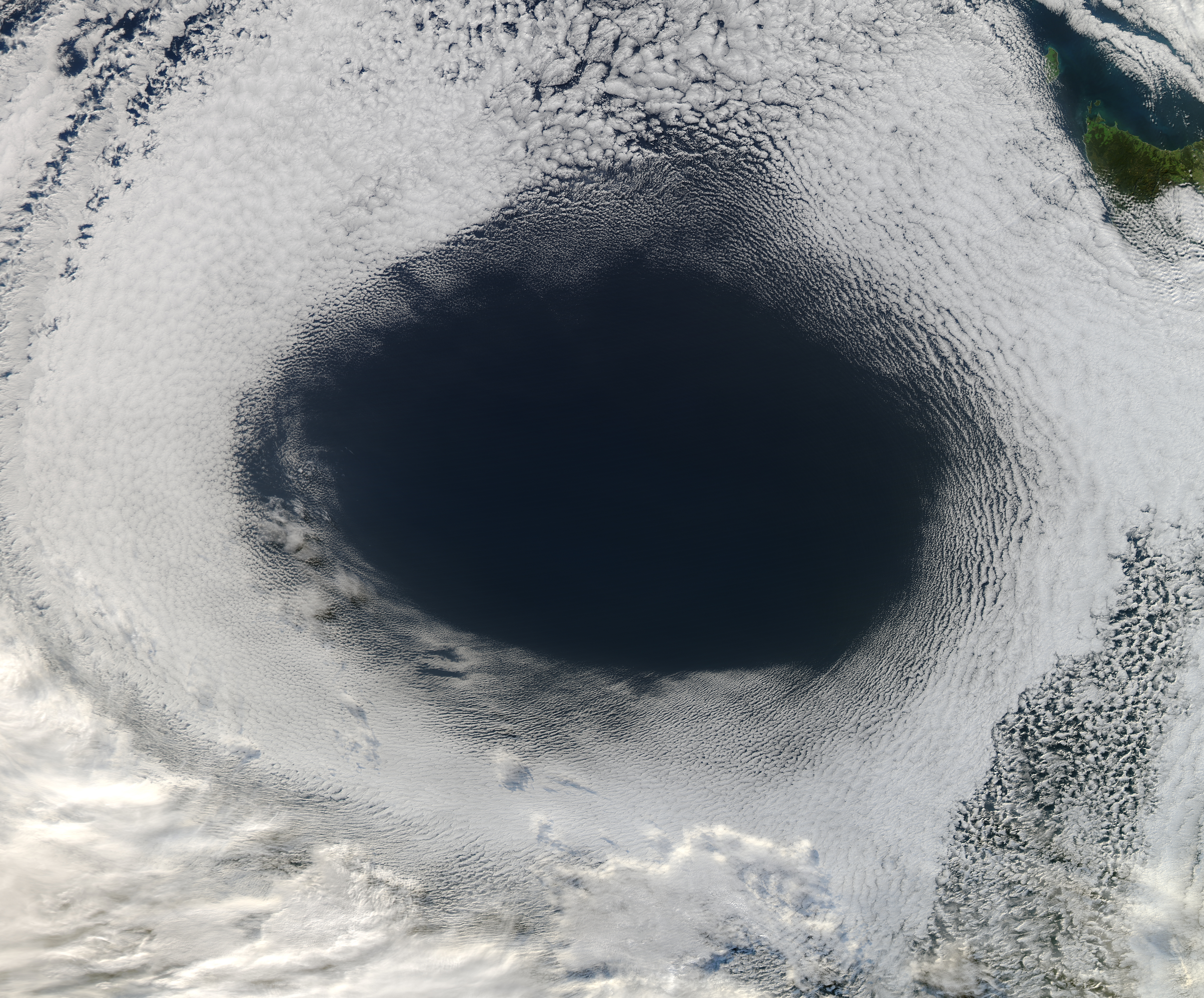
The eye is a region of mostly calm weather at the center of tropical cyclones. The eye of a storm is a roughly circular area, typically in diameter. It is surrounded by the ''eyewall'', a ring of towering thunderstorms where the most severe weather and highest winds occur. The cyclone's lowest barometric pressure occurs in the eye and can be as much as 15 percent lower than the pressure outside the storm. In strong tropical cyclones, the eye is characterized by light winds and clear skies, surrounded on all sides by a towering, symmetric eyewall. In weaker tropical cyclones, the eye is less well defined and can be covered by the central dense overcast, an area of high, thick clouds that show up brightly on satellite imagery. Weaker or disorganized storms may also feature an eyewall that does not completely encircle the eye or have an eye that features heavy rain. In all storms, however, the eye is the location of the storm's minimum barometric pressure—where the atmospheric pr ... [...More Info...] [...Related Items...] OR: [Wikipedia] [Google] [Baidu] |
