|
Cushendun
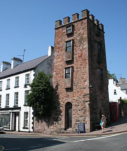
Cushendun () is a small coastal village in County Antrim, Northern Ireland. It sits off the A2 coast road between Cushendall and Ballycastle. It has a sheltered harbour and lies at the mouth of the River Dun and Glendun, one of the nine Glens of Antrim. The Mull of Kintyre in Scotland is only about 15 miles away across the North Channel and can be seen easily on clear days. In the 2001 Census it had a population of 138 people. It is part of Causeway Coast and Glens district. The hamlet of Knocknacarry is nearby. History Cushendun is where Shane O'Neill, chief of the Tyrone O'Neill dynasty, was killed by the MacDonnells in 1567. Cushendun village was designed for Ronald McNeill, the Conservative MP and author, later Lord Cushendun, in the style of a Cornish village by the architect Clough Williams-Ellis. He is buried in the Church of Ireland graveyard near his nationalist cousin Ada or Ide McNeill, Roger Casement's friend and admirer who died in 1959. The National Tr ... [...More Info...] [...Related Items...] OR: [Wikipedia] [Google] [Baidu] |
Ronald McNeill, 1st Baron Cushendun
Ronald John McNeill, 1st Baron Cushendun, PC (30 April 1861 – 12 October 1934), was a British Conservative politician. Background and education McNeill was born in Ulster. He was the son of Edmund McNeill, DL, JP, and Sheriff of County Antrim, and his wife Mary (née Miller). He was educated at Harrow and Christ Church, Oxford, graduating in 1886. He was called to the bar in 1888, and started to work as editor of ''The St James's Gazette'' (1900–04) as well as assistant editor of the ''Encyclopædia Britannica'' (1906–10). Political career Having unsuccessfully contested the seats of West Aberdeenshire (1906), Aberdeen South (1907 and Jan 1910), and Kirkcudbrightshire (Dec 1910), McNeill was elected as Unionist Member of Parliament for the St Augustine's division of Kent Kent is a county in South East England and one of the home counties. It borders Greater London to the north-west, Surrey to the west and East Sussex to the south-west, and Essex to the n ... [...More Info...] [...Related Items...] OR: [Wikipedia] [Google] [Baidu] |
Shane O'Neill (Irish Chieftain)
Shane O'Neill ( ga, Seán Mac Cuinn Ó Néill; c. 1530 – 2 June 1567), was an Irish chieftain of the O'Neill dynasty of Ulster in the mid-16th century. Shane O'Neill's career was marked by his ambition to be the O'Neill—sovereign of the dominant O'Neill family of Tír Eoghain. This brought him into conflict with competing branches of the O'Neill family and with the English government in Ireland, who recognised a rival claim. Shane's support was considered worth gaining by the English even during the lifetime of his father Conn O'Neill, 1st Earl of Tyrone (died 1559). But rejecting overtures from Thomas Radclyffe, 3rd Earl of Sussex, the lord deputy from 1556, Shane refused to help the English against the Scottish settlers on the coast of Antrim, allying himself for a short time instead with the MacDonnells, the most powerful of these settlers, Shane viewed the Scottish settlers as invaders, but decided to stay his hand against them with hopes of using them to strengthen h ... [...More Info...] [...Related Items...] OR: [Wikipedia] [Google] [Baidu] |
Knocknacarry
Knocknacarry ( ; – referring to a weir diverted off the River Dun which operated a watermill) is a hamlet and townland (of 155 acres) about 1 kilometre west of Cushendun and 17 kilometres south-east of Ballycastle in County Antrim, Northern Ireland. It is situated in the historic barony of Glenarm Lower and the civil parish of Layd. In the 2001 Census it had a population of 138 people. It is within the Causeway Coast and Glens Borough Council area. Knocknacarry lies within the Antrim Coast and Glens Area of Outstanding Natural Beauty, designated in 1988. St. Ciaran's Primary School, which also serves the village of Cushendun and the wider local area, is in Knocknacarry. The river bed of the River Dun at Knocknacarry Bridge, north of Knocknacarry, is of scientific interest in the field of mineralogy and an example of Cushendun Granite. References NI Neighbourhood Information System External links Photo: Entering the village of Knocknacarry from the south-westA ... [...More Info...] [...Related Items...] OR: [Wikipedia] [Google] [Baidu] |
River Dun, Northern Ireland
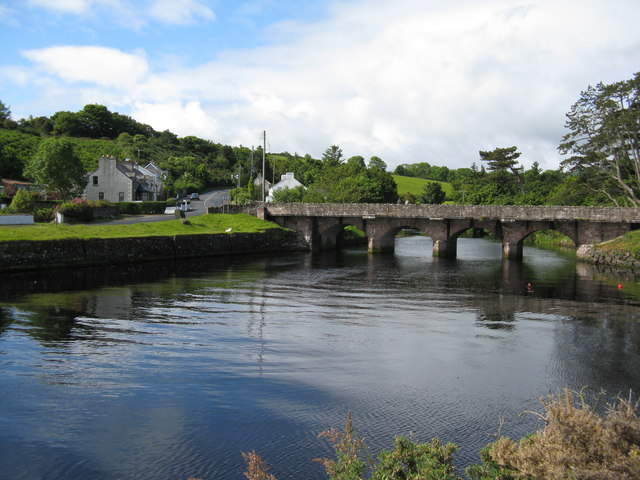
The River Dun, also known as the Glendun River (in Irish: ''Abhann Duinne'', brown river) is a river in County Antrim, Northern Ireland. It runs through Glendun, one of the nine Glens of Antrim. The river is named after its brown colour, which comes from the peat bogs at its source on the slopes of Slievenanee on the Antrim Plateau. The source of the river is a few hundred metres from that of the River Bush, which flows north-east to meet the sea at Bushmills. Cushendun (''Bun Abhann Duinne'', "foot of the River Dun" in Irish – although the English name derives from ''Cois Abhann Duinne'', "beside the River Dun") is a small coastal resort town lying at the mouth of the River Dun and Glendun. Glendun Viaduct The river is spanned by the Glendun Viaduct. The arched viaduct, known locally as the Big Bridge, was built between 1834 and 1839 by workers from County Monaghan and County Donegal. Angling The river supports a population of brown trout which rarely attain weights exc ... [...More Info...] [...Related Items...] OR: [Wikipedia] [Google] [Baidu] |
Causeway Coast And Glens
Ulster Scots: ''Causey Coast an Glens'' , settlement_type = Borough , image_skyline = , imagesize = , image_alt = , image_caption = , image_shield = , shield_size = , shield_alt = , shield_link = , image_map = Causeway_Coast_and_Glens_district_in_Northern_Ireland.svg , mapsize = 150px , map_alt = , map_caption = , subdivision_type = Sovereign state , subdivision_name = United Kingdom , subdivision_type1 = Constituent country , subdivision_type2 = , subdivision_type3 = , subdivision_type4 = Status , subdivision_type5 = Admin HQ , subdivision_name1 = Northern Ireland , subdivision_name2 = , subdivision_name3 = , subdivision_name4 = District , subdivision_name5 = Coleraine , established_title1 = Incorporated ... [...More Info...] [...Related Items...] OR: [Wikipedia] [Google] [Baidu] |
County Antrim
County Antrim (named after the town of Antrim, ) is one of six counties of Northern Ireland and one of the thirty-two counties of Ireland. Adjoined to the north-east shore of Lough Neagh, the county covers an area of and has a population of about 618,000. County Antrim has a population density of 203 people per square kilometre or 526 people per square mile. It is also one of the thirty-two traditional counties of Ireland, as well as part of the historic province of Ulster. The Glens of Antrim offer isolated rugged landscapes, the Giant's Causeway is a unique landscape and a UNESCO World Heritage Site, Bushmills produces whiskey, and Portrush is a popular seaside resort and night-life area. The majority of Belfast, the capital city of Northern Ireland, is in County Antrim, with the remainder being in County Down. According to the 2001 census, it is currently one of only two counties of the Island of Ireland in which a majority of the population are from a Protesta ... [...More Info...] [...Related Items...] OR: [Wikipedia] [Google] [Baidu] |
Glens Of Antrim
The Glens of Antrim,Logainm.ie ( Placenames Database of Ireland) known locally as simply The Glens, is a region of County Antrim, Northern Ireland. It comprises nine s (valleys), that radiate from the Antrim Plateau to the coast. The Glens are an area of outstanding natural beauty and are a major tourist attraction in north Antrim. The ... [...More Info...] [...Related Items...] OR: [Wikipedia] [Google] [Baidu] |
Glendun
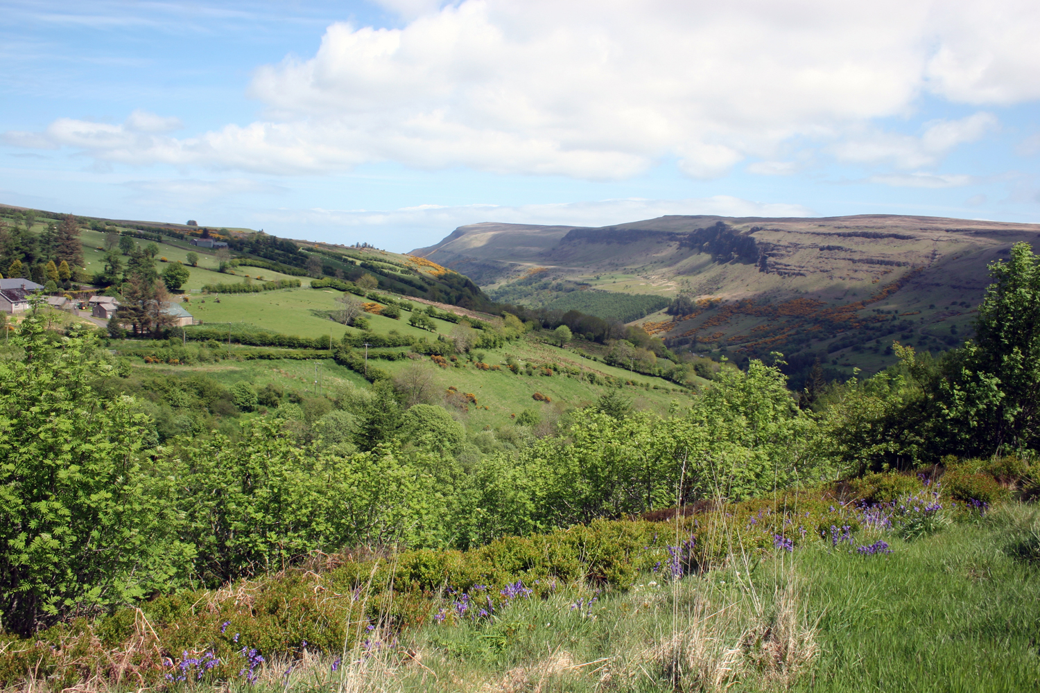
Glendun (in Irish: ''Gleann Abhann Duinne'') translates into English as ''glen of the brown river'' and is one of the nine Glens of Antrim in County Antrim in Northern Ireland. It is named after the River Dun which is coloured brown by the peat bogs at the river source. Like all glens in that area, it was shaped during the Ice Age by giant glaciers. The village of Cushendun and the hamlet of Knocknacarry Knocknacarry ( ; – referring to a weir diverted off the River Dun which operated a watermill) is a hamlet and townland (of 155 acres) about 1 kilometre west of Cushendun and 17 kilometres south-east of Ballycastle in County Antrim, Northern ... both lie at the foot of the glen. External linksGlens of Antrim Website Gl ... [...More Info...] [...Related Items...] OR: [Wikipedia] [Google] [Baidu] |
Cushendall
Cushendall (), formerly known as Newtownglens, is a coastal village and townland (of 153 acres) in County Antrim, Northern Ireland. It is located in the historic barony of Glenarm Lower and the civil parish of Layd, and is part of Causeway Coast and Glens district. Located on the A2 coast road between Glenariff and Cushendun, Cushendall is in the Antrim Coast and Glens an Area of Outstanding Natural Beauty. It lies in the shadow of the table topped Lurigethan Mountain and at the meeting point of three of the Glens of Antrim: Glenaan, Glenballyemon and Glencorp. This part of the Northern Irish coastline is separated from Scotland by the North Channel, with the Mull of Kintyre about 16 miles away. In the 2011 Census, Cushendall had a population of 1,280 people. This article contains quotations from this source, which is available under thOpen Government Licence v3.0 © Crown copyright. Much of the historic character of the 19th century settlement on the north bank ... [...More Info...] [...Related Items...] OR: [Wikipedia] [Google] [Baidu] |
Clough Williams-Ellis
Sir Bertram Clough Williams-Ellis, CBE, MC (28 May 1883 – 9 April 1978) was a Welsh architect known chiefly as the creator of the Italianate village of Portmeirion in North Wales. He became a major figure in the development of Welsh architecture in the first half of the 20th century, in a variety of styles and building types. Early life Clough Williams-Ellis was born in Gayton, Northamptonshire, England, but his family moved back to his father's native North Wales when he was four. The family have strong Welsh roots and Clough Williams-Ellis claimed direct descent from Owain Gwynedd, Prince of North Wales. His father John Clough Williams Ellis (1833–1913) was a clergyman and noted mountaineer while his mother Ellen Mabel Greaves (1851–1941) was the daughter of the slate mine proprietor John Whitehead Greaves and sister of John Ernest Greaves. He was educated at Oundle School in Northamptonshire. Though he read for the natural sciences tripos at Trinity College, Camb ... [...More Info...] [...Related Items...] OR: [Wikipedia] [Google] [Baidu] |
Architect
An architect is a person who plans, designs and oversees the construction of buildings. To practice architecture means to provide services in connection with the design of buildings and the space within the site surrounding the buildings that have human occupancy or use as their principal purpose. Etymologically, the term architect derives from the Latin ''architectus'', which derives from the Greek (''arkhi-'', chief + ''tekton'', builder), i.e., chief builder. The professional requirements for architects vary from place to place. An architect's decisions affect public safety, and thus the architect must undergo specialized training consisting of advanced education and a ''practicum'' (or internship) for practical experience to earn a license to practice architecture. Practical, technical, and academic requirements for becoming an architect vary by jurisdiction, though the formal study of architecture in academic institutions has played a pivotal role in the development of t ... [...More Info...] [...Related Items...] OR: [Wikipedia] [Google] [Baidu] |
Cornwall
Cornwall (; kw, Kernow ) is a historic county and ceremonial county in South West England. It is recognised as one of the Celtic nations, and is the homeland of the Cornish people. Cornwall is bordered to the north and west by the Atlantic Ocean, to the south by the English Channel, and to the east by the county of Devon, with the River Tamar forming the border between them. Cornwall forms the westernmost part of the South West Peninsula of the island of Great Britain. The southwesternmost point is Land's End and the southernmost Lizard Point. Cornwall has a population of and an area of . The county has been administered since 2009 by the unitary authority, Cornwall Council. The ceremonial county of Cornwall also includes the Isles of Scilly, which are administered separately. The administrative centre of Cornwall is Truro, its only city. Cornwall was formerly a Brythonic kingdom and subsequently a royal duchy. It is the cultural and ethnic origin of the Cor ... [...More Info...] [...Related Items...] OR: [Wikipedia] [Google] [Baidu] |


