|
Cumbernauld Railway Station
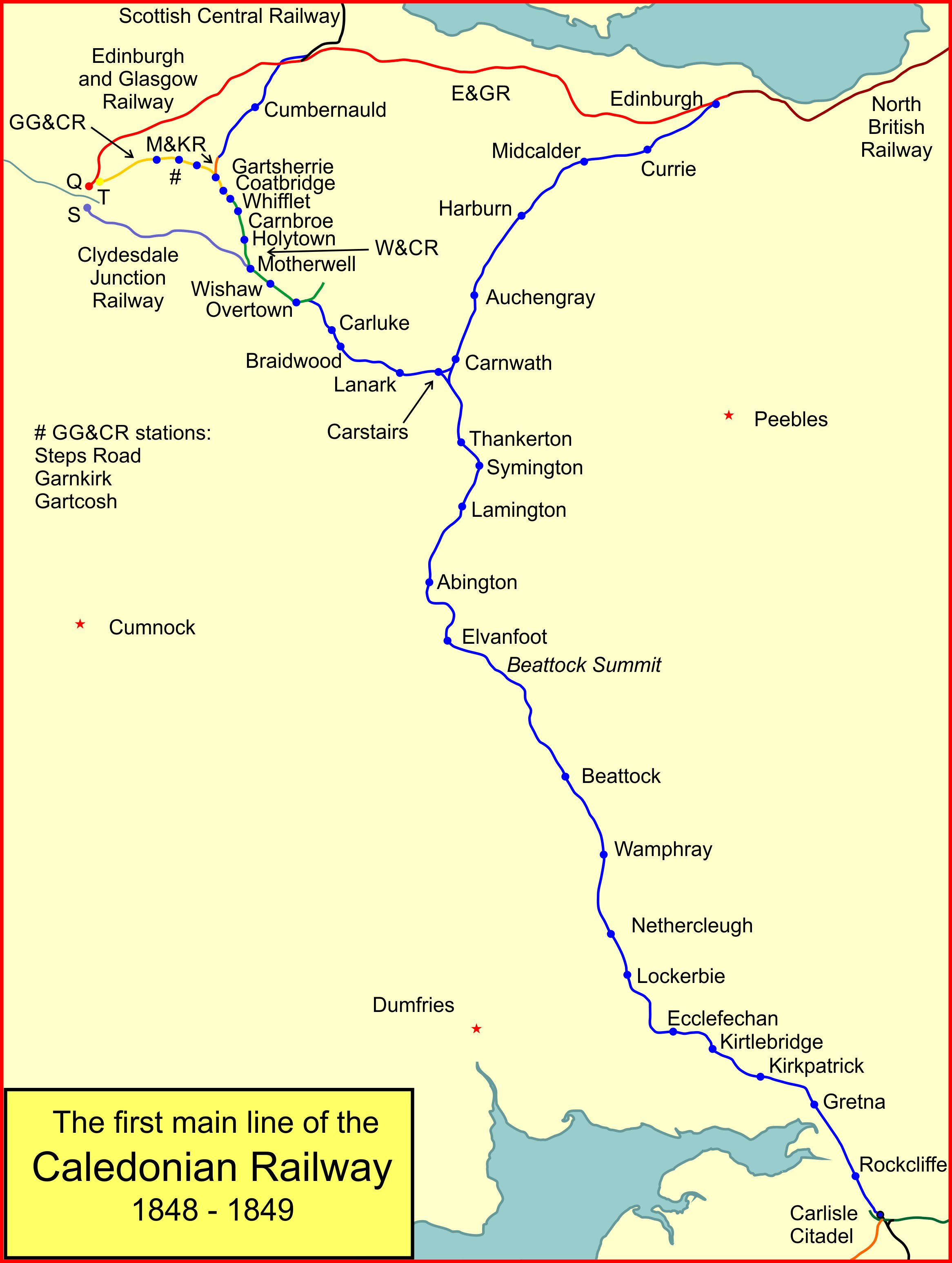
, symbol_location = gb , symbol = rail , image = Cumbernauld Station 3.jpg , caption = Cumbernauld railway station (northbound platform) , borough = Cumbernauld, North Lanarkshire , country = Scotland , coordinates = , grid_name = Grid reference , grid_position = , manager = ScotRail , platforms = 2 , code = CUB , zone = S6/S8 , transit_authority = SPT , original = Caledonian Railway , pregroup = Caledonian Railway , postgroup = London, Midland and Scottish Railway , years = 7 August 1848 , events = Opened , years1 = August 1849 , events1 = Closed , years2 = April 1870 , events2 = Reopened , mpassengers = , footnotes = Passenger statistics from the Office of Rail and Road Cumbernauld rai ... [...More Info...] [...Related Items...] OR: [Wikipedia] [Google] [Baidu] |
Cumbernauld
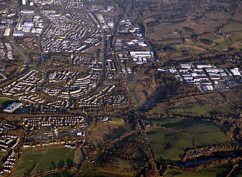
Cumbernauld (; gd, Comar nan Allt, meeting of the streams) is a large town in the historic county of Dunbartonshire and council area of North Lanarkshire, Scotland. It is the tenth most-populous locality in Scotland and the most populated town in North Lanarkshire, positioned in the centre of Scotland's Central Belt. Geographically, Cumbernauld sits between east and west, being on the Scottish watershed between the Forth and the Clyde; however, it is culturally more weighted towards Glasgow and the New Town's planners aimed to fill 80% of its houses from Scotland's largest city to reduce housing pressure there. Traces of Roman occupation are still visible, for example at Westerwood and, less conspicuously, north of the M80 where the legionaries surfaced the Via Flavii, later called the "Auld Cley Road". This is acknowledged in Cumbernauld Community Park, also site of Scotland's only visible open-air Roman altar, in the shadow of the imposing Carrickstone Water Tower. ... [...More Info...] [...Related Items...] OR: [Wikipedia] [Google] [Baidu] |
Condorrat
Condorrat is a former village in North Lanarkshire, Scotland. Like Luggiebank, Castlecary and Dullatur, it predates the new town of Cumbernauld, but unlike those Condorrat was officially included in the designated new town area. Since then it has officially been part of Cumbernauld although it retains some of its own distinctive character. Dalshannon Farm and cottages were located in the area west of the original town and farm, and north of the Luggie. So also was a corn mill called Wood Mill. Road signs show they are is now in the western part of Condorrat towards Mollinsburn. Condorrat now has many of its own facilities, including a health centre, 3 primary schools and a library. Governance Up until 1975, Condorrat sat within Cumbernauld Burgh and Dunbartonshire County. Upon Local Government re-organisation in 1975 it found itself part of Cumbernauld & Kilsyth District Council and Strathclyde Regional Council. Finally, in 1995, it was placed within the boundaries of the newly ... [...More Info...] [...Related Items...] OR: [Wikipedia] [Google] [Baidu] |
Lenziemill
Lenziemill is the site one of Cumbernauld's several industrial estates, built as satellite developments on the periphery of the Scottish town's residential areas. Toponymy The etymology of the name is uncertain but may distinguish the mill here in ancient Easter Lenzie from a nearby flax mill at Pettycastle in Blairlinn Blairlinn is the site of one of Cumbernauld's several industrial estates built as satellite developments on the periphery of the Scottish town's residential areas. Toponymy The etymology of the name is probably 'Pool, or mill-dam, plain’ (b ... in the parish of Old Monklands. History Several other old maps show Lenzie Mill with various spellings including maps by William Forrest, and John Thomson. There used to be a corn mill which was powered by water from the Luggie. Modern Estate There are several roads on the estate, several branching from Lenziemill Road which is 12 miles from Glasgow and 30 miles from Edinburgh. Companies include Cube Glass Li ... [...More Info...] [...Related Items...] OR: [Wikipedia] [Google] [Baidu] |
A73 Road
A73 or A-73 may refer to: * Benoni Defense, in the Encyclopaedia of Chess Openings * ARM Cortex-A73, a microprocessor * Samsung Galaxy A73 5G, an Android smartphone Roads * A73 motorway (Netherlands) * A73 road, in the United Kingdom * Quebec Autoroute 73 in Quebec * Autovía A-73, a Spanish motorway * Bundesautobahn 73 is a motorway in Germany. It connects Suhl to Nuremberg Nuremberg ( ; german: link=no, Nürnberg ; in the local East Franconian dialect: ''Nämberch'' ) is the second-largest city of the German state of Bavaria after its capital Munich, an ..., a German motorway also called A 73 Animals * A73, an orca more commonly known as Springer (orca) See also * List of highways numbered 73 {{Letter-NumberCombDisambig ... [...More Info...] [...Related Items...] OR: [Wikipedia] [Google] [Baidu] |
New Towns In The United Kingdom
The new towns in the United Kingdom were planned under the powers of the New Towns Act 1946 and later acts to relocate populations in poor or bombed-out housing following the Second World War. They were developed in three waves. Later developments included the expanded towns: existing towns which were substantially expanded to accommodate what was called the "overspill" population from densely populated areas of deprivation. Designated new towns were removed from local authority control and placed under the supervision of a development corporation. These corporations were later disbanded and their assets split between local authorities and, in England, the Commission for New Towns (later English Partnerships). Historical precedents Garden cities The concept of the "garden city" was first envisaged by Ebenezer Howard in his 1898 book '' To-morrow: A Peaceful Path to Real Reform,'' as an alternative to the pollution and overcrowding in Britain's growing urban areas. Taking i ... [...More Info...] [...Related Items...] OR: [Wikipedia] [Google] [Baidu] |
Stirling Railway Station, Scotland
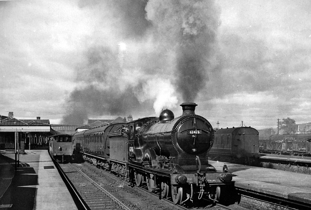
, symbol_location = gb , symbol = rail , image = Stirling railway station, frontage, Scotland.jpg , caption = The station frontage , borough = Stirling, Stirling , country = Scotland , coordinates = , grid_name = Grid reference , grid_position = , manager = ScotRail , platforms = 9 , code = STG , years = 1848 , events = Opened , years1 = 1913 , events1 = Rebuilt , mpassengers = , footnotes = Passenger statistics from the Office of Rail and Road , embedded = Stirling railway station is a railway station located in Stirling, Scotland. It is located on the former Caledonian Railway main line between Glasgow and Perth. It is the junction for the branch line to and Dunfermline via Kincardine and is also served by trains on the Edinburgh to Dunblane Line and long-distan ... [...More Info...] [...Related Items...] OR: [Wikipedia] [Google] [Baidu] |
Buchanan Street Railway Station
Buchanan Street station was the least known of Glasgow's four main terminus railway stations, the other three being , and . It was to the north-west of Queen Street station and served the north of Scotland. History Constructed in 1849 by the Caledonian Railway Company as its main terminus for the city, the original station buildings consisted of supposedly temporary wooden structures, which lasted until the 1930s. A goods station at the site opened in 1850. Services ran primarily northbound, to Aberdeen, Perth and Stirling and other destinations. The station was earmarked for closure and replacement in the "Bruce Report" about how to redevelop Glasgow in the post-Second World War period. The plan included replacing Buchanan Street and Queen Street stations with a Glasgow North station on land including the site of Buchanan Street, but many times larger. There was also a similar scheme to replace Central and St Enoch stations with a Glasgow South station, but neither came to ... [...More Info...] [...Related Items...] OR: [Wikipedia] [Google] [Baidu] |
Scottish Central Railway
The Scottish Central Railway was formed in 1845 to link Perth and Stirling to Central Scotland, by building a railway line to join the Edinburgh and Glasgow Railway near Castlecary. The line opened in 1848 including a branch to South Alloa. The line immediately became part of the forming trunk railway network in Scotland, and amalgamation with other railways was considered, and in 1865 the Scottish Central Railway amalgamated with the Caledonian Railway. The main line continues in use today as a major part of the Scottish Railway network carrying frequent passenger services and a significant freight traffic. History Conception In earlier years Perth had been an important trading town, but in the 1830s its significance was being overshadowed by the cities of central Scotland. There were short local railways in the area around Dundee, but connection to the emerging network further south, and potentially in England, seemed to be essential, and proposals were put forward from 184 ... [...More Info...] [...Related Items...] OR: [Wikipedia] [Google] [Baidu] |
Garnkirk And Glasgow Railway
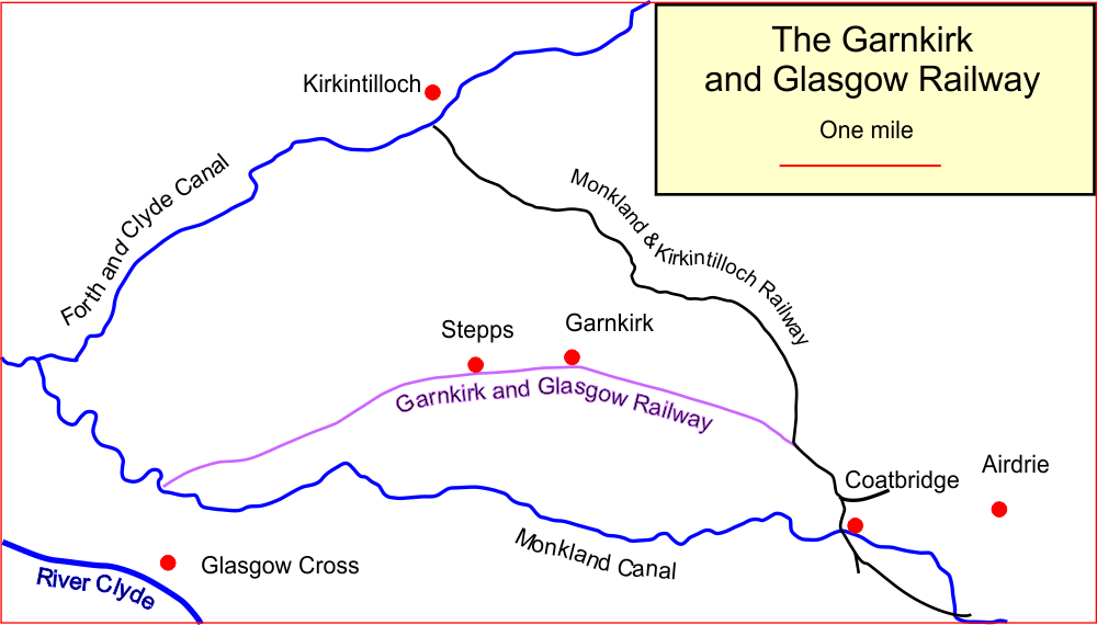
The Garnkirk and Glasgow Railway was an early railway built primarily to carry coal to Glasgow and other markets from the Monkland coalfields, shortening the journey and bypassing the monopolistic charges of the Monkland Canal; passenger traffic also developed early in the line's existence. It opened officially on 27 September 1831 using horse traction, and had the track gauge of that had been adopted by the Monkland and Kirkintilloch Railway, with which it was to connect. It was dependent on the Monkland and Kirkintilloch Railway for access to the best areas of the coalfields, but eventually it by-passed this constraint by extending its line southwards through Coatbridge, enabling a direct link with another coal railway, the Wishaw and Coltness Railway. Widening its horizons it changed its name to the Glasgow, Garnkirk and Coatbridge Railway. The track gauge originally chosen was now a limitation and it altered its gauge to the standard of . When the Caledonian Railway adva ... [...More Info...] [...Related Items...] OR: [Wikipedia] [Google] [Baidu] |
Caley Main Line
George Caley (10 June 1770 – 23 May 1829) was an English botanist and explorer, active in Australia for the majority of his career. Early life Caley was born in Craven, Yorkshire, England, the son of a horse-dealer. He was educated at the Free Grammar School at Manchester for around four years and was then taken into his father's stables. According to a letter which was sent to William Withering on 15 June 1798, he started teaching himself botany after he coming across a volume of book about farriery which was written by William Gibson cause he became interested in the herbs mentioned in prescriptions. He started learning botany by studying Botanical arrangement (1787-92) by William Withering. He changed his job to that of a weaver in order to allow himself to spent more time with his associate in Manchester School of Botanists which consist of John Mellor, James Crowther, and John Dewhurst. This school was also attended by John Horsefield on 1808. In March 1795 he wrote ... [...More Info...] [...Related Items...] OR: [Wikipedia] [Google] [Baidu] |
Abronhill
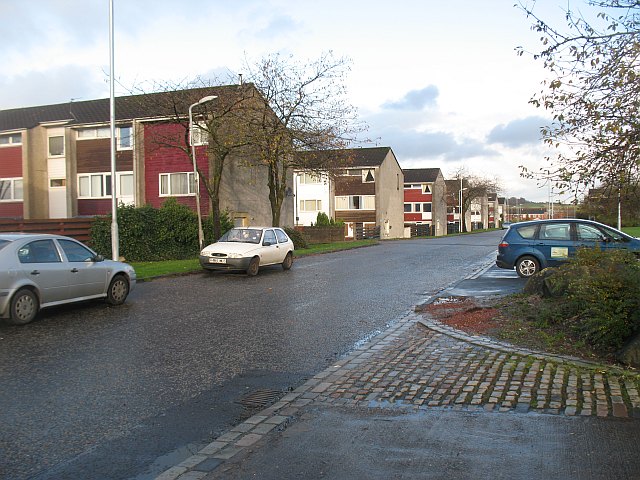
Abronhill () is an area in the north-east of Cumbernauld, North Lanarkshire, Scotland. It extends from Cumbernauld Town Centre. Abronhill was planned with its own shopping centre and has three primary schools, along with several churches. Abronhill has 41 streets. Abronhill, and particularly the now-demolished Abronhill High School, (shut down in 2014 with secondary pupils now attending Cumbernauld Academy), were used extensively as the filming location for Bill Forsyth's 1981 film ''Gregory's Girl'' and its sequel ''Gregory's Two Girls''. All of the roads in the older part of Abronhill were named after a tree for example Cedar Road or Oak Road. This is in contrast to other parts of the New Town where historic local placenames or famous Scots or their art were incorporated into the street names. Abronhill, along with Condorrat and The Village, is one of the parts of Cumbernauld with buildings which pre-date the New Town although Abronhill was very small even compared to those ... [...More Info...] [...Related Items...] OR: [Wikipedia] [Google] [Baidu] |
