|
Crystal Township, Hancock County, Iowa
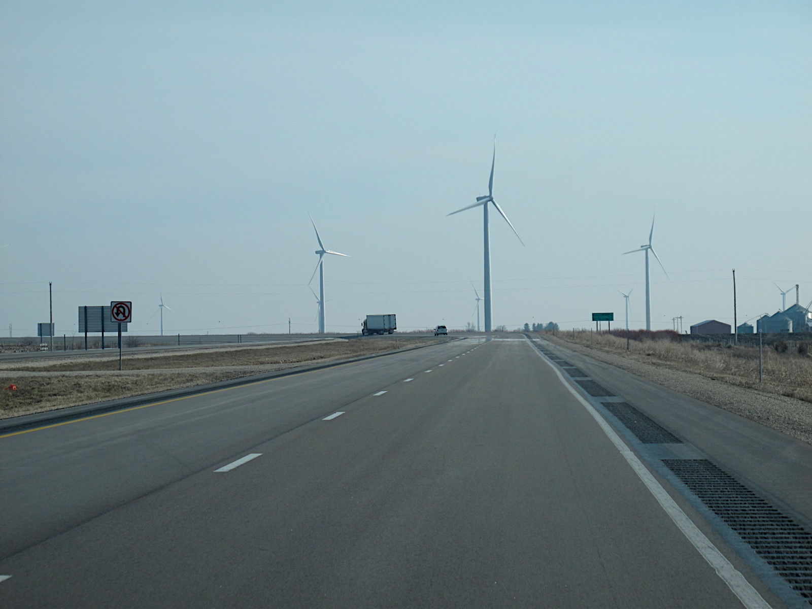
Crystal Township is one of sixteen townships in Hancock County, Iowa, USA. As of the 2000 census, its population was 529. History Crystal Township was founded in 1869. The township was named from Crystal Lake. Geography According to the United States Census Bureau, Crystal Township covers an area of 35.5 square miles (91.96 square kilometers); of this, 35.11 square miles (90.93 square kilometers, 98.88 percent) is land and 0.4 square miles (1.03 square kilometers, 1.12 percent) is water. Cities, towns, villages * Crystal Lake Adjacent townships * Linden Township, Winnebago County (north) * Forest Township, Winnebago County (northeast) * Madison Township (east) * Garfield Township (southeast) * Britt Township (south) * Orthel Township (southwest) * Bingham Township (west) * Grant Township, Winnebago County (northwest) Cemeteries The township contains Crystal Township Cemetery. Major highways * Iowa Highway 111 Airports and landing strips * South 80 Field Lakes * C ... [...More Info...] [...Related Items...] OR: [Wikipedia] [Google] [Baidu] |
Civil Township
A civil township is a widely used unit of local government in the United States that is subordinate to a county, most often in the northern and midwestern parts of the country. The term town is used in New England, New York, and Wisconsin to refer to the equivalent of the civil township in these states; Minnesota uses "town" officially but often uses it and "township" interchangeably. Specific responsibilities and the degree of autonomy vary based on each state. Civil townships are distinct from survey townships, but in states that have both, the boundaries often coincide and may completely geographically subdivide a county. The U.S. Census Bureau classifies civil townships as minor civil divisions. Currently, there are 20 states with civil townships. Township functions are generally overseen by a governing board (the name varies from state to state) and a clerk, trustee, or mayor (in New Jersey and the metro townships of Utah). Township officers frequently include justice of ... [...More Info...] [...Related Items...] OR: [Wikipedia] [Google] [Baidu] |
Forest Township, Winnebago County, Iowa
Forest Township is a township in Winnebago County, Iowa, United States The United States of America (U.S.A. or USA), commonly known as the United States (U.S. or US) or America, is a country primarily located in North America. It consists of 50 states, a federal district, five major unincorporated territorie .... History Forest Township was founded in 1857. References Townships in Winnebago County, Iowa Townships in Iowa 1857 establishments in Iowa Populated places established in 1857 {{WinnebagoCountyIA-geo-stub ... [...More Info...] [...Related Items...] OR: [Wikipedia] [Google] [Baidu] |
Iowa's 4th Congressional District
Iowa's 4th congressional district is a congressional district in the U.S. state of Iowa that covers its northwestern part, bordering the states of Minnesota, South Dakota, and Nebraska, and the Missouri River. The district includes Sioux City, Ames, Mason City, Fort Dodge, Boone and Carroll; it is currently represented by Republican Randy Feenstra, who has been in office since 2021. With a Cook Partisan Voting Index rating of R+16, it is the most Republican district in Iowa. History Since the 1880s, there have been major changes in the location or nature of Iowa's 4th Congressional District. From 1886 until 1941, the district was made up of largely rural counties in northeastern Iowa, including the easternmost five counties in the northernmost two rows (and, during the 1930s, Buchanan and Delaware counties from the third row). During that era, the district included areas from Mason City east to the Mississippi River. In 1941, Iowa's 5th Congressional District (made up of ru ... [...More Info...] [...Related Items...] OR: [Wikipedia] [Google] [Baidu] |
Iowa Highway 111
U.S. Highway 18 (US 18) is the northernmost east–west U.S. Highway in the state of Iowa. As with all state highways in Iowa, it is maintained by the Iowa Department of Transportation (Iowa DOT). It enters the state by crossing the Big Sioux River between Inwood and Canton, South Dakota. It travels and connects Spencer, Mason City and Charles City. The highway leaves the state via the Marquette–Joliet Bridge over the Mississippi River at Marquette. Prior to becoming a U.S. Highway, the route US 18 follows was known as Primary Road No. 19 and the National Parks Pike. Route description US 18 begins at the Big Sioux River approximately east of Canton, South Dakota. It runs easterly through rural Lyon County, in the northwestern corner of the state. At Inwood it meets Iowa 182, which provides access to Sioux Falls, South Dakota, via Iowa 9 and South Dakota Highway 42. US 18 turns south at Inwood and heads into Sioux County. The ... [...More Info...] [...Related Items...] OR: [Wikipedia] [Google] [Baidu] |
Iowa 111
U.S. Highway 18 (US 18) is the northernmost east–west U.S. Highway in the state of Iowa. As with all state highways in Iowa, it is maintained by the Iowa Department of Transportation (Iowa DOT). It enters the state by crossing the Big Sioux River between Inwood and Canton, South Dakota. It travels and connects Spencer, Mason City and Charles City. The highway leaves the state via the Marquette–Joliet Bridge over the Mississippi River at Marquette. Prior to becoming a U.S. Highway, the route US 18 follows was known as Primary Road No. 19 and the National Parks Pike. Route description US 18 begins at the Big Sioux River approximately east of Canton, South Dakota. It runs easterly through rural Lyon County, in the northwestern corner of the state. At Inwood it meets Iowa 182, which provides access to Sioux Falls, South Dakota, via Iowa 9 and South Dakota Highway 42. US 18 turns south at Inwood and heads into Sioux County. The ... [...More Info...] [...Related Items...] OR: [Wikipedia] [Google] [Baidu] |
Grant Township, Winnebago County, Iowa
Grant Township is a township in Winnebago County, Iowa, United States. History Grant Township was established in 1886. It was named for Ulysses S. Grant Ulysses S. Grant (born Hiram Ulysses Grant ; April 27, 1822July 23, 1885) was an American military officer and politician who served as the 18th president of the United States from 1869 to 1877. As Commanding General, he led the Union Ar .... References Townships in Winnebago County, Iowa Townships in Iowa 1886 establishments in Iowa {{WinnebagoCountyIA-geo-stub ... [...More Info...] [...Related Items...] OR: [Wikipedia] [Google] [Baidu] |
Bingham Township, Hancock County, Iowa
Bingham Township is one of sixteen Civil township, townships in Hancock County, Iowa, Hancock County, Iowa, United States, USA. At the United States Census, 2000, 2000 census, its population was 487. History Bingham Township was organized in 1878. Bingham is the name of John Bingham, a pioneer settler from England. Geography According to the United States Census Bureau, Bingham Township covers an area of (91.58 square kilometers); of which (99.78 percent) is land and (0.22 percent) is water. Cities, towns, villages * Woden, Iowa, Woden Adjacent townships * Grant Township, Winnebago County, Iowa, Grant Township, Winnebago County (north) * Linden Township, Winnebago County, Iowa, Linden Township, Winnebago County (northeast) * Crystal Township, Hancock County, Iowa, Crystal Township (east) * Britt Township, Hancock County, Iowa, Britt Township (southeast) * Orthel Township, Hancock County, Iowa, Orthel Township (south) * Wesley Township, Kossuth County, Iowa, Wesley Township, K ... [...More Info...] [...Related Items...] OR: [Wikipedia] [Google] [Baidu] |
Orthel Township, Hancock County, Iowa
Orthel Township is one of sixteen townships in Hancock County, Iowa, USA. As of the 2000 census, its population was 247. History Orthel Township was founded in 1882. Geography According to the United States Census Bureau, Orthel Township covers an area of 35.84 square miles (92.82 square kilometers); of this, 35.77 square miles (92.64 square kilometers, 99.81 percent) is land and 0.07 square miles (0.17 square kilometers, 0.18 percent) is water. Unincorporated towns * Hutchins at (This list is based on USGS data and may include former settlements.) Adjacent townships * Bingham Township (north) * Crystal Township (northeast) * Britt Township (east) * Erin Township (southeast) * Boone Township (south) * Prairie Township, Kossuth County (southwest) * Wesley Township, Kossuth County (west) * Buffalo Township, Kossuth County (northwest) Cemeteries The township contains Orthel Township Cemetery. Major highways * U.S. Route 18 Airports and landing strips * Wesley Landi ... [...More Info...] [...Related Items...] OR: [Wikipedia] [Google] [Baidu] |
Britt Township, Hancock County, Iowa
Britt Township is one of sixteen townships in Hancock County, Iowa, US. As of the 2000 census, its population was 2,293. History Britt Township was founded in 1873. Geography According to the United States Census Bureau, Britt Township covers an area of 35.44 square miles (91.79 square kilometers); of this, 35.11 square miles (90.94 square kilometers, 99.07 percent) is land and 0.33 square miles (0.85 square kilometers, 0.93 percent) is water. Cities, towns, villages * Britt Adjacent townships * Crystal Township (north) * Madison Township (northeast) * Garfield Township (east) * Liberty Township (southeast) * Erin Township (south) * Boone Township (southwest) * Orthel Township (west) * Bingham Township (northwest) Cemeteries The township contains Evergreen Cemetery. Major highways * U.S. Route 18 * Iowa Highway 111 Landmarks * Eagle Lake State Park School districts * Garner-Hayfield-Ventura Community School District * West Hancock Community School District Po ... [...More Info...] [...Related Items...] OR: [Wikipedia] [Google] [Baidu] |
Garfield Township, Hancock County, Iowa
Garfield Township is one of sixteen townships in Hancock County, Iowa, USA. As of the 2000 census, its population was 421. History Garfield Township was organized in 1880. It was named for President James A. Garfield. Geography According to the United States Census Bureau, Garfield Township covers an area of 35.44 square miles (91.8 square kilometers); of this, 35.02 square miles (90.7 square kilometers, 98.8 percent) is land and 0.42 square miles (1.1 square kilometers, 1.2 percent) is water. Unincorporated towns * Duncan at (This list is based on USGS data and may include former settlements.) Adjacent townships * Madison Township (north) * Ellington Township (northeast) * Concord Township (east) * Ell Township (southeast) * Liberty Township (south) * Erin Township (southwest) * Britt Township (west) * Crystal Township (northwest) Cemeteries The township contains these two cemeteries: Saint Boniface and Saint John. Major highways * U.S. Route 18 * U.S. Route 69 ... [...More Info...] [...Related Items...] OR: [Wikipedia] [Google] [Baidu] |
Madison Township, Hancock County, Iowa
Madison Township is one of sixteen townships in Hancock County, Iowa, USA. At the 2000 census, its population was 775. History Madison Township was organized in 1858. Geography According to the United States Census Bureau, Madison Township covers an area of 35 square miles (90.65 square kilometers). Cities, towns, villages * Forest City (south one-third) Unincorporated towns * Hawley at * Hayfield at (This list is based on USGS data and may include former settlements.) Adjacent townships * Forest Township, Winnebago County (north) * Mount Valley Township, Winnebago County (northeast) * Ellington Township (east) * Concord Township (southeast) * Garfield Township (south) * Britt Township (southwest) * Crystal Township (west) * Linden Township, Winnebago County (northwest) Cemeteries The township contains Madison Cemetery. Major highways * U.S. Route 69 Airports and landing strips * Forest City Municipal Airport School districts * Forest City Community School ... [...More Info...] [...Related Items...] OR: [Wikipedia] [Google] [Baidu] |
Linden Township, Winnebago County, Iowa
Linden Township is a township in Winnebago County, Iowa, United States. History Linden Township was founded in 1880. The Mattison home was the site of Linden's first school, which began in 1873. Linden No. 2 provided instruction in 1887 and 1889. A photograph shows students at Linden No. 4 in 1919. References Townships in Winnebago County, Iowa Townships in Iowa {{WinnebagoCountyIA-geo-stub ... [...More Info...] [...Related Items...] OR: [Wikipedia] [Google] [Baidu] |


