|
Cromstrijen
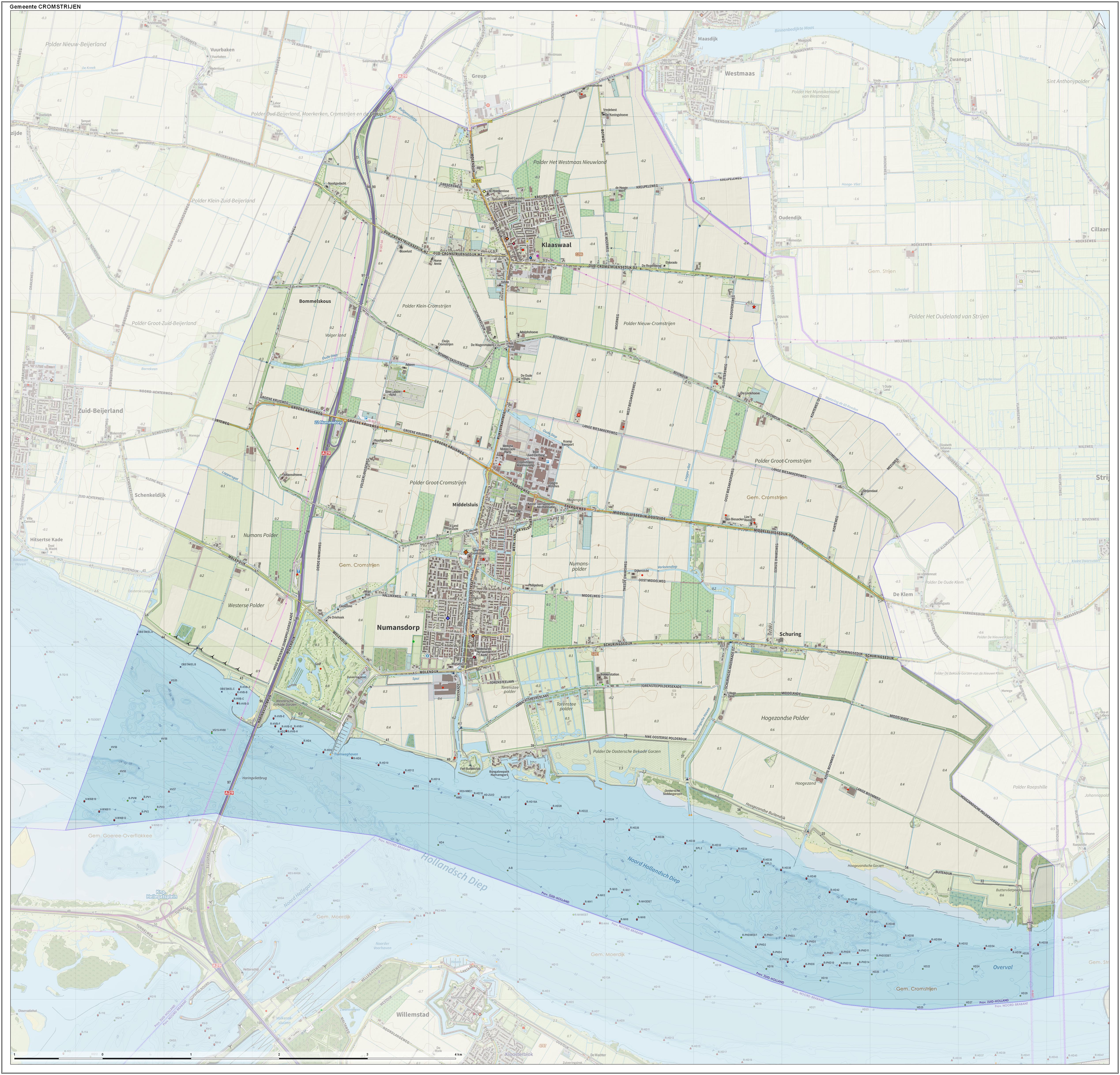
Cromstrijen (; ''Cromstrien'' in local dialect) was a municipality on the Hoeksche Waard Island in the western Netherlands, in the province of South Holland. The municipality covers an area of of which is water. It was formed on 1 January 1984, when the municipalities on the Hoeksche Waard were merged into larger municipalities. On 1 January 2019 it was merged with the municipalities of Binnenmaas, Korendijk, Oud-Beijerland, and Strijen to form the municipality of Hoeksche Waard The Hoekse Waard (; pre-1947 spelling: Hoeksche Waard) is an island between the Oude Maas, Dordtsche Kil, Hollands Diep, Haringvliet and Spui rivers in the province of South Holland in the Netherlands. The island, part of the namesake munic .... The municipality of Cromstrijen consists of the communities Klaaswaal and Numansdorp (townhall). Its population was in . Topography ''Dutch topographic map of the municipality of Cromstrijen, June 2015'' See also References External linksO ... [...More Info...] [...Related Items...] OR: [Wikipedia] [Google] [Baidu] |
Numansdorp
Numansdorp is a town and former municipality in the province South Holland in the Netherlands and is located on the island Hoeksche Waard near the Hollands Diep. On 1 January 1984, the municipalities Numansdorp and Klaaswaal were merged into one municipality called Cromstrijen. Cromstrijen was merged into the new municipality Hoeksche Waard in January 2019. History Numansdorp was founded in 1642. The village was built in the Numanspolder. It took a while till the embankment of this polder was started. The reason for the delay was a disagreement between the Lords of Cromstrijen and the owners of Zuid-Beijerland. When the founding of the village had finally taken place, it still didn't have an official name, even though the locals called it Buitensluis. In a meeting it was decided to call the village "Village of Cromstrijen" (Dorp van Cromstrijen). But Dijkgraaf Vos, the chairman of the meeting, believed the village should me named after the first Ambachtsheer, Gerard Numan. ... [...More Info...] [...Related Items...] OR: [Wikipedia] [Google] [Baidu] |
Binnenmaas
Binnenmaas () was a municipality in the western Netherlands, in the province of South Holland. The municipality had a population of in , and covers an area of of which is water. It is named after the lake of the same name. The municipality was formed on January 1, 1984, by the merger of the municipalities Puttershoek, Maasdam, Mijnsheerenland, Westmaas, and Heinenoord. On January 1, 2007, the municipality 's-Gravendeel was added to Binnenmaas. On January 1, 2019 it was merged with Cromstrijen, Korendijk, Oud-Beijerland, and Strijen to form the municipality of Hoeksche Waard. 11 July 2018, accessed at overheid.nl The municipality of Binnenmaas consists of the following communi ... [...More Info...] [...Related Items...] OR: [Wikipedia] [Google] [Baidu] |
Klaaswaal
Klaaswaal is a village and former municipality in the Dutch province of South Holland. It is centrally located on one of the island Hoeksche Waard. Klaaswaal was a separate municipality until 1984, when it was merged with Numansdorp to form the municipality Cromstrijen. History The village was first mentioned in 1555 as "Claes Wael", and means "pool after dike breach belonging to Claes (person)". In 1539 embankment of the polder ''Het Westmaas Nieuwland'' was started. The lords reserved a part of the new land for the new to found village ''Claeswaal''. The first buildings were built along the Voorstraat. At the end of this street, a church was built in 1566. Originally, it was built as a Catholic church, but the pastor of Strijen didn't want to come to the village as he considered the distance as too far. The community found a minister who was willing to hold the services, and therefore the services were of a Protestant nature. The Dutch Reformed church is a single aisled chur ... [...More Info...] [...Related Items...] OR: [Wikipedia] [Google] [Baidu] |
Hoeksche Waard (municipality)
Hoeksche Waard () is a municipality in the western Netherlands, in the province of South Holland, consisting of the eponymous Hoeksche Waard and Tiengemeten islands. The municipality was formed on 1 January 2019 by the merger of the municipalities Binnenmaas, Cromstrijen, Korendijk, Oud-Beijerland, and Strijen. Gallery File:'s-Gravendeel, de Kerk op de Heul GM1963-WN13 IMG 0979 2021-09-06 17.30.jpg, 's-Gravendeel, church: the Kerk op de Heul File:'s-Gravendeel, korenmolen het Vliegend Hert RM17406 foto3 2014-04-14 17.10.jpg, 's-Gravendeel, windmill: korenmolen het Vliegend Hert File:Westmaas, de Nederlands Hervormde kerk RM38856 IMG 0929 2021-09-06 13.38.jpg, Westmaas, reformed church File:Klaaswaal, de Nederlands Hervormde kerk RM23662 IMG 0941 2021-09-06 14.04.jpg, Klaaswaal, reformed church File:Strijen, de Grote- of Sint Lambertuskerk RM34945 IMG 0960 2021-09-06 16.04.jpg, Strijen, church: the Grote- or Sint Lambertuskerk File:Maasdam, de Kerk GM1963-WN24 IMG 0978 2021 ... [...More Info...] [...Related Items...] OR: [Wikipedia] [Google] [Baidu] |
Strijen
Strijen () is a town and former municipality in the western Netherlands, in the province of South Holland. The municipality, covering an area of of which is water, is located on the Hoeksche Waard island along the Hollands Diep estuary. On 1 January 2019 it was merged with the municipalities of Binnenmaas, Cromstrijen, Korendijk, and Oud-Beijerland to form the municipality of Hoeksche Waard. Strijen hosts a public library, swimming pool, a small shopping centre and a local museum. Furthermore, Strijen is home to an important and welcome resting stop for migrating birds, especially geese. During winter, the endangered Eurasian spoonbill uses this area as a foraging ground. The municipality of Strijen also includes the population centres of Cillaarshoek, De Klem, Mookhoek Mookhoek is a village in the Dutch province of South Holland and is part of the municipality of Hoeksche Waard The Hoekse Waard (; pre-1947 spelling: Hoeksche Waard) is an island between the Oude ... [...More Info...] [...Related Items...] OR: [Wikipedia] [Google] [Baidu] |
Korendijk
Korendijk () was a municipality in the western Netherlands, in the province of South Holland. The municipality covered an area of of which was water. With the municipal reorganization of the Hoeksche Waard on 1 January 1984, the municipality of Korendijk was formed out of the former municipalities of Goudswaard, Nieuw-Beijerland, Piershil (location of town hall), Zuid-Beijerland, and the island Tiengemeten. In addition to these villages, it also had the population centres Nieuwendijk and Zuidzijde. On 1 January 2019, it merged into the municipality of Hoeksche Waard. The municipality of Korendijk was bordered on the southside by the Haringvliet estuary, on the westside by the Spui River, and by the municipalities Oud-Beijerland Oud-Beijerland () is a town and former municipality in the western Netherlands, in the province of South Holland, now a part of the Hoeksche Waard municipality. With a population of 24,575 in 2020, it is the most populous town of the Hoeksche Waard .. ... [...More Info...] [...Related Items...] OR: [Wikipedia] [Google] [Baidu] |
Oud-Beijerland
Oud-Beijerland () is a town and former municipality in the western Netherlands, in the province of South Holland, now a part of the Hoeksche Waard municipality. With a population of 24,575 in 2020, it is the most populous town of the Hoeksche Waard island. The town is located adjacent to the confluence of the Oude Maas and Spui River. The town of Oud-Beijerland also includes the communities Vuurbaken and Zinkweg. History After the St. Elizabeth's flood (1421), large parts of the islands Putten and Grote Waard were lost and became clay banks and salt marshes which would be inundated at high tide and be unsuitable for habitation. In subsequent centuries, portions of land would be reclaimed. Oud-Beijerland was formed in 1559 as "Beijerland" by Lamoral, Count of Egmont. He was granted the rights to this area in 1557 and had the land reclaimed. This new polder was named ''Beijerland, Moerkerken, Cromstrijen en de Greup''. Circa 1624 the smaller polders Bosschenpolder and Nieuwlandp ... [...More Info...] [...Related Items...] OR: [Wikipedia] [Google] [Baidu] |
Hoeksche Waard
The Hoekse Waard (; pre-1947 spelling: Hoeksche Waard) is an island between the Oude Maas, Dordtsche Kil, Hollands Diep, Haringvliet and Spui rivers in the province of South Holland in the Netherlands. The island, part of the namesake municipality of Hoeksche Waard, is a mostly agricultural region, south of the outskirts of Rotterdam. The Hoeksche Waard consists of reclaimed land (polders): after the Saint Elisabeth flood of 1421 most of the area was flooded. The land has been reclaimed gradually in the following centuries. Former municipalities The Hoeksche Waard formerly consisted of the following municipalities until these were merged on 1 January 2019: * Binnenmaas (villages Blaaksedijk, Heinenoord, Goidschalxoord, Maasdam, Mijnsheerenland, Puttershoek, Westmaas and 's-Gravendeel) * Cromstrijen (villages Klaaswaal and Numansdorp) * Korendijk (villages Goudswaard, Nieuw-Beijerland, Piershil and Zuid-Beijerland, and the island of Tiengemeten) * Oud-Beijerland * Str ... [...More Info...] [...Related Items...] OR: [Wikipedia] [Google] [Baidu] |
North Brabant
North Brabant ( nl, Noord-Brabant ; Brabantian: ; ), also unofficially called Brabant, is a province in the south of the Netherlands. It borders the provinces of South Holland and Gelderland to the north, Limburg to the east, Zeeland to the west, and the Flemish provinces of Antwerp and Limburg to the south. The northern border follows the Meuse westward to its mouth in the Hollands Diep strait, part of the Rhine–Meuse–Scheldt delta. North Brabant has a population of 2,562,566 as of November 2019. Major cities in North Brabant are Eindhoven (pop. 231,642), Tilburg (pop. 217,259), Breda (pop. 183,873) and its provincial capital 's-Hertogenbosch (pop. 154,205). History The Duchy of Brabant was a state of the Holy Roman Empire established in 1183 or 1190. It developed from the Landgraviate of Brabant and formed the heart of the historic Low Countries, part of the Burgundian Netherlands from 1430 and of the Habsburg Netherlands from 1482, until it was split up after th ... [...More Info...] [...Related Items...] OR: [Wikipedia] [Google] [Baidu] |
Moerdijk
Moerdijk () is a municipality and a town in the South of the Netherlands, in the province of North Brabant. History The municipality of Moerdijk was founded in 1997 following the merger of the municipalities of Fijnaart en Heijningen, Klundert, Standdaarbuiten, Willemstad, and Zevenbergen. At that time the new municipality was called Zevenbergen. The name changed to Moerdijk on 1 April 1998. * List of mayors of Moerdijk Population centres Topography ''Dutch Topographic map of the municipality of Moerdijk, June 2015'' The village of Moerdijk The village of Moerdijk is one of the smaller villages of the municipality. Population as of 2002 is 1,205. ''Moerdijk'' is however a well-known name in the Netherlands, because of the large Moerdijk industrial area, with a large power plant, and because of the well-known Moerdijk bridges (highway and railway bridges) across the Hollands Diep. This was the last bridge available for the retreat from the vital Scheldt Estuary of the r ... [...More Info...] [...Related Items...] OR: [Wikipedia] [Google] [Baidu] |
Hollands Diep
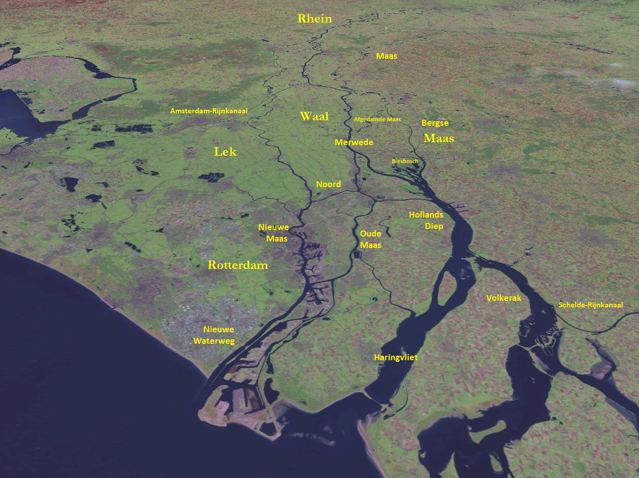
Hollands Diep ( pre-1947 spelling: Hollandsch Diep) is a wide river in the Netherlands and an estuary of the Rhine and Meuse rivers. Through the Scheldt-Rhine Canal it connects to the Scheldt river and Antwerp. The Bergse Maas river and the Nieuwe Merwede river join near Lage Zwaluwe to form the Hollands Diep. The Dordtsche Kil connects to it near Moerdijk. Near Numansdorp it splits into the Haringvliet and the Volkerak. History The Hollands Diep was formed as a result of the extensive flood of 1216, which breached the dunes of Voorne-Putten, Voorne and created a deep saltwater inlet (the current Haringvliet). During a second flood, the St. Elizabeth floods, this inlet connected to the Merwede and became an important estuary of the Rhine and Meuse rivers. From that moment on, the freshwater part of the estuary (east of the Hellegatsplein) was renamed Hollands Diep. The former river Striene, that used to connect the Meuse with the Scheldt The Scheldt (french: Escaut ; nl ... [...More Info...] [...Related Items...] OR: [Wikipedia] [Google] [Baidu] |


