|
Cromartyshire
Cromartyshire ( gd, Siorrachd Chromba) is a historic county in the Highlands of Scotland, comprising the medieval "old shire" around the county town of Cromarty and 22 enclaves and exclaves transferred from Ross-shire in the late 17th century. The largest part, six times the size of the old shire, is Coigach, northwest from Ullapool. In 1890, Cromartyshire was merged with Ross-shire into the administrative county of Ross and Cromarty, which in 1975 was merged into the new council area of Highland. History The medieval sheriffdom of Cromarty encompassed a single tract on the north of the Black Isle peninsula. The sheriffdom was hereditary in Clan Urquhart. It comprised the parish of Cromarty; most of the adjacent parish of Kirkmichael, excluding a portion at Balblair where a ferry crossed the Cromarty Firth to Invergordon; and a single farm in Cullicudden parish. As late as the mid-nineteenth century, ownership of the moor of Mulbuie was uncertain between Cromartyshire and ... [...More Info...] [...Related Items...] OR: [Wikipedia] [Google] [Baidu] |
Cromarty
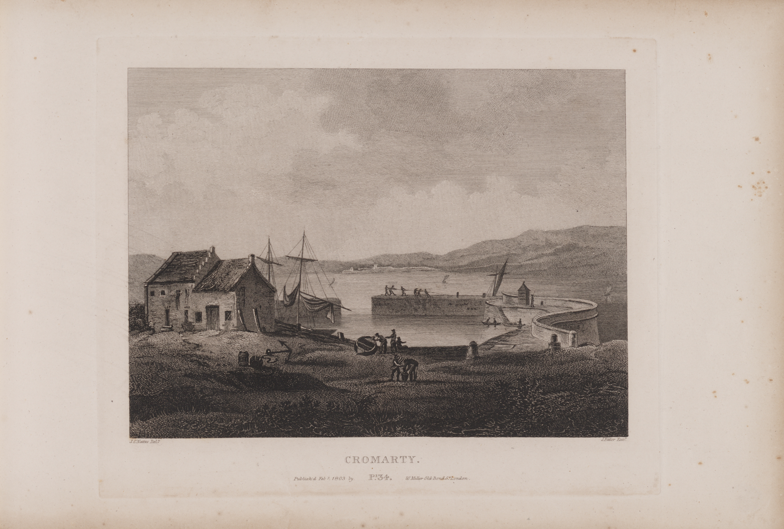
Cromarty (; gd, Cromba, ) is a town, civil parish and former royal burgh in Ross and Cromarty, in the Highland area of Scotland. Situated at the tip of the Black Isle on the southern shore of the mouth of Cromarty Firth, it is seaward from Invergordon on the opposite coast. In the 2001 census, it had a population of 719. History The name ''Cromarty'' variously derives from the Gaelic ''crom'' (crooked), and from ''bati'' (bay), or from ''àrd'' (height), meaning either the "crooked bay", or the "bend between the heights" (referring to the high rocks, or Sutors, which guard the entrance to the Firth), and gave the title to the Earldom of Cromartie. In 1264, its name was ''Crumbathyn''. Cromarty is a sea port, and its economy was closely linked to the sea for most of its history. Fishing was the major industry, with salmon stations around the surrounding coast, and boats going out to catch herring. Other trade was also by boat: Cromarty's connections to surrounding towns were l ... [...More Info...] [...Related Items...] OR: [Wikipedia] [Google] [Baidu] |
Ross And Cromarty
Ross and Cromarty ( gd, Ros agus Cromba), sometimes referred to as Ross-shire and Cromartyshire, is a variously defined area in the Highlands and Islands of Scotland. There is a registration county and a lieutenancy area in current use, the latter of which is in extent. Historically there has also been a constituency of the Parliament of the United Kingdom (1832 to 1983), a local government county (1890 to 1975), a district of the Highland local government region (1975 to 1996) and a management area of the Highland Council (1996 to 2007). The local government county is now divided between two local government areas: the Highland area and Na h-Eileanan Siar (the Western Isles). Ross and Cromarty border Sutherland to the north and Inverness-shire to the south. The county was formed by the uniting of the shires of Ross-shire and Cromartyshire. Both these shires had themselves been formed from the historic province of Ross, out of which the many enclaves and exclaves that forme ... [...More Info...] [...Related Items...] OR: [Wikipedia] [Google] [Baidu] |
Ross-shire
Ross-shire (; gd, Siorrachd Rois) is a historic county in the Scottish Highlands. The county borders Sutherland to the north and Inverness-shire to the south, as well as having a complex border with Cromartyshire – a county consisting of numerous enclaves or exclaves scattered throughout Ross-shire's territory. Ross-shire includes most of Ross along with Lewis in the Outer Hebrides. Dingwall is the traditional county town. The area of Ross-shire is based on that of the historic province of Ross, but with the exclusion of the many enclaves that form Cromartyshire. For shreival purposes the area was first separated from the authority of the sheriff of Inverness by Act of Parliament during the reign of King James IV, the sheriff to sit at Tain or Dingwall. Sheriffs were seldom appointed, and further acts of 1649 and 1661 restated its separation from Inverness. The 1661 act also clarified the area encompassed, based on the pre-Reformation Diocese of Ross. Sir George ... [...More Info...] [...Related Items...] OR: [Wikipedia] [Google] [Baidu] |
Shires Of Scotland
The shires of Scotland ( gd, Siorrachdan na h-Alba), or counties of Scotland, are historic subdivisions of Scotland established in the Middle Ages and used as administrative divisions until 1975. Originally established for judicial purposes (being the territory over which a sheriff had jurisdiction), from the 17th century they started to be used for local administration purposes as well. The areas used for judicial functions (sheriffdoms) came to diverge from the shires, which ceased to be used for local government purposes after 1975 under the Local Government (Scotland) Act 1973. Today, local government in Scotland is based upon council areas, which sometimes incorporate county names, but frequently have vastly different boundaries. Counties continue to be used for land registration, and form the basis of the lieutenancy areas (although the latter are not entirely identical). History Sheriffdoms or shires Malcolm III (reigned 1058 to 1093) appears to have introduced sheri ... [...More Info...] [...Related Items...] OR: [Wikipedia] [Google] [Baidu] |
Ullapool
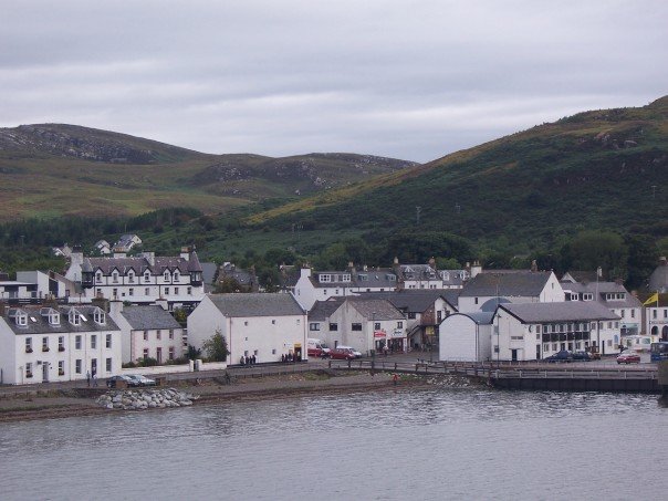
Ullapool (; gd, Ulapul ) is a village and port located in Northern Scotland. Ullapool has a population of around 1,500 inhabitants. It is located around northwest of Inverness in Ross and Cromarty, Scottish Highlands. Despite its modest size, it is the largest settlement for many miles around, and an important port and tourist destination. The North Atlantic Drift passes Ullapool, moderating the temperature. A few ''Cordyline australis'' (New Zealand cabbage trees) are grown in the town and are often mistaken for palm trees. The town lies on Loch Broom, on the A835 road from Inverness. The Ullapool River flows through the village. History On the east shore of Loch Broom, Ullapool was founded in 1788 as a herring port by the British Fisheries Society. It was designed by Thomas Telford. Prior to 1788 the town was only an insignificant hamlet made up of just over 20 households. The harbour is used as a fishing port, yachting haven, and ferry port. Ferries sail to Stornoway in the ... [...More Info...] [...Related Items...] OR: [Wikipedia] [Google] [Baidu] |
Coigach
Coigach () is a peninsula north of Ullapool, in Wester Ross in the Northwest Highlands of Scotland. The area consists of a traditional crofting and fishing community of a couple of hundred houses located between mountain and shore on a peninsula looking over the Summer Isles and the sea. The main settlement is Achiltibuie. Like its northerly neighbour, Assynt in Sutherland, Coigach has mountains which rise sharply from quiet, lochan-studded moorland, and a highly indented rocky coast with many islands, bays and headlands. The highest summit is Ben Mor Coigach at 743 metres; the distinctive profile of Stac Pollaidh is the other main peak within Coigach. The scenic qualities of Coigach, along with neighbouring Assynt, have led to the area being designated as the ''Assynt-Coigach National Scenic Area'', one of 40 such areas in Scotland. The name is derived from the Gaelic for "five" or "fifths", and refers to the five townships of Achduart, Achnacarinan, Acheninver, Achnahaird an ... [...More Info...] [...Related Items...] OR: [Wikipedia] [Google] [Baidu] |
Tarbat
Tarbat (Gaelic , meaning 'a crossing or isthmus'Place-names of Ross and Cromarty, by W J Watson, publ. The Northern Counties Printing and Publishing Co. Ltd., Inverness 1904; p.45) is a civil parish in Highland, Scotland, in the north-east corner of Ross and Cromarty. The parish is a promontory between Dornoch Firth to the north-west and Moray Firth to the east, while to the south it borders the parish of Fearn.Ordnance Gazetteer of Scotland: A survey of Scottish Topography statistical biographical and historical, by Francis H. Groome; publ. Thomas C. Jack, Edinburgh, 1882 - 1885. (Article on Tarbat) The peninsula is relatively flat, the highest point being the hill adjacent to Geanies House which reaches , on the southern border of the parish.Historic Environment Scotland Portal website (Article on Geanies House) portal.historicenvironment.scot/designation/GDL00217 Retrieved April 2021Ordnance Survey series 1 in. to 1 mile Sheet 22 - Dornoch, Publ. 1965 The coast along the D ... [...More Info...] [...Related Items...] OR: [Wikipedia] [Google] [Baidu] |
County Town
In the United Kingdom and Ireland, a county town is the most important town or city in a county. It is usually the location of administrative or judicial functions within a county and the place where the county's members of Parliament are elected. Following the establishment of the English county councils in 1889, the headquarters of the new councils were usually located in the county town of each county. However, the concept of a county town pre-dates the establishment of these councils. The concept of a county town is ill-defined and unofficial. Some counties have their administrative bodies located elsewhere. For example, Lancaster is the county town of Lancashire, but the county council is located in Preston. Some county towns are no longer situated within the administrative county because of changes in the county's boundaries. For example, Nottingham is administered by a unitary authority separate from the rest of Nottinghamshire. UK county towns, pre-19th-century refor ... [...More Info...] [...Related Items...] OR: [Wikipedia] [Google] [Baidu] |
Enclave
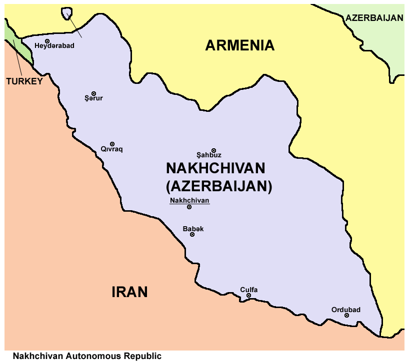
An enclave is a territory (or a small territory apart of a larger one) that is entirely surrounded by the territory of one other state or entity. Enclaves may also exist within territorial waters. ''Enclave'' is sometimes used improperly to denote a territory that is only partly surrounded by another state. The Vatican City and San Marino, both enclaved by Italy, and Lesotho, enclaved by South Africa, are completely enclaved sovereign states. An exclave is a portion of a state or district geographically separated from the main part by surrounding alien territory (of one or more states or districts etc). Many exclaves are also enclaves, but not all: an exclave can be surrounded by the territory of more than one state. The Azerbaijani exclave of Nakhchivan is an example of an exclave that is not an enclave, as it borders Armenia, Turkey and Iran. Semi-enclaves and semi-exclaves are areas that, except for possessing an unsurrounded sea border (a coastline contiguous with internat ... [...More Info...] [...Related Items...] OR: [Wikipedia] [Google] [Baidu] |
Exclave
An enclave is a territory (or a small territory apart of a larger one) that is entirely surrounded by the territory of one other state or entity. Enclaves may also exist within territorial waters. ''Enclave'' is sometimes used improperly to denote a territory that is only partly surrounded by another state. The Vatican City and San Marino, both enclaved by Italy, and Lesotho, enclaved by South Africa, are completely enclaved sovereign states. An exclave is a portion of a state or district geographically separated from the main part by surrounding alien territory (of one or more states or districts etc). Many exclaves are also enclaves, but not all: an exclave can be surrounded by the territory of more than one state. The Azerbaijani exclave of Nakhchivan is an example of an exclave that is not an enclave, as it borders Armenia, Turkey and Iran. Semi-enclaves and semi-exclaves are areas that, except for possessing an unsurrounded sea border (a coastline contiguous with internati ... [...More Info...] [...Related Items...] OR: [Wikipedia] [Google] [Baidu] |
County Town
In the United Kingdom and Ireland, a county town is the most important town or city in a county. It is usually the location of administrative or judicial functions within a county and the place where the county's members of Parliament are elected. Following the establishment of the English county councils in 1889, the headquarters of the new councils were usually located in the county town of each county. However, the concept of a county town pre-dates the establishment of these councils. The concept of a county town is ill-defined and unofficial. Some counties have their administrative bodies located elsewhere. For example, Lancaster is the county town of Lancashire, but the county council is located in Preston. Some county towns are no longer situated within the administrative county because of changes in the county's boundaries. For example, Nottingham is administered by a unitary authority separate from the rest of Nottinghamshire. UK county towns, pre-19th-century refor ... [...More Info...] [...Related Items...] OR: [Wikipedia] [Google] [Baidu] |
Black Isle
The Black Isle ( gd, an t-Eilean Dubh, ) is a peninsula within Ross and Cromarty, in the Scottish Highlands. It includes the towns of Cromarty and Fortrose, and the villages of Culbokie, Jemimaville, Rosemarkie, Avoch, Munlochy, Tore, and North Kessock, as well as numerous smaller settlements. About 12,000 people live on the Black Isle, depending on the definition. The northern slopes of the Black Isle offer fine views of Dingwall, Ben Wyvis, Fyrish and the deepwater anchorage at Invergordon. To the south, Inverness and the Monadhliath Mountains can be seen. Description Despite its name, the Black Isle is not an island but a peninsula, surrounded on three sides by the sea – the Cromarty Firth to the north, the Beauly Firth to the south, and the Moray Firth to the east. On the fourth, western side, its boundary is broadly delineated by rivers. The River Conon, which divides Maryburgh from Conon Bridge, defines the border in the north-west. The south-western boundary ... [...More Info...] [...Related Items...] OR: [Wikipedia] [Google] [Baidu] |


.jpg)


