|
Cromarty
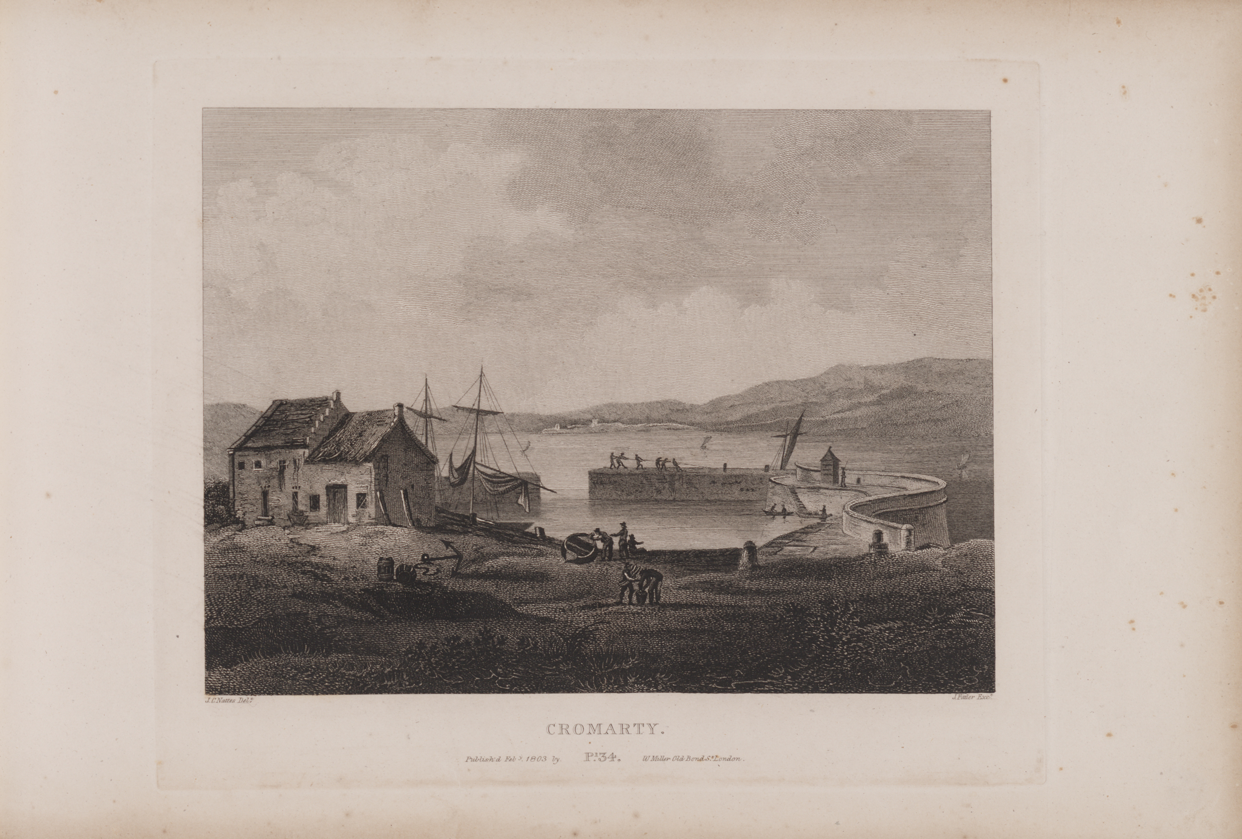
Cromarty (; gd, Cromba, ) is a town, civil parishes in Scotland, civil parish and former royal burgh in Ross and Cromarty, in the Highland (council area), Highland area of Scotland. Situated at the tip of the Black Isle on the southern shore of the mouth of Cromarty Firth, it is seaward from Invergordon on the opposite coast. In the 2001 census, it had a population of 719. History The name ''Cromarty'' variously derives from the Gaelic ''crom'' (crooked), and from ''bati'' (bay), or from ''àrd'' (height), meaning either the "crooked bay", or the "bend between the heights" (referring to the high rocks, or Sutors, which guard the entrance to the Firth), and gave the title to the Earldom of Cromartie. In 1264, its name was ''Crumbathyn''. Cromarty is a sea port, and its economy was closely linked to the sea for most of its history. Fishing was the major industry, with salmon stations around the surrounding coast, and boats going out to catch herring. Other trade was also by boa ... [...More Info...] [...Related Items...] OR: [Wikipedia] [Google] [Baidu] |
Cromartyshire
Cromartyshire ( gd, Siorrachd Chromba) is a historic county in the Highlands of Scotland, comprising the medieval "old shire" around the county town of Cromarty and 22 enclaves and exclaves transferred from Ross-shire in the late 17th century. The largest part, six times the size of the old shire, is Coigach, northwest from Ullapool. In 1890, Cromartyshire was merged with Ross-shire into the administrative county of Ross and Cromarty, which in 1975 was merged into the new council area of Highland. History The medieval sheriffdom of Cromarty encompassed a single tract on the north of the Black Isle peninsula. The sheriffdom was hereditary in Clan Urquhart. It comprised the parish of Cromarty; most of the adjacent parish of Kirkmichael, excluding a portion at Balblair where a ferry crossed the Cromarty Firth to Invergordon; and a single farm in Cullicudden parish. As late as the mid-nineteenth century, ownership of the moor of Mulbuie was uncertain between Cromartyshire a ... [...More Info...] [...Related Items...] OR: [Wikipedia] [Google] [Baidu] |
Ross And Cromarty
Ross and Cromarty ( gd, Ros agus Cromba), sometimes referred to as Ross-shire and Cromartyshire, is a variously defined area in the Highlands and Islands of Scotland. There is a registration county and a lieutenancy area in current use, the latter of which is in extent. Historically there has also been a constituency of the Parliament of the United Kingdom (1832 to 1983), a local government county (1890 to 1975), a district of the Highland local government region (1975 to 1996) and a management area of the Highland Council (1996 to 2007). The local government county is now divided between two local government areas: the Highland area and Na h-Eileanan Siar (the Western Isles). Ross and Cromarty border Sutherland to the north and Inverness-shire to the south. The county was formed by the uniting of the shires of Ross-shire and Cromartyshire. Both these shires had themselves been formed from the historic province of Ross, out of which the many enclaves and exclaves ... [...More Info...] [...Related Items...] OR: [Wikipedia] [Google] [Baidu] |
Cromarty Firth
The Cromarty Firth (; gd, Caolas Chrombaidh ; literally "kyles /nowiki>straits">strait.html" ;"title="/nowiki>strait">/nowiki>straitsof Cromarty") is an arm of the Moray Firth in Scotland. Geography The entrance to the Cromarty Firth is guarded by two precipitous headlands; the one on the north high and the one on the south high — called "The Sutors" from a fancied resemblance to a couple of shoemakers (in Scots, ''souters'') bent over their lasts. From the Sutors the Firth extends inland in a westerly and then south-westerly direction for a distance of . Excepting between Nigg Bay and Cromarty Bay where it is about wide, and Alness Bay where it is wide, it has an average width of . The southern shore of the Firth is formed by a peninsula known as the Black Isle. Good views of the Cromarty Firth are to be had from the Sutors or Cnoc Fyrish. At its head the Firth receives its principal river, the River Conon, other rivers include the Allt Graad, Peffery, Sgithe ... [...More Info...] [...Related Items...] OR: [Wikipedia] [Google] [Baidu] |
Black Isle
The Black Isle ( gd, an t-Eilean Dubh, ) is a peninsula within Ross and Cromarty, in the Scottish Highlands. It includes the towns of Cromarty and Fortrose, and the villages of Culbokie, Jemimaville, Rosemarkie, Avoch, Munlochy, Tore, and North Kessock, as well as numerous smaller settlements. About 12,000 people live on the Black Isle, depending on the definition. The northern slopes of the Black Isle offer fine views of Dingwall, Ben Wyvis, Fyrish and the deepwater anchorage at Invergordon. To the south, Inverness and the Monadhliath Mountains can be seen. Description Despite its name, the Black Isle is not an island but a peninsula, surrounded on three sides by the sea – the Cromarty Firth to the north, the Beauly Firth to the south, and the Moray Firth to the east. On the fourth, western side, its boundary is broadly delineated by rivers. The River Conon, which divides Maryburgh from Conon Bridge, defines the border in the north-west. The south-western ... [...More Info...] [...Related Items...] OR: [Wikipedia] [Google] [Baidu] |
Ross-shire
Ross-shire (; gd, Siorrachd Rois) is a historic county in the Scottish Highlands. The county borders Sutherland to the north and Inverness-shire to the south, as well as having a complex border with Cromartyshire – a county consisting of numerous enclaves or exclaves scattered throughout Ross-shire's territory. Ross-shire includes most of Ross along with Lewis in the Outer Hebrides. Dingwall is the traditional county town. The area of Ross-shire is based on that of the historic province of Ross, but with the exclusion of the many enclaves that form Cromartyshire. For shreival purposes the area was first separated from the authority of the sheriff of Inverness by Act of Parliament during the reign of King James IV, the sheriff to sit at Tain or Dingwall. Sheriffs were seldom appointed, and further acts of 1649 and 1661 restated its separation from Inverness. The 1661 act also clarified the area encompassed, based on the pre-Reformation Diocese of Ross. Sir George M ... [...More Info...] [...Related Items...] OR: [Wikipedia] [Google] [Baidu] |
Nigg, Highland
Nigg (from the gd, An Neag meaning "the notch", referring to a feature of the hills above the parish church) is a village and parish in Easter Ross, administered by the Highland Council. It lies on the north shore of the entrance to the Cromarty Firth. Nigg Old Church The present parish church is an 18th-century building on an early Christian site dating back to at least the 8th century. The Nigg Stone, one of the most elaborate stone monuments of early medieval western Europe, is preserved in a room at the west end of the church. This late 8th century Pictish cross-slab formerly stood in the churchyard, but was moved indoors for preservation in recent years. The nearby manse is one of the oldest to survive in Scotland, dating back to the first half of the 17th century. It is now privately owned and no longer used as the parish minister's residence. Nigg Old has its odd and curious features. In the churchyard is the Cholera Stone, dating from the cholera epidemic of 183 ... [...More Info...] [...Related Items...] OR: [Wikipedia] [Google] [Baidu] |
HMS Natal (1905)
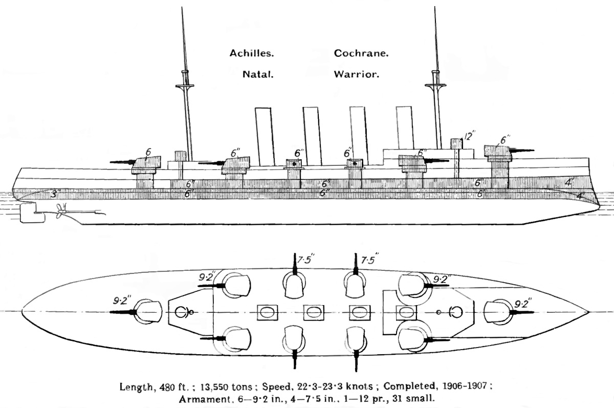
HMS ''Natal'' was a armoured cruiser built for the Royal Navy in the first decade of the 20th century. She escorted the royal yacht in 1911–1912 for the newly crowned King George V's trip to India to attend the Delhi Durbar. During World War I the ship was assigned to the 2nd Cruiser Squadron of the Grand Fleet, but did not participate in any battles. ''Natal'' was sunk by an internal explosion near Cromarty on 30 December 1915 with the loss of at least 390 crewmen and civilians. Most of her wreck was slowly salvaged over the decades until the remnants were demolished in the 1970s so they were no longer a hazard to navigation. The remains of her wreck are designated as a controlled site under the Protection of Military Remains Act 1986 as a war grave. Description ''Natal'' displaced as built and fully loaded. The ship had an overall length of , a beam of and a draught of . She was powered by four-cylinder triple-expansion steam engines, driving two shafts, which deve ... [...More Info...] [...Related Items...] OR: [Wikipedia] [Google] [Baidu] |
Shipping Forecast
The Shipping Forecast is a BBC Radio broadcast of weather reports and forecasts for the seas around the coasts of the British Isles. It is produced by the Met Office and broadcast by BBC Radio 4 on behalf of the Maritime and Coastguard Agency. The forecasts sent over the Navtex system use a similar format and the same sea areas. The waters around the British Isles are divided into 31 sea areas, also known as weather areas (see map below). There are currently four broadcasts per day at the following ( UK local) times: * 00:48 – transmitted on FM and LW. Includes weather reports from an extended list of coastal stations at 00:52 and an inshore waters forecast at 00:55 and concludes with a brief UK weather outlook for the coming day. The broadcast finishes at approximately 00:58. * 05:20 – transmitted on FM and LW. Includes weather reports from coastal stations at 05:25, and an inshore waters forecast at 05:27. * 12:01 – normally transmitted on LW only. * 17:54 – trans ... [...More Info...] [...Related Items...] OR: [Wikipedia] [Google] [Baidu] |
Thomas Urquhart
Sir Thomas Urquhart (1611–1660) was a Scottish aristocrat, writer, and translator. He is best known for his translation of the works of French Renaissance writer François Rabelais to English. Biography Urquhart was born to Thomas Urquhart of Cromarty and Christian Elphinstone, daughter of Alexander Elphinstone, 4th Lord Elphinstone. At the age of eleven he attended King's College, University of Aberdeen. Afterwards he toured the Continent, returning in 1636. In 1639, he participated in the Royalist uprising known as the Trot of Turriff; he was knighted by Charles I at Whitehall for his support. In 1641 he published his first book, a volume of epigrams. Urquhart's father died in 1642, leaving behind a large estate encumbered by larger debts. As the eldest son, Urquhart was from that time on harassed by creditors. He left for the Continent in order to economize, but returned in 1645 and published ''Trissotetras'', a mathematical treatise. In 1648, Urquhart participated in ... [...More Info...] [...Related Items...] OR: [Wikipedia] [Google] [Baidu] |
Tain
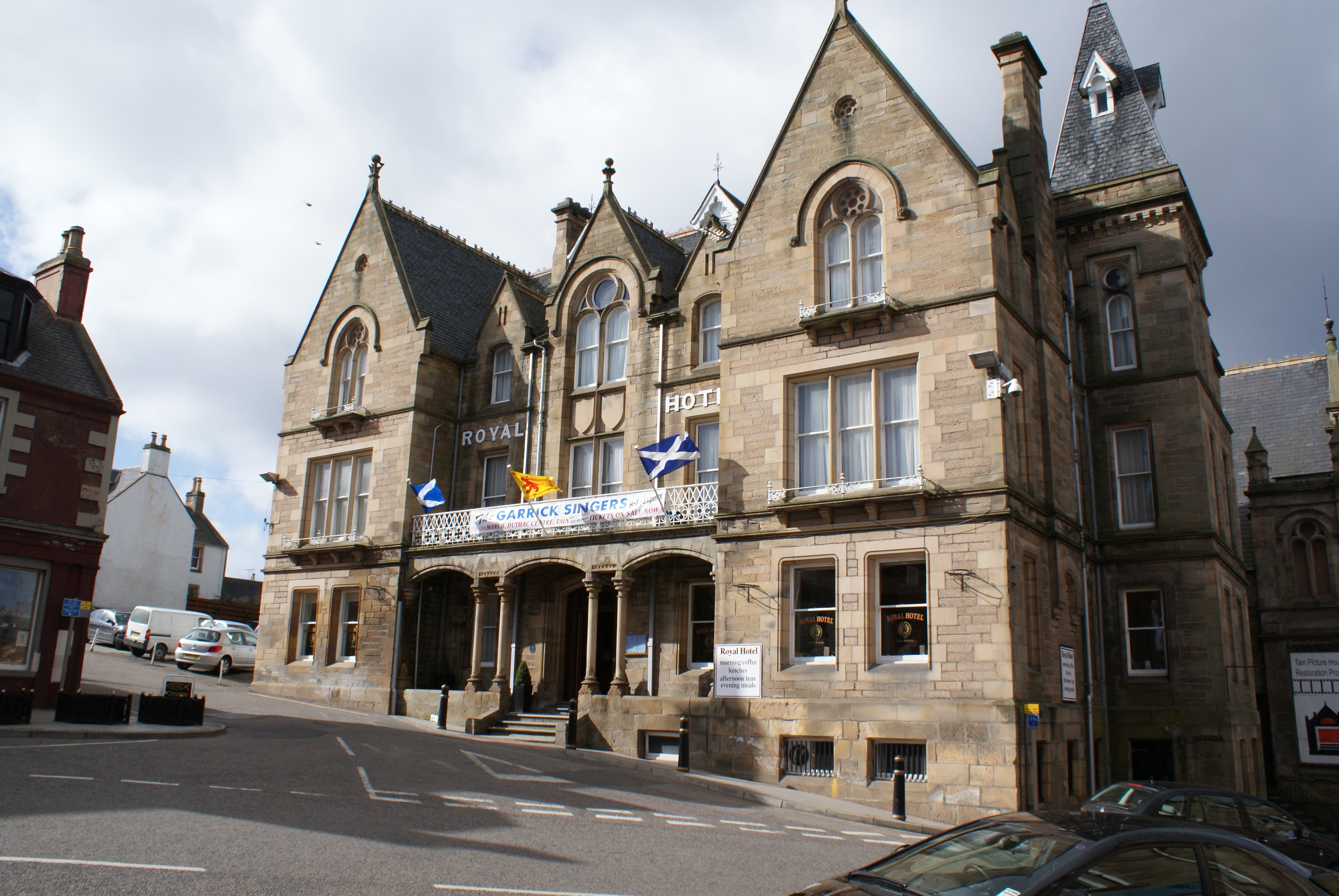
Tain ( Gaelic: ''Baile Dhubhthaich'') is a royal burgh and parish in the County of Ross, in the Highlands of Scotland. Etymology The name derives from the nearby River Tain, the name of which comes from an Indo-European root meaning 'flow'. The Gaelic name, ''Baile Dubhthaich'', means 'Duthac's town', after a local saint also known as Duthus. History Tain was granted its first royal charter in 1066, making it Scotland's oldest royal burgh, commemorated in 1966 with the opening of the Rose Garden by Queen Elizabeth, the Queen Mother. The 1066 charter, granted by King Malcolm III, confirmed Tain as a sanctuary, where people could claim the protection of the church, and an immunity, in which resident merchants and traders were exempt from certain taxes. Little is known of earlier history although the town owed much of its importance to Duthac. He was an early Christian figure, perhaps 8th or 9th century, whose shrine had become so important by 1066 that it resulted in the royal ... [...More Info...] [...Related Items...] OR: [Wikipedia] [Google] [Baidu] |
Invergordon
Invergordon (; gd, Inbhir Ghòrdain or ) is a town and port in Easter Ross, in Ross and Cromarty, Highland, Scotland. It lies in the parish of Rosskeen. History The town built up around the harbour which was established in 1828. The area became a police burgh in 1863 and Invergordon Town Hall was completed in 1871. The Invergordon Grain Distillery, operated by Philippines-owned whisky giant Whyte & Mackay, was established in 1959. Connected to the distillery was the Invergordon Distillery Pipe Band which was formed in 1964. In 1971, the British Aluminium Company, which was 47% owned by Reynolds Metals, opened an aluminum smelter at Invergordon. Naval Base The naval institute was designed in 1914 by Edinburgh architect Stewart Kaye in anticipation of the First World War. The naval base was the venue for the Invergordon Mutiny of 1931. Remains of the naval base are evidenced in the tank farm lying behind the town centre; the port used to contain fuel oil and water suppli ... [...More Info...] [...Related Items...] OR: [Wikipedia] [Google] [Baidu] |
Earldom Of Cromartie
Earl of Cromartie () is a title that has been created twice, both for members of the Mackenzie family. It was first created as Earl of Cromarty in the Peerage of Scotland in 1703 for Sir George Mackenzie, 2nd Baronet, but his titles were forfeited after the Jacobite rising of 1745. It was recreated in 1861 in the Peerage of the United Kingdom for Anne Sutherland-Leveson-Gower, Duchess of Sutherland (''née'' Hay-Mackenzie). Since 1979, the Earl of Cromartie has been chief of Clan Mackenzie. History First creation This branch of the family descends from Sir Roderick Mackenzie, whose elder brother Kenneth Mackenzie was created Lord Mackenzie of Kintail in 1609 and was the father of Colin Mackenzie, 1st Earl of Seaforth (see the Earl of Seaforth for further history of this branch of the family). Sir Roderick's son, John Mackenzie, was in 1628 created a baronet, of Tarbat in the County of Ross, in the Baronetage of Nova Scotia, with remainder to his heirs male whatsoever. He was s ... [...More Info...] [...Related Items...] OR: [Wikipedia] [Google] [Baidu] |


.jpg)


