|
Covehithe
Covehithe is a village and civil parish in the East Suffolk district of the English county of Suffolk. It lies on the North Sea coast around north of Southwold and south of Lowestoft. Neighbouring settlements include Benacre, South Cove and Frostenden. The coastline in the Covehithe area suffers from the highest rate of erosion in the UK, and the settlement has suffered significant loss of land and buildings in the past. Attempts to slow erosion are thought to be unsustainable, and estimates suggest that Covehithe will disappear entirely within 100 years. The village is located within the Suffolk Coast & Heaths AONB. History A possible section of Roman road has been discovered in the parish which, along with pottery finds and a possible Roman enclosure, suggests that the area was inhabited in the Roman period.https://archaeologydataservice.ac.uk/archiveDS/archiveDownload?t=arch-1893-1/dissemination/pdf/englishh2-376310_1.pdf, Hegarty, C. and Newsome, S. (2005). Retrieved 202 ... [...More Info...] [...Related Items...] OR: [Wikipedia] [Google] [Baidu] |
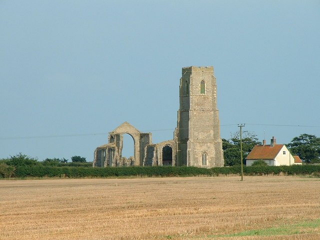
St Andrew's Church, Covehithe
St Andrew's Church is a partly redundant Anglican church in the hamlet of Covehithe in the English county of Suffolk. It is recorded in the National Heritage List for England as a designated Grade I listed building, Part of the church is in ruins and this is under the care of the Churches Conservation Trust. The church stands on a lane leading directly towards the sea, in an area of coast which has suffered significant ongoing erosion. The parish of Covehithe has been combined with neighbouring Benacre. History The oldest fabric in the original large medieval church dates from the 14th century, although most of it is from the 15th century. During the Civil War much of the stained glass was destroyed by the local iconoclast William Dowsing. By the later part of that century the large church was too expensive for the parishioners to maintain, and they were given permission in 1672 to remove the roof and to build a much smaller church within it. This small ch ... [...More Info...] [...Related Items...] OR: [Wikipedia] [Google] [Baidu] |
South Cove, Suffolk
South Cove is a civil parish in the east of the English county of Suffolk. It is north of the coastal town of Southwold and south of the village of Wrentham in the East Suffolk district. Neighbouring parishes include Covehithe, Frostenden and Reydon as well as Wrentham.South Cove . Retrieved 2023-03-25. The village lies to the east of the main , on the B1127 road between Wrentham and Southwold, [...More Info...] [...Related Items...] OR: [Wikipedia] [Google] [Baidu] |
Benacre, Suffolk
Benacre is a village and civil parish in the East Suffolk district of the English county of Suffolk. The village is located about south of Lowestoft and north-east of Wrentham, between the main A12 road and the North Sea coast. Neighbouring villages include Kessingland and Covehithe with the town of Southwold to the south. The village is dispersed around Benacre Hall, the estate of the Gooch family. It had a population of around 70 in mid-2008.''A profile of Waveney'', Waveney District Council, February 2011. Retrieved 2011-04-18. The population declined dramatically during the 20th century from 216 at the 1901 census.Benacre CP: Historical statistics – population Vision of Britain. Retrieved 2011-05-07. The area ... [...More Info...] [...Related Items...] OR: [Wikipedia] [Google] [Baidu] |
Suffolk Coast & Heaths
The Suffolk Coast and Heaths AONB is an Area of Outstanding Natural Beauty in Suffolk and Essex, England. The AONB covers ancient woodland, commercial forestry, the estuaries of the Alde, Blyth, Deben, Orwell and Stour rivers, farmland, salt marsh, heathland, mudflats, reed beds, small towns and villages, shingle beaches and low eroding cliffs along 60 miles of coastline. Features include the coastal towns of Aldeburgh and Southwold, Bawdsey, Covehithe, Dunwich, Minsmere, Orford, Orford Ness, Sizewell, Thorpeness, Walberswick and the RSPB Minsmere Reserve. There are three National Nature Reserves in the area and many Sites of Special Scientific Interest. Three long-distance footpaths pass through the AONB: the Suffolk Coast Path, the Sandlings Walk and the Stour and Orwell Walk. In July 2020 the AONB was extended by around 38 square kilometres to cover land north of Brantham, and an area around Mistley and Wrabness in Essex Essex () is a county in the East of Engl ... [...More Info...] [...Related Items...] OR: [Wikipedia] [Google] [Baidu] |
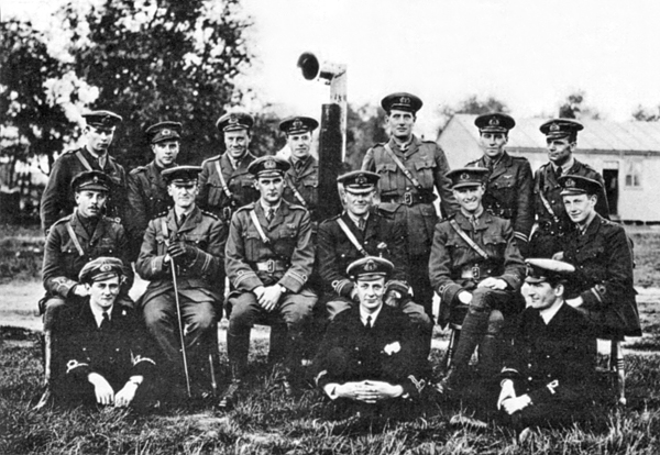
Royal Naval Air Service
The Royal Naval Air Service (RNAS) was the air arm of the Royal Navy, under the direction of the Admiralty's Air Department, and existed formally from 1 July 1914 to 1 April 1918, when it was merged with the British Army's Royal Flying Corps to form the Royal Air Force (RAF), the world's first independent air force. It was replaced by the Fleet Air Arm, initially consisting of those RAF units that normally operated from ships, but emerging as a separate unit similar to the original RNAS by the time of World War 2. Background In 1908, the British Government recognised the military potential of aircraft. The Prime Minister of the United Kingdom, Prime Minister, H. H. Asquith, approved the formation of an "Advisory Committee for Aeronautics" and an "Aerial Sub-Committee of the Committee of Imperial Defence". Both committees were composed of politicians, British Army, army officers and Royal Navy officers. On 21 July 1908 Captain Reginald Bacon, who was a member of the Aerial Na ... [...More Info...] [...Related Items...] OR: [Wikipedia] [Google] [Baidu] |
AONB
An Area of Outstanding Natural Beauty (AONB; , AHNE) is an area of countryside in England, Wales, and Northern Ireland, that has been designated for conservation due to its significant landscape value. Areas are designated in recognition of their national importance by the relevant public body: Natural England, Natural Resources Wales, and the Northern Ireland Environment Agency respectively. In place of AONB, Scotland uses the similar national scenic area (NSA) designation. Areas of Outstanding Natural Beauty enjoy levels of protection from development similar to those of UK national parks, but unlike national parks the responsible bodies do not have their own planning powers. They also differ from national parks in their more limited opportunities for extensive outdoor recreation. History The idea for what would eventually become the AONB designation was first put forward by John Dower in his 1945 ''Report to the Government on National Parks in England and Wales''. Dower ... [...More Info...] [...Related Items...] OR: [Wikipedia] [Google] [Baidu] |
Dunwich
Dunwich is a village and civil parish in Suffolk, England. It is in the Suffolk Coast and Heaths AONB around north-east of London, south of Southwold and north of Leiston, on the North Sea coast. In the Anglo-Saxon period, Dunwich was the capital of the Kingdom of the East Angles, but the harbour and most of the town have since disappeared due to coastal erosion. At its height it was an international port similar in size to 14th-century London. Its decline began in 1286 when a storm surge hit the East Anglian coast, followed by a great storm in 1287 and another great storm, also in 1287, until it eventually shrank to the village it is today. Dunwich is possibly connected with the lost Anglo-Saxon placename ''Dommoc''. The population of the civil parish at the 2001 census was 84, [...More Info...] [...Related Items...] OR: [Wikipedia] [Google] [Baidu] |
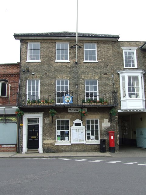
Southwold
Southwold is a seaside town and civil parish on the English North Sea coast in the East Suffolk district of Suffolk. It lies at the mouth of the River Blyth within the Suffolk Coast and Heaths Area of Outstanding Natural Beauty. The town is about south of Lowestoft, north-east of Ipswich and north-east of London, within the parliamentary constituency of Suffolk Coastal. The "All Usual Residents" 2011 Census figure gives a total of 1,098 persons for the town. The 2012 Housing Report by the Southwold and Reydon Society concluded that 49 per cent of the dwellings are used as second homes or let to holiday-makers. History Southwold was mentioned in ''Domesday Book'' (1086) as a fishing port, and after the "capricious River Blyth withdrew from Dunwich in 1328, bringing trade to Southwold in the 15th century", it received its town charter from Henry VII in 1489. The grant of the charter is marked by the annual Trinity Fair, when it is read out by the Town Clerk. Over following ... [...More Info...] [...Related Items...] OR: [Wikipedia] [Google] [Baidu] |
Coastal Erosion
Coastal erosion is the loss or displacement of land, or the long-term removal of sediment and rocks along the coastline due to the action of waves, currents, tides, wind-driven water, waterborne ice, or other impacts of storms. The landward retreat of the shoreline can be measured and described over a temporal scale of tides, seasons, and other short-term cyclic processes. Coastal erosion may be caused by hydraulic action, abrasion, impact and corrosion by wind and water, and other forces, natural or unnatural. On non-rocky coasts, coastal erosion results in rock formations in areas where the coastline contains rock layers or fracture zones with varying resistance to erosion. Softer areas become eroded much faster than harder ones, which typically result in landforms such as tunnels, bridges, columns, and pillars. Over time the coast generally evens out. The softer areas fill up with sediment eroded from hard areas, and rock formations are eroded away. Also erosion commonly ... [...More Info...] [...Related Items...] OR: [Wikipedia] [Google] [Baidu] |
William De Warenne, 1st Earl Of Surrey
William de Warenne, 1st Earl of Surrey, Lord of Lewes, Seigneur de Varennes (died 1088), was a Norman nobleman created Earl of Surrey under William II Rufus. He is among the few known from documents to have fought under William the Conqueror at the Battle of Hastings in 1066. At the time of the Domesday Survey in 1086, he held extensive lands in 13 counties, including the Rape of Lewes, a tract now divided between the ceremonial counties of East Sussex and West Sussex. Early career William was a son of Rodulf or Ralph de Warenne and Emma, and reported to have descended from a sibling of Duchess Gunnor, wife of Duke Richard I. Chronicler Robert of Torigny reported, in his additions to the ''Gesta Normannorum Ducum'' of William of Jumièges, that William de Warenne and Anglo-Norman baron Roger de Mortimer were both sons of an unnamed niece of Gunnor. Unfortunately, Robert's genealogies are somewhat confused – elsewhere he gives Roger as the son of William, and yet again makes bo ... [...More Info...] [...Related Items...] OR: [Wikipedia] [Google] [Baidu] |
St Andrews Covehithe - Geograph
ST, St, or St. may refer to: Arts and entertainment * Stanza, in poetry * Suicidal Tendencies, an American heavy metal/hardcore punk band * Star Trek, a science-fiction media franchise * Summa Theologica, a compendium of Catholic philosophy and theology by St. Thomas Aquinas * St or St., abbreviation of "State", especially in the name of a college or university Businesses and organizations Transportation * Germania (airline) (IATA airline designator ST) * Maharashtra State Road Transport Corporation, abbreviated as State Transport * Sound Transit, Central Puget Sound Regional Transit Authority, Washington state, US * Springfield Terminal Railway (Vermont) (railroad reporting mark ST) * Suffolk County Transit, or Suffolk Transit, the bus system serving Suffolk County, New York Other businesses and organizations * Statstjänstemannaförbundet, or Swedish Union of Civil Servants, a trade union * The Secret Team, an alleged covert alliance between the CIA and American industry ... [...More Info...] [...Related Items...] OR: [Wikipedia] [Google] [Baidu] |
Peter Ditchfield
Rev. Peter Hempson Ditchfield, FSA (1854–1930) was a Church of England priest, an historian and a prolific author. He is notable for having co-edited three Berkshire volumes of the ''Victoria County History'' which were published between 1907 and 1924. Life Ditchfield was born in Westhoughton, Lancashire in 1854. He was schooled at the Clitheroe Royal Grammar School and studied at Oriel College, Oxford. He was ordained deacon in 1878 and priest in 1879. Ditchfield served his title as curate of St Michael's parish church, Sandhurst until 1880, followed by a second curacy at Christ Church, Reading, Berkshire. Ditchfield was appointed Rector of Barkham in 1886: a post that he held until his death. From 1886 until 1903 Ditchfield was Inspector of Schools for the Diocese of Oxford. In 1898 Ditchfield married the daughter of Charles Smith of Ravenswood, Berkshire. Ditchfield was an historian and a prolific author. He also co-edited with W.H. Page three Berkshire volumes of t ... [...More Info...] [...Related Items...] OR: [Wikipedia] [Google] [Baidu] |


