|
Suffolk Coast , a coastal county on Long Island
{{Place name disambiguation ...
Suffolk Coast may refer to: United Kingdom The coast of Suffolk, a county of England * Suffolk Coast National Nature Reserve, a wetland * Suffolk Coast Path, a footpath * Suffolk Coastal (UK Parliament constituency), * Suffolk Coastal, a local government district which existed between 1974 and 2019 * Suffolk Coast and Heaths, an Area of Outstanding Natural Beauty United States * Suffolk County, New York Suffolk County () is the easternmost county in the U.S. state of New York. It is mainly located on the eastern end of Long Island, but also includes several smaller islands. According to the 2020 United States census, the county's populatio ... [...More Info...] [...Related Items...] OR: [Wikipedia] [Google] [Baidu] |
Suffolk Coast National Nature Reserve
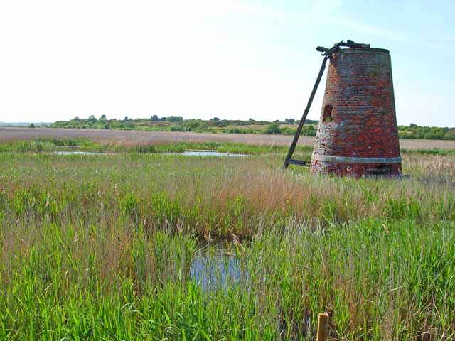
Suffolk Coast National Nature Reserve is a wildlife reserve on the North Sea coast of the English county of Suffolk. It is located around the village of Walberswick to the south of the town of Southwold. The reserve was designated in 2003, combining the existing Walberswick National Nature Reserve with reserves at Dingle Marshes and Hen Reedbeds to create a reserve.Suffolk Coast NNR ''Natural England''. Retrieved 2012-10-31.National nature reserve to be unveiled ''East Anglian Daily Times'', 2003-06-11. Retrieved 2012-10-31. The reserve is managed by |
Suffolk Coast Path
The Suffolk Coast Path is a long-distance footpath along the Suffolk Heritage Coast in England. It is long. Previously known as the Suffolk Coast and Heaths Path after the Suffolk Coast and Heaths Area of Outstanding Natural Beauty through which it runs, the path has been rebranded with new waymarkers bearing the new namehttps://www.flickr.com/photos/omcoc/3237114905/] The path runs along river and sea walls, across marsh, heath, foreshore and cliffs. It starts at Felixstowe and ends at Lowestoft , via Bawdsey, Snape Maltings, Aldeburgh, North Warren, Thorpeness, Minsmere, Dunwich, Southwold and Kessingland. It connects with the Sandlings Walk and (via the Stour and Orwell Walk) with the Essex Way and the Stour Valley Path. Much of W. G. Sebald's novel The Rings of Saturn describes a walking tour that roughly follows the Suffolk Coast Path. See also *Long-distance footpaths in the UK There are hundreds of long-distance footpaths in the United Kingdom designated i ... [...More Info...] [...Related Items...] OR: [Wikipedia] [Google] [Baidu] |
Suffolk Coastal (UK Parliament Constituency)
Suffolk Coastal (sometimes known as Coastal Suffolk) is a parliamentary constituency in the county of Suffolk, England which has been represented in the House of Commons of the UK Parliament since 2010 by Thérèse Coffey, a Conservative Member of Parliament. She is formerly the Deputy Prime Minister of the United Kingdom and the Health Secretary. The constituency is in the far East of England, and borders the North Sea. History This East Anglian constituency was created for the 1983 general election from eastern parts of the abolished county constituencies of Eye, and Sudbury and Woodbridge, including the towns of Felixstowe and Woodbridge. Its initial boundaries were coterminous with the recently created District of Suffolk Coastal. The current constituency area includes three former borough constituencies which sent their own MPs to Parliament until abolished as 'rotten boroughs' by the Great Reform Act, 1832 – Aldeburgh, Dunwich and Orford. The seat was held f ... [...More Info...] [...Related Items...] OR: [Wikipedia] [Google] [Baidu] |
Suffolk Coastal
Suffolk Coastal was a local government district in Suffolk, England. Its council was based in Melton, having moved from neighbouring Woodbridge in 2017. Other towns include Felixstowe, Framlingham, Leiston, Aldeburgh, and Saxmundham. The district was formed on 1 April 1974, under the Local Government Act 1972, as a merger of the municipal borough of Aldeburgh, along with Felixstowe, Leiston-cum-Sizewell, Saxmundham and Woodbridge urban districts, and Blyth Rural District and Deben Rural District. The population of the district was 124,298 at the 2011 Census. Suffolk Coastal district was merged with Waveney district on 1 April 2019 to form the new East Suffolk district. Election results There were new ward boundaries in 2003 and 2015. Wards represented Below is a list of wards with the number of councillors they returned in the relevant periods. There were 118 civil parish In England, a civil parish is a type of administrative parish used for local government ... [...More Info...] [...Related Items...] OR: [Wikipedia] [Google] [Baidu] |
Suffolk Coast And Heaths
The Suffolk Coast and Heaths AONB is an Area of Outstanding Natural Beauty in Suffolk and Essex, England. The AONB covers ancient woodland, commercial forestry, the estuaries of the Alde, Blyth, Deben, Orwell and Stour rivers, farmland, salt marsh, heathland, mudflats, reed beds, small towns and villages, shingle beaches and low eroding cliffs along 60 miles of coastline. Features include the coastal towns of Aldeburgh and Southwold, Bawdsey, Covehithe, Dunwich, Minsmere, Orford, Orford Ness, Sizewell, Thorpeness, Walberswick and the RSPB Minsmere Reserve. There are three National Nature Reserves in the area and many Sites of Special Scientific Interest. Three long-distance footpaths pass through the AONB: the Suffolk Coast Path, the Sandlings Walk and the Stour and Orwell Walk. In July 2020 the AONB was extended by around 38 square kilometres to cover land north of Brantham, and an area around Mistley and Wrabness in Essex Essex () is a county in the East of Eng ... [...More Info...] [...Related Items...] OR: [Wikipedia] [Google] [Baidu] |
