|
Couverden Island
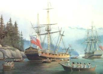
Couverden Island is a small island located at the western entrance of Lynn Canal in Alaska. The first European to see it was Joseph Whidbey in 1794, master of the ''Discovery'' during George Vancouver's 1792-1794 exploration of the Pacific Northwest. The south point of the island was named by Vancouver ''Point Couverden'', "which I called after the seat of my ancestors".The small city of Coevorden in the eastern Netherlands ) , anthem = ( en, "William of Nassau") , image_map = , map_caption = , subdivision_type = Sovereign state , subdivision_name = Kingdom of the Netherlands , established_title = Before independence , established_date = Spanish Netherl .... The name was apparently later transferred to the island. The island is located in Haines Borough in southeastern Alaska. References External links Map of Couverden Island Islands of the Alexander Archipelago Islands of Haines Borough, Alaska Islands of Alaska {{HainesAK-geo-stub ... [...More Info...] [...Related Items...] OR: [Wikipedia] [Google] [Baidu] |
Lynn Canal
Lynn Canal is an inlet (not an artificial canal) into the mainland of southeast Alaska. Lynn Canal runs about from the inlets of the Chilkat River south to Chatham Strait and Stephens Passage. At over in depth, Lynn Canal is the deepest fjord in North America (outside Greenland) and one of the deepest and longest in the world. The northern portion of the canal braids into the respective Chilkat, Chilkoot, and Taiya Inlets. Lynn Canal was explored by Joseph Whidbey in 1794 and named by George Vancouver for his birthplace, King's Lynn, Norfolk, England. Lynn Canal was frequently visited by maritime fur traders from at least 1800. The '' Atahualpa'' visited in 1801 and its log mentions an earlier trading visit by an unidentified ship. In April 1811 the American maritime fur trader Samuel Hill Samuel Hill (13 May 1857 – 26 February 1931), usually known as Sam Hill, was an American businessman, lawyer, railroad executive, and advocate of good roads. He su ... [...More Info...] [...Related Items...] OR: [Wikipedia] [Google] [Baidu] |
Europe
Europe is a large peninsula conventionally considered a continent in its own right because of its great physical size and the weight of its history and traditions. Europe is also considered a Continent#Subcontinents, subcontinent of Eurasia and it is located entirely in the Northern Hemisphere and mostly in the Eastern Hemisphere. Comprising the westernmost peninsulas of Eurasia, it shares the continental landmass of Afro-Eurasia with both Africa and Asia. It is bordered by the Arctic Ocean to the north, the Atlantic Ocean to the west, the Mediterranean Sea to the south and Asia to the east. Europe is commonly considered to be Boundaries between the continents of Earth#Asia and Europe, separated from Asia by the drainage divide, watershed of the Ural Mountains, the Ural (river), Ural River, the Caspian Sea, the Greater Caucasus, the Black Sea and the waterways of the Turkish Straits. "Europe" (pp. 68–69); "Asia" (pp. 90–91): "A commonly accepted division between Asia and E ... [...More Info...] [...Related Items...] OR: [Wikipedia] [Google] [Baidu] |
Joseph Whidbey
Joseph Whidbey Fellow of the Royal Society, FRS (1757 – 9 October 1833) was a member of the Royal Navy who served on the Vancouver Expedition 1791–95, and later achieved renown as a naval engineer. He is notable for having been the first European to discover and chart Admiralty Island in the Alexander Archipelago in 1794. Little is recorded of Whidbey's life before his warranting as a sailing master in 1779. After years of service during the War of American Independence, he received a peacetime appointment to , where with then-Lieutenant George Vancouver, he conducted a detailed survey of Port Royal. ''Europa'' Ship decommissioning, paid off, but Whidbey soon gained a berth, along with Vancouver, in the newly built . During the Nootka Crisis, both men were transferred to , but returned to ''Discovery'' and departed for the northwest coast of America. In 1792, Whidbey accompanied Lieutenant Peter Puget in small boats to explore what was later named Puget Sound. On 2 June, t ... [...More Info...] [...Related Items...] OR: [Wikipedia] [Google] [Baidu] |
HMS Discovery (1789)
HMS ''Discovery'' was a Royal Navy ship launched in 1789 and best known as the lead ship in George Vancouver's exploration of the west coast of North America in his famous 1791-1795 expedition. She was converted to a bomb vessel in 1798 and participated in the Battle of Copenhagen. Thereafter she served as a hospital ship and later as a convict ship until 1831. She was broken up in 1834. Early years ''Discovery'' was launched in 1789 and purchased for the Navy in 1790. She was named after the previous HMS ''Discovery'', one of the ships on James Cook's third voyage to the Pacific Ocean. The earlier ''Discovery'' was the ship on which Vancouver had served as a midshipman. ''Discovery'' was a full-rigged ship with a standard crew complement of 100 including a widow's man. She had been designed and built for a voyage of exploration to the Southern whale fisheries. ''Discovery''s first captain was Henry Roberts, with Vancouver as his first lieutenant. But when the Noo ... [...More Info...] [...Related Items...] OR: [Wikipedia] [Google] [Baidu] |
George Vancouver
Captain George Vancouver (22 June 1757 – 10 May 1798) was a British Royal Navy officer best known for his 1791–1795 expedition, which explored and charted North America's northwestern Pacific Coast regions, including the coasts of what are now the Canadian province of British Columbia as well as the US states of Alaska, Washington and Oregon. He also explored the Hawaiian Islands and the southwest coast of Australia. Vancouver Island, the city of Vancouver in British Columbia, Vancouver, Washington in the United States, Mount Vancouver on the Canadian–US border between Yukon and Alaska, and New Zealand's fourth-highest mountain, also Mount Vancouver, are all named after him. Early life George Vancouver was born in the seaport town of King's Lynn (Norfolk, England) on 22 June 1757 - the sixth and youngest child of John Jasper Vancouver, a Dutch-born deputy collector of customs, and Bridget Berners. He came from an old respected family. The surname Vancouver comes ... [...More Info...] [...Related Items...] OR: [Wikipedia] [Google] [Baidu] |
Coevorden
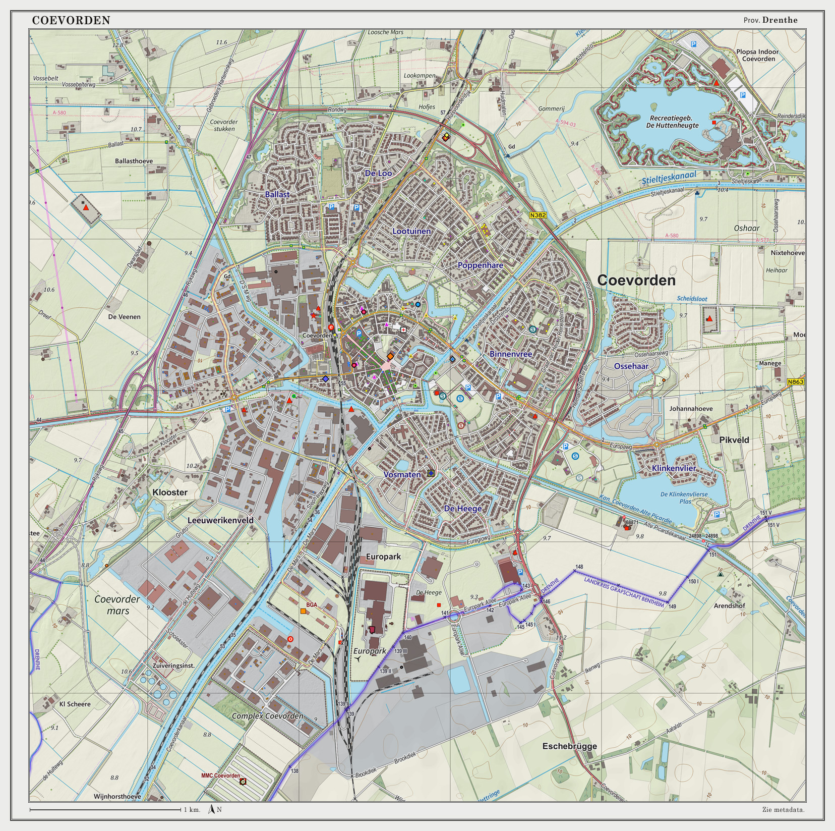
Coevorden (; nds-nl, Koevern) is a city and municipality in the province of Drenthe, Netherlands. During the 1998 municipal reorganisation in the province, Coevorden merged with Dalen, Sleen, Oosterhesselen and Zweeloo, retaining its name. In August 2017, it had a population of 35,267. Etymology The name ''Coevorden'' means "cow ford(s)" or "cow crossing", similar to ''Bosporus'' or ''Oxford''. History Coevorden received city rights in 1408. It is the oldest city in the province of Drenthe. The city was captured from the Spanish in 1592 by a Dutch and English force under the command of Maurice, Prince of Orange. The following year it was besieged by a Spanish force but the city held out until its relief in May 1594. Coevorden was then reconstructed in the early seventeenth century to an ''ideal city'' design, similar to Palmanova. The streets were laid out in a radial pattern within polygonal fortifications and extensive outer earthworks. The city of Coevorden indir ... [...More Info...] [...Related Items...] OR: [Wikipedia] [Google] [Baidu] |
Netherlands
) , anthem = ( en, "William of Nassau") , image_map = , map_caption = , subdivision_type = Sovereign state , subdivision_name = Kingdom of the Netherlands , established_title = Before independence , established_date = Spanish Netherlands , established_title2 = Act of Abjuration , established_date2 = 26 July 1581 , established_title3 = Peace of Münster , established_date3 = 30 January 1648 , established_title4 = Kingdom established , established_date4 = 16 March 1815 , established_title5 = Liberation Day (Netherlands), Liberation Day , established_date5 = 5 May 1945 , established_title6 = Charter for the Kingdom of the Netherlands, Kingdom Charter , established_date6 = 15 December 1954 , established_title7 = Dissolution of the Netherlands Antilles, Caribbean reorganisation , established_date7 = 10 October 2010 , official_languages = Dutch language, Dutch , languages_type = Regional languages , languages_sub = yes , languages = , languages2_type = Reco ... [...More Info...] [...Related Items...] OR: [Wikipedia] [Google] [Baidu] |
Haines Borough, Alaska
Haines Borough is a home rule, home-rule Borough (United States), borough located in the U.S. state, state of Alaska. As of the 2020 United States census, 2020 census, the population was 2,080, down from 2,508 in 2010. Geography The borough has a total area of , of which is land and (14.9%) is water. Adjacent boroughs and census areas * Municipality of Skagway Borough, Alaska – northeast * Juneau City and Borough, Alaska – southeast * Hoonah-Angoon Census Area, Alaska – south, west * Stikine Region, British Columbia – northwest, east National protected area * Tongass National Forest (part) ** Endicott River Wilderness Demographics At the 2000 United States Census, 2000 census there were 2,392 people, 991 households, and 654 families living in the borough. The population density was 0.88 people per square mile (0,34/km2). There were 1,419 housing units at an average density of 0.52 per square mile (0,20/km2). The Race and ethnicity in the United States Censu ... [...More Info...] [...Related Items...] OR: [Wikipedia] [Google] [Baidu] |
Islands Of The Alexander Archipelago
An island (or isle) is an isolated piece of habitat that is surrounded by a dramatically different habitat, such as water. Very small islands such as emergent land features on atolls can be called islets, skerries, cays or keys. An island in a river or a lake island may be called an eyot or ait, and a small island off the coast may be called a holm. Sedimentary islands in the Ganges delta are called chars. A grouping of geographically or geologically related islands, such as the Philippines, is referred to as an archipelago. There are two main types of islands in the sea: continental and oceanic. There are also artificial islands, which are man-made. Etymology The word ''island'' derives from Middle English ''iland'', from Old English ''igland'' (from ''ig'' or ''ieg'', similarly meaning 'island' when used independently, and -land carrying its contemporary meaning; cf. Dutch ''eiland'' ("island"), German ''Eiland'' ("small island")). However, the spelling of the word ... [...More Info...] [...Related Items...] OR: [Wikipedia] [Google] [Baidu] |
Islands Of Haines Borough, Alaska
An island (or isle) is an isolated piece of habitat that is surrounded by a dramatically different habitat, such as water. Very small islands such as emergent land features on atolls can be called islets, skerries, cays or keys. An island in a river or a lake island may be called an eyot or ait, and a small island off the coast may be called a holm. Sedimentary islands in the Ganges delta are called chars. A grouping of geographically or geologically related islands, such as the Philippines, is referred to as an archipelago. There are two main types of islands in the sea: continental and oceanic. There are also artificial islands, which are man-made. Etymology The word ''island'' derives from Middle English ''iland'', from Old English ''igland'' (from ''ig'' or ''ieg'', similarly meaning 'island' when used independently, and -land carrying its contemporary meaning; cf. Dutch ''eiland'' ("island"), German ''Eiland'' ("small island")). However, the spelling of the word w ... [...More Info...] [...Related Items...] OR: [Wikipedia] [Google] [Baidu] |


