|
Cooston, Oregon
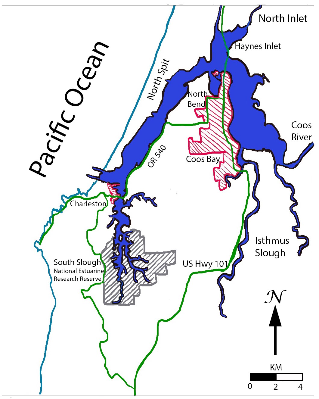
Cooston is an unincorporated community in Coos County, Oregon, United States. It is located on the east shore of Coos Bay across from North Bend, about eight miles from the city of Coos Bay. The origin of the name Cooston is the same of that of Coos County, after the Coos people. Cooston post office was established in 1908 and closed in 1939. The post office was named by town founder William E. Homme, who was also the first postmaster. Homme's father was the founder of Wittenberg, Wisconsin. The post office was in Homme's store. Before moving to Cooston, Homme published the ''Glendale News'' in Glendale Glendale is the anglicised version of the Gaelic Gleann Dail, which means ''valley of fertile, low-lying arable land''. It may refer to: Places Australia * Glendale, New South Wales ** Stockland Glendale, a shopping centre *Glendale, Queensland, .... References Unincorporated communities in Coos County, Oregon 1908 establishments in Oregon Populated places establ ... [...More Info...] [...Related Items...] OR: [Wikipedia] [Google] [Baidu] |
Unincorporated Area
An unincorporated area is a region that is not governed by a local municipal corporation. Widespread unincorporated communities and areas are a distinguishing feature of the United States and Canada. Most other countries of the world either have no unincorporated areas at all or these are very rare: typically remote, outlying, sparsely populated or List of uninhabited regions, uninhabited areas. By country Argentina In Argentina, the provinces of Chubut Province, Chubut, Córdoba Province (Argentina), Córdoba, Entre Ríos Province, Entre Ríos, Formosa Province, Formosa, Neuquén Province, Neuquén, Río Negro Province, Río Negro, San Luis Province, San Luis, Santa Cruz Province, Argentina, Santa Cruz, Santiago del Estero Province, Santiago del Estero, Tierra del Fuego Province, Argentina, Tierra del Fuego, and Tucumán Province, Tucumán have areas that are outside any municipality or commune. Australia Unlike many other countries, Australia has only local government in Aus ... [...More Info...] [...Related Items...] OR: [Wikipedia] [Google] [Baidu] |
Coos County, Oregon
Coos County ( ) is one of the 36 counties in the U.S. state of Oregon. As of the 2020 census, the population was 64,929. The county seat is Coquille. The county was formed from the western parts of Umpqua and Jackson counties. It is named after a tribe of Native Americans who live in the region. Coos County comprises the Coos Bay, OR Micropolitan Statistical Area. History The name Coos originated from the name of the Native American tribe that had settled the area. "Coos" loosely translates to "lake" or "place of pines". Lewis and Clark noted Cook-koo-oose. Early maps and documents spelled it Kowes, Cowes, Coose, Koos, among others. Although exploration and trapping in the area occurred as early as 1828, the first European-American settlement was established at Empire City in 1853 by members of the Coos Bay Company; this is now part of Coos Bay, Oregon. Coos County was created by the Territorial Legislature from parts of Umpqua, and Jackson counties on December 22, 1 ... [...More Info...] [...Related Items...] OR: [Wikipedia] [Google] [Baidu] |
Oregon
Oregon () is a U.S. state, state in the Pacific Northwest region of the Western United States. The Columbia River delineates much of Oregon's northern boundary with Washington (state), Washington, while the Snake River delineates much of its eastern boundary with Idaho. The 42nd parallel north, 42° north parallel delineates the southern boundary with California and Nevada. Oregon has been home to many Indigenous peoples of the Americas, indigenous nations for thousands of years. The first European traders, explorers, and settlers began exploring what is now Oregon's Pacific coast in the early-mid 16th century. As early as 1564, the Spanish expeditions to the Pacific Northwest, Spanish began sending vessels northeast from the Philippines, riding the Kuroshio Current in a sweeping circular route across the northern part of the Pacific. In 1592, Juan de Fuca undertook detailed mapping and studies of ocean currents in the Pacific Northwest, including the Oregon coast as well as ... [...More Info...] [...Related Items...] OR: [Wikipedia] [Google] [Baidu] |
Coos Bay
Coos Bay is an estuary where the Coos River enters the Pacific Ocean, the estuary is approximately 12 miles long and up to two miles wide. It is the largest estuary completely within Oregon state lines. The Coos Bay watershed covers an area of about 600 square miles and is located in northern Coos County, Oregon in the United States. The Coos River, which begins in the Oregon Coast Range, enters the bay from the east. From Coos River, the bay forms a sharp loop northward before arching back to the south and out to the Pacific Ocean. Haynes Inlet enters the top of this loop. South Slough branches off from the bay directly before its entrance into the Pacific Ocean. The bay was formed when sea levels rose over 20,000 years ago at the end of the Last Glacial Maximum, flooding the mouth of the Coos River. Coos Bay is Oregon's most important coastal industrial center and international shipping port, with close ties to San Francisco, the Columbia River, Puget Sound and other major po ... [...More Info...] [...Related Items...] OR: [Wikipedia] [Google] [Baidu] |
North Bend, Oregon
North Bend is a city in Coos County, Oregon, United States with a population of 9,695 as of the 2010 census."Incorporated Cities: North Bend" Oregon Blue Book (website). Accessed May 2010. North Bend is surrounded on three sides by , an S-shaped water inlet and where the Coos River enters Coos Bay and borders the city of to the south. North Bend became an incorporated city in 1903. ...
|
Coos Bay, Oregon
Coos Bay ( Coos language: Atsixiis) is a city located in Coos County, Oregon, United States, where the Coos River enters Coos Bay on the Pacific Ocean. The city borders the city of North Bend, and together they are often referred to as one entity called either Coos Bay-North Bend or Oregon's Bay Area. Coos Bay's population as of the 2020 census was 15,985 residents, making it the most populous city on the Oregon Coast. Oregon's Bay Area is estimated to be home to 32,308 (Coos Bay Census County Division). History Prior to Europeans first visiting the Oregon coast, Native American tribes claimed the Coos Bay region as their homeland for thousands of years."Bay Area History" [...More Info...] [...Related Items...] OR: [Wikipedia] [Google] [Baidu] |
DeLorme
DeLorme is the producer of personal satellite tracking, messaging, and navigation technology. The company’s main product, ''inReach'', integrates GPS and satellite technologies. ''inReach'' provides the ability to send and receive text messages anywhere in the world (including when beyond cell phone range) by using the Iridium satellite constellation. By pairing with a smart phone, navigation is possible with access to free downloadable topographic maps and NOAA charts. On February 11, 2016, the company announced that it had been purchased by Garmin, a multinational producer of GPS products and services.Garmin® Signs Purchase Agreement to Acquire DeLorme® 11 February 2016 DeLorme also produces printed atlas and topographic software prod ... [...More Info...] [...Related Items...] OR: [Wikipedia] [Google] [Baidu] |
Yarmouth, Maine
Yarmouth is a town in Cumberland County, Maine, United States, twelve miles north of the state's largest city, Portland. When originally settled in 1636, as North Yarmouth, it was part of Massachusetts, and remained as such for 213 years. In 1849, twenty-nine years after Maine's admittance to the Union as the twenty-third state, it was incorporated as the Town of Yarmouth. Yarmouth is part of the Portland– South Portland-Biddeford Metropolitan Statistical Area. The town's population was 8,990 in the 2020 census. The town's proximity to the Atlantic Ocean, and its location on the banks of the Royal River (formerly ''Yarmouth River''), which empties into Casco Bay less than one mile away, means it is a prime location as a harbor. Ships were built in Yarmouth's harbor mainly between 1818 and the 1870s, at which point demand declined dramatically. Meanwhile, the Royal River's four waterfalls within Yarmouth, whose Main Street sits about above sea level, resulted in the foun ... [...More Info...] [...Related Items...] OR: [Wikipedia] [Google] [Baidu] |
Coos People
Coos people are an indigenous people of the Northwest Plateau, living in Oregon. They live on the southwest Oregon Pacific coast. Today, Coos people are enrolled in the following federally recognized tribes: * Confederated Tribes of the Coos, Lower Umpqua and Siuslaw Indians of Oregon * Confederated Tribes of Siletz Indians of Oregon * Coquille Indian Tribe. Language The Coos language is dormant. It belongs to the Coosan language family, and is divided into two dialects: Hanis language and Miluk language. The Confederated Tribes of Coos, Lower Umpqua and Siuslaw has a language program to revitalize the language. History Their neighbors were Siuslauan, Kalapuyan, and the Umpqua Indians. The total population of Hanis and Miluk Coos in 1780 has been estimated to be around 2,000. On February 8, 1806 the Coos people were first mentioned by Euro-Americans. William Clark, wintering at Fort Clatsop near the Columbia with Meriwether Lewis and the Corp of Discovery, reported the ... [...More Info...] [...Related Items...] OR: [Wikipedia] [Google] [Baidu] |
Wittenberg, Wisconsin
Wittenberg is a village in Shawano County, Wisconsin, United States. The population was 1,081 at the 2010 census. The village is located within the Town of Wittenberg. History In 1886, the Wittenberg Indian School was established by the Norwegian Evangelical Church of America after a purchase of land in Winnebago traditional territory. This was a residential school for Native American children who the government removed from their families as part of an effort to assimilate Native Americans into white American culture. It was also known as the Bethany Indian Mission. Initial attempts to recruit students for the school were met with resistance, particularly from Winnebago "medicine men" who the missionaries believed were concerned about their intention to convert the children to Christianity. The school initially only taught a few children but eventually expanded to include over a hundred students who came from the Winnebago, Oneida, Stockbridge, Brothertown, Menominee, M ... [...More Info...] [...Related Items...] OR: [Wikipedia] [Google] [Baidu] |
Glendale, Oregon
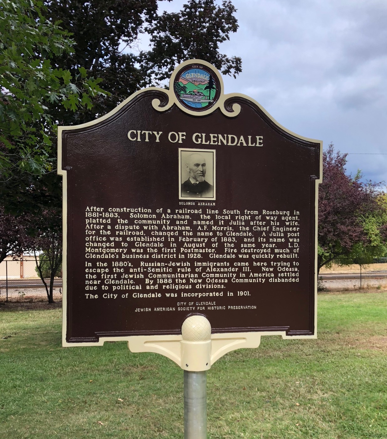
Glendale is a city in Douglas County, Oregon, United States. The population was 874 at the 2010 census. History After construction of a railroad line south from Roseburg in 1881–83, Solomon Abraham, the local right-of-way agent, platted the community and named it "Julia" after his wife. After a dispute with Abraham, A. F. Morris, the chief engineer for the railroad, changed the name to "Glendale". A Julia post office was established in February 1883, and its name was changed to Glendale in August of the same year. L. D. Montgomery was the first postmaster. Fire destroyed much of Glendale's business district in 1928. Glendale was quickly rebuilt. In the 1880s, Russian-Jewish immigrants came here trying to escape the anti-Semitic rule of Alexander III. New Odessa, the first Jewish Communitarian Community in America settled near Glendale. By 1888 the New Odessa Community disbanded due to political and religious division. Glendale was incorporated in 1901. Geography Accord ... [...More Info...] [...Related Items...] OR: [Wikipedia] [Google] [Baidu] |
Unincorporated Communities In Coos County, Oregon
Unincorporated may refer to: * Unincorporated area, land not governed by a local municipality * Unincorporated entity, a type of organization * Unincorporated territories of the United States, territories under U.S. jurisdiction, to which Congress has determined that only select parts of the U.S. Constitution apply * Unincorporated association Unincorporated associations are one vehicle for people to cooperate towards a common goal. The range of possible unincorporated associations is nearly limitless, but typical examples are: :* An amateur football team who agree to hire a pitch onc ..., also known as voluntary association, groups organized to accomplish a purpose * ''Unincorporated'' (album), a 2001 album by Earl Harvin Trio {{disambig ... [...More Info...] [...Related Items...] OR: [Wikipedia] [Google] [Baidu] |


.jpg)


_(cooD0088).jpg)


