|
Connecticut Route 182
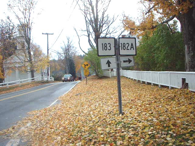
Route 182 is a rural state highway in northwestern Connecticut, running from Norfolk to Colebrook. Route description Route 182 begins at an intersection with US 44 in the town center of Norfolk and heads east towards the town of Colebrook. It crosses into Colebrook later, continuing east another to end at an intersection with Route 183 south of Colebrook center. Route 182A is a short loop route that goes through the town center. Route 182 is known as Colebrook Road in Norfolk, and as Stillman Hill Road in Colebrook. History In the 1920s, The Norfolk-Colebrook route was designated as a secondary state highway known as Highway 327. In 1932, old Highway 327 was renumbered to Route 182, which originally ran along the current route of Route 182A near Colebrook center. In 1940, the route was rerouted to the current location and the former alignment redesignated Route 182A. Junction list Route 182A Route 182A is a alternate route of Route 182 within Colebrook, including a ... [...More Info...] [...Related Items...] OR: [Wikipedia] [Google] [Baidu] |
Norfolk, Connecticut
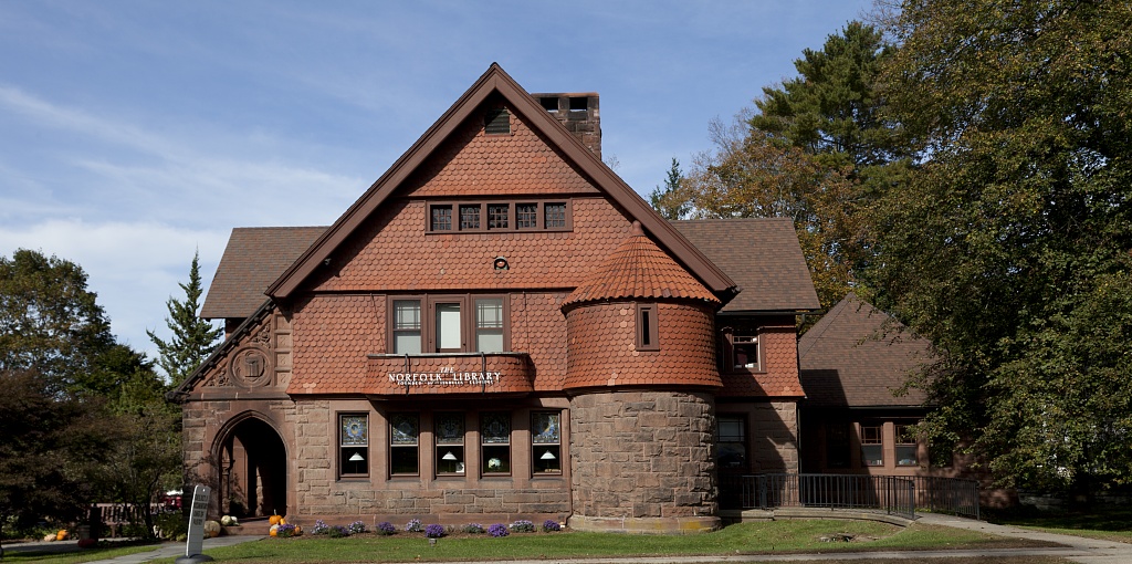
Norfolk () is a town in Litchfield County, Connecticut, United States. The population was 1,588 at the 2020 census. The urban center of the town is the Norfolk census-designated place, with a population of 553 at the 2010 census. Norfolk is perhaps best known as the site of the Yale Summer School of Music— Norfolk Chamber Music Festival, which hosts an annual chamber music concert series in "the Music Shed", a performance hall located on the Ellen Battell Stoeckel estate to the west of the village green. Norfolk has important examples of regional architecture, notably the Village Hall (now Infinity Hall, a shingled 1880s Arts-and-Crafts confection, with an opera house upstairs and storefronts at street level); the Norfolk Library (a shingle-style structure, designed by George Keller, /1889); and over thirty buildings, in a wide variety of styles, designed by Alfredo S. G. Taylor (of the New York firm Taylor & Levi) in the four decades before the Second World War. History ... [...More Info...] [...Related Items...] OR: [Wikipedia] [Google] [Baidu] |
Colebrook, Connecticut
Colebrook is a town in Litchfield County, Connecticut, United States. The population was 1,361 at the 2020 census. Colebrook was named after Colebrooke in the English county of Devon; the reason is now unknown. Geography Colebrook is in northeastern Litchfield County and is bounded to the east by Hartford County, Connecticut, and to the north by Berkshire and Hampden County in Massachusetts. According to the United States Census Bureau, the town has a total area of , of which are land and , or 4.23%, are water. Colebrook River Lake and West Branch Reservoir, both on the West Branch of the Farmington River, are in the northeast part of the town. Algonquin State Forest is in the central part of the town. Colebrook is north of Torrington and northwest of Hartford, the state capitol. Principal communities *Colebrook center *North Colebrook *Robertsville Demographics As of the census of 2000, there were 1,471 people, 566 households, and 419 families residing in the town. ... [...More Info...] [...Related Items...] OR: [Wikipedia] [Google] [Baidu] |
Litchfield County, Connecticut
Litchfield County is in northwestern Connecticut. As of the 2020 census, the population was 185,186. The county was named after Lichfield, in England. Litchfield County has the lowest population density of any county in Connecticut and is the state's largest county by area. Litchfield County comprises the Torrington, CT Micropolitan Statistical Area, which is included in the New York–Newark, NY– NJ–CT– PA Combined Statistical Area. As is the case with the other seven Connecticut counties, there is no county government and no county seat. Each town is responsible for all local services such as schools, snow removal, sewers, and fire and police departments. However, in some cases in rural areas, adjoining towns may agree to jointly provide services or even establish a regional school system. History Litchfield County was created on October 9, 1751, by an act of the Connecticut General Court from land belonging to Fairfield, New Haven, and Hartford counties. The ac ... [...More Info...] [...Related Items...] OR: [Wikipedia] [Google] [Baidu] |
State Highway
A state highway, state road, or state route (and the equivalent provincial highway, provincial road, or provincial route) is usually a road that is either ''numbered'' or ''maintained'' by a sub-national state or province. A road numbered by a state or province falls below numbered national highways (Canada being a notable exception to this rule) in the hierarchy (route numbers are used to aid navigation, and may or may not indicate ownership or maintenance). Roads maintained by a state or province include both nationally numbered highways and un-numbered state highways. Depending on the state, "state highway" may be used for one meaning and "state road" or "state route" for the other. In some countries such as New Zealand, the word "state" is used in its sense of a sovereign state or country. By this meaning a state highway is a road maintained and numbered by the national government rather than local authorities. Countries Australia Australia's State Route system covers u ... [...More Info...] [...Related Items...] OR: [Wikipedia] [Google] [Baidu] |
Connecticut
Connecticut () is the southernmost state in the New England region of the Northeastern United States. It is bordered by Rhode Island to the east, Massachusetts to the north, New York to the west, and Long Island Sound to the south. Its capital is Hartford and its most populous city is Bridgeport. Historically the state is part of New England as well as the tri-state area with New York and New Jersey. The state is named for the Connecticut River which approximately bisects the state. The word "Connecticut" is derived from various anglicized spellings of "Quinnetuket”, a Mohegan-Pequot word for "long tidal river". Connecticut's first European settlers were Dutchmen who established a small, short-lived settlement called House of Hope in Hartford at the confluence of the Park and Connecticut Rivers. Half of Connecticut was initially claimed by the Dutch colony New Netherland, which included much of the land between the Connecticut and Delaware Rivers, although the firs ... [...More Info...] [...Related Items...] OR: [Wikipedia] [Google] [Baidu] |
Connecticut Route 183
Route 183 is a state highway in northwestern Connecticut, running from Torrington to the Massachusetts state line in Norfolk. Route description Route 183 begins at the junction with Route 4 (New Harwinton Road) in the Litchfield County city of Torrington. A two-lane road through the eastern reaches of Torrington, Route 183 runs north along Torringford Street as a residential road, passing nearby Joe Ruwet Park. The route soon reaches a junction with U.S. Route 202 (US 202; named East Main Street) in the Torringford section of the city. Running northeast past Bishop Donnelly Park, the route passes the nearby middle school and enters a rural section of the town of Torrington. Route 183 starts paralleling Route 8, a nearby freeway, which is connected via Pinewoods Road. The route runs past the Green Woods Country Club, which separates Route 183 and Route 8. Entering the town of Winchester, Route 183 winds northwest into a jun ... [...More Info...] [...Related Items...] OR: [Wikipedia] [Google] [Baidu] |
Sandisfield, Massachusetts
Sandisfield is a town in Berkshire County, Massachusetts, United States. It is part of the Pittsfield, Massachusetts Metropolitan Statistical Area. The population was 989 at the 2020 census. History Sandisfield was first settled in 1750 as Housatonic Township Number 4, and was officially incorporated in 1762. It was most likely named to honor Lord Sandys, a British colonial official—pronounced "Sands". The town was mostly an agricultural setting in the earliest times, with rye fields and orchards filling the land. Sawmills grew up along the rivers, but most industry failed in the late nineteenth century, when a planned railway along the Farmington River fell through. Significant numbers of Ukrainian farmers moved in during the late nineteenth century, many of them running chicken farms. ''The Record'' was published from 1981 to 1985 and ''The Newsletter'' for a decade during the 1990s. The volunteer-run ''Sandisfield Times'' has been published 11 times a year since 2009. To ... [...More Info...] [...Related Items...] OR: [Wikipedia] [Google] [Baidu] |
State Highways In Connecticut
State may refer to: Arts, entertainment, and media Literature * ''State Magazine'', a monthly magazine published by the U.S. Department of State * ''The State'' (newspaper), a daily newspaper in Columbia, South Carolina, United States * ''Our State'', a monthly magazine published in North Carolina and formerly called ''The State'' * The State (Larry Niven), a fictional future government in three novels by Larry Niven Music Groups and labels * States Records, an American record label * The State (band), Australian band previously known as the Cutters Albums * ''State'' (album), a 2013 album by Todd Rundgren * ''States'' (album), a 2013 album by the Paper Kites * ''States'', a 1991 album by Klinik * ''The State'' (album), a 1999 album by Nickelback Television * ''The State'' (American TV series), 1993 * ''The State'' (British TV series), 2017 Other * The State (comedy troupe), an American comedy troupe Law and politics * State (polity), a centralized political organizatio ... [...More Info...] [...Related Items...] OR: [Wikipedia] [Google] [Baidu] |


