|
Confederation Bridge
The Confederation Bridge (french: Pont de la Confédération) is a box girder bridge carrying the Trans-Canada Highway across the Abegweit Passage of the Northumberland Strait, linking the province of Prince Edward Island with the province of New Brunswick on the mainland. Opened May 31, 1997, the bridge is Canada's longest bridge and the world's longest bridge over ice-covered water. Construction took place from October 1993 to May 1997 and cost C$1.3 billion. Before its official naming, Prince Edward Islanders often referred to the bridge as the "Fixed Link". It officially opened to traffic on May 31, 1997. In April 2022, the PEI legislature voted unanimously in favour of renaming the bridge to "Epekwitk Crossing", whereas Epekwitk ( ) is the traditional Mi'kmaq name for Prince Edward Island. The name change would need to be approved by the Canadian federal government in order to take effect. Structure The bridge is a two-lane toll bridge that carries the Trans-Canada ... [...More Info...] [...Related Items...] OR: [Wikipedia] [Google] [Baidu] |
New Brunswick Route 16
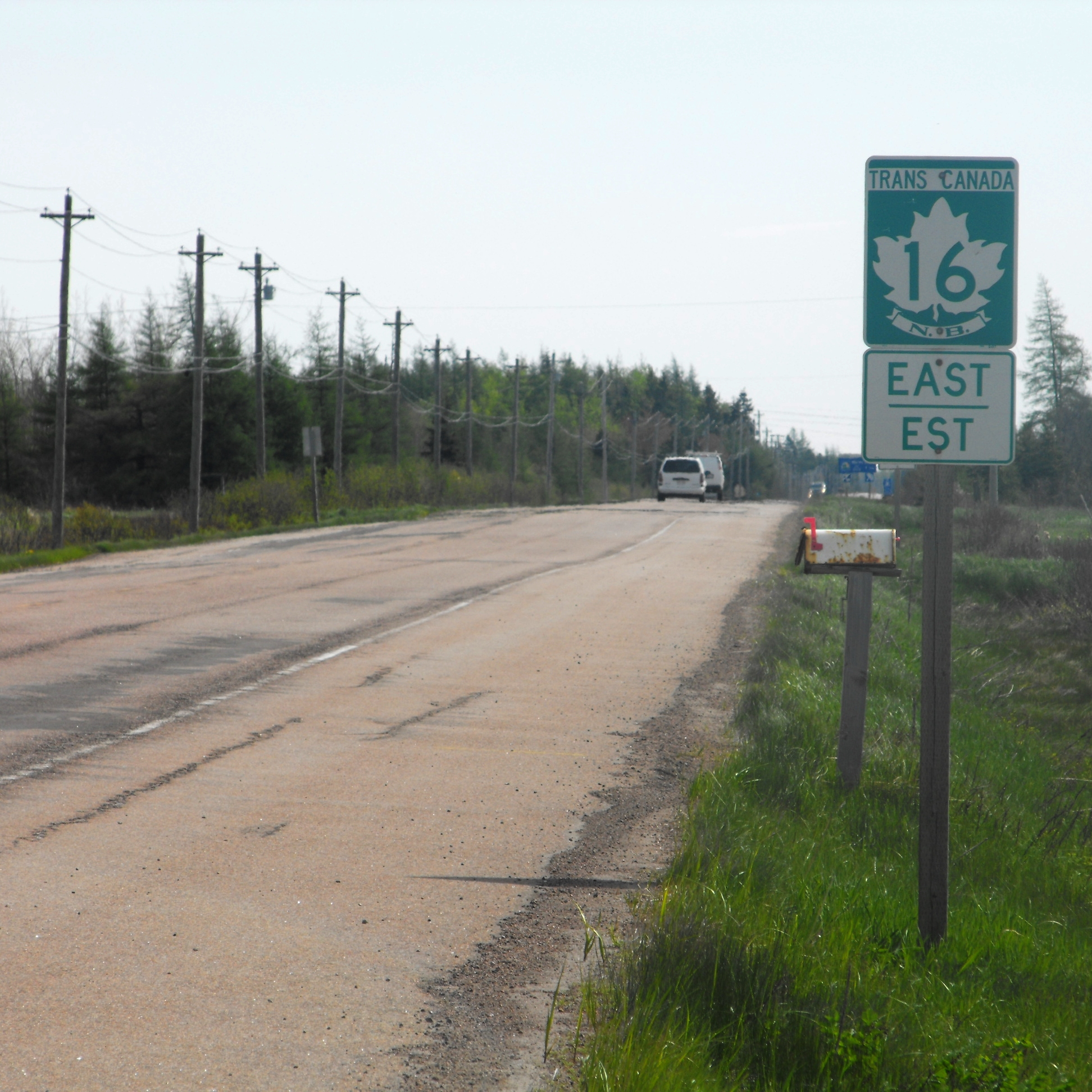
__NOTOC__ Route 16 is a 2-lane highway in the Canadian province of New Brunswick. The route begins at a T intersection with Aulac Road at Aulac and ends at the western abutment of the Confederation Bridge at Cape Jourimain. It functions as a secondary leg of the Trans-Canada Highway to connect Prince Edward Island with the mainline Trans-Canada Highway Route 2 in Aulac. Route 16 is the last section of the Trans-Canada in New Brunswick that is not 4-lanes with no plans in the near future to be 4 lanes. The highway number "16" is also the number given to the branch of the Trans-Canada, the Yellowhead Highway in Western Canada. However, the numeric designation is strictly coincidental, and Route 16 is not part of that route. Route description Route 16 begins in Aulac at a T intersection with the Aulac Road; this road having been the original alignment of Route 2 until a 4-lane alignment opened in the early 1990s. Approximately east of Aulac Road, Route 16 interchanges with Rou ... [...More Info...] [...Related Items...] OR: [Wikipedia] [Google] [Baidu] |
Air Draft
Air draft (or air draught) is the distance from the surface of the water to the highest point on a vessel. This is similar to the " deep draft" of a vessel which is measured from the surface of the water to the deepest part of the hull below the surface, but air draft is expressed as a height, not a depth. Clearance below The vessel's " clearance" is the distance in excess of the air draft which allows a vessel to pass safely under a bridge or obstacle such as power lines, etc. A bridge's "clearance below" is most often noted on charts as measured from the surface of the water to the under side of the bridge at the chart datum Mean High Water (MHW), a less restrictive clearance than Mean Higher High Water (MHHW). In 2014, the United States Coast Guard reported that 1.2% of the collisions it investigated in the recent past were due to vessels attempting to pass underneath structures with insufficient clearance. Examples The Bridge of the Americas in Panama limits which ... [...More Info...] [...Related Items...] OR: [Wikipedia] [Google] [Baidu] |
Cape Tormentine, New Brunswick
Cape Tormentine is a local service district in southeastern New Brunswick, Canada. It is located on the Northumberland Strait at the Abegweit Passage, the shortest crossing between Prince Edward Island and the mainland. It once flourished as a transportation hub between New Brunswick and Prince Edward Island but has been in decline since 1997 when the ferry service was closed due to the opening of the Confederation Bridge. At the Canada 2011 Census the population was 108, three quarters what it was at the 2006 census. Cape Tormentine is named for the eponymous cape. As an unincorporated community, it is part of the Bayfield local service district. For the purpose of Statistics Canada's census it is in Botsford Parish. Freight and passenger terminal timeline * 1827: the Northumberland Strait iceboat service, known as the Capes Route, begins operating across the strait to Cape Traverse, Prince Edward Island (PEI). * 1873: under the terms of PEI joining Confederation, the ... [...More Info...] [...Related Items...] OR: [Wikipedia] [Google] [Baidu] |
Ferry
A ferry is a ship, watercraft or amphibious vehicle used to carry passengers, and sometimes vehicles and cargo, across a body of water. A passenger ferry with many stops, such as in Venice, Italy, is sometimes called a water bus or water taxi. Ferries form a part of the public transport systems of many waterside cities and islands, allowing direct transit between points at a capital cost much lower than bridges or tunnels. Ship connections of much larger distances (such as over long distances in water bodies like the Mediterranean Sea) may also be called ferry services, and many carry vehicles. History In ancient times The profession of the ferryman is embodied in Greek mythology in Charon, the boatman who transported souls across the River Styx to the Underworld. Speculation that a pair of oxen propelled a ship having a water wheel can be found in 4th century Roman literature "''Anonymus De Rebus Bellicis''". Though impractical, there is no reason why it co ... [...More Info...] [...Related Items...] OR: [Wikipedia] [Google] [Baidu] |
Northumberland Strait Iceboat
A Northumberland Strait iceboat is a rowing boat, typically in length, in beam, with runners fastened to the hull for dragging over sea ice. Construction and use Constructed of wood, similar to fishing dories built in Atlantic Canada and New England, the iceboats were operated in the Northumberland Strait during the 19th century and early 20th century, running between Prince Edward Island and the mainland provinces of New Brunswick and Nova Scotia during the winter months between December and April when sea ice made passage by non-icebreaking steam ships impossible. They were also used during the winter months to connect Pictou Island with mainland Nova Scotia, sometimes in conjunction with passages from Prince Edward Island. History Throughout the 19th century, iceboats became an essential link to mainland North America for Prince Edward Island, transporting both mail and passengers. Passengers would sometimes assist the crew. In addition to pulling ropes attached to th ... [...More Info...] [...Related Items...] OR: [Wikipedia] [Google] [Baidu] |
Shediac
Shediac (official in both languages; ''Shédiac'' is colloquial French) is a heavily Acadian town in Westmorland County, New Brunswick. The town is home to the famous Parlee Beach and is known as the "Lobster Capital of the World". It hosts an annual festival every July which promotes its ties to lobster fishing. At the western entrance to the town is a 90-ton sculpture called '' The World's Largest Lobster''. It is believed that chiac, a well-known French accent, was named after Shediac. Etymology Shediac was originally called La Batture. Its name was later changed to Shediac in reference to its position at the basin of the Shediac River. The name "Shediac" itself is derived from the Micmac word ''Esedeiik'', which means "which comes from far away", possibly in reference to the Shediac Bay or the current of the Petitcodiac river. Geography Shediac is situated primarily on Route 133 around Shediac Bay, a sub-basin of the Northumberland Strait. Its topography is relat ... [...More Info...] [...Related Items...] OR: [Wikipedia] [Google] [Baidu] |
Summerside, Prince Edward Island
Summerside is a Canadian city in Prince County, Prince Edward Island. It is the second largest city in the province and the primary service centre for the western part of the island. History Summerside was officially incorporated as a town on April 1, 1877. On April 1, 1995, the Town of Summerside amalgamated with the incorporated communities of St. Eleanors and Wilmot. At the same time, the amalgamated Summerside annexed portions of the Community of Sherbrooke and the Lot 17 township. It was PEI's second incorporated city, after the provincial capital of Charlottetown. Summerside is named for an inn owned by George Linkletter II, called Summer Side House. Demographics In the 2021 Census of Population conducted by Statistics Canada, Summerside had a population of living in of its total private dwellings, a change of from its 2016 population of . With a land area of , it had a population density of in 2021. Economy The largest single employer within the city i ... [...More Info...] [...Related Items...] OR: [Wikipedia] [Google] [Baidu] |
Pictou
Pictou ( ; Canadian Gaelic: ''Baile Phiogto'') is a town in Pictou County, in the Canadian province of Nova Scotia. Located on the north shore of Pictou Harbour, the town is approximately 10 km (6 miles) north of the larger town of New Glasgow. Once an active shipping port and the shire town of the county, today Pictou is primarily a local service centre for surrounding rural communities and the primary tourist destination in this region of Nova Scotia. The name Pictou derives from the Mi'kmaq name , meaning "explosive place", a reference to the river of pitch that was found in the area, or perhaps from methane bubbling up from coal seams below the harbour. History Pictou Town had been the location of an annual Mi'kmaq summer coastal community prior to European settlement. Pictou was part of the Epekwitk aq Piktuk Mi'kmaq District, which included present-day Prince Edward Island and Pictou. Pictou Town was a receiving point for many Scottish immigrants moving to a ne ... [...More Info...] [...Related Items...] OR: [Wikipedia] [Google] [Baidu] |
Georgetown, Prince Edward Island
Georgetown is a community located within the municipality of Three Rivers in Kings County, Prince Edward Island, Canada. It is the Capital of Kings County. Previously incorporated as a town, it amalgamated with the town of Montague, the rural municipalities of Brudenell, Cardigan, Lorne Valley, Lower Montague, and Valleyfield, and portions of three adjacent unincorporated areas in 2018. History This area of eastern Prince Edward Island traces its history of human settlement to the Mi'kmaq Nation, which long inhabited the area. These people were referred to as ''Epegoitnag'' and for them, the region was an Acadian forest. It had wild game, as well as fruit, berries and wild nuts for gathering, and plentiful marine resources in the nearby rivers and Northumberland Strait. The land in this area was called ''Samkook'', which translates to 'the land of the sandy shore'. Georgetown lies opposite Brudenell Point, which divides the Brudenell River to the north from the Mont ... [...More Info...] [...Related Items...] OR: [Wikipedia] [Google] [Baidu] |
Charlottetown
Charlottetown is the capital and largest city of the Canadian province of Prince Edward Island, and the county seat of Queens County. Named after Queen Charlotte, Charlottetown was an unincorporated town until it was incorporated as a city in 1855. It was the site of the famous Charlottetown Conference in 1864, the first gathering of Canadian and Maritime statesmen to discuss the proposed Maritime Union. This conference led, instead, to the union of British North American colonies in 1867, which was the beginning of the Canadian confederation. PEI, however, did not join Confederation until 1873. From this, the city adopted as its motto ''Cunabula Foederis'', "Birthplace of Confederation". The population of Charlottetown is estimated to be 40,500 (2022); this forms the centre of a census agglomeration of 83,063 (2021), which is roughly half of the province's population (160,302). History Early history (1720–1900) The first European settlers in the area were French; ... [...More Info...] [...Related Items...] OR: [Wikipedia] [Google] [Baidu] |
Intercolonial Railway
The Intercolonial Railway of Canada , also referred to as the Intercolonial Railway (ICR), was a historic Canadian railway that operated from 1872 to 1918, when it became part of Canadian National Railway The Canadian National Railway Company (french: Compagnie des chemins de fer nationaux du Canada) is a Canadian Class I railroad, Class I freight railway headquartered in Montreal, Quebec, which serves Canada and the Midwestern United States, M ...s. As the railway was also completely owned and controlled by the Government of Canada, the Intercolonial was also one of Canada's first Crown corporations of Canada, Crown corporations. Origins The idea of a railway connecting Britain's North American colonies arose as soon as the railway age began in the 1830s. In the decades following the War of 1812 and ever-mindful of the issue of security, the colonies of Upper Canada, Upper and Lower Canada (later the Province of Canada after 1840) wished to improve land-based transportati ... [...More Info...] [...Related Items...] OR: [Wikipedia] [Google] [Baidu] |
Nova Scotia
Nova Scotia ( ; ; ) is one of the thirteen provinces and territories of Canada. It is one of the three Maritime provinces and one of the four Atlantic provinces. Nova Scotia is Latin for "New Scotland". Most of the population are native English-speakers, and the province's population is 969,383 according to the 2021 Census. It is the most populous of Canada's Atlantic provinces. It is the country's second-most densely populated province and second-smallest province by area, both after Prince Edward Island. Its area of includes Cape Breton Island and 3,800 other coastal islands. The Nova Scotia peninsula is connected to the rest of North America by the Isthmus of Chignecto, on which the province's land border with New Brunswick is located. The province borders the Bay of Fundy and Gulf of Maine to the west and the Atlantic Ocean to the south and east, and is separated from Prince Edward Island and the island of Newfoundland (island), Newfoundland by the Northumberland Stra ... [...More Info...] [...Related Items...] OR: [Wikipedia] [Google] [Baidu] |


.jpg)


