|
Comines-Warneton
Comines-Warneton (; nl, Komen-Waasten, ; pcd, Comène-Warneuton; vls, Koomn-Woastn; wa, Cômene-Varneton) is a city and municipality of Wallonia located in the province of Hainaut, Belgium. On January 1, 2006, it had a total population of 17,562. Its total area is which gives a population density of . The name "Comines" is believed to have a Celtic, or Gaulish, origin. Comines-Warneton is a municipality with language facilities for Dutch-speakers. The municipality consists of the following districts: Bas-Warneton, Comines, Houthem, Ploegsteert, and Warneton (including the hamlet of Gheer). They were all transferred in 1963 from the arrondissement of Ypres in the Dutch-speaking province of West Flanders to the newly created arrondissement of Mouscron in French-speaking Hainaut. The five municipalities (Comines, Houthem, Ploegsteert, Bas-Warneton, Warneton) were merged into a single Comines-Warneton municipality in 1977. Since then, the municipality forms an exclave of ... [...More Info...] [...Related Items...] OR: [Wikipedia] [Google] [Baidu] |
Heuvelland
Heuvelland () is a Municipalities of Belgium, municipality located in the Belgium, Belgian province of West Flanders. The municipality comprises the villages of Dranouter, Kemmel, De Klijte, Loker, Nieuwkerke, Westouter, Wijtschate and Wulvergem. Heuvelland is a thinly populated rural municipality, located between the small urban centres of Ypres and Poperinge and the metropolitan area of Kortrijk-Lille along the European route 17, E17. On 1 January 2006 Heuvelland had a total population of 8,217. The total area is 94.24 km2 which gives a population density of 87 inhabitants per km2. The name ''heuvelland'' is Dutch language, Dutch meaning "hill country", as the municipality is characterized by the different hills on its territory. Geography Landscape The municipality is located in an area known as the West-Flemish Hills. The highest hill in Heuvelland is the Kemmelberg (156 m); followed by the Vidaigneberg (136 m), the Rodeberg (West Flanders), Rodeberg (129 m), the Scherpenbe ... [...More Info...] [...Related Items...] OR: [Wikipedia] [Google] [Baidu] |
Voeren
Voeren (; ) is a Flemish Dutch-speaking municipality with facilities for the French-speaking minority, located in the Belgian province of Limburg. Bordering the Netherlands to the north and the Wallonia region's Liège Province () to the south, it is geographically detached from the rest of Flanders, making Voeren an exclave of Flanders. Voeren's name is derived from that of a small right-bank tributary of the Meuse, the Voer, which flows through the municipality. The current municipality of Voeren was established by the municipal reform of 1977. On 1 January 2008, Voeren had a total population of 4,207. Its total area is , giving a population density of . About 25% of the population is made up of foreign nationals, most of whom have Dutch nationality. Villages The municipality consists of the six villages of 's-Gravenvoeren (french: Fouron-le-Comte), Sint-Pieters-Voeren (french: Fouron-Saint-Pierre), Sint-Martens-Voeren (french: Fouron-Saint-Martin), Moelingen (french: Mo ... [...More Info...] [...Related Items...] OR: [Wikipedia] [Google] [Baidu] |
Municipalities With Language Facilities
There are 27 municipalities with language facilities ( nl, faciliteitengemeenten; french: communes à facilités; german: Fazilitäten-Gemeinden) in Belgium which must offer linguistic services to residents in Dutch, French, or German in addition to their single official languages. All other municipalities – with the exception of those in the bilingual Brussels region – are unilingual and only offer services in their official languages, either Dutch or French. Belgian law stipulates that: *12 municipalities in Flanders must offer services in French; of these 12, six ( located around Brussels) are now believed to have become majority French-speaking. *Wallonia contains two language areas: **In the French-speaking part of Wallonia, four municipalities offer services in Dutch and another two offer services in German. **All municipalities in the German-speaking part of Wallonia ( annexed after WWI) offer services in French. *In Brussels, Dutch and French are co-official. *At ... [...More Info...] [...Related Items...] OR: [Wikipedia] [Google] [Baidu] |
Ploegsteert
Ploegsteert ( pcd, Ploster) is a village of Wallonia and a district of the municipality of Comines-Warneton, located in the province of Hainaut, Belgium. It is the most westerly settlement of Wallonia. It is approximately north of the French border. Created in 1850 on part of the territory of Warneton, it includes the hamlet of Le Bizet, which is the border with France (there is also a hamlet named "Le Bizet" in France). It is largely francophone, with facilities for Dutch speakers. In late 1914 and early 1915, the nearby Ploegsteert Wood was the site of fierce WWI fighting. Today there are numerous cemeteries and memorials, including the Hyde Park Corner (Royal Berks) CWGC Cemetery and the Berks CWGC Cemetery Extension with the Ploegsteert Memorial to the Missing, which commemorates more than 11,000 British and Empire servicemen who died outside the Ypres Salient and have no known grave. From January to May 1916, Winston Churchill served in the area as Commanding Officer ( ... [...More Info...] [...Related Items...] OR: [Wikipedia] [Google] [Baidu] |
Zonnebeke
Zonnebeke (; vls, Zunnebeke) is a municipality located in the Belgian province of West Flanders. The municipality comprises the villages of , , Passendale, Zandvoorde and Zonnebeke proper. On January 1, 2006, Zonnebeke had a total population of 11,758. The total area is 67.57 km2 which gives a population density of 174 inhabitants per km2. History The villages of Zonnebeke congregated around a large Augustinian abbey and its associated Benedictine convent in Nonnebosschen. Both were destroyed during the iconoclastic outbreak in 1580. Only the abbey was rebuilt, but was looted during the French occupation the abbey was confiscated. Passendale played a role in the Battle of Westrozebeke in 1382. Situated in the centre of the Ypres Salient, World War I destroyed the whole area. Left abandoned until the early 1920s, people slowly returned and rebuilt the villages. In 1932, the locals opened a cheese making facility, which to this day is the only source of Passendale chee ... [...More Info...] [...Related Items...] OR: [Wikipedia] [Google] [Baidu] |
Wolverton
Wolverton is a constituent town of Milton Keynes, England. It is located at the northern edge of Milton Keynes, beside the West Coast Main Line, the Grand Union Canal and the river Great Ouse. It is the administrative seat of Wolverton and Greenleys civil parish. It is one of the places in historic Buckinghamshire that went into the foundation of Milton Keynes in 1967. The village recorded in Domesday is known today as Old Wolverton but, because of peasant clearances in the early 17th century, only field markings remain of the medieval settlement. Modern Wolverton is a new settlement founded in the early 19th century as a railway town, with its centre relocated about to the south-east. History Old Wolverton The town name is an Old English language word, and means 'Wulfhere's settlement'. It was recorded in the Domesday Book of 1086 as ''Wluerintone''. The original Wolverton was a medieval settlement just north and west of today's town. This site is now known as Ol ... [...More Info...] [...Related Items...] OR: [Wikipedia] [Google] [Baidu] |
Le Gheer
Gheer is a hamlet of Wallonia in the municipality of Comines-Warneton, district of Warneton, located in the province of Hainaut, Belgium. The hamlet is situated on the Warneton - Ploegsteert road, approximately 15 km south of Ypres . The hamlet was completely destroyed in the First World War World War I (28 July 1914 11 November 1918), often abbreviated as WWI, was one of the deadliest global conflicts in history. Belligerents included much of Europe, the Russian Empire, the United States, and the Ottoman Empire, with fightin .... External links Le Gheer weather internet site [...More Info...] [...Related Items...] OR: [Wikipedia] [Google] [Baidu] |
Warneton, Belgium
Warneton ( nl, Waasten; pcd, Varnetån/Warneuton) is a village of Wallonia and a district of the municipality of Comines-Warneton, located in the province of Hainaut, Belgium. It was a municipality of its own until the 1977 merger of Belgian municipalities. It is immediately to the north of the French commune of Warneton, across the river Lys or Leie. The hamlet of Gheer is on its territory. Etymology * 1007 ''Uuarnasthun'' * 1065 ''Uuarnestun'' * 1104 ''Guarnestun'' * 1168 ''Warnestun'' Farm (Saxon ''thun'', Germanic ''*tûna'', "enclosure") of Warin, a Saxon and Frankish anthroponym (Saxon settlement set up in the Merovingian era). History Cut away from Ploegsteert in 1850, it was transferred from the province of West Flanders to the province of Hainaut, in 1963. Since that date its minority Dutch-speaking inhabitants have benefitted from language facilities There are 27 municipalities with language facilities ( nl, faciliteitengemeenten; french: communes à fa ... [...More Info...] [...Related Items...] OR: [Wikipedia] [Google] [Baidu] |
Hedge End
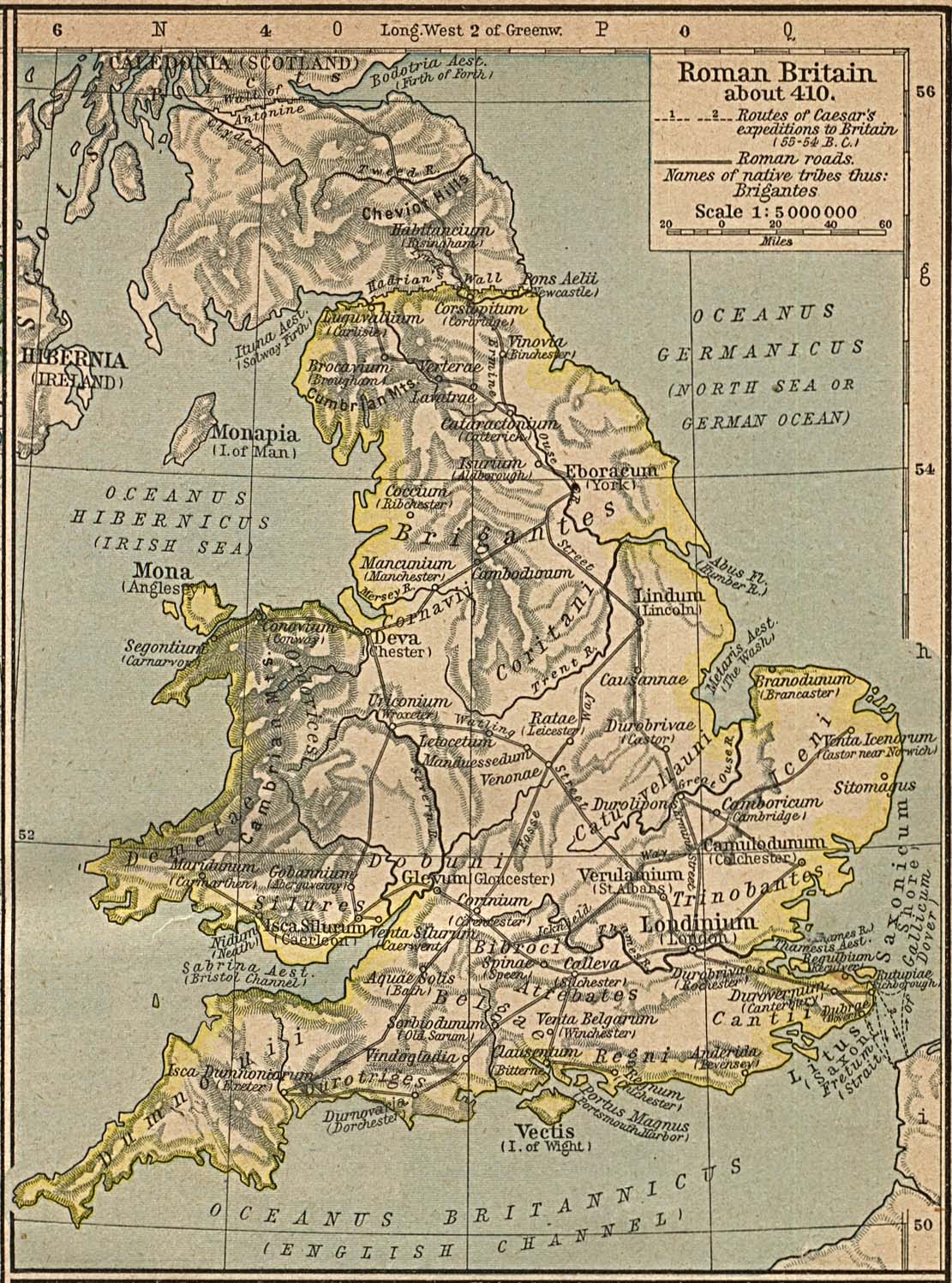
Hedge End is a town and civil parish in Hampshire, England. Situated to the east of the City of Southampton, it adjoins the districts of West End and Botley. Hedge End lies within the Borough of Eastleigh and is part of the Southampton Urban Area. The original hamlet developed on Botley Common after 1250 when it was granted to the men of Botley as common pasture. In 1267, royal charters allowed Botley to hold an annual fair and a weekly market on the common which eventually became a market town. History Origins The Belgae tribe inhabited the Hedge End area prior to the Roman conquest. A Roman road from Clausentum (a fortified harbour in what is now Bitterne, Southampton) passed through the area on route to Portus Adurni (Portchester Castle) and Noviomagus Reginorum (Chichester).The Changing Face of Hedge End. Joyce B Blyth The crossing of the River Itchen at Mansbridge and the crossing of the River Hamble at Botley date to AD932. The road that linked those two rive ... [...More Info...] [...Related Items...] OR: [Wikipedia] [Google] [Baidu] |
Johannes Despauterius
Jan de Spauter (Ninove, c. 1480 – Komen, 1520) was a prominent Flemish humanist. His name was Latinized to Johannes Despauterius as was common in the Middle Ages. Life At the age of 18 Despauterius went to the humanistic college ''De Lelie'' in Leuven where he studied for three years. In Leuven he became a Master of Arts: which meant he had studied and mastered Latin grammar, rhetorica, dialectica, musica, arithmica, geometrica and astronomica. After his studies he started teaching. Works After several years of teaching experience, Despauterius published books on Latin grammar (''Syntaxis'', ''Ars versificatoria'', ''Grammatica pars prima'' and ''Ortographia''). They became the standard works of reference for the study of Latin for the following centuries in Western Europe. Legacy At the end of the 17th century, James Kirkwood was asked what he thought of the Latin grammar of Despauter. He replied that if some defects were remedied, it could be made excellent. He ... [...More Info...] [...Related Items...] OR: [Wikipedia] [Google] [Baidu] |
Ypres
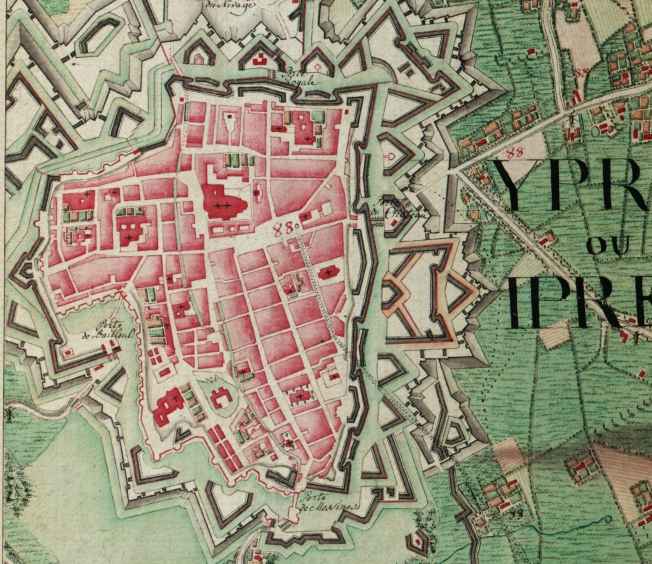
Ypres ( , ; nl, Ieper ; vls, Yper; german: Ypern ) is a Belgian city and municipality in the province of West Flanders. Though the Dutch name is the official one, the city's French name is most commonly used in English. The municipality comprises the city of Ypres/Ieper and the villages of Boezinge, Brielen, Dikkebus, Elverdinge, Hollebeke, Sint-Jan, Vlamertinge, Voormezele, Zillebeke, and Zuidschote. Together, they are home to about 34,900 inhabitants. During the First World War, Ypres (or "Wipers" as it was commonly known by the British troops) was the centre of the Battles of Ypres between German and Allied forces. History Origins before First World War Ypres is an ancient town, known to have been raided by the Romans in the first century BC. It is first mentioned by name in 1066 and is probably named after the river Ieperlee on the banks of which it was founded. During the Middle Ages, Ypres was a prosperous Flemish city with a population of 40,000 in 1200 A ... [...More Info...] [...Related Items...] OR: [Wikipedia] [Google] [Baidu] |
Wervik
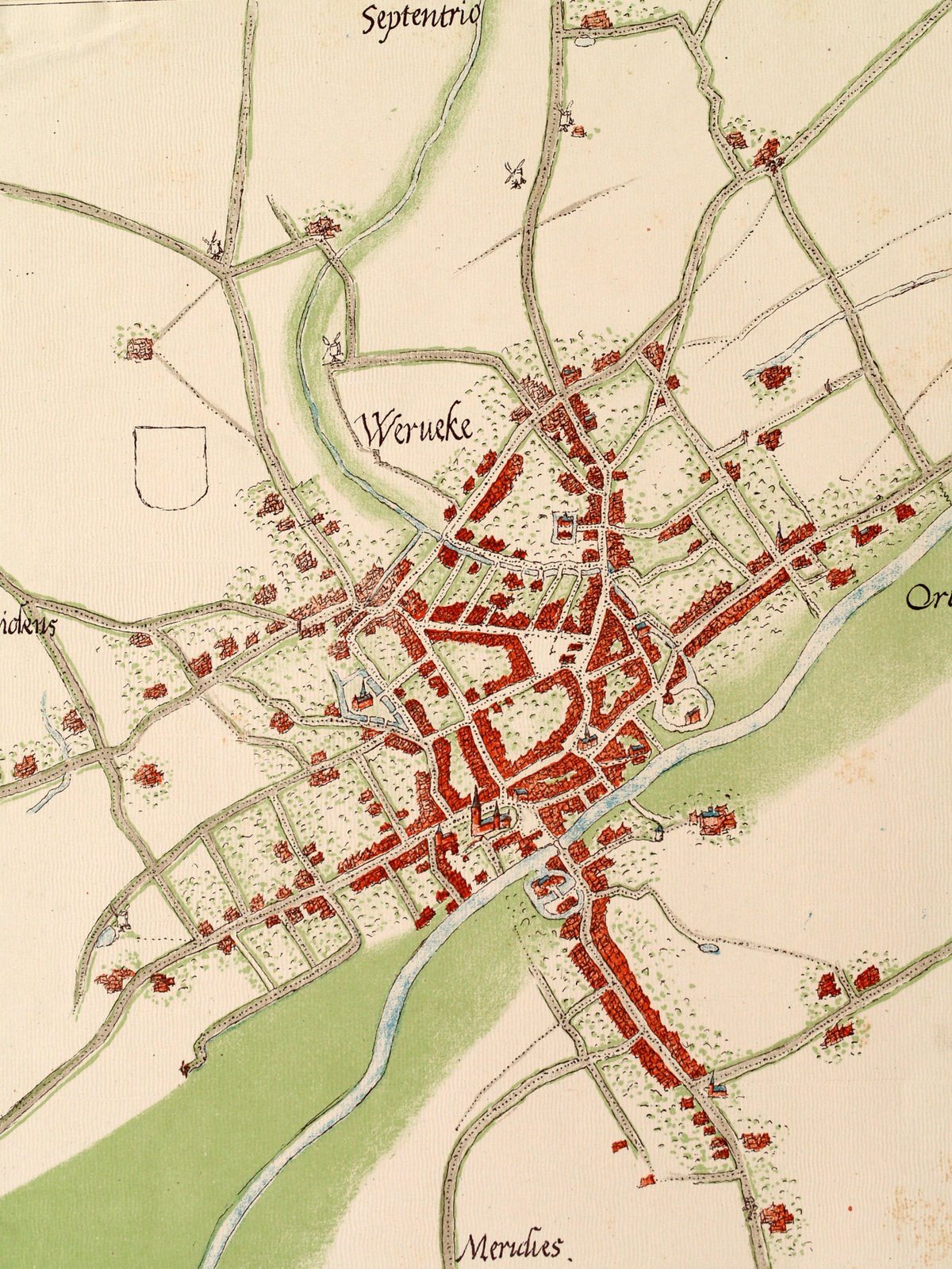
Wervik (; french: Wervicq, ; vls, Wervik; la, Viroviacum) is a city and municipality located in the Belgian province of West Flanders. The municipality comprises the city of Wervik and the town of Geluwe. On January 1, 2014, Wervik had a total population of 18,435. The total area is 43.61 km2 which gives a population density of 423 inhabitants per km2. The area is famous for its excellent tobacco and has a tobacco museum. The town is separated from its French counterpart Wervicq-Sud by the river Lys. History Wervik is one of the oldest towns in Belgium. Prehistory Stone Age artefacts, flint axes and spearheads, were found in the district of ''Bas-Flanders'' and the site ''Oosthove''. The archeological excavations at ''de Pioneer'' in 2009 yielded traces of inhabitation from the Iron Age to the Roman Period. Roman period Wervik was probably a settlement of the Menapians led by the chief Virovos, at a small height along the banks of the Lys (current Island Balokken). Thi ... [...More Info...] [...Related Items...] OR: [Wikipedia] [Google] [Baidu] |


