|
Come-to-Good
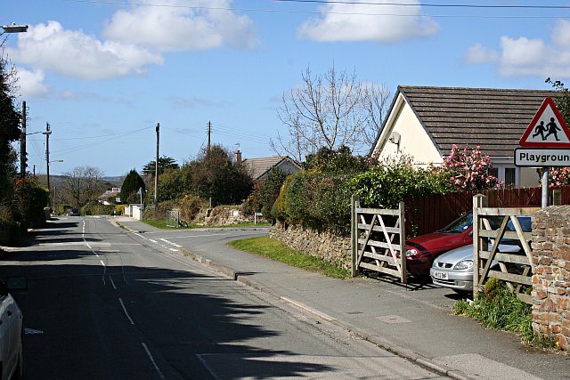
Come-to-Good is a small settlement in Cornwall, England, United Kingdom. It consists of a farm, seven residential houses and a Quaker Meeting House, built in 1710. It lies on the Tregye Road between Carnon Downs and King Harry Ferry.''Philip's Street Atlas Cornwall''. London: Philip's, 2003; p. 82 The boundary between Feock parish to the south and Kea parish to the north runs along the Tregye Road, south of the Meeting House and its burial ground and curves northward to the west, along the path of the stream and to the east, along the track to Penelewey. The Tregye Campus of Truro College is nearby. The name Patricia Griffith saysPatricia Griffith ''Early Quakers at Come-to-Good'' Come-to-Good Quaker Meeting (1995). "There has been much discussion about the origins of such a delightful name and for some time it was thought it derived from the supposed Cornish Cwm-ty-coit meaning "the coombe by the dwelling in the wood". However this derivation has never been felt to be total ... [...More Info...] [...Related Items...] OR: [Wikipedia] [Google] [Baidu] |
Friends Meeting House, Come-To-Good
The Friends Meeting House is a meeting house of the Society of Friends (Quakers), in the hamlet of Come-to-Good on the southern border of the parish of Kea, near Truro in Cornwall. It was also known as Kea Meeting House and Feock Meeting House. It is a simple thatched structure built of cobstone and whitewashed outside and in. It was completed in 1710 and is still in use today. History George Fox, the founder of the Religious Society of Friends, commonly known as the Quakers, came to Cornwall in 1656. He was arrested several times for blasphemy because his ideas were at odds with mainstream Christianity at the time. However people wanted to hear what he had to say and a group met regularly from 1680. They wanted a simple place in which to meet, and built a cob-and-thatch meeting house. The meeting house The meeting house is a Grade I Listed building In the United Kingdom, a listed building or listed structure is one that has been placed on one of the four statutory li ... [...More Info...] [...Related Items...] OR: [Wikipedia] [Google] [Baidu] |
Kea, Cornwall
Kea ( ; kw, Sen Ke) is a civil parish and village in Cornwall, England, United Kingdom. It is a '' "large straggling parish" '' GENUKI website; Kea; retrieved April 2010 in a former Mining in Cornwall, mining area south of . Kea village is situated just over one mile (1.6 km) southwest of Truro.Ordnance Survey: Landranger map sheet 204 ''Truro & Falmouth'' is situated two miles (3 km) to the east on the west bank of the [...More Info...] [...Related Items...] OR: [Wikipedia] [Google] [Baidu] |
Boxing The Compass
The points of the compass are a set of horizontal, radially arrayed compass directions (or azimuths) used in navigation and cartography. A compass rose is primarily composed of four cardinal directions—north, east, south, and west—each separated by 90 degrees, and secondarily divided by four ordinal (intercardinal) directions—northeast, southeast, southwest, and northwest—each located halfway between two cardinal directions. Some disciplines such as meteorology and navigation further divide the compass with additional azimuths. Within European tradition, a fully defined compass has 32 'points' (and any finer subdivisions are described in fractions of points). Compass points are valuable in that they allow a user to refer to a specific azimuth in a colloquial fashion, without having to compute or remember degrees. Designations The names of the compass point directions follow these rules: 8-wind compass rose * The four cardinal directions are north (N), east (E) ... [...More Info...] [...Related Items...] OR: [Wikipedia] [Google] [Baidu] |
Feock, Cornwall
Feock ( ; kw, Lannfyek) is a coastal civil parish and village in Cornwall, England, United Kingdom. It is about south of Truro at the head of Carrick Roads on the River Fal. To the south, the parish is bordered by Restronguet Creek and to the east by Carrick Roads and the River Fal. To the north it is bordered by Kea parish and to the west by Perranarworthal parish. Feock parish includes the villages of Carnon Downs, Chycoose, Devoran, Goon Piper, Harcourt, Killiganoon, Penelewey, Penpol, Porthgwidden, Restronguet Point, Trevilla, and Trelissick. The electoral ward is called Feock and Kea. At the 2011 census it had a population of 4,511 whereas the civil parish including Bissom has a population of 3,708 only. The garden of the Trelissick Estate is a National Trust property. The King Harry Ferry takes cars across the Fal to Philleigh and the Roseland Peninsula. Feock lies within the Cornwall Area of Outstanding Natural Beauty (AONB). Almost a third of Cornwall has AONB d ... [...More Info...] [...Related Items...] OR: [Wikipedia] [Google] [Baidu] |
Truro And Falmouth (UK Parliament Constituency)
Truro and Falmouth is a constituency that has been represented in the House of Commons of the UK Parliament since 2019 by Cherilyn Mackrory, a Conservative Party politician. The seat was held by Sarah Newton from 2010 to 2019. History The constituency was created for the 2010 general election following a review of parliamentary representation in Cornwall by the Boundary Commission, which increased the number of seats in the county from five to six. It replaces parts of the former Truro and St Austell and Falmouth and Camborne seats. ;Political history The result was a very marginal one in 2010, with the previous results in either predecessor seat also closely fought between the Liberal Democrats and the Conservatives. In the 2017 general election, the constituency was held by the Conservative, although the constituency experienced a 22.5% surge in the Labour vote (the third largest in the UK) - an 11.4% swing that nearly broke the Tories' seven-year hold on the seat. The 3 ... [...More Info...] [...Related Items...] OR: [Wikipedia] [Google] [Baidu] |
Cornwall
Cornwall (; kw, Kernow ) is a historic county and ceremonial county in South West England. It is recognised as one of the Celtic nations, and is the homeland of the Cornish people. Cornwall is bordered to the north and west by the Atlantic Ocean, to the south by the English Channel, and to the east by the county of Devon, with the River Tamar forming the border between them. Cornwall forms the westernmost part of the South West Peninsula of the island of Great Britain. The southwesternmost point is Land's End and the southernmost Lizard Point. Cornwall has a population of and an area of . The county has been administered since 2009 by the unitary authority, Cornwall Council. The ceremonial county of Cornwall also includes the Isles of Scilly, which are administered separately. The administrative centre of Cornwall is Truro, its only city. Cornwall was formerly a Brythonic kingdom and subsequently a royal duchy. It is the cultural and ethnic origin of the Cornish dias ... [...More Info...] [...Related Items...] OR: [Wikipedia] [Google] [Baidu] |
Hamlet (place)
A hamlet is a human settlement that is smaller than a town or village. Its size relative to a Parish (administrative division), parish can depend on the administration and region. A hamlet may be considered to be a smaller settlement or subdivision or satellite entity to a larger settlement. The word and concept of a hamlet has roots in the Anglo-Norman settlement of England, where the old French ' came to apply to small human settlements. Etymology The word comes from Anglo-Norman language, Anglo-Norman ', corresponding to Old French ', the diminutive of Old French ' meaning a little village. This, in turn, is a diminutive of Old French ', possibly borrowed from (West Germanic languages, West Germanic) Franconian languages. Compare with modern French ', Dutch language, Dutch ', Frisian languages, Frisian ', German ', Old English ' and Modern English ''home''. By country Afghanistan In Afghanistan, the counterpart of the hamlet is the Qila, qala (Dari language, Dari: ... [...More Info...] [...Related Items...] OR: [Wikipedia] [Google] [Baidu] |
Carnon Downs
Carnon Downs ( kw, Goon Karnen) is a village in Cornwall, England, United Kingdom. It is about three miles southwest of Truro Truro (; kw, Truru) is a City status in the United Kingdom, cathedral city and civil parishes in England, civil parish in Cornwall, England. It is Cornwall's county town, sole city and centre for administration, leisure and retail trading. Its ... on the A39 Truro to Falmouth road. Carnon Downs is in the civil parish of Feock (the population at the 2011 census included here) and consists mostly of bungalows and detached housing built in the latter half of the 20th century. References Villages in Cornwall {{Cornwall-geo-stub ... [...More Info...] [...Related Items...] OR: [Wikipedia] [Google] [Baidu] |
King Harry Ferry
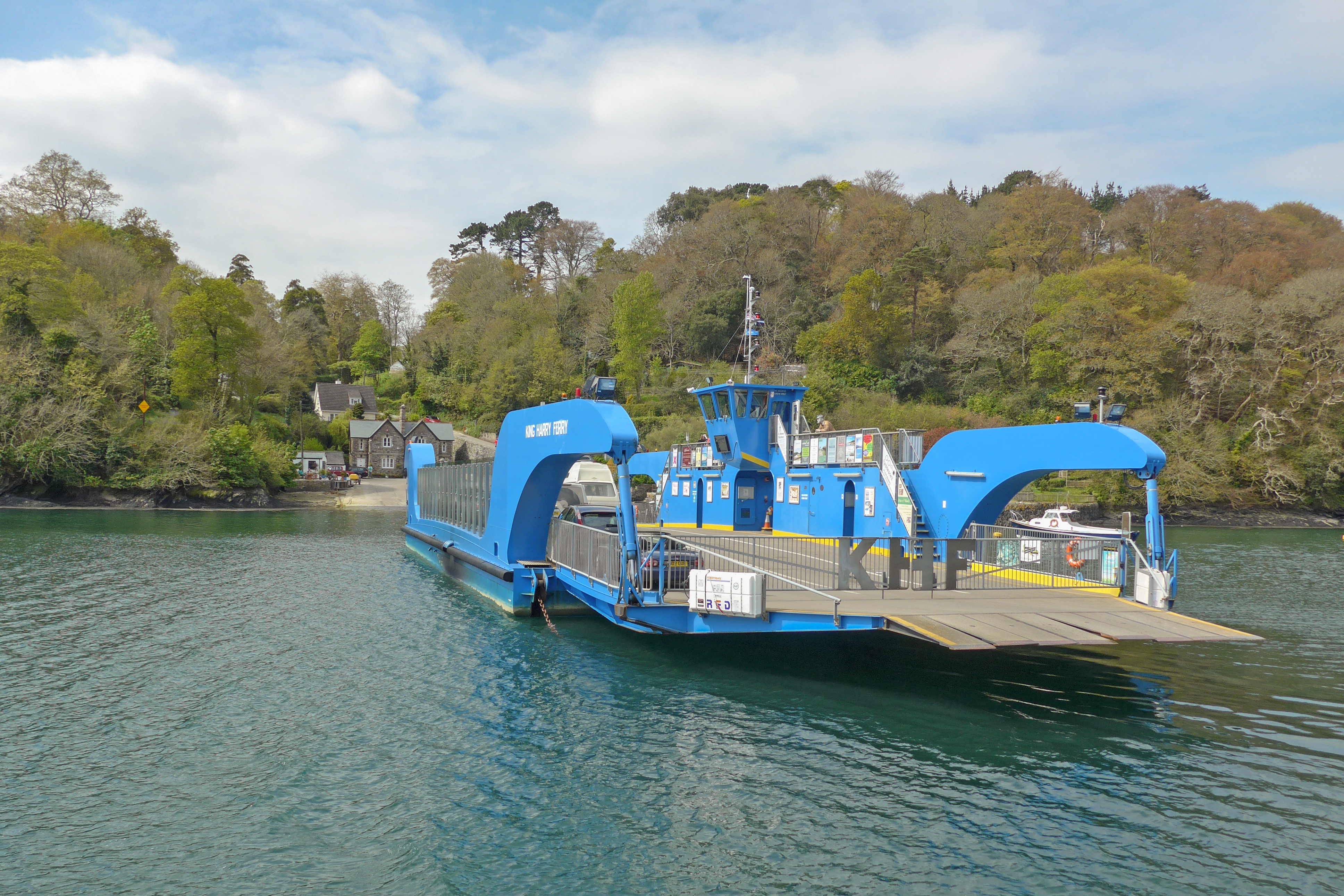
The King Harry Ferry Bridge is a vehicular chain ferry which crosses the Carrick Roads reach of the estuary of the River Fal in Cornwall, England, UK. The ferry crosses between the parishes of Feock and Philleigh, roughly halfway between the city of Truro, the lowest bridging point on the estuary, and the town of Falmouth, at the estuary's mouth. The ferry is owned and operated by the King Harry Steam Ferry Company Ltd. The current ferry boat, named ''No. 7'', was built in 2006 and can carry up to 34 cars. History It is likely that there has been a ferry of some description at the King Harry Passage for centuries, but there are conflicting stories about the origins of the name. One such story is that King Henry VIII spent his honeymoon with Anne Boleyn at St Mawes, and signed a charter for the ferry on this site. A more likely origin lies in the fact that a small chapel formerly stood on the Philleigh side of the passage. All that remains of this today is a small pile of ston ... [...More Info...] [...Related Items...] OR: [Wikipedia] [Google] [Baidu] |
Penelewey
Penelewey is a hamlet southeast of Playing Place in Cornwall Cornwall (; kw, Kernow ) is a historic county and ceremonial county in South West England. It is recognised as one of the Celtic nations, and is the homeland of the Cornish people. Cornwall is bordered to the north and west by the Atlantic ..., England, UK. Penelewey is on the B3289 road.Ordnance Survey ''One-inch Map of Great Britain; Truro and Falmouth, sheet 190''. 1961 References Hamlets in Cornwall {{Cornwall-geo-stub ... [...More Info...] [...Related Items...] OR: [Wikipedia] [Google] [Baidu] |
Oliver Padel
Oliver James Padel (born 31 October 1948 in St Pancras, London, England) is an English medievalist and toponymist specializing in Welsh and Cornish studies. He is currently Honorary Research Fellow in the Department of Anglo-Saxon, Norse, and Celtic in the University of Cambridge. and Visiting Professor of Celtic at the University of the West of England Biography Padel was born in 1948, the son of John Hunter Padel and his wife Hilda (née Barlow), daughter of Sir Alan Barlow, 2nd Baronet and his wife Nora, (née Darwin), through whom he is a great-great-grandson of Charles Darwin. His older sister is the poet Ruth Padel. He was educated at University College School, Hampstead, and Peterhouse, Cambridge, whence he graduated with a BA in Anglo-Saxon, Norse and Celtic in 1970. He was subsequently awarded an M.Litt. for his thesis on the inscriptions of Pictland by the University of Edinburgh in 1972. In 1992, he took a Litt.D. for his work on Cornish place-names. He was a fo ... [...More Info...] [...Related Items...] OR: [Wikipedia] [Google] [Baidu] |


