|
Colliers End, Hertfordshire
Colliers End is a village in the civil parish of Standon, in the East Hertfordshire district, in Hertfordshire, England. It lies upon what was the A10, however the A10 Wadesmill by-pass has now been built around Colliers End and neighbouring villages. What was the A10 that used to run through Colliers End and the neighbouring settlements were once part of the Roman road, Ermine Street. It is 1.9 miles (3.1km) away from Standon and 5.7 miles (9.2km) away from the county town of Hertford. The population was 415 as of the 2011 census. Nearby settlements Some nearby settlements include the hamlet of High Cross A high cross or standing cross ( ga, cros ard / ardchros, gd, crois àrd / àrd-chrois, cy, croes uchel / croes eglwysig) is a free-standing Christian cross made of stone and often richly decorated. There was a unique Early Medieval traditi ... to the south, the village of Standon to the northeast, and the hamlet of Levens Green to the northwest. Reference ... [...More Info...] [...Related Items...] OR: [Wikipedia] [Google] [Baidu] |
Ware, Hertfordshire
Ware is a town in Hertfordshire, England close to the county town of Hertford. It is also a civil parishes in England, civil parish in East Hertfordshire district. Location The town lies on the north–south A10 road (Great Britain), A10 road which is partly shared with the east–west A414 road, A414 (for Hertford to the west and Harlow to the east). There is a large Kingsmead Viaduct, viaduct over the River Lee (England), River Lea at Kings Meads. The £3.6m two-mile bypass opened on 17 January 1979. At the north end of the bypass is the Wodson Park Sports and Leisure Centre and Hanbury Manor, a hotel and country club. The former route of the A10 through the town is now the A1170. The Ware railway station, railway station is on the Hertford East Branch Line and operated by Greater Anglia (train operating company), Greater Anglia and is on a short single track section of the otherwise double track line. History Archaeology has shown that Ware has been occupied since at least t ... [...More Info...] [...Related Items...] OR: [Wikipedia] [Google] [Baidu] |
Standon, Hertfordshire
Standon is a village and civil parish in Hertfordshire, England. The parish includes the adjoining village of Puckeridge. The village church of St Mary has Saxon origins with much Victorian restoration. It contains the ornate tomb of the Tudor courtier Sir Ralph Sadler. The Prime Meridian passes to the west of Standon. The place-name is first attested in a Saxon charter of 944–46 AD and means "stony hill". Standon village has many local facilities. In addition to the church, there is a village hall, two public houses, a Chinese restaurant, post office, butcher, baker, and newsagent. Villagers also make frequent use of facilities in neighbouring Puckeridge, which include a pharmacy, estate agent, petrol station, public houses, doctor's surgery and primary schools (including St Thomas of Canterbury, a Roman Catholic primary school). Arthur Martin-Leake, one of only three men to be awarded the Victoria Cross The Victoria Cross (VC) is the highest and most prestigious a ... [...More Info...] [...Related Items...] OR: [Wikipedia] [Google] [Baidu] |
East Hertfordshire
East Hertfordshire is a local government district in Hertfordshire, England. Its council is based in Hertford, the county town of Hertfordshire. The largest town in the district is Bishop's Stortford, and the other main towns are Ware, Buntingford and Sawbridgeworth. At the 2011 Census, the population of the district was 137,687. The district was formed on 1 April 1974, under the Local Government Act 1972, by the merger of the municipal borough of Hertford with Bishop's Stortford, Sawbridgeworth and Ware urban districts, and Braughing Rural District, Ware Rural District and part of Hertford Rural District. By area it is the largest of the ten local government districts in Hertfordshire. It borders the North Hertfordshire district and the boroughs of Stevenage, Welwyn Hatfield and Broxbourne in Hertfordshire, and the districts of Epping Forest, Harlow and Uttlesford in Essex. In the 2006 edition of Channel 4's "Best and Worst Places to Live in the UK", East Hertfordshire ... [...More Info...] [...Related Items...] OR: [Wikipedia] [Google] [Baidu] |
Hertfordshire
Hertfordshire ( or ; often abbreviated Herts) is one of the home counties in southern England. It borders Bedfordshire and Cambridgeshire to the north, Essex to the east, Greater London to the south, and Buckinghamshire to the west. For government statistical purposes, it forms part of the East of England region. Hertfordshire covers . It derives its name – via the name of the county town of Hertford – from a hart (stag) and a ford, as represented on the county's coat of arms and on the flag. Hertfordshire County Council is based in Hertford, once the main market town and the current county town. The largest settlement is Watford. Since 1903 Letchworth has served as the prototype garden city; Stevenage became the first town to expand under post-war Britain's New Towns Act of 1946. In 2013 Hertfordshire had a population of about 1,140,700, with Hemel Hempstead, Stevenage, Watford and St Albans (the county's only ''city'') each having between 50,000 and 100,000 r ... [...More Info...] [...Related Items...] OR: [Wikipedia] [Google] [Baidu] |
Civil Parish
In England, a civil parish is a type of administrative parish used for local government. It is a territorial designation which is the lowest tier of local government below districts and counties, or their combined form, the unitary authority. Civil parishes can trace their origin to the ancient system of ecclesiastical parishes, which historically played a role in both secular and religious administration. Civil and religious parishes were formally differentiated in the 19th century and are now entirely separate. Civil parishes in their modern form came into being through the Local Government Act 1894, which established elected parish councils to take on the secular functions of the parish vestry. A civil parish can range in size from a sparsely populated rural area with fewer than a hundred inhabitants, to a large town with a population in the tens of thousands. This scope is similar to that of municipalities in Continental Europe, such as the communes of France. However, ... [...More Info...] [...Related Items...] OR: [Wikipedia] [Google] [Baidu] |
A10 Road (England)
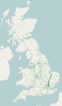
The A10 (in certain sections known as ''Great Cambridge Road'' or Old North Road) is a major road in England. Its southern end is at London Bridge in the London Borough of Southwark, and its northern end is the Norfolk port town of King's Lynn. From London to Royston it chiefly follows the line of Roman Ermine Street. The main route to Cambridge is now via the M11 motorway, however non-motorway traffic still uses the A10. Route Within the City of London, the route of the A10 comprises King William Street, Gracechurch Street, Bishopsgate and Norton Folgate. It then becomes Shoreditch High Street, Kingsland Road, Kingsland High Street and Stoke Newington Road. It runs through Stoke Newington as Stoke Newington High Street and then becomes Stamford Hill, through Stamford Hill until Tottenham. In July 2013, the Tottenham Hale gyratory was removed and the A10 now follows the route of Tottenham High Road in both directions. North of Tottenham, the A10 leaves its historic ... [...More Info...] [...Related Items...] OR: [Wikipedia] [Google] [Baidu] |
Wadesmill
Wadesmill is a hamlet in Hertfordshire, England, located on the north side of the River Rib with an estimated population of 264. At the 2011 Census the population of the hamlet was included in the civil parish of Thundridge. Running through the centre of Wadesmill is the road formerly known as the A10 - the main London to King's Lynn (via Cambridge) road - but now that the A10 by-pass has been built, Wadesmill and surrounding villages have returned to the quiet of former times. The route that was formerly the A10 is an ancient one with portions of it following the line of the Roman Road Ermine Street. Ermine street also figures as the former main street in Wadesmill's adjacent village Thundridge. History Historically Wadesmill is particularly notable for two features - it is the location of the first turnpike in England (and therefore the world), and the presence of the Clarkson Memorial halfway up nearby High Cross hill, a memorial to Thomas Clarkson's rest point in his travel ... [...More Info...] [...Related Items...] OR: [Wikipedia] [Google] [Baidu] |
Roman Empire
The Roman Empire ( la, Imperium Romanum ; grc-gre, Βασιλεία τῶν Ῥωμαίων, Basileía tôn Rhōmaíōn) was the post-Republican period of ancient Rome. As a polity, it included large territorial holdings around the Mediterranean Sea in Europe, North Africa, and Western Asia, and was ruled by emperors. From the accession of Caesar Augustus as the first Roman emperor to the military anarchy of the 3rd century, it was a Principate with Italia as the metropole of its provinces and the city of Rome as its sole capital. The Empire was later ruled by multiple emperors who shared control over the Western Roman Empire and the Eastern Roman Empire. The city of Rome remained the nominal capital of both parts until AD 476 when the imperial insignia were sent to Constantinople following the capture of the Western capital of Ravenna by the Germanic barbarians. The adoption of Christianity as the state church of the Roman Empire in AD 380 and the fall of the Western ... [...More Info...] [...Related Items...] OR: [Wikipedia] [Google] [Baidu] |
Ermine Street
Ermine Street is a major Roman road in England that ran from London (''Londinium'') to Lincoln (''Lindum Colonia'') and York (''Eboracum''). The Old English name was ''Earninga Strǣt'' (1012), named after a tribe called the ''Earningas'', who inhabited a district later known as ''Armingford Hundred'', around Arrington, Cambridgeshire, and Royston, Hertfordshire. "Armingford", and "Arrington" share the same Old English origin. The original Celtic and Roman names for the route remain unknown. It is also known as the Old North Road from London to where it joins the A1 Great North Road near Godmanchester. Course Ermine Street begins at Bishopsgate, where one of the seven gates in the wall surrounding Roman London was located. From here it runs north up Norton Folgate, Shoreditch High Street and Kingsland Road through Stoke Newington (forming Stoke Newington Road and Stoke Newington High Street), Tottenham, Edmonton and eastern Enfield (Ponders End, Enfield Highway, Enfield W ... [...More Info...] [...Related Items...] OR: [Wikipedia] [Google] [Baidu] |
High Cross, East Hertfordshire
High Cross is a village in the civil parish of Thundridge, in the East Hertfordshire district, in Hertfordshire, England. It lies upon what was the A10 road (England), A10, however the A10 Wadesmill by-pass has now been built around High Cross and neighbouring villages. Sections of the A10 that used to run through High Cross and the neighbouring settlements such as Wadesmill were once part of the Roman Empire, Roman road, Ermine Street. It is north of the town of Ware, Hertfordshire, Ware and north east of the county town of Hertford. The population was 853 as of the 2021 census. Nearby settlements Some nearby settlements include the villages of Thundridge and Wadesmill to the south, the hamlets of Colliers End, Hertfordshire, Colliers End to the north, Dane End to the west and Barwick to the east. Amenities High Cross contains Puller Memorial Primary school, St John the Evangelist Church, and formerly the White Horse Pub which closed down in 2017. Notable Residents ... [...More Info...] [...Related Items...] OR: [Wikipedia] [Google] [Baidu] |


