|
Cocopah Indian Reservation
The Cocopah Indian Reservation is the reservation of the federally recognized Cocopah Indian Tribe (Cocopah: Xawiłł Kwñchawaay), which represents Cocopah peoples in the United States. As of the 2000 census a resident population of 1,025 persons, of whom 519 were solely of Native American heritage, lived on the Cocopah Indian Reservation, which is composed of three non-contiguous sections in Yuma County, Arizona, lying northwest, southwest and south of the city of Yuma, Arizona. United States Census Bureau The larger section, bordering the , lies west of the Yuma suburb of Somerton, wh ... [...More Info...] [...Related Items...] OR: [Wikipedia] [Google] [Baidu] |
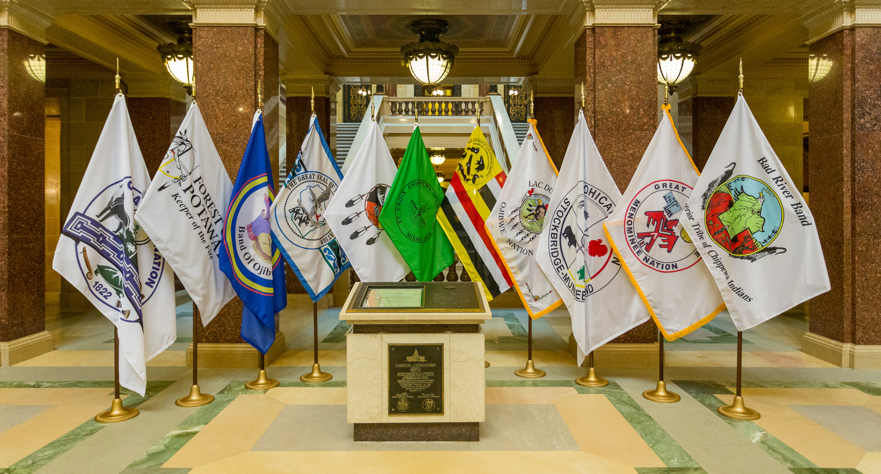
Flag Of The Cocopah Reservation
A flag is a piece of fabric (most often rectangular or quadrilateral) with a distinctive design and colours. It is used as a symbol, a signalling device, or for decoration. The term ''flag'' is also used to refer to the graphic design employed, and flags have evolved into a general tool for rudimentary signalling and identification, especially in environments where communication is challenging (such as the maritime environment, where semaphore is used). Many flags fall into groups of similar designs called flag families. The study of flags is known as "vexillology" from the Latin , meaning "flag" or "banner". National flags are patriotic symbols with widely varied interpretations that often include strong military associations because of their original and ongoing use for that purpose. Flags are also used in messaging, advertising, or for decorative purposes. Some military units are called "flags" after their use of flags. A ''flag'' (Arabic: ) is equivalent to a brigade in ... [...More Info...] [...Related Items...] OR: [Wikipedia] [Google] [Baidu] |
Arizona
Arizona ( ; nv, Hoozdo Hahoodzo ; ood, Alĭ ṣonak ) is a state in the Southwestern United States. It is the 6th largest and the 14th most populous of the 50 states. Its capital and largest city is Phoenix. Arizona is part of the Four Corners region with Utah to the north, Colorado to the northeast, and New Mexico to the east; its other neighboring states are Nevada to the northwest, California to the west and the Mexican states of Sonora and Baja California to the south and southwest. Arizona is the 48th state and last of the contiguous states to be admitted to the Union, achieving statehood on February 14, 1912. Historically part of the territory of in New Spain, it became part of independent Mexico in 1821. After being defeated in the Mexican–American War, Mexico ceded much of this territory to the United States in 1848. The southernmost portion of the state was acquired in 1853 through the Gadsden Purchase. Southern Arizona is known for its desert cl ... [...More Info...] [...Related Items...] OR: [Wikipedia] [Google] [Baidu] |
Federally Recognized Tribes In The United States
This is a list of federally recognized tribes in the contiguous United States of America. There are also federally recognized Alaska Native tribes. , 574 Indian tribes were legally recognized by the Bureau of Indian Affairs (BIA) of the United States.Federal Acknowledgment of the Pamunkey Indian Tribe Of these, 231 are located in Alaska. Description  In the United States, the Indian tribe is a fundamental unit, and the constitution grants
|
Native American Tribes In Arizona
The Indigenous peoples of Arizona are the Native American people of the state of Arizona. These include people that have lived in the region since time immemorial; tribes who entered the region centuries ago, such as the Southern Athabascan peoples; and the Pascua Yaqui who settled Arizona in mass in the early 20th century, though small communities had been in the region for hundreds of years prior. Arizona has the third largest Native American population of any U.S. state. Almost a quarter of Arizona is reservation land. The Navajo Nation has the largest reservation in the United States, and the Tohono O'odham Nation in southeast Arizona has the second-largest reservation. There are 17 federally recognized tribes completely within the borders of Arizona, and 5 more in Arizona whose territory spans multiple states. Of these, 20 tribes are members of the Inter-Tribal Council of Arizona (ITCA). Native American tribes in Arizona today # Ak Chin Indian Community of the Maric ... [...More Info...] [...Related Items...] OR: [Wikipedia] [Google] [Baidu] |
Fort Yuma Indian Reservation
The Fort Yuma Indian Reservation is a part of the traditional lands of the Quechan people. Established in 1884 from the former Fort Yuma, the reservation, at , has a land area of in southeastern Imperial County, California, and western Yuma County, Arizona, near the city of Yuma, Arizona. Both the county and city are named for the tribe. As of the 2010 Census the population was 2,189. In 1910, the community of Bard, California, was created after the eastern part of the reservation was declared surplus under the Dawes Act The Dawes Act of 1887 (also known as the General Allotment Act or the Dawes Severalty Act of 1887) regulated land rights on tribal territories within the United States. Named after Senator Henry L. Dawes of Massachusetts, it authorized the Pre .... In 2009, the Quechan Tribe opened a large gaming resort, the Quechan Casino Resort, on their reservation land. References {{authority control Quechan American Indian reservations in Arizona American ... [...More Info...] [...Related Items...] OR: [Wikipedia] [Google] [Baidu] |
Quechan
The Quechan (or Yuma) (Quechan: ''Kwatsáan'' 'those who descended') are a Native American tribe who live on the Fort Yuma Indian Reservation on the lower Colorado River in Arizona and California just north of the Mexican border. Despite their name, they are not related to the Quechua people of the Andes. Members are enrolled into the Quechan Tribe of the Fort Yuma Indian Reservation. The federally recognized Quechan tribe's main office is located in Winterhaven, California. Its operations and the majority of its reservation land are located in California, United States. History The historic Yuman-speaking people in this region were skilled warriors and active traders, maintaining exchange networks with the Pima in southern Arizona, New Mexico, and with peoples of the Pacific coast. The first significant contact of the Quechan with Europeans was with the Spanish explorer Juan Bautista de Anza and his party in the winter of 1774. Relations were friendly. On Anza's return fr ... [...More Info...] [...Related Items...] OR: [Wikipedia] [Google] [Baidu] |
Native American Gaming
Native American gaming comprises casinos, bingo halls, and other gambling operations on Indian reservations or other tribal lands in the United States. Because these areas have tribal sovereignty, states have limited ability to forbid gambling there, as codified by the Indian Gaming Regulatory Act of 1988. As of 2011, there were 460 gambling operations run by 240 tribes, with a total annual revenue of $27 billion. History In the early 1970s, Russell and Helen Bryan, a married Chippewa couple living in a mobile home on Indian lands in northern Minnesota, received a property tax bill from the local county, Itasca County.Kevin K. Washburn"The Legacy of Bryan v. Itasca County: How an Erroneous $147 County Tax Notice Helped Bring Tribes $200 Billion in Indian Gaming Revenue"92 Minnesota Law Review 919 (2008). The Bryans had never received a property tax bill from the county before. Unwilling to pay it, they took the tax notice to local legal aid attorneys at Leech Lake Legal Ser ... [...More Info...] [...Related Items...] OR: [Wikipedia] [Google] [Baidu] |
Somerton, Arizona
Somerton is a city in Yuma County, Arizona, United States. As of the 2010 census the population was 14,287. It is part of the Yuma Metropolitan Statistical Area. Somerton was established in 1898 and incorporated in 1918. Somerton's economy is based on agriculture, medical services, and tourism. from , updated 3/2/16 Geography Somerton is located at (32.597258, -114.712242). According to theUnited States Census Bureau ...
[...More Info...] [...Related Items...] OR: [Wikipedia] [Google] [Baidu] |
Colorado River
The Colorado River ( es, Río Colorado) is one of the principal rivers (along with the Rio Grande) in the Southwestern United States and northern Mexico. The river drains an expansive, arid drainage basin, watershed that encompasses parts of seven U.S. states and two Mexican states. The name Colorado derives from the Spanish language for "colored reddish" due to its heavy silt load. Starting in the central Rocky Mountains of Colorado, it flows generally southwest across the Colorado Plateau and through the Grand Canyon before reaching Lake Mead on the Arizona–Nevada border, where it turns south toward the Mexico–United States border, international border. After entering Mexico, the Colorado approaches the mostly dry Colorado River Delta at the tip of the Gulf of California between Baja California and Sonora. Known for its dramatic canyons, whitewater rapids, and eleven National parks of the United States, U.S. National Parks, the Colorado River and its tributaries are a v ... [...More Info...] [...Related Items...] OR: [Wikipedia] [Google] [Baidu] |
Yuma, Arizona
Yuma ( coc, Yuum) is a city in and the county seat of Yuma County, Arizona, United States. The city's population was 93,064 at the 2010 census, up from the 2000 census population of 77,515. Yuma is the principal city of the Yuma, Arizona, Metropolitan Statistical Area, which consists of Yuma County. According to the United States Census Bureau, the 2020 estimated population of the Yuma MSA is 203,247. According to Guinness World Records, Yuma is the "Sunniest City on Earth," promising "sunshine and warm weather at least 91% of the year." Anywhere from 70,000 to over 85,000 out-of-state visitors make Yuma their winter residence. Yuma's weather also makes it an agricultural powerhouse, growing over 175 types of crops, the largest of which is lettuce. Yuma County provides 90% of all leafy vegetables grown from November to March in the United States. Yuma is also known for its large military population due to several military bases, including the Marine Corps Air Station. Yum ... [...More Info...] [...Related Items...] OR: [Wikipedia] [Google] [Baidu] |
Cocopah Nation-The Sovereign Nation Of The Cocopahs
The Cocopah (Cocopah: Xawitt Kwñchawaay) are Native Americans who live in Baja California, Mexico, and Arizona, United States. In the United States, Cocopah people belong to the federally recognized Cocopah Tribe of Arizona. Name The Cocopah are also called the Cucapá (in Cocopa: Kwapa or Kwii Capáy. This translates as "Cloud People," referring to the fog along the Colorado River). Language The Cocopah language belongs to the Delta–California branch of the Yuman family. The Spanish term for Cocopah is ''Cucapá''. Their self-designation is Xawiƚƚ kwñchawaay, translating to “Those Who Live on the Cloudy River” (from ''Xawíƚƚy'' - "river", ''kwii'' - "cloud", ''(ny)way'' - "to live", ''llyay/nyaam'' - "many"). According to the US Census, there were 1,009 Cocopah in 2010. History Precontact Ancestors of the Cocopah inhabited parts of present-day Arizona, California, and Baja California and are known by western academics as belonging to the Patayan cultu ... [...More Info...] [...Related Items...] OR: [Wikipedia] [Google] [Baidu] |
Yuma County, Arizona
Yuma County is a county in the southwestern corner of the U.S. state of Arizona. As of the 2020 census, its population was 203,881. The county seat is Yuma. Yuma County includes the Yuma, Arizona Metropolitan Statistical Area. The county borders three states: Sonora, Mexico, to the south, and two other states to the west, across the Colorado River: California of the United States and the Mexican state of Baja California. Being 63.8% Hispanic in 2020, Yuma is Arizona's largest majority-Hispanic county. History Long settled by Native Americans of indigenous cultures for thousands of years, this area was controlled by the Spanish Empire in the colonial era. In the 19th century, it was part of independent Mexico before the Mexican–American War and Gadsden Purchase. Yuma County was one of four original Arizona counties created by the 1st Arizona Territorial Legislature. The county territory was defined as being west of longitude 113° 20' and south of the Bill Williams River ... [...More Info...] [...Related Items...] OR: [Wikipedia] [Google] [Baidu] |


