|
Clondrohid
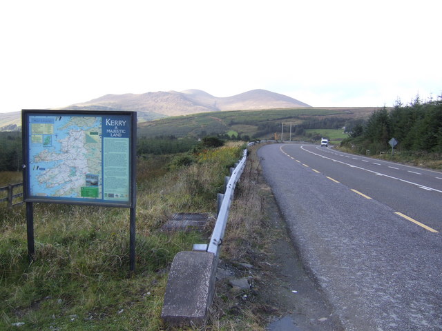
Clondrohid () is a village and civil parish in County Cork, Ireland, four miles (6 km) north of Macroom. As of the 2016 census, the population of the village was recorded as 179, down from 188 people as of the 2011 census. Geography Parishes adjoining Clondrohid include Aghabulloge, Ballyvourney, Drishane, Kilcorney, Kilnamartry, and Macroom. The townlands of Clondrohid were part of the barony of West Muskerry. Clondrohid lies within the Cork North-West Dáil constituency. Amenities Local amenities include Clondrohid National School and community hall and a number of shops, pubs and services. A childcare facility is next to the GAA pitch which is also a preschool and an afterschool. Carrigaphooca Castle is in one of the neighbouring townlands. Carrigaphooca stone circle, about 3,000 years old, stands next to it. Much of the western side of the village is a part of the Irish-speaking area or ''Gaeltacht''. Some pupils of the national school go to the second l ... [...More Info...] [...Related Items...] OR: [Wikipedia] [Google] [Baidu] |
List Of Townlands Of The Barony Of West Muskerry In County Cork
This is a sortable table of the townlands in the barony Barony may refer to: * Barony, the peerage, office of, or territory held by a baron * Barony, the title and land held in fealty by a feudal baron * Barony (county division), a type of administrative or geographical division in parts of the British ... of Muskerry West, County Cork, Ireland. Retrieved: 2010-09-10. Duplicate names occur where there is more than one townland with the same name in the barony (such as Glebe), and also where a townland is known by two alternative names. Names marked in bold typeface are towns and villages, and the word ''Town'' appears for those entries in the area column. Towns shown below are Inchigeelagh, Macroom, Millstreet. The smallest townland in West Muskerry is Glebe in Kilcorney at 13 acres. The largest is Caherbarnagh at 3,626 acres. < ... [...More Info...] [...Related Items...] OR: [Wikipedia] [Google] [Baidu] |
Muskerry West
Muskerry West ( ga, Múscraí Thiar) is one of the baronies of Ireland, a historical geographical unit of land. Its chief town is Macroom. It is one of 24 baronies in the county of Cork. It may also be viewed as a half barony because sometime before the 1821 census, it was divided from its other half – Muskerry East. Other neighbouring baronies include Duhallow to the north (whose chief town is Newmarket) and the Barony of Carbery East (West Division) to the south (whose chief town is Dunmanway). Legal context Baronies were created after the Norman invasion of Ireland as divisions of counties and were used the administration of justice and the raising of revenue. While baronies continue to be officially defined units, they have been administratively obsolete since 1898. However, they continue to be used in land registration and in specification, such as in planning permissions. In many cases, a barony corresponds to an earlier Gaelic túath which had submitted to the Crown. ... [...More Info...] [...Related Items...] OR: [Wikipedia] [Google] [Baidu] |
Macroom
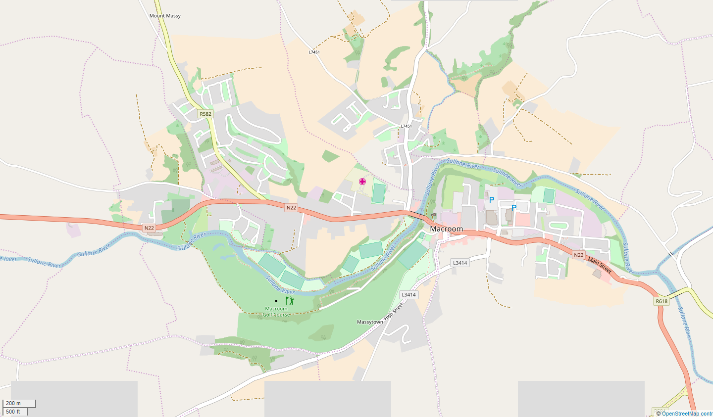
Macroom (; ga, Maigh Chromtha) is a market town in County Cork, Ireland, located in the valley of the River Sullane, halfway between Cork city and Killarney. Its population has grown and receded over the centuries as it went through periods of war, famine and workhouses, forced emigration and intermittent prosperity. The 2011 census gave an urban population of 3,879 people, while the 2016 census recorded 3,765 people. Macroom began as a meeting place for the druids of Munster. It is first mentioned is in 6th-century records, and the immediate area hosted a major battle involving the Irish king Brian Boru. During the middle ages, the town was invaded by a succession of warring clans, including the Murcheatach Uí Briain and Richard de Cogan families. In the early modern period the MacCarthy's took control and later the area found prosperity via milling. The MacCarthys built a series of tower houses, some of which survive. The family lost influence during the Williami ... [...More Info...] [...Related Items...] OR: [Wikipedia] [Google] [Baidu] |
Cork North-West (Dáil Constituency)
Cork North-West is a parliamentary constituency represented in Dáil Éireann, the lower house of the Irish parliament or Oireachtas. The constituency elects 3 deputies ( Teachtaí Dála, commonly known as TDs) on the system of proportional representation by means of the single transferable vote (PR-STV). History and boundaries The constituency was created by the Electoral (Amendment) Act 1980 and first used at the 1981 general election. It is a large rural 3-seat constituency. Due to its size and landscape it is considered one of the most difficult constituencies to canvass in Ireland. The constituency encompasses the western part of Ireland's largest county of Cork. It runs from Charleville and Rockchapel in the north to Ballingeary, Crookstown and Crossbarry in the south, and also takes in parts of the Mallow and Fermoy electoral areas. TDs Elections 2020 general election 2016 general election 2011 general elec ... [...More Info...] [...Related Items...] OR: [Wikipedia] [Google] [Baidu] |
Ballyvourney
Ballyvourney ( ga, Baile Bhuirne , meaning 'Town of the Beloved', also spelled ) is a Gaeltacht village in southwest County Cork, Ireland. It is a civil parish in the barony of Muskerry West, and is also an ecclesiastical parish in the Roman Catholic Diocese of Cloyne. Ballyvourney is part of the Cork North-West Dáil Constituency. Location and access The village stretches along the N22 road which links Cork city (to the southeast) with Killarney (to the northwest). The nearest large town is Macroom, while the nearest international airport is Cork Airport. As of 2015, there has been a proposal to construct 22 km of dual carriageway from Coolcour at the eastern side of Macroom, bypassing Macroom to the north and finishing west of Ballyvourney. Bus Éireann Expressway Route 40 between Rosslare Europort and Tralee runs through Ballyvourney. Physical geography and political subdivisions The village lies on the River Sullane:"The river Sullane has its source in the par ... [...More Info...] [...Related Items...] OR: [Wikipedia] [Google] [Baidu] |
Peadar Ó Laoghaire
Father Peadar Ua Laoghaire or Peadar Ó Laoghaire (, first name locally ; 30 April 1839 – 21 March 1920), also anglicized as Peter O'Leary, was an Irish writer and Catholic priest, who is regarded today as one of the founders of modern literature in Irish. Life He was born in Liscarrigane () in the parish of Clondrohid (), County Cork, and grew up speaking Munster Irish in the Muskerry Gaeltacht. He was a descendant of the Carrignacurra branch of the Ó Laoghaire of the ancient Corcu Loígde. He attended Maynooth College and was ordained a priest of the Roman Catholic Church in 1867. He became a parish priest in Castlelyons in 1891, and it was there that he wrote his most famous story, , and told it as a fireside story to three little girls. was the first major literary work of the emerging Gaelic revival. It was serialised in the Gaelic Journal from 1894, and published in book form in 1904. The plot of the story concerns a deal that the shoemaker Séadna struck with "the Dar ... [...More Info...] [...Related Items...] OR: [Wikipedia] [Google] [Baidu] |
List Of Towns And Villages In The Republic Of Ireland
This is a link page for cities, towns and villages in the Republic of Ireland, including townships or urban centres in Dublin, Cork, Limerick, Galway, Waterford and other major urban areas. Cities are shown in bold; see City status in Ireland for an independent list. __NOTOC__ A B C D E F G H I J K L M N O P Q R S T U V W Y See also * List of places in Ireland ** List of places in the Republic of Ireland **: List of cities, boroughs and towns in the Republic of Ireland The following table and map show the areas in Ireland, previously designated as Cities, Boroughs, or Towns in the Local Government Act 2001. Under the Local Government (Ireland) Act 1898, Ireland had a two-tier system of local authorities. The ..., with municipal councils and legally defined boundaries. **: List of census towns in the Republic of Ireland as defined by the Central Statistics Office, sorted by cou ... [...More Info...] [...Related Items...] OR: [Wikipedia] [Google] [Baidu] |
Carrigaphooca Castle
Carrigaphooca Castle ( ga, Caisleán Carraig a' Phúca, meaning Castle on the Rock of the Fairy; the word ''Púca'' translates as ghost or fairy), is a ruined five storey rectangular tower house situated on a steep-sided rock overlooking the River Sullane. It is located 6 km west of Macroom, County Cork, Ireland, in an area once known as Gleann na n-Dearg (''Valley of the Reds'').O'Brien (1990), 31 The tower dominates the landscape of Lissacresig (''Fairyland'') in Clondrohid, and Lower Shanballyshane, in Kilnamartyra.O'Brien (1990), 30 Carrigaphooca is made of sandstone and limestone and was built as a defensive tower by MacCarthy clan member Donal MacCarthy of Drishane c. 1336-51. Carrigaphooca is positioned in an area rich with neolithic monuments; a stone circle lies two fields to the east. The tower is located on private property, and is no longer accessible to the public, although it is owned by the state and maintained by the Office of Public Works.Heritage Unit of ... [...More Info...] [...Related Items...] OR: [Wikipedia] [Google] [Baidu] |
Gaeltacht
( , , ) are the districts of Ireland, individually or collectively, where the Irish government recognises that the Irish language is the predominant vernacular, or language of the home. The ''Gaeltacht'' districts were first officially recognised during the 1920s in the early years of the Irish Free State, following the Gaelic Revival, as part of a government policy aimed at restoring the Irish language. The Gaeltacht is threatened by serious language decline. Research published in 2015 showed that Irish is spoken on a daily basis by two-thirds or more of the population in only 21 of the 155 electoral divisions in the Gaeltacht. Daily language use by two-thirds or more of the population is regarded by some academics as a tipping point for language survival.RTÉ News Report of Friday 29 May 2015 History In 1926, the official Gaeltacht was designated as a result of the report of the first Gaeltacht Commission '' Coimisiún na Gaeltachta''. The exact boundaries were not de ... [...More Info...] [...Related Items...] OR: [Wikipedia] [Google] [Baidu] |
Association Football Pitch
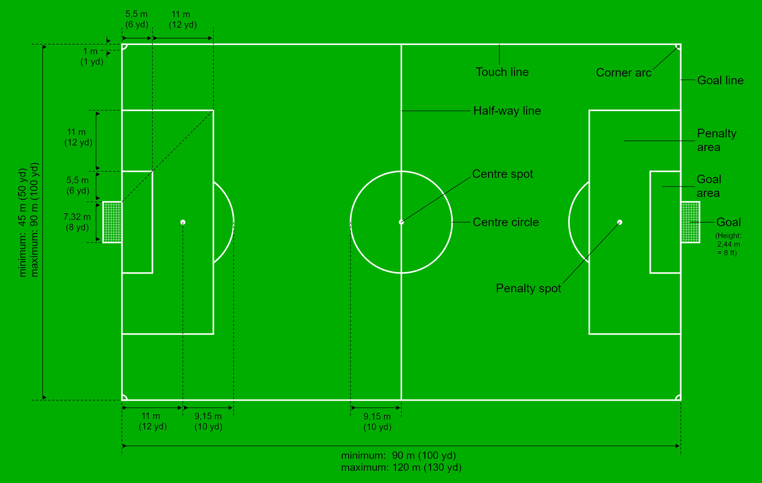
A football pitch (also known as soccer field) is the playing surface for the game of association football. Its dimensions and markings are defined by Law 1 of the Laws of the Game, "The Field of Play". The pitch is typically made of natural turf or artificial turf, although amateur and recreational teams often play on dirt fields. Artificial surfaces are allowed only to be green in colour. All line markings on the pitch form part of the area which they define. For example, a ball on or above the touchline is still on the field of play, and a foul committed over the line bounding the penalty area results in a penalty. Therefore, a ball has to completely cross the touchline to be out of play, and a ball has to wholly cross the goal line (between the goal posts) in order for a goal to be scored; if any part of the ball is still on or above the line, a goal is not scored and the ball is still in play. The field descriptions that apply to adult matches are described below. Bec ... [...More Info...] [...Related Items...] OR: [Wikipedia] [Google] [Baidu] |


.png)

