|
Claverham
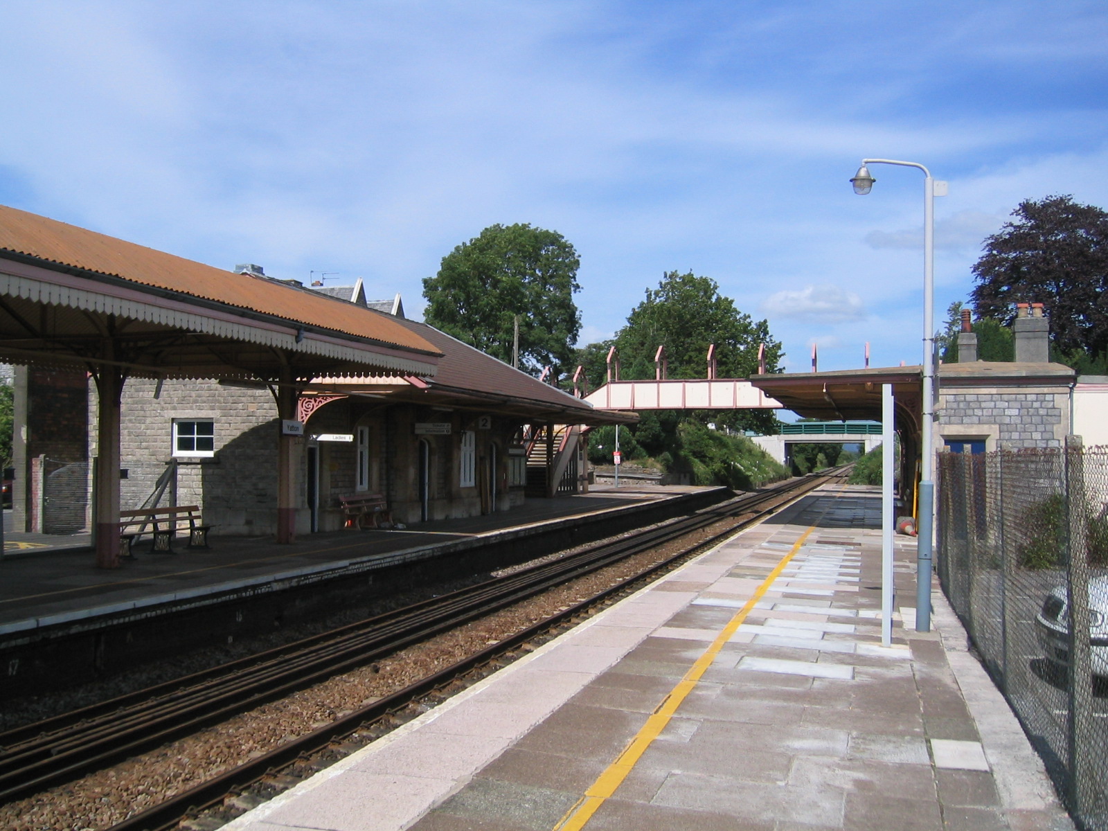
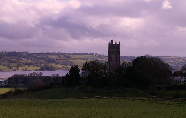
Yatton is a village and civil parish within the unitary authority of North Somerset, which falls within the ceremonial county of Somerset, England. It is located south-west of Bristol. Its population in 2011 was 7,552. The parish includes Claverham, a small village which was originally a farming hamlet. The origins of the village and its name are unclear; however, there is evidence of Iron Age hill fort and a Roman villa in the area. The arrival of the railway in the 19th century and more recent road building have led to expansion of the village with Yatton now acting as a home to many commuters, while also supporting manufacturing industry and commerce. The village is located on the North Somerset Levels, where the low-lying land, a mixture of peat, estuarine alluvium and low hills of sand and gravel, is crossed by a myriad of watercourses, providing a habitat for several scarce species. St Mary's Church dates from the 14th century and there are a range of other places of wor ... [...More Info...] [...Related Items...] OR: [Wikipedia] [Google] [Baidu] |
North Somerset
North Somerset is a unitary authorities of England, unitary district in Somerset, South West England. Whilst its area covers part of the Ceremonial counties of England, ceremonial county of Somerset, it is administered independently of the non-metropolitan county. Its administrative headquarters is in the town hall in Weston-super-Mare. North Somerset, which was renamed from the Woodspring district in 1996, borders the city and county of Bristol and the local government areas of Bath and North East Somerset, Mendip District, Mendip and Sedgemoor. The area comprises the parliamentary constituencies of Weston-super-Mare (UK Parliament constituency), Weston-super-Mare and North Somerset (UK Parliament constituency), North Somerset. History Between 1 April 1974 and 31 March 1996, this area was the Woodspring Districts of England, district of the county of Avon (named after Woodspring Priory, an isolated medieval church near the coast just north east of Weston-super-Mare). The dist ... [...More Info...] [...Related Items...] OR: [Wikipedia] [Google] [Baidu] |
North Somerset Levels
The North Somerset Levels is a coastal plain, an expanse of low-lying flat ground, which occupies an area between Weston-super-Mare and Bristol in North Somerset, England. The River Banwell, River Kenn, River Yeo and Land Yeo are the three principal rivers draining the area. To the south the levels are bounded by the Mendip Hills, to the east by the Yeo Valley and the Lulsgate Plateau, and to the north by the Tickenham Ridge. To the west lies the Severn Estuary. The levels are distinct from two similar areas: the much larger Somerset Levels to the south in Somerset, and the smaller Gordano Valley to the north. The water level management and maintenance of rhynes in the area are the responsibility of the North Somerset Internal Drainage Board. The term "Avon Levels" has also been used - either as a synonym for the North Somerset Levels, or to refer a larger area also including all of the other low-lying flat areas in the former county of Avon (e.g. the Gordano Valley and the ... [...More Info...] [...Related Items...] OR: [Wikipedia] [Google] [Baidu] |
Church Of St Mary, Yatton
The Church of St Mary in central Yatton, Somerset, England, is often called the Cathedral of the Moors due to its size and grandeur in relation to the village. It has been designated by English Heritage as a Grade I listed building. While the current church was constructed in the 14th century, it is likely that a previous church was located on the same site. The chapel which was added in 1496, and various other alterations and expansions of the church can be seen in the account which have survived since 1445. The central tower, which was built around 1400, has three stages with diagonal weathered buttresses with crocketed pinnacles. There is a south-east hexagonal stair Turret (architecture), turret rising above the parapet with panelled sides to the top, and an open cusped parapet. Unusually for Somerset a Dundry stone steeple was built in 1455–1456. In 1595 freemasons were engaged to take down the spire and reduce it to its present dimensions. There is a ring of bells within ... [...More Info...] [...Related Items...] OR: [Wikipedia] [Google] [Baidu] |
Blagdon
Blagdon is a village and civil parish in the ceremonial county of Somerset, within the unitary authority of North Somerset, in England. It is located in the Mendip Hills, a recognised Area of Outstanding Natural Beauty. According to the 2011 census it has a population of 1,116. The village is about east of Weston-super-Mare on the A368 between Churchill and Compton Martin. History The village was called ''Blachedon'' in the 1086 Domesday Book and the name comes from the Old English ''bloec'' and ''dun'' meaning 'the black or bleak down'. Romans There was a Roman presence in Blagdon from about 49 AD until the end of the Roman occupation of Britain. Several Roman coins and fragments of Roman pottery have been found in the village. There were lead and silver workings in Charterhouse, about a mile and a half uphill to the south, so it is likely that the wealthier supervisors had their houses away from the toxic smoke in the village. Wade and Wade in their 1929 book ''Somers ... [...More Info...] [...Related Items...] OR: [Wikipedia] [Google] [Baidu] |
Wrington Vale Light Railway
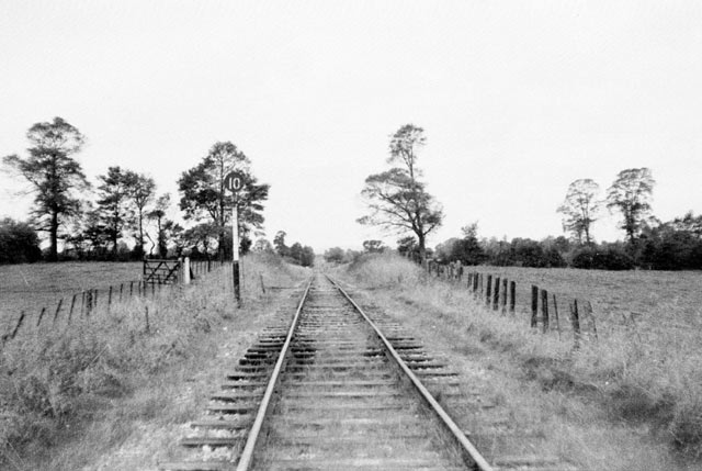
The Wrington Vale Light Railway was a railway from Congresbury on the Cheddar Valley line to Blagdon, and serving villages in the Yeo Valley, North Somerset, England. Construction of the line started in 1897 and it opened in 1901. Never more than a purely local line, it closed to passengers in 1931, and completely in 1963. History Construction The first attempt to build a railway line in this part of North Somerset took place in 1882, when an Act was obtained (on 18 August) incorporating the Radstock, Wrington & Congresbury Junction Railway, which was to run from Farrington Gurney on the Bristol and North Somerset Railway to Congresbury through Wrington. However sufficient capital could not be raised, and the company was dissolved in 1886. The Light Railways Act of 1896 was passed with the intention of enabling low-cost local railways to be built, and a line from Blagdon to Congresbury was promoted. At this time the Bristol Waterworks Company were building a reservoir at ... [...More Info...] [...Related Items...] OR: [Wikipedia] [Google] [Baidu] |
Wells, Somerset
Wells () is a cathedral city and civil parish in the Mendip district of Somerset, located on the southern edge of the Mendip Hills, south-east of Weston-super-Mare, south-west of Bath and south of Bristol. Although the population recorded in the 2011 census was only 10,536, (increased to 12,000 by 2018) and with a built-up area of just , Wells has had city status since medieval times, because of the presence of Wells Cathedral. Often described as England's smallest city, it is actually second smallest to the City of London in area and population, but unlike London it is not part of a larger urban agglomeration. Wells takes its name from three wells dedicated to Saint Andrew, one in the market place and two within the grounds of the Bishop's Palace and cathedral. A small Roman settlement surrounded them, which grew in importance and size under the Anglo-Saxons when King Ine of Wessex founded a minster church there in 704. The community became a trading centre based on ... [...More Info...] [...Related Items...] OR: [Wikipedia] [Google] [Baidu] |
Cheddar, Somerset
Cheddar is a large village and civil parish in the Sedgemoor district of the English county of Somerset. It is situated on the southern edge of the Mendip Hills, north-west of Wells, south-east of Weston-super-Mare and south-west of Bristol. The civil parish includes the hamlets of Nyland and Bradley Cross. The parish had a population of 5,755 in 2011 and an acreage of as of 1961. Cheddar Gorge, on the northern edge of the village, is the largest gorge in the United Kingdom and includes several show caves, including Gough's Cave. The gorge has been a centre of human settlement since Neolithic times including a Saxon palace. It has a temperate climate and provides a unique geological and biological environment that has been recognised by the designation of several Sites of Special Scientific Interest. It is also the site of several limestone quarries. The village gave its name to Cheddar cheese and has been a centre for strawberry growing. The crop was formerly transporte ... [...More Info...] [...Related Items...] OR: [Wikipedia] [Google] [Baidu] |
Clevedon Branch Line
The Clevedon branch line was a branch railway line that ran from Yatton railway station on the Bristol to Taunton Line to Clevedon in North Somerset, England, with no intermediate stops. It was opened on 28 July 1847 by the Bristol and Exeter Railway. Initially it was built as broad gauge but was converted to standard gauge in 1879. History Seaside resorts became fashionable during the early years of the reign of Queen Victoria. When the Bristol and Exeter Railway (B&ER) opened its main line (at first to Bridgwater) in 1841, a station was provided at "Clevedon Road", about distant. In the 1845 the B&ER obtained the necessary Parliamentary sanction to open a branch line to the town.E T MacDermot, ''History of the Great Western Railway'', volume II, published by the Great Western Railway, London, 1932 The line was opened on 28 July 1847. Starting from Clevedon Road station, which was renamed at the same time, it was long. Branch trains had a bay platform on the upside wi ... [...More Info...] [...Related Items...] OR: [Wikipedia] [Google] [Baidu] |
West Country
The West Country (occasionally Westcountry) is a loosely defined area of South West England, usually taken to include all, some, or parts of the counties of Cornwall, Devon, Dorset, Somerset, Bristol, and, less commonly, Wiltshire, Gloucestershire and Herefordshire. "Which counties make up the West Country?", ''YouGov.co.uk'', 23 October 2019 Retrieved 22 June 2021 The West Country has a distinctive regional English dialect and accent, and is also home to the . Extent ...
|
Great Western Railway
The Great Western Railway (GWR) was a British railway company that linked London with the southwest, west and West Midlands of England and most of Wales. It was founded in 1833, received its enabling Act of Parliament on 31 August 1835 and ran its first trains in 1838 with the initial route completed between London and Bristol in 1841. It was engineered by Isambard Kingdom Brunel, who chose a broad gauge of —later slightly widened to —but, from 1854, a series of amalgamations saw it also operate standard-gauge trains; the last broad-gauge services were operated in 1892. The GWR was the only company to keep its identity through the Railways Act 1921, which amalgamated it with the remaining independent railways within its territory, and it was finally merged at the end of 1947 when it was nationalised and became the Western Region of British Railways. The GWR was called by some "God's Wonderful Railway" and by others the "Great Way Round" but it was famed as the "Holiday ... [...More Info...] [...Related Items...] OR: [Wikipedia] [Google] [Baidu] |
Isambard Kingdom Brunel
Isambard Kingdom Brunel (; 9 April 1806 – 15 September 1859) was a British civil engineer who is considered "one of the most ingenious and prolific figures in engineering history," "one of the 19th-century engineering giants," and "one of the greatest figures of the Industrial Revolution, hochanged the face of the English landscape with his groundbreaking designs and ingenious constructions." Brunel built dockyards, the Great Western Railway (GWR), a series of steamships including the first propeller-driven transatlantic steamship, and numerous important bridges and tunnels. His designs revolutionised public transport and modern engineering. Though Brunel's projects were not always successful, they often contained innovative solutions to long-standing engineering problems. During his career, Brunel achieved many engineering firsts, including assisting in the building of the first tunnel under a navigable river (the River Thames) and the development of the , the first ... [...More Info...] [...Related Items...] OR: [Wikipedia] [Google] [Baidu] |
Bristol & Exeter Railway
The Bristol & Exeter Railway (B&ER) was an English railway company formed to connect Bristol and Exeter. It was built on the broad gauge and its engineer was Isambard Kingdom Brunel. It opened in stages between 1841 and 1844. It was allied with the Great Western Railway (GWR), which built its main line between London and Bristol, and in time formed part of a through route between London and Cornwall. It became involved in the gauge wars, a protracted and expensive attempt to secure territory against rival companies supported by the London and South Western Railway (LSWR) which used the narrow gauge, later referred to as ''standard gauge''. At first it contracted with the GWR for that company to work the line, avoiding the expense of acquiring locomotives, but after that arrangement expired in 1849, the B&ER operated its own line. It opened a number of branches within the general area it served: to Clevedon, Cheddar, Wells, Weston-super-Mare, Chard, Yeovil and Tiverton. The B&E ... [...More Info...] [...Related Items...] OR: [Wikipedia] [Google] [Baidu] |


