|
Ciutadella Lighthouse
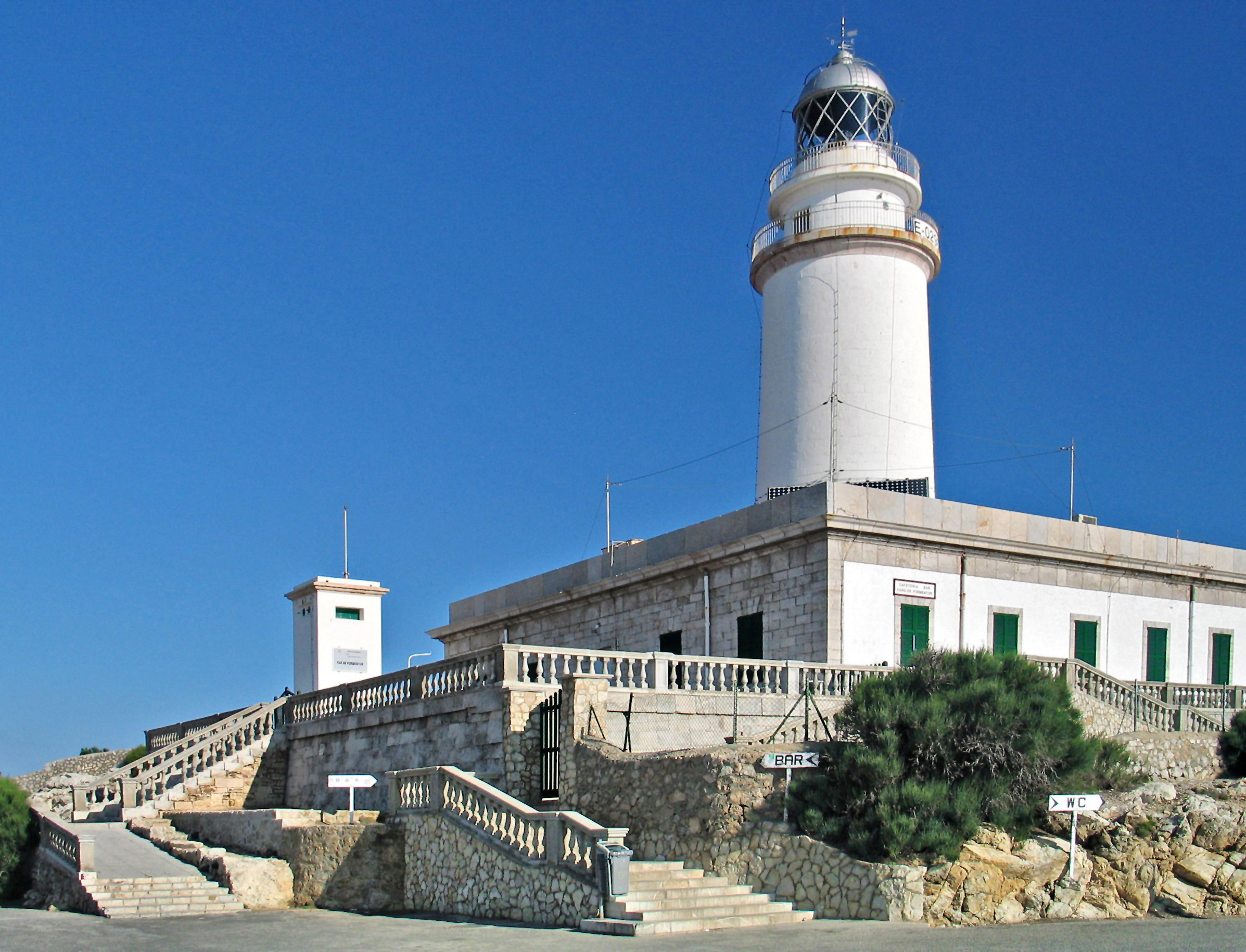
The Ciutadella, Punta de Sa Farola or Sa Farola Lighthouse ( ca, Far de Ciutadella) is an active 19th century lighthouse on the Spanish island of Menorca. Originally completed in 1863, the tower has subsequently undergone a number of modifications. It lies close to the seaward entrance of the port of Ciutadella on the Sa Farola point, at the western end of the island. On the opposite headland is the Castell de Sant Nicolau, a 17th-century defensive tower. History Designed by the architect Emili Pou who planned a number of lights in the Balearic Islands, work started in 1861 and it first became operational in April 1863. It was originally equipped with a 6th order Catadioptric lens displaying a fixed light. It marks the entrance to the old port, but its exposed position has caused problems due to waves breaking over the cliffs, especially during heavy storms when seawater has flooded the lower levels of the buildings. To alleviate this, a high concrete sea wall was built facin ... [...More Info...] [...Related Items...] OR: [Wikipedia] [Google] [Baidu] |
Ciutadella De Menorca
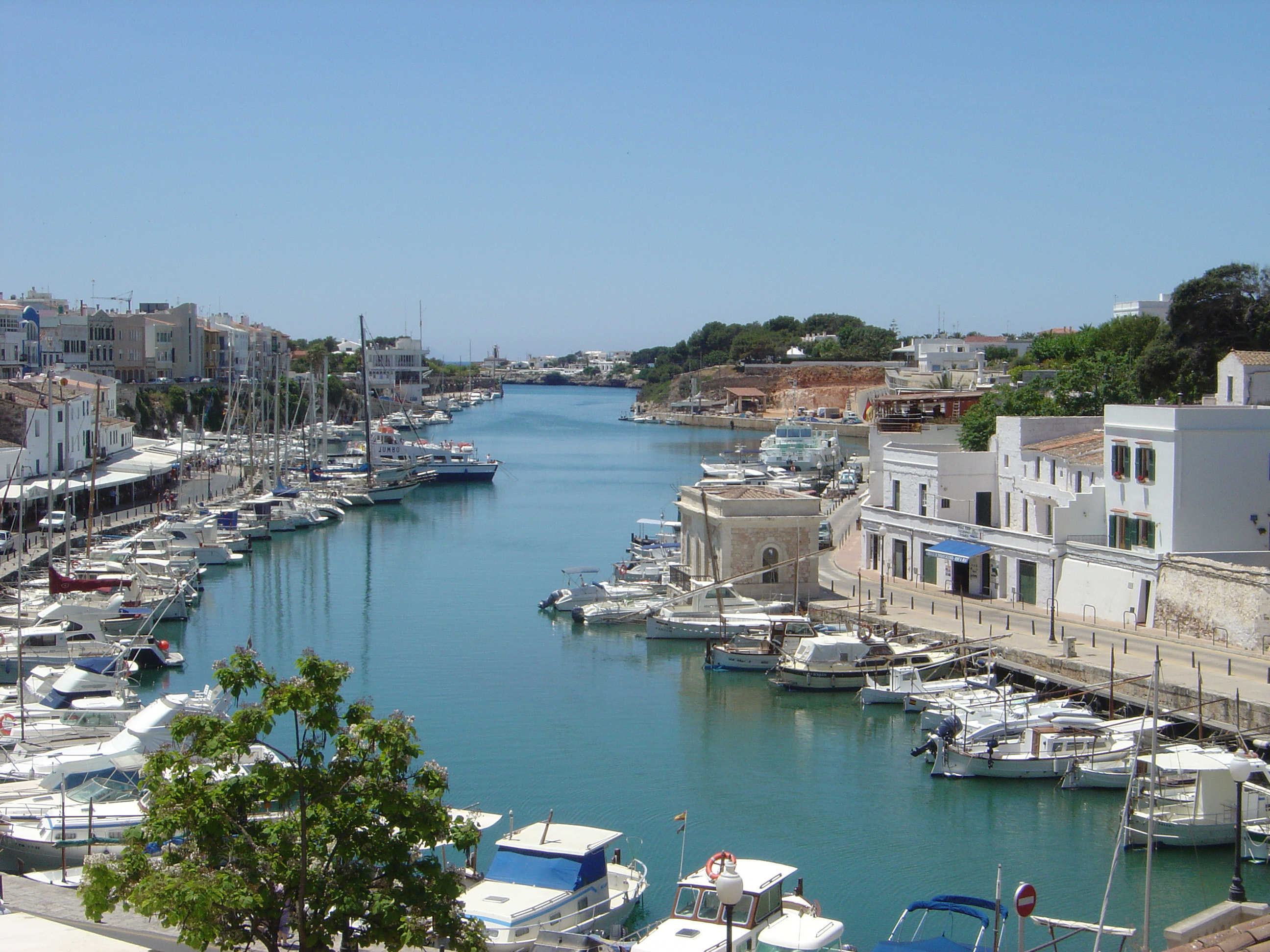
Ciutadella de Menorca () or simply Ciutadella is a town and a municipality in the western end of Menorca, one of the Balearic Islands (Spain). It is one of the two primary cities in the island, along with Maó. History It was founded by the Carthaginians, and became the seat of a bishop in the 4th century. After being governed by the Moors under the names of ''Medīna el Jezīra'' ( ar, مدينة الجزيرة) and ''Medīna Menūrqa'' (مدينة منورقة) for several centuries, Ciutadella was recaptured during the reconquista by men serving Alfonso III and became part of the Crown of Aragon. During the Middle Ages, it became an important trading center. On 9 July 1558, the Turks under Piyale Pasha and Turgut Reis with a powerful Turkish Armada of 140 ships and 15,000 soldiers, put the town under siege for eight days entered and decimated the town. The town was defended by only a few hundred men. All of Ciutadella's 3,099 inhabitants who survived the siege were taken a ... [...More Info...] [...Related Items...] OR: [Wikipedia] [Google] [Baidu] |
Camí De Cavalls
The Camí de Cavalls is an ancient path, in length, that encircles the island of Menorca, Spain. This Long-distance trail, long-distance walking route is the GR 223 of the GR footpath, Senderos de Gran Recorrido network in Spain that connects some of the most inaccessible List of beaches in Menorca, beaches of Menorca. History It is widely accepted that the Camí de Cavalls was built in order to connect the watchtowers, fortresses and cannons distributed along the coast of the island and to make the transport of troops and artillery easier. However, the date of its origin is not so clear. The most accepted theory attributes it to the French invaders during the different periods they lived in the island, but according to some studies, it could have been created in the 14th century. Since its original function was the defence and the control of the island, it was patrolled by soldiers mounted on Menorquín horse, Menorquin horses, hence the word ''cavalls'' (meaning "horses" in ... [...More Info...] [...Related Items...] OR: [Wikipedia] [Google] [Baidu] |
Lighthouses In The Balearic Islands
A lighthouse is a tower, building, or other type of physical structure designed to emit light from a system of lamps and lenses and to serve as a beacon for navigational aid, for maritime pilots at sea or on inland waterways. Lighthouses mark dangerous coastlines, hazardous shoals, reefs, rocks, and safe entries to harbors; they also assist in aerial navigation. Once widely used, the number of operational lighthouses has declined due to the expense of maintenance and has become uneconomical since the advent of much cheaper, more sophisticated and effective electronic navigational systems. History Ancient lighthouses Before the development of clearly defined ports, mariners were guided by fires built on hilltops. Since elevating the fire would improve the visibility, placing the fire on a platform became a practice that led to the development of the lighthouse. In antiquity, the lighthouse functioned more as an entrance marker to ports than as a warning signal for reefs and ... [...More Info...] [...Related Items...] OR: [Wikipedia] [Google] [Baidu] |
List Of Lighthouses In The Balearic Islands
This is a list of lighthouses in the Balearic Islands. The Spain, Spanish archipelago lies at the western end of the Mediterranean Sea. Lighthouses See also * List of lighthouses in Spain * List of lighthouses in the Canary Islands References External links * {{DEFAULTSORT:Balearic Islands Lighthouses in the Balearic Islands, * Lists of lighthouses in Spain Balearic Islands-related lists, Lighthouses ... [...More Info...] [...Related Items...] OR: [Wikipedia] [Google] [Baidu] |
List Of Lighthouses In Spain
This is a list of lighthouses in Spain. Lighthouses By autonomous communities * List of lighthouses in the Balearic Islands * List of lighthouses in the Canary Islands See also * Lists of lighthouses and lightvessels * List of tallest lighthouses References External links {{Architecture of Spain Lists of lighthouses in Spain, ... [...More Info...] [...Related Items...] OR: [Wikipedia] [Google] [Baidu] |
National Geospatial-Intelligence Agency
The National Geospatial-Intelligence Agency (NGA) is a combat support agency within the United States Department of Defense whose primary mission is collecting, analyzing, and distributing geospatial intelligence (GEOINT) in support of national security. Initially known as the National Imagery and Mapping Agency (NIMA) from 1996 to 2003, it is a member of the United States Intelligence Community. NGA headquarters, also known as NGA Campus East or NCE, is located at Fort Belvoir North Area in Springfield, Virginia. The agency also operates major facilities in the St. Louis, Missouri area (referred to as NGA Campus West or NCW), as well as support and liaison offices worldwide. The NGA headquarters, at , is the third-largest government building in the Washington metropolitan area after The Pentagon and the Ronald Reagan Building. In addition to using GEOINT for U.S. military and intelligence efforts, NGA provides assistance during natural and man-made disasters, aids in security ... [...More Info...] [...Related Items...] OR: [Wikipedia] [Google] [Baidu] |
Port Authority
In Canada and the United States, a port authority (less commonly a port district) is a governmental or quasi-governmental public authority for a special-purpose district usually formed by a legislative body (or bodies) to operate ports and other transportation infrastructure. In Canada, the federal Minister of Transport selects the local chief executive board member and the rest of the board is appointed at the recommendation of port users to the federal Minister; while all Canadian port authorities have a federal or Crown charter called '' Letters Patent''. Numerous Caribbean nations have port authorities, including those of Aruba, British Virgin Islands, Bahamas, Jamaica, Cayman Islands, Trinidad and Tobago, St. Lucia, St. Maarten, St. Vincent and the Grenadines. Central and South America also have port agencies such as ''autoridad'' and ''consorcio'' (authority and consortium). In Mexico, the federal government created sixteen port administrations in 1994–1995 called ''Admin ... [...More Info...] [...Related Items...] OR: [Wikipedia] [Google] [Baidu] |
Daymark
A daymark is a navigational aid for sailors and pilots, distinctively marked to maximize its visibility in daylight. The word is also used in a more specific, technical sense to refer to a signboard or daytime identifier that is attached to a day beacon or other aid to navigation. In that sense, a daymark conveys to the mariner during daylight hours the same significance as does the aid's light or reflector at night. Standard signboard shapes are square, triangular and rectangular; and the standard colours are red, green, orange, yellow and black. Notable daymarks * Trinity House Obelisk * Kingswear Daymark *Tasku beacon tower *Keskiniemi beacon tower *Hiidenniemi beacon tower *Laitakari beacon tower *Herring Tower, Langness *Le Hocq *La Tour Cârrée *Scharhörnbake Symbols used on US charts Chart symbols used by the US National Oceanic and Atmospheric Administration Department, 2013. See also * Landmark * Sea mark * Lighthouse A lighthouse is a tower, buildin ... [...More Info...] [...Related Items...] OR: [Wikipedia] [Google] [Baidu] |
Nautical Miles
A nautical mile is a unit of length used in air, marine, and space navigation, and for the definition of territorial waters. Historically, it was defined as the meridian arc length corresponding to one minute ( of a degree) of latitude. Today the international nautical mile is defined as exactly . The derived unit of speed is the knot, one nautical mile per hour. Unit symbol There is no single internationally agreed symbol, with several symbols in use. * M is used as the abbreviation for the nautical mile by the International Hydrographic Organization. * NM is used by the International Civil Aviation Organization. * nmi is used by the Institute of Electrical and Electronics Engineers and the United States Government Publishing Office. * nm is a non-standard abbreviation used in many maritime applications and texts, including U.S. Government Coast Pilots and Sailing Directions. It conflicts with the SI symbol for nanometre. History The word mile is from the Latin word for ... [...More Info...] [...Related Items...] OR: [Wikipedia] [Google] [Baidu] |
Punta Nati Lighthouse
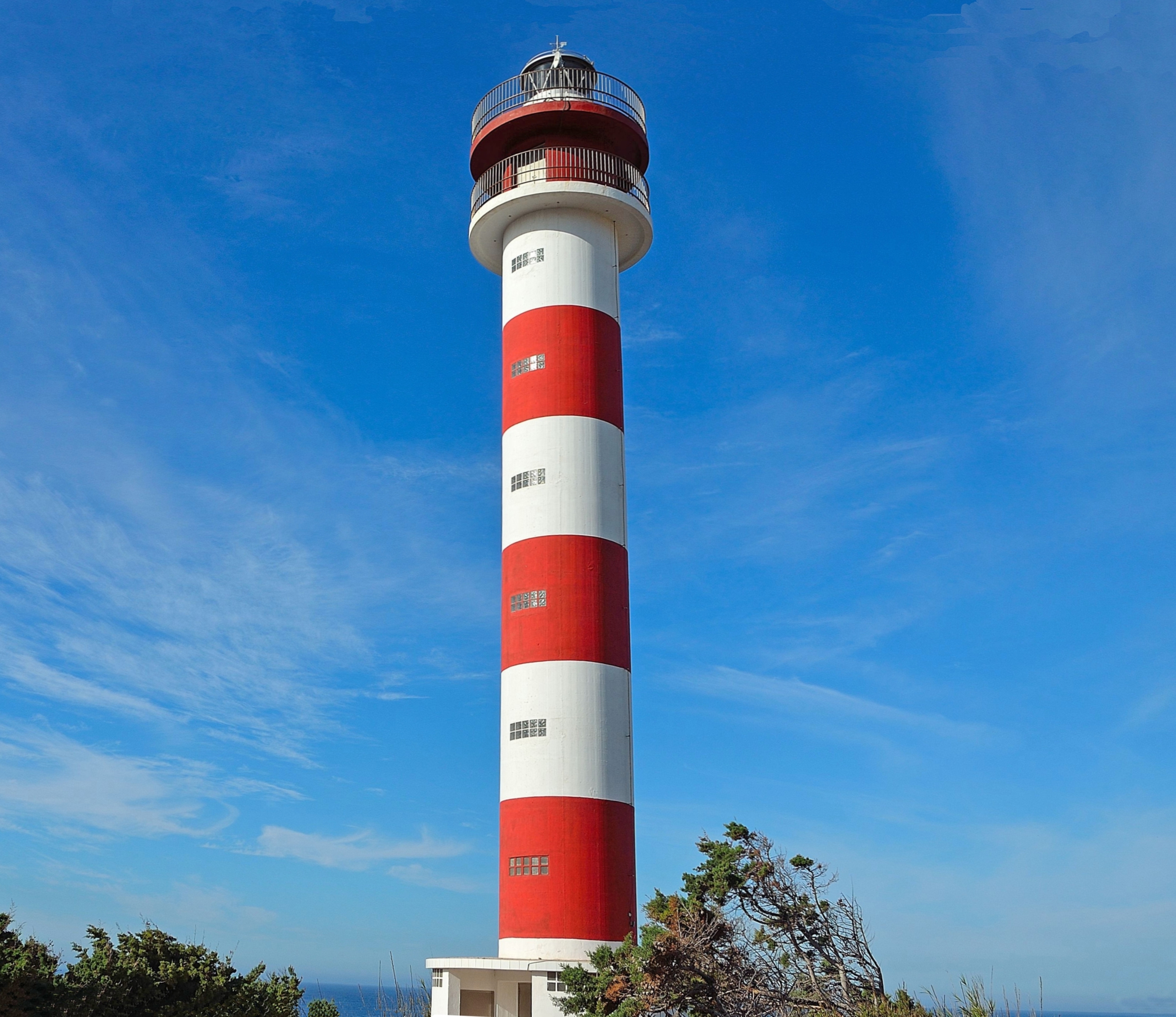
The Punta Nati Lighthouse is an active aid to navigation located on the rocky north western coast of the Spanish island of Menorca. The lighthouse was built following demands from the French authorities to light the northern coast of the island. This was primarily in response to the sinking of the French steamship ''Général Chanzy'' nearby in 1910, during which 156 passengers and crew lost their lives. Designed by the engineer Mauro Serret, Punta Nati was constructed rapidly in just over a year, it became operational in 1913, and was fully completed in 1914. The loss of the ''Général Chanzy'' was the catalyst for building the light, but a number of other shipwrecks had also occurred in the area despite the presence of the lighthouse at Cavalleria, which was completed in 1857. Construction of a third lighthouse on the northern coast at Favàritx began in 1917, which was also designed by Serret. Loss of the Général Chanzy Named after the famous French general Antoine Chanz ... [...More Info...] [...Related Items...] OR: [Wikipedia] [Google] [Baidu] |
Correos
Sociedad Estatal de Correos y Telégrafos, S.A., trading as Correos (literally "Mails"), is a state-owned company responsible for providing postal service in Spain and, due to bilateral agreements, it has responsibility for mail services in Andorra alongside the French company La Poste. The origins of Correos dates back to 1716. The change of dynasty in Spain ended the tradition of giving to some relevant families the duty to take care of the postal services and, on July 8, 1716, King Philip V appointed Juan Tomás de Goyeneche as Chief Superintendent and General Administrator of the Postal Offices, making the postal service responsibility of the State. The company is 100% state owned, through the State Society for Industrial Participations (SEPI). With more than 53,000 employees and 5.4 billion pieces of mail sent each year, Correos is one of the largest postal services in the world. Based in Madrid, it has over 10,000 postal centres all over Spain. The Correos Group is cur ... [...More Info...] [...Related Items...] OR: [Wikipedia] [Google] [Baidu] |
Menorca
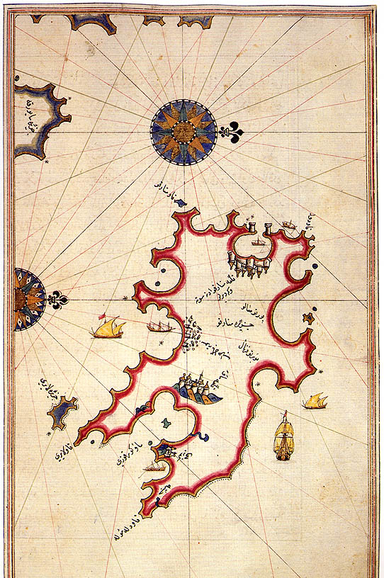
Menorca or Minorca (from la, Insula Minor, , smaller island, later ''Minorica'') is one of the Balearic Islands located in the Mediterranean Sea belonging to Spain. Its name derives from its size, contrasting it with nearby Majorca. Its capital is Mahón ( ca, Maó), situated on the island's eastern end, although Menorca is not a province and forms a political union with the other islands in the archipelago. Ciutadella and Mahon are the main ports and largest towns. The port of Mahon is the second biggest natural port in the world. Menorca has a population of approximately 93,397 (at 1 January 2019). It is located 39°47' to 40°00'N, 3°52' to 4°24'E. Its highest point, called El Toro (from Catalan "''turó''" meaning ''hill''), is above sea level. History The island is known for its collection of megalithic stone monuments: ''navetes'', ''taules'' and ''talaiots'', which indicate very early prehistoric human activity. Some of the earliest culture on Menorca was ... [...More Info...] [...Related Items...] OR: [Wikipedia] [Google] [Baidu] |


