|
Cirrus Spissatus Cloud
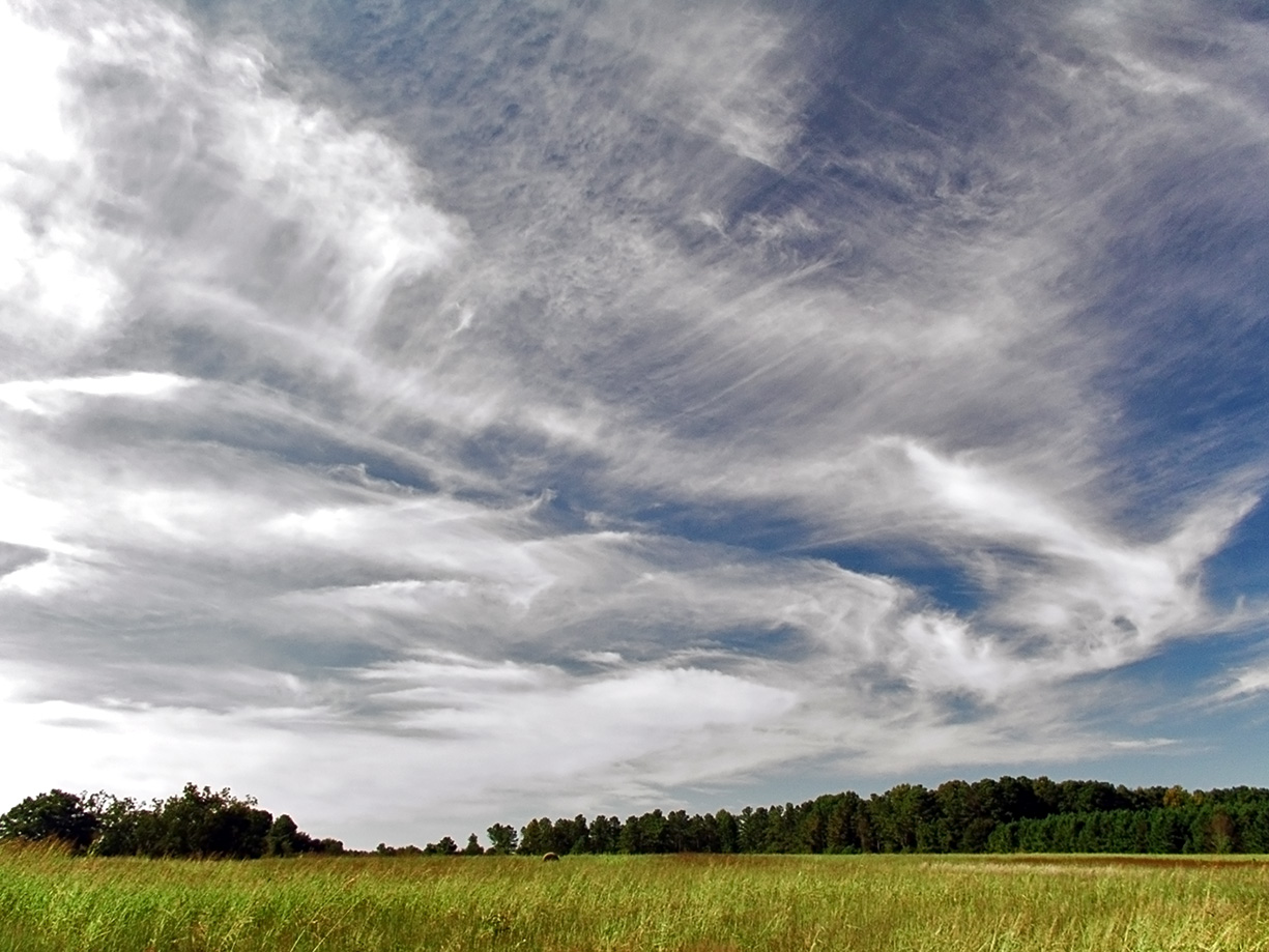
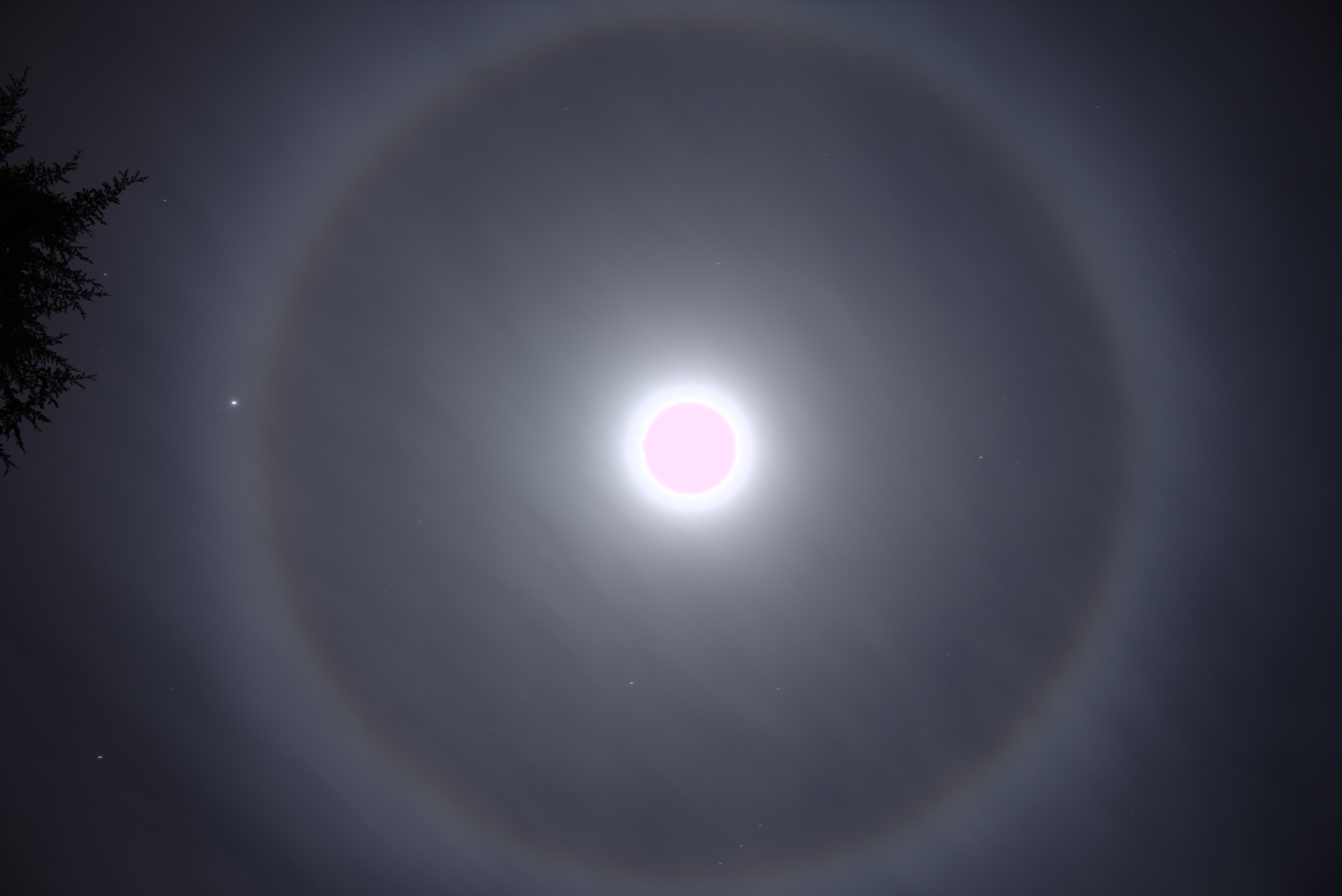
Cirrus spissatus or also called Cirrus densus and Cirrus nothus clouds are the highest of the main cloud genera, and may sometimes even occur in the lower stratosphere. The characteristic features of cirrus clouds are fine threads or wisps of ice crystals, generally white, but appearing grey when dense and seen against the light. There is no precipitation at the ground. It also frequently exhibits optical phenomena. Cirrus spissatus is the dense cirrus that will partly or completely hide the sun (or moon) and which appears dark grey when seen against the light. Although it arises under various circumstances, it is particularly commonly found in the plumes or anvils of cumulonimbus clouds. Precipitation is likely within 15 to 25 hours if winds are steady from NE E to S, or sooner if winds SE to S. Other winds bring an overcast sky. A different variety of cirrus spissatus also forms from phenomena that have nothing to do with cumulonimbus blow-off or dissipating cumulonimbus cells ... [...More Info...] [...Related Items...] OR: [Wikipedia] [Google] [Baidu] |
Cirrus Uncinus
Cirrus uncinus is a type of cirrus cloud. The name ''cirrus uncinus'' is derived from Latin, meaning "curly hooks". Also known as ''mares' tails'', these clouds are generally sparse in the sky and very thin. The clouds occur at high altitudes, at a temperature of about . They are generally seen when a warm or occluded front is approaching. They are very high in the troposphere and generally mean that precipitation, usually rain, is approaching. File:Cirrus clouds 011.jpg, Cirrus uncinus clouds in Salinas Victoria, Nuevo Leon, Mexico. See also *List of cloud types The list of cloud types groups all genera as ''high'' (cirro-, cirrus), ''middle'' (alto-), ''multi-level'' (nimbo-, cumulo-, cumulus), and ''low'' (strato-, stratus). These groupings are determined by the altitude level or levels in the troposphe ... References External linksInternational Cloud Atlas – Cirrus uncinus Cirrus {{Cloud-stub ... [...More Info...] [...Related Items...] OR: [Wikipedia] [Google] [Baidu] |
Cloud
In meteorology, a cloud is an aerosol consisting of a visible mass of miniature liquid droplets, frozen crystals, or other particles suspended in the atmosphere of a planetary body or similar space. Water or various other chemicals may compose the droplets and crystals. On Earth, clouds are formed as a result of saturation of the air when it is cooled to its dew point, or when it gains sufficient moisture (usually in the form of water vapor) from an adjacent source to raise the dew point to the ambient temperature. They are seen in the Earth's homosphere, which includes the troposphere, stratosphere, and mesosphere. Nephology is the science of clouds, which is undertaken in the cloud physics branch of meteorology. There are two methods of naming clouds in their respective layers of the homosphere, Latin and common name. Genus types in the troposphere, the atmospheric layer closest to Earth's surface, have Latin names because of the universal adoption of Luke Howard's ... [...More Info...] [...Related Items...] OR: [Wikipedia] [Google] [Baidu] |
Stratosphere
The stratosphere () is the second layer of the atmosphere of the Earth, located above the troposphere and below the mesosphere. The stratosphere is an atmospheric layer composed of stratified temperature layers, with the warm layers of air high in the sky and the cool layers of air in the low sky, close to the planetary surface of the Earth. The increase of temperature with altitude is a result of the absorption of the Sun's ultraviolet (UV) radiation by the ozone layer. The temperature inversion is in contrast to the troposphere, near the Earth's surface, where temperature decreases with altitude. Between the troposphere and stratosphere is the tropopause border that demarcates the beginning of the temperature inversion. Near the equator, the lower edge of the stratosphere is as high as , at midlatitudes around , and at the poles about . Temperatures range from an average of near the tropopause to an average of near the mesosphere. Stratospheric temperatures also vary w ... [...More Info...] [...Related Items...] OR: [Wikipedia] [Google] [Baidu] |
Cirrus Cloud
Cirrus ( cloud classification symbol: Ci) is a genus of high cloud made of ice crystals. Cirrus clouds typically appear delicate and wispy with white strands. Cirrus are usually formed when warm, dry air rises, causing water vapor deposition onto rocky or metallic dust particles at high altitudes. Globally, they form anywhere between above sea level, with the higher elevations usually in the tropics The tropics are the regions of Earth surrounding the Equator. They are defined in latitude by the Tropic of Cancer in the Northern Hemisphere at N and the Tropic of Capricorn in the Southern Hemisphere at S. The tropics are also referr ... and the lower elevations in more Polar regions of Earth, polar regions. Cirrus clouds can form from the tops of cumulonimbus cloud, thunderstorms and tropical cyclones and sometimes predict the arrival of precipitation, rain or storms. Although they are a sign that rain and maybe storms are on the way, cirrus themselves drop no more ... [...More Info...] [...Related Items...] OR: [Wikipedia] [Google] [Baidu] |
Ice Crystals
Ice crystals are solid ice exhibiting atomic ordering on various length scales and include hexagonal columns, hexagonal plates, dendritic crystals, and diamond dust. Formation The hugely symmetric shapes are due to depositional growth, namely, direct deposition of water vapor onto the ice crystal. Depending on environmental temperature and humidity, ice crystals can develop from the initial hexagonal prism into numerous symmetric shapes. Possible shapes for ice crystals are columns, needles, plates and dendrites. If the crystal migrates into regions with different environmental conditions, the growth pattern may change, and the final crystal may show mixed patterns. Ice crystals tend to fall with their major axis aligned along the horizontal, and are thus visible in polarimetric weather radar signatures with enhanced (positive) differential reflectivity values. Electrification of ice crystals can induce alignments different from the horizontal. Electrified ice crystals are ... [...More Info...] [...Related Items...] OR: [Wikipedia] [Google] [Baidu] |
Precipitation (meteorology)
In meteorology, precipitation is any product of the condensation of atmospheric water vapor that falls under gravitational pull from clouds. The main forms of precipitation include drizzle, rain, sleet, snow, ice pellets, graupel and hail. Precipitation occurs when a portion of the atmosphere becomes saturated with water vapor (reaching 100% relative humidity), so that the water condenses and "precipitates" or falls. Thus, fog and mist are not precipitation but colloids, because the water vapor does not condense sufficiently to precipitate. Two processes, possibly acting together, can lead to air becoming saturated: cooling the air or adding water vapor to the air. Precipitation forms as smaller droplets coalesce via collision with other rain drops or ice crystals within a cloud. Short, intense periods of rain in scattered locations are called showers. Moisture that is lifted or otherwise forced to rise over a layer of sub-freezing air at the surface may be condense ... [...More Info...] [...Related Items...] OR: [Wikipedia] [Google] [Baidu] |
Optical Phenomenon
Optical phenomena are any observable events that result from the interaction of light and matter. All optical phenomena coincide with quantum phenomena. Common optical phenomena are often due to the interaction of light from the sun or moon with the atmosphere, clouds, water, dust, and other particulates. One common example is the rainbow, when light from the sun is reflected and refracted by water droplets. Some phenomena, such as the green ray, are so rare they are sometimes thought to be mythical. Others, such as Fata Morganas, are commonplace in favored locations. Other phenomena are simply interesting aspects of optics, or optical effects. For instance, the colors generated by a prism are often shown in classrooms. List Optical phenomena include those arising from the optical properties of the atmosphere; the rest of nature (other phenomena); of objects, whether natural or human-made (optical effects); and of our eyes (Entoptic phenomena). Also listed here are unexpla ... [...More Info...] [...Related Items...] OR: [Wikipedia] [Google] [Baidu] |
Moon
The Moon is Earth's only natural satellite. It is the fifth largest satellite in the Solar System and the largest and most massive relative to its parent planet, with a diameter about one-quarter that of Earth (comparable to the width of Australia). The Moon is a planetary-mass object with a differentiated rocky body, making it a satellite planet under the geophysical definitions of the term and larger than all known dwarf planets of the Solar System. It lacks any significant atmosphere, hydrosphere, or magnetic field. Its surface gravity is about one-sixth of Earth's at , with Jupiter's moon Io being the only satellite in the Solar System known to have a higher surface gravity and density. The Moon orbits Earth at an average distance of , or about 30 times Earth's diameter. Its gravitational influence is the main driver of Earth's tides and very slowly lengthens Earth's day. The Moon's orbit around Earth has a sidereal period of 27.3 days. During each synodic period ... [...More Info...] [...Related Items...] OR: [Wikipedia] [Google] [Baidu] |
Cumulonimbus Cloud
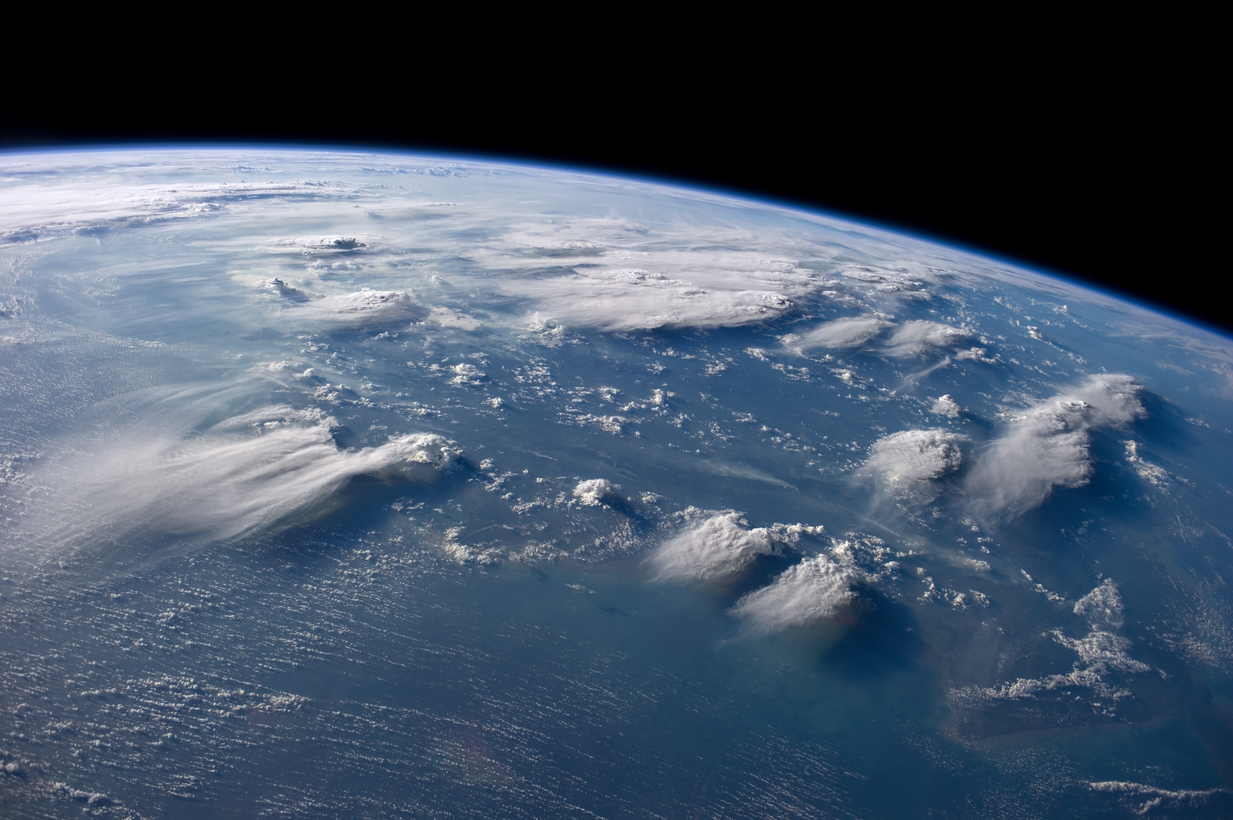
Cumulonimbus (from Latin ''cumulus'', "heaped" and ''nimbus'', "rainstorm") is a dense, towering vertical cloud, typically forming from water vapor condensing in the lower troposphere that builds upward carried by powerful buoyant air currents. Above the lower portions of the cumulonimbus the water vapor becomes ice crystals, such as snow and graupel, the interaction of which can lead to hail and to lightning formation, respectively. When occurring as a thunderstorm these clouds may be referred to as thunderheads. Cumulonimbus can form alone, in clusters, or along squall lines. These clouds are capable of producing lightning and other dangerous severe weather, such as tornadoes, hazardous winds, and large hailstones. Cumulonimbus progress from overdeveloped cumulus congestus clouds and may further develop as part of a supercell. Cumulonimbus is abbreviated Cb. Appearance Towering cumulonimbus clouds are typically accompanied by smaller cumulus clouds. The cumulonimbus bas ... [...More Info...] [...Related Items...] OR: [Wikipedia] [Google] [Baidu] |
Overcast
Overcast or overcast weather, as defined by the World Meteorological Organization, is the meteorological condition of clouds obscuring at least 95% of the sky. However, the total cloud cover must not be entirely due to obscuring phenomena near the surface, such as fog. Overcast, written as "OVC" in the METAR observation, is reported when the cloud cover is observed to equal eight oktas (eighths). An overcast sky may be explicitly identified as thin (mostly transparent), but otherwise is considered opaque, which always constitutes a ceiling in aviation meteorology. Sometimes clouds can be different colors such as black or white, but overcast usually refers to darker skies.''Oxford English Dictionary'', 3rd ed. (website), s.v. “overcast," 2a and 2b. http://www.oed.com/view/Entry/134377#eid32922408 (Accessed September 7, 2016). In some cases, it can be impossible to see distinct borders of clouds or the sky may be covered by a single type of cloud, such as stratus, and the whole ... [...More Info...] [...Related Items...] OR: [Wikipedia] [Google] [Baidu] |
List Of Cloud Types
The list of cloud types groups all genera as ''high'' (cirro-, cirrus), ''middle'' (alto-), ''multi-level'' (nimbo-, cumulo-, cumulus), and ''low'' (strato-, stratus). These groupings are determined by the altitude level or levels in the troposphere at which each of the various cloud types is normally found. Small cumulus are commonly grouped with the low clouds because they do not show significant vertical extent. Of the multi-level genus-types, those with the greatest convective activity are often grouped separately as ''towering vertical''. The genus types all have Latin names. The genera are also grouped into five physical forms. These are, in approximate ascending order of instability or convective activity: ''stratiform'' sheets; ''cirriform'' wisps and patches; ''stratocumuliform'' patches, rolls, and ripples; ''cumuliform'' heaps, and ''cumulonimbiform'' towers that often have complex structures. Most genera are divided into ''species'' with Latin names, some of which are c ... [...More Info...] [...Related Items...] OR: [Wikipedia] [Google] [Baidu] |


