|
Cilymaenllwyd
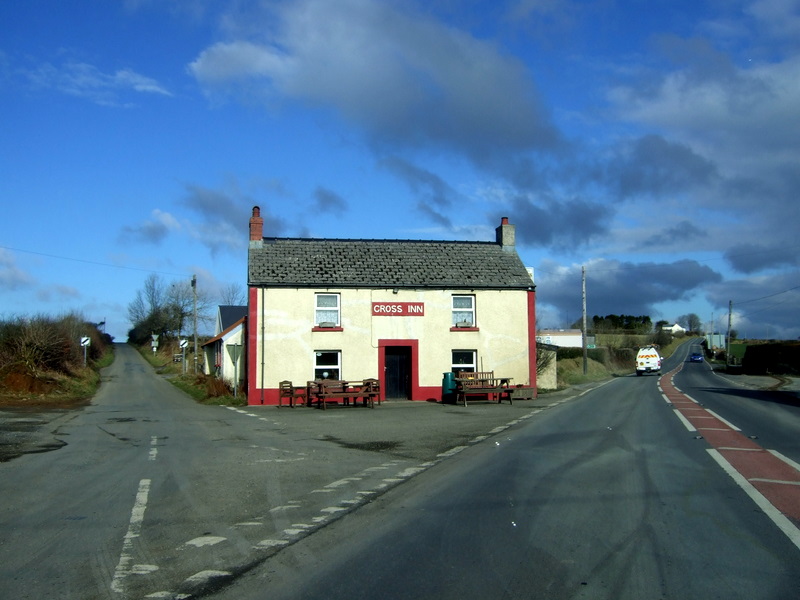
Cilymaenllwyd is a community on the extreme northwest of Carmarthenshire in Wales. The community population at the 2011 census was 742. It lies about west of Carmarthen, southeast of Fishguard and northwest of Haverfordwest. The A478 road runs through the community. Location and demographics Cilymaenllwyd has an area of 2,628 hectares and had a population of 725 in 2003. The western edge of the community borders Pembrokeshire. The community is bordered by the communities of Llanboidy and Henllanfallteg in Carmarthenshire, and by Clynderwen, Mynachlog-ddu and Crymych in Pembrokeshire. The River Tâf forms the eastern boundary. The area is part of the foothills of the Preseli Mountains rising to an altitude of 248 metres and is dissected by deep valleys of the Tâf and its tributaries. Historically it was part of Derllys Hundred. In the 20th century the main road through the community, which links Cardigan, Ceredigion in the north to Tenby, Pembrokeshire in the south, was design ... [...More Info...] [...Related Items...] OR: [Wikipedia] [Google] [Baidu] |
Llanboidy
Llanboidy is a village and community in the principal area and historic county of Carmarthenshire, West Wales. The community includes the village of Llanglydwen. Location According to the 2001 United Kingdom Census, the community had a population of 988 rising to 1,061 at the 2011 Census. It is located near the border with Pembrokeshire close to the Landsker Line. The village itself is on the Welsh speaking side. The community is bordered by the communities of: Llanwinio; Llangynin; St Clears; Eglwyscummin; Whitland; Henllanfallteg; and Cilymaenllwyd, all being in Carmarthenshire; and by Crymych in Pembrokeshire. Governance An electoral ward in the same name exists. This ward stretches beyond the boundaries of Llanboidy. The population of the ward taken at the 2011 census was 2,087. History and amenities Llanboidy is a scenic village in West Carmarthenshire, Wales. Its history goes back to the Iron Age where the site of a timber built fort can be seen near the village centr ... [...More Info...] [...Related Items...] OR: [Wikipedia] [Google] [Baidu] |
Henllanfallteg
Henllanfallteg (Welsh language, Welsh: ''Henllan Fallteg'') is a Community (Wales), community in the west of Carmarthenshire, Wales. It comprises the villages of Cwmfelin Boeth, Henllan Amgoed, Hiraeth, Carmarthenshire, Hiraeth, Llanfallteg, and Rhydywrach. The community population taken at the United Kingdom Census 2011, 2011 census was 480. The community is bordered by the communities of: Cilymaenllwyd; Llanboidy; and Whitland, all being in Carmarthenshire; and by Llanddewi Velfrey and Clynderwen in Pembrokeshire. References External links * Communities in Carmarthenshire Villages in Carmarthenshire {{Carmarthenshire-geo-stub ... [...More Info...] [...Related Items...] OR: [Wikipedia] [Google] [Baidu] |
River Tâf
The River Taf ( cy, Afon Taf) is a river in West Wales. It rises in the Preseli Hills, Pembrokeshire, and continues through Carmarthenshire to Laugharne. It is one of the three rivers to enter the sea on the east side of Carmarthen Bay. The other two are the River Gwendraeth and River Tywi. Course The River Taf is about from Crymych to Ginst Point, of which about is tidal.The Journal of Conchology 1979 p 7 "CARMARTHEN BAY. Three large estuaries, the Gwendraeth, Afon Tywi and Afon Taf enter the sea on the east side of Carmarthen Bay and these rivers contribute to deposits of muddy shores. Water drains from high ground above the village of Crymych in Pembrokeshire, and at one time flowed at ground level across the main Cardigan–Tenby road ( A478) before falling to the level of the Whitland and Cardigan Railway station Crymmych Arms (Great Western Railway) where on the UK Ordnance Survey map of 1866 it is shown as the source of the Taf. The stream fulfills its description "C ... [...More Info...] [...Related Items...] OR: [Wikipedia] [Google] [Baidu] |
Rebecca Riots
The Rebecca Riots (Welsh: ''Terfysgoedd Beca'') took place between 1839 and 1843 in West and Mid Wales. They were a series of protests undertaken by local farmers and agricultural workers in response to levels of taxation. The rioters, often men dressed as women, took their actions against toll-gates, as they were tangible representations of taxes and tolls. The rioters went by the name of 'Merched Beca' which translates directly from Cymraeg as Rebecca's Daughters. The riots ceased prior to 1844 due to several factors, including increased troop levels, a desire by the protestors to avoid violence and the appearance of criminal groups using the guise of the biblical character Rebecca for their own purposes. In 1844 an Act of Parliament to consolidate and amend the laws relating to turnpike trusts in Wales was passed. History Events leading to the riots In the late 1830s and early 1840s, the agricultural communities of west Wales were in dire poverty.Howell (1988), pg, 113 In 1 ... [...More Info...] [...Related Items...] OR: [Wikipedia] [Google] [Baidu] |
A478 Road
The A478 road is a major road in Wales. The route is from its junction with the A487 at Cardigan, Ceredigion, to Tenby, Pembrokeshire. It crosses the Preseli Hills and winds through farmland for almost all of its route. The road just touches the very west of Carmarthenshire. History A road between Cardigan and Narberth was recorded between 1536 and 1642. The 1555 Highways Act made parishes responsible for the roads that crossed them. Most were unsuitable for wheeled traffic. Turnpike trusts were set up in the late 18th and early 19th centuries to manage road maintenance; at least part of this road came under the Whitland Trust. However, by the mid-19th century, some trusts were badly managed or abused, exacerbating rural poverty and in part leading to the Rebecca riots in the 1840s, some of the earliest of which were on this road, particularly at Efailwen in the Cilymaenllwyd Community. The trusts were reformed in 1844. The northern two-thirds of the A478 was a drovers' road, ... [...More Info...] [...Related Items...] OR: [Wikipedia] [Google] [Baidu] |
Clynderwen
Clynderwen ( cy, Clunderwen; ) is a rural linear village and community (Wales), community, Historic counties of Wales, historically in Carmarthenshire in Wales, but administered as part of Pembrokeshire. It lies on the A478 road, A478 Tenby to Cardigan, Ceredigion, Cardigan road south of the village of Llandissilio and north of the town of Narberth, Pembrokeshire, Narberth. The village has its own community council of 10 members. Name Clunderwen, translating into English as "oak thicket", is named after an estate of the same name. On 1 April 2003, the village was transferred from the administrative county of Carmarthenshire to that of Pembrokeshire, following a boundary change between the counties. At the same time, a name change to Clunderwen was proposed to reflect the actual usage by the community council and on road and other signs. History The earliest known record of Clynderwen is in 1822: a mansion and farm of that name, the Clynderwen Estate, is to the east of the presen ... [...More Info...] [...Related Items...] OR: [Wikipedia] [Google] [Baidu] |
Maenclochog
Maenclochog () is a village, parish and Community (Wales), community in Pembrokeshire, south-west Wales. It is also the name of Maenclochog (electoral ward), an electoral ward comprising a wider area of four surrounding communities. Maenclochog Community includes the small settlement of Llanycefn () and the village of Rosebush, Pembrokeshire, Rosebush. The Maenclochog community population was 731 in 2011. Maenclochog lies south of the Preseli Hills, about one mile southeast of Rosebush on the B4313 Narberth, Pembrokeshire, Narberth to Fishguard road. Origin of the name The origin of the name Maenclochog is unclear. It appears to be made up of two Welsh words, ''maen'' ("stone") and ''clochog'' ("noisy, clamorous"). A local tale reports that there were stones near Ffynnon Fair ("Mary's Well"), to the south of the village, which rang like bells when struck, but these were blown up by treasure-hunters, in the mistaken belief that they concealed a golden treasure. This may repres ... [...More Info...] [...Related Items...] OR: [Wikipedia] [Google] [Baidu] |
Llangolman
Llangolman () is a village and parish in the southeastern Preseli Hills in Pembrokeshire, Wales. It is part of the community of Mynachlog-ddu. There are prehistoric remains nearby and the parish has a history of slate and clay quarrying. History Llangolman lies in a historic landscape near the upper part of the valley of the Eastern Cleddau and its tributaries. The village place name derives from the church dedicated to St. Golman, or in Irish, St Colman. Colman is attributed to Colmán of Dromore, a 6th-century saint. Anglican church Llangolman church stands on high ground just to the south of the main village. The current building is Victorian or early Victorian, with little to show for the original medieval building that once stood on the site. Of historical interest is the recording in the 19th century of a stone gate post about from the churchyard. This stone, known as the Maen-ar-Golman (the stone upon Colman) is about tall with a number of cross markings carved ... [...More Info...] [...Related Items...] OR: [Wikipedia] [Google] [Baidu] |
Picnic At Efailwen, Carmarthenshire
A picnic is a meal taken outdoors ( ''al fresco'') as part of an excursion, especially in scenic surroundings, such as a park, lakeside, or other place affording an interesting view, or else in conjunction with a public event such as preceding an open-air theater performance, and usually in summer. It is different from other meals because it requires free time to leave home. History shows us that the idea of a meal that was jointly contributed to and enjoyed out-of-doors was essential to picnic from the early 19th century. Picnickers like to sit on the ground on a rug or blanket. Picnics can be informal with throwaway plates or formal with silver cutlery and crystal wine glasses. Tables and chairs may be used but this is less common. Outdoor games or some other form of entertainment are common at large picnics. In public parks, a picnic area generally includes picnic tables and possibly built-in grills, water faucets (taps), garbage (rubbish) containers and restrooms (to ... [...More Info...] [...Related Items...] OR: [Wikipedia] [Google] [Baidu] |
Community (Wales)
A community ( cy, cymuned) is a division of land in Wales that forms the lowest tier of local government in Wales. Welsh communities are analogous to civil parishes in England. There are 878 communities in Wales. History Until 1974 Wales was divided into civil parishes. These were abolished by section 20 (6) of the Local Government Act 1972, and replaced by communities by section 27 of the same Act. The principal areas of Wales are divided entirely into communities. Unlike in England, where unparished areas exist, no part of Wales is outside a community, even in urban areas. Most, but not all, communities are administered by community councils, which are equivalent to English parish councils in terms of their powers and the way they operate. Welsh community councils may call themselves town councils unilaterally and may have city status granted by the Crown. In Wales, all town councils are community councils. There are now three communities with city status: Bangor, St Asaph ... [...More Info...] [...Related Items...] OR: [Wikipedia] [Google] [Baidu] |
Parish
A parish is a territorial entity in many Christian denominations, constituting a division within a diocese. A parish is under the pastoral care and clerical jurisdiction of a priest, often termed a parish priest, who might be assisted by one or more curates, and who operates from a parish church. Historically, a parish often covered the same geographical area as a manor. Its association with the parish church remains paramount. By extension the term ''parish'' refers not only to the territorial entity but to the people of its community or congregation as well as to church property within it. In England this church property was technically in ownership of the parish priest ''ex-officio'', vested in him on his institution to that parish. Etymology and use First attested in English in the late, 13th century, the word ''parish'' comes from the Old French ''paroisse'', in turn from la, paroecia, the latinisation of the grc, παροικία, paroikia, "sojourning in a foreign ... [...More Info...] [...Related Items...] OR: [Wikipedia] [Google] [Baidu] |


