|
A478 Road
The A478 road is a major road in Wales. The route is from its junction with the A487 at Cardigan, Ceredigion, to Tenby, Pembrokeshire. It crosses the Preseli Hills and winds through farmland for almost all of its route. The road just touches the very west of Carmarthenshire. History A road between Cardigan and Narberth was recorded between 1536 and 1642. The 1555 Highways Act made parishes responsible for the roads that crossed them. Most were unsuitable for wheeled traffic. Turnpike trusts were set up in the late 18th and early 19th centuries to manage road maintenance; at least part of this road came under the Whitland Trust. However, by the mid-19th century, some trusts were badly managed or abused, exacerbating rural poverty and in part leading to the Rebecca riots in the 1840s, some of the earliest of which were on this road, particularly at Efailwen in the Cilymaenllwyd Community. The trusts were reformed in 1844. The northern two-thirds of the A478 was a drovers' road, ... [...More Info...] [...Related Items...] OR: [Wikipedia] [Google] [Baidu] |
Cardigan, Ceredigion
Cardigan ( cy, Aberteifi, ) is both a town and a community in the county of Ceredigion, Wales. Positioned on the tidal reach of the River Teifi at the point where Ceredigion meets Pembrokeshire, Cardigan was the county town of the historic county of Cardiganshire. Cardigan is the second-largest town in Ceredigion. The largest town, Aberystwyth, is one of the two administrative centres; the other is Aberaeron. The settlement at Cardigan was developed around the Norman castle built in the late 11th or early 12th century. The castle was the location of the first National Eisteddfod in 1176. The town became an important port in the 18th century, but declined by the early 20th century owing to its shallow harbour. The castle underwent restoration in 2014. The population in 2001 was 4,203, reducing slightly to 4,184 at the 2011 census. Toponymy Cardigan is an anglicisation of the Welsh ' ("Ceredig's land"), the surrounding territory its Norman castle once controlled. Ceredig ... [...More Info...] [...Related Items...] OR: [Wikipedia] [Google] [Baidu] |
Llandudoch
St Dogmaels ( cy, Llandudoch) is a village, parish and community in Pembrokeshire, Wales, on the estuary of the River Teifi, a mile downstream from the town of Cardigan in neighbouring Ceredigion. A little to the north of the village, further along the estuary, lies Poppit Sands beach. The parish includes the small settlement of Cippyn, south of Cemaes Head. Name The English and Welsh names seem to bear no similarity, but it has been suggested that possibly both names refer to the same saint or founder Dogmael (Dogfael), with ‘mael’ (prince) and ‘tud’ (land or people of) being added to Dog/doch as in ''Dog mael'' and ''Tud doch''. It is the current standard usage not to have a full-stop after the 'St' or an apostrophe in 'Dogmaels'. History St Dogmaels Abbey is 12th-century Tironesian and was one of the richer monastic institutions in Wales. Adjacent to the abbey ruins is the parish church (Church in Wales) of St Thomas, which appears successively to have occupied ... [...More Info...] [...Related Items...] OR: [Wikipedia] [Google] [Baidu] |
Glandy Cross
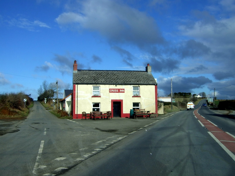
Cilymaenllwyd is a community on the extreme northwest of Carmarthenshire in Wales. The community population at the 2011 census was 742. It lies about west of Carmarthen, southeast of Fishguard and northwest of Haverfordwest. The A478 road runs through the community. Location and demographics Cilymaenllwyd has an area of 2,628 hectares and had a population of 725 in 2003. The western edge of the community borders Pembrokeshire. The community is bordered by the communities of Llanboidy and Henllanfallteg in Carmarthenshire, and by Clynderwen, Mynachlog-ddu and Crymych in Pembrokeshire. The River Tâf forms the eastern boundary. The area is part of the foothills of the Preseli Mountains rising to an altitude of 248 metres and is dissected by deep valleys of the Tâf and its tributaries. Historically it was part of Derllys Hundred. In the 20th century the main road through the community, which links Cardigan, Ceredigion in the north to Tenby, Pembrokeshire in the south, was des ... [...More Info...] [...Related Items...] OR: [Wikipedia] [Google] [Baidu] |
Pentre Galar
Pentre Galar (or Pentregalar, Pentre-Galar) is a small settlement in the Preseli Mountains south of the village of Crymych, north Pembrokeshire, Wales, on the A478 Cardigan to Tenby road. The western part of the settlement lies in the parish of Mynachlog-ddu and the eastern part in Llanfyrnach parish. Name The English translation for ''pentre'' is village, and ''galar'' can mean mourning, sorrow or grief. The origin of this name is obscure. Geography The land slopes from Crugiau Dwy at a height of in the west down towards the valley of Afon Gafel, a tributary of the River Taf. Most of the terrain is above . Land use is agricultural, with a rectilinear field pattern. Minor roads connect Pentre Galar with the villages of Hermon, Glandwr and Mynachlog-ddu, and most houses are alongside the main road. The part of the settlement to the west of the A478 lies within the Pembrokeshire Coast National Park. History The land surrounding Pentre Galar was enclosed by Act of Parliament ... [...More Info...] [...Related Items...] OR: [Wikipedia] [Google] [Baidu] |
Crymych
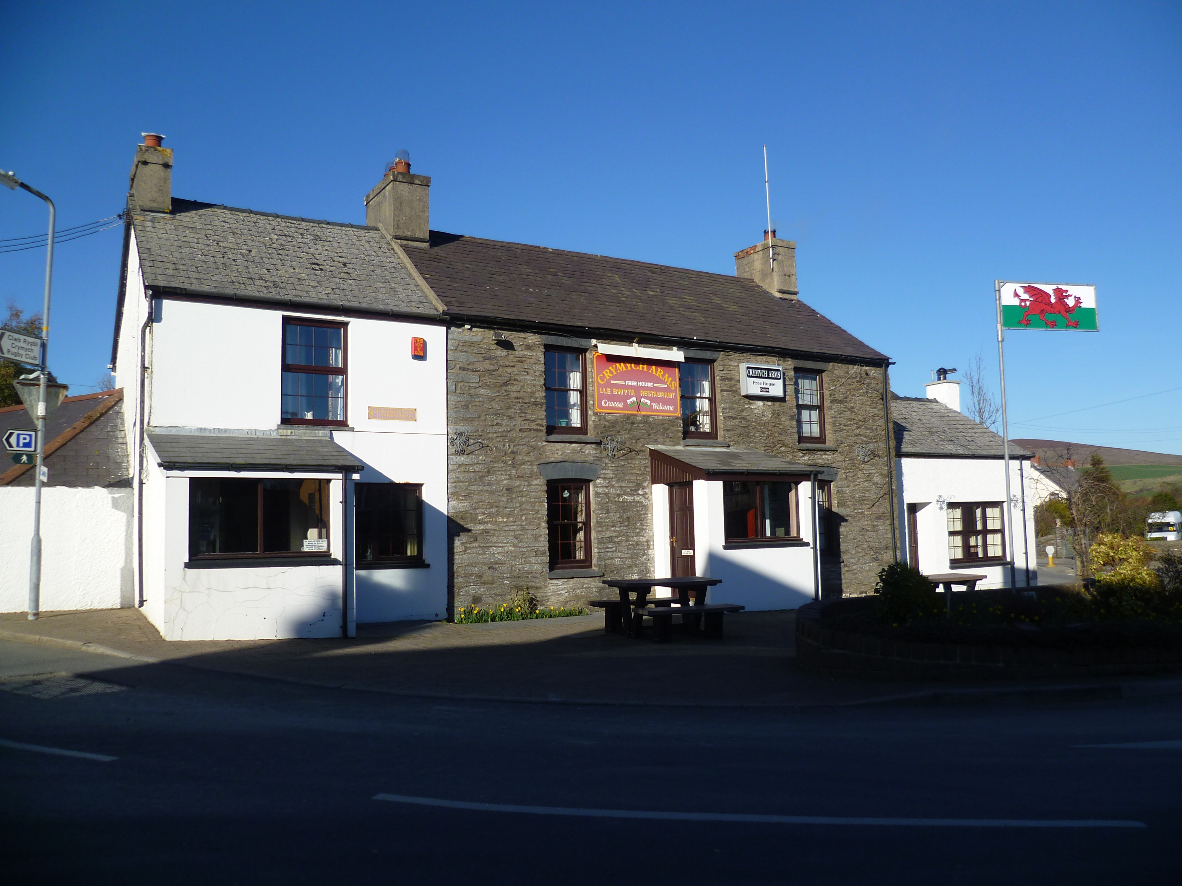
Crymych () is a village of around 800 inhabitants and a community (population 1,739) in the northeast of Pembrokeshire, Wales. It is situated approximately above sea level at the eastern end of the Preseli Mountains, on the old Tenby to Cardigan turnpike road, now the A478. The village developed around the former Crymmych Arms railway station on the now-closed Whitland to Cardigan Railway, nicknamed ''Cardi Bach'' (Little Cardi). Crymych, which is twinned with Plomelin in Brittany, has an elected community council. The village has given its name to an electoral ward of Pembrokeshire that encompasses the villages of Crymych itself and Eglwyswrw. The community includes Hermon, Glandwr, Glogue and Llanfyrnach. History The name Crymych translates into English as ''crooked stream'' referring to the River Taf which rises in the high ground above the village and takes a sharp turn in the valley at the north end of the village. Evidence of prehistoric occupation in the communi ... [...More Info...] [...Related Items...] OR: [Wikipedia] [Google] [Baidu] |
Afon Nyfer
The River Nevern ( cy, Afon Nyfer) is a river in Pembrokeshire, Wales. Its source is north of the village of Crymych and its length is about to its estuary at Newport, Pembrokeshire. Course The source of the river is a spring on the southwest slope of Frenni Fawr, near Crymych. It flows southwest for a short distance, then to the north and then generally west, skirting the northern slopes of the Preseli Hills. Principal tributaries are Afon Bannon (L - i.e. left, facing downstream), Afon Brynberian (L) and Nant Duad (R). The river is bridged by several lanes and the B4329 Eglwyswrw to Crosswell road before passing beneath the A487 at Felindre Farchog. It is bridged by the B4582 at the Grade II-listed Nevern Bridge, then winds along wooded valleys until reaching its estuary at Newport, where it is bridged for the final time at Feidr Pen-y-Bont. The river discharges into the sea at Newport's old port area of Parrog where it is possible to ford the river on foot, with caution, ... [...More Info...] [...Related Items...] OR: [Wikipedia] [Google] [Baidu] |
Blaenffos
Blaenffos is a small village of around 200 inhabitants in the north of Pembrokeshire, Wales, in the community of Boncath. It sits on the boundary between the former parishes of Llanfihangel Penbedw and Castellan Chapelry (part of Penrydd parish). Lying one mile to the north of Crymych, Blaenffos has an average elevation of , lying on the western slopes of ''Y Frenni'' which at is the most easterly peak in the Preseli Hills. The village straddles the A478 former drovers' road which runs from Cardigan in Ceredigion south to Tenby, is surrounded by farmland, and is in the heart of Welsh-speaking Pembrokeshire with a rich history and associated folklore. Origin of name According to Thomas Morgan (1912), Blaenffos takes its name ''"from a farmhouse so called, signifying the head of the ditch"'' (Welsh: ''blaen ffôs''). A farm bearing this name still exists to the west of the village. History, tradition and folklore Local evidence indicates that the area that is now Blaenffos would ... [...More Info...] [...Related Items...] OR: [Wikipedia] [Google] [Baidu] |
Cenarth
Cenarth () is a village, parish and community in Carmarthenshire, on the border between Ceredigion and Carmarthenshire, and close to the border with Pembrokeshire, Wales. It stands on the banks of the River Teifi, east of Cardigan and west of Newcastle Emlyn, and features the Cenarth Falls, a popular visitor attraction, and several other listed structures including an 18th-century corn mill incorporating the National Coracle Centre. History and governance The ancient parish extended south of the river, and included the town of Newcastle Emlyn. In 1934, it annexed the adjoining parish of East Cilrhedyn, and the enlarged parish corresponds with the modern community, which had a population of 1,022 in the 2001 census. With the community of Newcastle Emlyn, it makes up the Carmarthenshire electoral ward of Cenarth, which had a population of 1,995 in 2001, with 60 per cent Welsh language speakers. The ancient parish (less Newcastle Emlyn) had an area of . Its census populatio ... [...More Info...] [...Related Items...] OR: [Wikipedia] [Google] [Baidu] |
Eglwyswrw
Eglwyswrw is a village, community and parish in the former Cantref of Cemais, Pembrokeshire, Wales. The village lies between Newport and Cardigan at the junction of the A487 road and the B4332 at an altitude of . The village is in the heart of the Welsh-speaking area of Pembrokeshire; its history goes back at least to Norman times and there are 19 listed buildings in the community. History There is much of archaeological interest in and around Eglwyswrw community, and the village is recorded from Norman times; on the west side of the village is a small Norman motte, designated ''Castell Eglwyswrw'' by Coflein. The sacred nature of the site where the church now stands (see also Worship, below) may date back to before the 8th century, but there was a later Norman church, the earliest record of which is in 1291. A 1578 map in the British Library shows Eglwyswrw parish as ''Eglosserrow'', possibly an English phonetic rendering of the name. The village hosted several important ... [...More Info...] [...Related Items...] OR: [Wikipedia] [Google] [Baidu] |
Rhoshill, Pembrokeshire
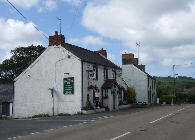
Rhoshill (also known as Rhos-hill) is a hamlet on the A478 road, in the community and parish of Cilgerran, in Pembrokeshire, South-west Wales. The hamlet is situated at the crossroads between the A478 road and the unclassified road from Cilgerran to Eglwyswrw, and includes the Rhosygilwen estate. Description Rhoshill is a collection of about twenty houses at an elevation of , surrounded by farmland, and the local name given to the hill which runs westwards from the hamlet. On some maps the hill to the south of Rhoshill is marked as Windy Hill. An area of the hill is marked as ''Mynydd Crogwy'', but the significance of this is not clear as there is no direct translation (although ''crogwyr'' means hangman). Rhoshill is in the parish of Cilgerran and is administered by Cilgerran Community Council. It is home to an agricultural engineering company and a number of other business including a herb grower (medicinal and culinary) and holiday lets. History The north–south road (now ... [...More Info...] [...Related Items...] OR: [Wikipedia] [Google] [Baidu] |
Bridell
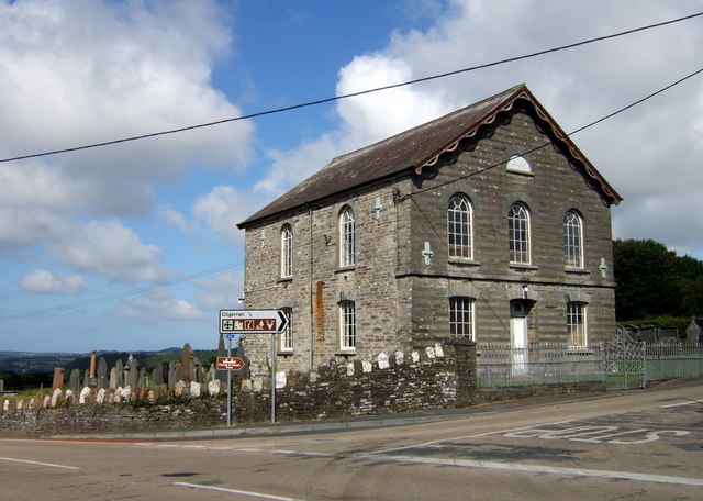
Bridell ( cy, Y Bridell) is a small settlement and parish in north Pembrokeshire, Wales. The parish includes the village of Pen-y-bryn. Together with the parishes of Cilgerran and Llantood, it is in the community of Cilgerran. Bridell Parish The Church in Wales parish of Bridell is on the A478, south of Cardigan and consists of a few private houses, the church (St David's) and Plas Bridell Manor house, a 19th-century mansion which, until 2019, was a nursing home. The derivation of the parish name is obscure. Lying on the western border of the cantref of Emlyn, it has always been essentially Welsh-speaking. Bridell (as ''Brydelthe'') appears on a 1578 parish map of Pembrokeshire. In the churchyard of St David's is a high stone cross whose inscription appears unreadable, but has been deciphered as ''Nettasagri maqi mucoi Briaci'', and commemorates a man named Nettasagri, the son of the kin of Briaci. The stone is believed to be 5th century, and was probably "Chritianised" w ... [...More Info...] [...Related Items...] OR: [Wikipedia] [Google] [Baidu] |
.jpg)
