|
Chualar, California
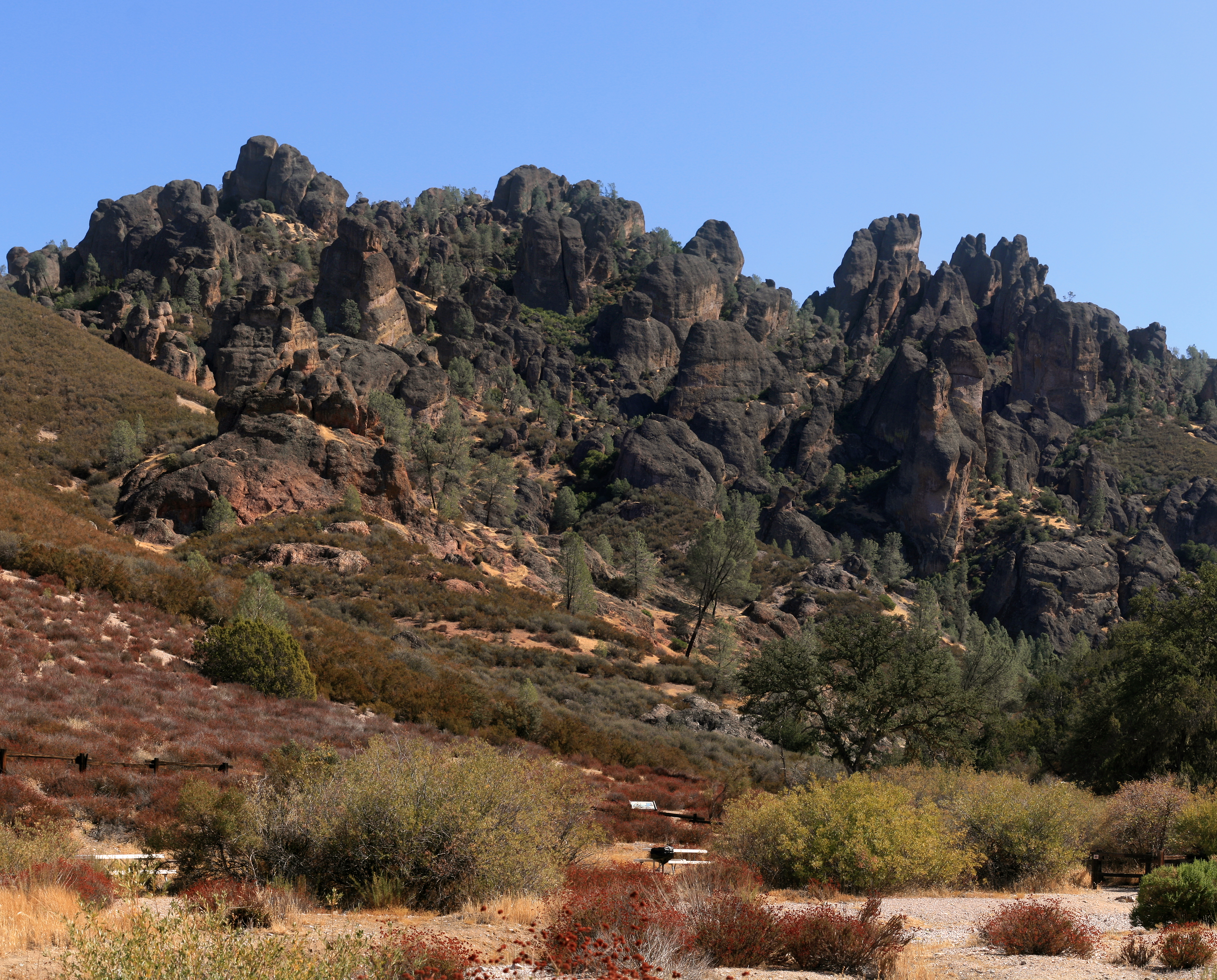
Chualar (Spanish for "Pigweed grove") is an unincorporated community and census-designated place (CDP) in the Salinas Valley of Monterey County, California, United States. Chualar is located southeast of Salinas, at an elevation of . The population was 1,185 at the 2020 census. Geography Chualar is located in northeastern Monterey County at . U.S. Route 101 runs along the southwest side of the community, leading northwest to Salinas and southeast to Soledad. According to the United States Census Bureau, the CDP has a total area of , all of it land. In her ''Spanish and Indian Place Names of California'' (1914), Sanchez states that ''chualar'' was the indigenous word for an abundant and native goosefoot. This plant could possibly be ''Chenopodium californicum'', the California goosefoot (also known as pigweed). In his ''1500 California Place Names'' (1998), William Bright writes that the name is Spanish for "where the ''chual'' grows," ''chual'' being Mexican Spanish for pi ... [...More Info...] [...Related Items...] OR: [Wikipedia] [Google] [Baidu] |
Unincorporated Community
An unincorporated area is a parcel of land that is not governed by a local general-purpose municipal corporation. (At p. 178.) They may be governed or serviced by an encompassing unit (such as a county) or another branch of the state (such as the military). There are many unincorporated communities and areas in the United States and Canada, but many countries do not use the concept of an unincorporated area. By country Argentina In Argentina, the provinces of Chubut Province, Chubut, Córdoba Province (Argentina), Córdoba, Entre Ríos Province, Entre Ríos, Formosa Province, Formosa, Neuquén Province, Neuquén, Río Negro Province, Río Negro, San Luis Province, San Luis, Santa Cruz Province, Argentina, Santa Cruz, Santiago del Estero Province, Santiago del Estero, Tierra del Fuego Province, Argentina, Tierra del Fuego, and Tucumán Province, Tucumán have areas that are outside any municipality or commune. Australia Unlike many other countries, Australia has only local go ... [...More Info...] [...Related Items...] OR: [Wikipedia] [Google] [Baidu] |
Census Designated Place
A census-designated place (CDP) is a Place (United States Census Bureau), concentration of population defined by the United States Census Bureau for statistical purposes only. CDPs have been used in each decennial census since 1980 as the counterparts of incorporated places, such as self-governing city (United States), cities, town (United States), towns, and village (United States), villages, for the purposes of gathering and correlating statistical data. CDPs are populated areas that generally include one officially designated but currently unincorporated area, unincorporated community, for which the CDP is named, plus surrounding inhabited countryside of varying dimensions and, occasionally, other, smaller unincorporated communities as well. CDPs include small rural communities, Edge city, edge cities, colonia (United States), colonias located along the Mexico–United States border, and unincorporated resort and retirement community, retirement communities and their environs. ... [...More Info...] [...Related Items...] OR: [Wikipedia] [Google] [Baidu] |
Levee
A levee ( or ), dike (American English), dyke (British English; see American and British English spelling differences#Miscellaneous spelling differences, spelling differences), embankment, floodbank, or stop bank is an elevated ridge, natural or artificial, alongside the river banks, banks of a river, often intended to flood control, protect against flooding of the area adjoining the river. It is usually soil, earthen and often runs parallel (geometry), parallel to the course of a river in its floodplain or along low-lying coastlines. Naturally occurring levees form on river floodplains following flooding. Sediment and alluvium are deposition (geology), deposited on the banks and settle, forming a ridge that increases the river channel's capacity. Alternatively, levees can be artificially constructed from fill dirt, fill, designed to regulate water levels. In some circumstances, artificial levees can be environmental degradation, environmentally damaging. Ancient civilization ... [...More Info...] [...Related Items...] OR: [Wikipedia] [Google] [Baidu] |
Bracero
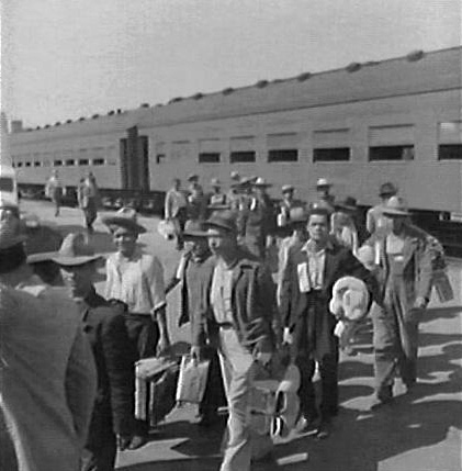
The Bracero Program (from the Spanish language, Spanish term ''bracero'' , meaning "manual laborer" or "one who works using his arms") was a temporary labor initiative between the United States and Mexico that allowed Mexican workers to be employed in the U.S. agricultural and railroad industries from 1942 to 1964. Origins and purpose The program, which was designed to fill agriculture shortages during World War II, offered employment contracts to 4.6 million braceros in 24 U.S. states. It was the largest guest worker program in U.S. history. The program was the result of a series of laws and diplomatic agreements, initiated on August 4, 1942, when the United States signed the Mexican Farm Labor Agreement with Mexico. The program was jointly managed by the U.S. State Department, Department of Labor, and the Immigration and Naturalization Service (INS). Under the agreement, braceros were promised fair treatment, including: * Adequate living conditions (shelter, food, and sani ... [...More Info...] [...Related Items...] OR: [Wikipedia] [Google] [Baidu] |
1963 Chualar Bus Crash
The Chualar bus crash took place on September 17, 1963, when a freight train collided with a makeshift "bus"— a flatbed truck with two long benches and a canopy— carrying 58 migrant farmworkers on a railroad crossing outside Chualar in the Salinas Valley, California, United States, killing 32 people and injuring 25. The crash is ranked as the deadliest automobile accident in U.S. history, according to the National Safety Council. The collision was a factor in the decision by Congress in 1964 to terminate the bracero program, despite its strong support among farmers. It also helped spur the Chicano Civil Rights Movement. Background The workers riding on the bus lived at the Earl Myers Company labor camp in Salinas, Monterey County, California, and were returning after a ten-hour shift harvesting celery and other vegetables from two fields in the Salinas Valley. 53 were braceros contracted by the Growers Farm Labor Association of Salinas. There were also five non-brace ... [...More Info...] [...Related Items...] OR: [Wikipedia] [Google] [Baidu] |
Nahuatl
Nahuatl ( ; ), Aztec, or Mexicano is a language or, by some definitions, a group of languages of the Uto-Aztecan language family. Varieties of Nahuatl are spoken by about Nahuas, most of whom live mainly in Central Mexico and have smaller populations Nahuatl language in the United States, in the United States. Nahuatl has been spoken in central Mexico since at least the seventh century CE. It was the language of the Mexica, who dominated what is now central Mexico during the Late Postclassic period of Mesoamerican chronology, Mesoamerican history. During the centuries preceding the Spanish conquest of the Aztec Empire, the Aztecs had expanded to incorporate a large part of central Mexico. Their influence caused the variety of Nahuatl spoken by the residents of Tenochtitlan to become a prestige language in Mesoamerica. Following the Spanish conquest, Spanish colonists and missionaries introduced the Latin script, and Nahuatl became a literary language. Many chronicles, gram ... [...More Info...] [...Related Items...] OR: [Wikipedia] [Google] [Baidu] |
Mexico
Mexico, officially the United Mexican States, is a country in North America. It is the northernmost country in Latin America, and borders the United States to the north, and Guatemala and Belize to the southeast; while having maritime boundary, maritime boundaries with the Pacific Ocean to the west, the Caribbean Sea to the southeast, and the Gulf of Mexico to the east. Mexico covers 1,972,550 km2 (761,610 sq mi), and is the List of countries by area, thirteenth-largest country in the world by land area. With a population exceeding 130 million, Mexico is the List of countries by population, tenth-most populous country in the world and is home to the Hispanophone#Countries, largest number of native Spanish speakers. Mexico City is the capital and List of cities in Mexico, largest city, which ranks among the List of cities by population, most populous metropolitan areas in the world. Human presence in Mexico dates back to at least 8,000 BC. Mesoamerica, considered a cradle ... [...More Info...] [...Related Items...] OR: [Wikipedia] [Google] [Baidu] |
Pigweed
Pigweed can mean any of a number of weedy plants which may be used as pig fodder: * ''Amaranthus'' species ** ''Amaranthus albus'', white pigweed, tumble pigweed ** '' Amaranthus blitoides'', prostrate pigweed ** '' Amaranthus californicus'', California pigweed ** '' Amaranthus fimbriatus'', fringed pigweed ** '' Amaranthus hybridus'', smooth pigweed ** '' Amaranthus palmeri'', the 'pigweed' resistant to glyphosate in the US Southeast ** ''Amaranthus retroflexus'', redroot pigweed * ''Chenopodium album'' white goosefoot * ''Polygonum aviculare ''Polygonum aviculare'' or common knotgrass is a plant related to buckwheat and dock. It is also called prostrate knotweed, birdweed, pigweed and lowgrass. It is an annual found in fields and wasteland, with white flowers from June to October. I ...'' * '' Portulaca'' species See also * Hogweed {{Plant common name ... [...More Info...] [...Related Items...] OR: [Wikipedia] [Google] [Baidu] |
United States Census Bureau
The United States Census Bureau, officially the Bureau of the Census, is a principal agency of the Federal statistical system, U.S. federal statistical system, responsible for producing data about the American people and American economy, economy. The U.S. Census Bureau is part of the United States Department of Commerce, U.S. Department of Commerce and its Director of the United States Census Bureau, director is appointed by the president of the United States. Currently, Ron S. Jarmin is the acting director of the U.S. Census Bureau. The Census Bureau's primary mission is conducting the United States census, U.S. census every ten years, which allocates the seats of the United States House of Representatives, U.S. House of Representatives to the U.S. state, states based on their population. The bureau's various censuses and surveys help allocate over $675 billion in federal funds every year and it assists states, local communities, and businesses in making informed decisions. T ... [...More Info...] [...Related Items...] OR: [Wikipedia] [Google] [Baidu] |
Soledad, California
Soledad is a city in Monterey County, California, United States. It is in the Salinas Valley, southeast of Salinas, California, Salinas, the county seat. Soledad's population was 24,925 at the 2020 United States census, 2020 census, down from 25,738 in 2010 United States census, 2010. Soledad's origins started with Mission Nuestra Señora de la Soledad, founded by the Spanish in 1791, under the leadership of Fermín de Lasuén. Catalina Munrás began developing the town of Soledad on her Rancho San Vicente (Munrás), Rancho San Vicente in the 1860s, which eventually incorporated as a city in 1921. Today, Soledad is a notable tourist destination, owing to the heavily restored mission, its proximity to Pinnacles National Park, and its numerous vineyards, as part of the Monterey AVA, Monterey wine region. History The Chalon people, Chalon tribe of the Ohlone nation of indigenous Californians have inhabited the area around Soledad for thousands of years. The Paraíso Hot Springs, ... [...More Info...] [...Related Items...] OR: [Wikipedia] [Google] [Baidu] |


