|
Chipinge Urban
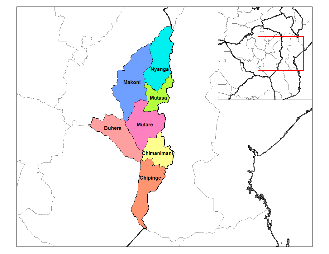
Chipinge is a town in Zimbabwe, located in Chipinge District, in Manicaland Province, in southeastern Zimbabwe, close to the border with Mozambique. Location The town lies approximately , by road, south of Mutare, the nearest large city. This location lies about , by road, east of Masvingo, on the road (Highway A-9) to Bulawayo, Zimbabwe's second-largest city, approximately , further west of Masvingo. The coordinates of the town are: 20° 12' 0.00"S, 32° 37' 12.00"E (Latitude:20.2000; Longitude:32.6200). Chipinge sits at an elevation of , above sea level. Overview The average annual rainfall in Chipinge is about . The warm climate and high rainfall are well suited to agriculture. The local farmers grow tea, coffee, macadamia nuts and rear dairy cattle. The surrounding mountain slopes are covered with pine and acacia plantations. One of Zimbabwe's most famous landmarks, the Birchenough Bridge is located on the Sabi River about , northwest of Chipinge. The town is th ... [...More Info...] [...Related Items...] OR: [Wikipedia] [Google] [Baidu] |
Zimbabwe
Zimbabwe (), officially the Republic of Zimbabwe, is a landlocked country located in Southeast Africa, between the Zambezi and Limpopo Rivers, bordered by South Africa to the south, Botswana to the south-west, Zambia to the north, and Mozambique to the east. The capital and largest city is Harare. The second largest city is Bulawayo. A country of roughly 15 million people, Zimbabwe has 16 official languages, with English, Shona language, Shona, and Northern Ndebele language, Ndebele the most common. Beginning in the 9th century, during its late Iron Age, the Bantu peoples, Bantu people (who would become the ethnic Shona people, Shona) built the city-state of Great Zimbabwe which became one of the major African trade centres by the 11th century, controlling the gold, ivory and copper trades with the Swahili coast, which were connected to Arab and Indian states. By the mid 15th century, the city-state had been abandoned. From there, the Kingdom of Zimbabwe was established, fol ... [...More Info...] [...Related Items...] OR: [Wikipedia] [Google] [Baidu] |
Save River (Africa)
The Save River, or Sabi River (Portuguese: ''Rio Save'') is a river of southeastern Africa, flowing through Zimbabwe and Mozambique. The river has its source in Zimbabwe, some south of Harare, then flows south and then east, from the Zimbabwean highveld to its confluence with the Odzi River. It then turns south, drops over the Chivirira (“Place of Boiling”) Falls, and flows down the western side of Zimbabwe's Eastern Highlands forming a dry river valley in the rain shadow of these mountains. It is joined by the Runde River or Lundi at the Mozambique border, forming a dramatic confluence at Mahenya. It then crosses Mozambique to flow into the Indian Ocean at about 21°S. The Save River provided irrigation for sugar plantation, but now supports the cultivation of citrus, cotton, rice, and wheat. It is also a source of small-scale fishing for the local population. It divides Mozambique administratively, politically, ethnically and ecologically: * During the colonial era, the ... [...More Info...] [...Related Items...] OR: [Wikipedia] [Google] [Baidu] |
National Oceanic And Atmospheric Administration
The National Oceanic and Atmospheric Administration (abbreviated as NOAA ) is an United States scientific and regulatory agency within the United States Department of Commerce that forecasts weather, monitors oceanic and atmospheric conditions, charts the seas, conducts deep sea exploration, and manages fishing and protection of marine mammals and endangered species in the U.S. exclusive economic zone. Purpose and function NOAA's specific roles include: * ''Supplying Environmental Information Products''. NOAA supplies to its customers and partners information pertaining to the state of the oceans and the atmosphere, such as weather warnings and forecasts via the National Weather Service. NOAA's information services extend as well to climate, ecosystems, and commerce. * ''Providing Environmental Stewardship Services''. NOAA is a steward of U.S. coastal and marine environments. In coordination with federal, state, local, tribal and international authorities, NOAA manages the ... [...More Info...] [...Related Items...] OR: [Wikipedia] [Google] [Baidu] |
World Meteorological Organization
The World Meteorological Organization (WMO) is a specialized agency of the United Nations responsible for promoting international cooperation on atmospheric science, climatology, hydrology and geophysics. The WMO originated from the International Meteorological Organization, a nongovernmental organization founded in 1873 as a forum for exchanging weather data and research. Proposals to reform the status and structure of the IMO culminated in the World Meteorological Convention of 1947, which formally established the World Meteorological Organization. The Convention entered into force on 23 March 1950, and the following year the WMO began operations as an intergovernmental organization within the UN system. The WMO is made up of 193 countries and territories, and facilitates the "free and unrestricted" exchange of data, information, and research between the respective meteorological and hydrological institutions of its members. It also collaborates with nongovernmental partners ... [...More Info...] [...Related Items...] OR: [Wikipedia] [Google] [Baidu] |
British Raj
The British Raj (; from Hindi ''rāj'': kingdom, realm, state, or empire) was the rule of the British Crown on the Indian subcontinent; * * it is also called Crown rule in India, * * * * or Direct rule in India, * Quote: "Mill, who was himself employed by the British East India company from the age of seventeen until the British government assumed direct rule over India in 1858." * * and lasted from 1858 to 1947. * * The region under British control was commonly called India in contemporaneous usage and included areas directly administered by the United Kingdom, which were collectively called British India, and areas ruled by indigenous rulers, but under British paramountcy, called the princely states. The region was sometimes called the Indian Empire, though not officially. As ''India'', it was a founding member of the League of Nations, a participating nation in the Summer Olympics in 1900, 1920, 1928, 1932, and 1936, and a founding member of the United Nations in San F ... [...More Info...] [...Related Items...] OR: [Wikipedia] [Google] [Baidu] |


