|
Chinnar River
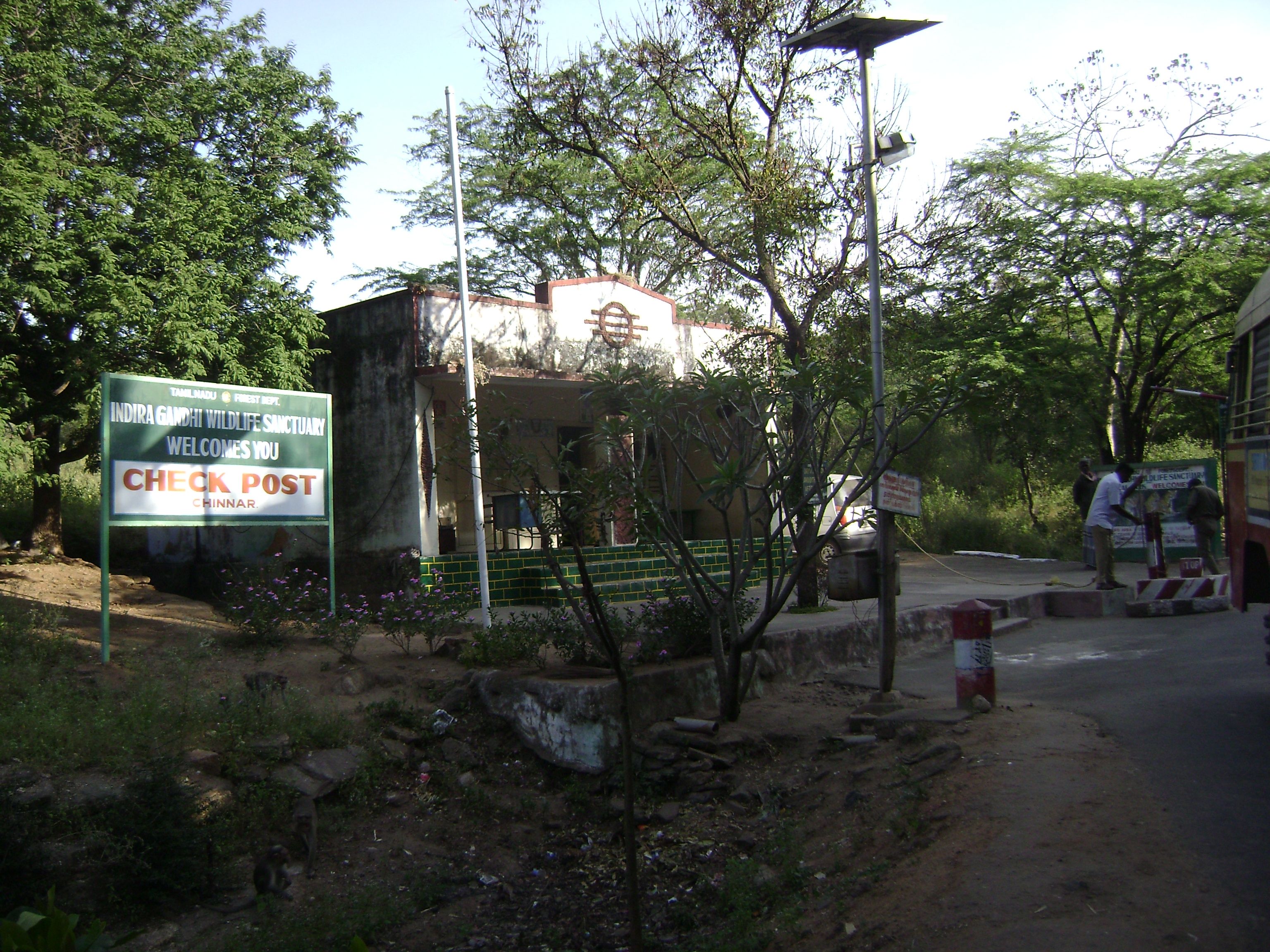
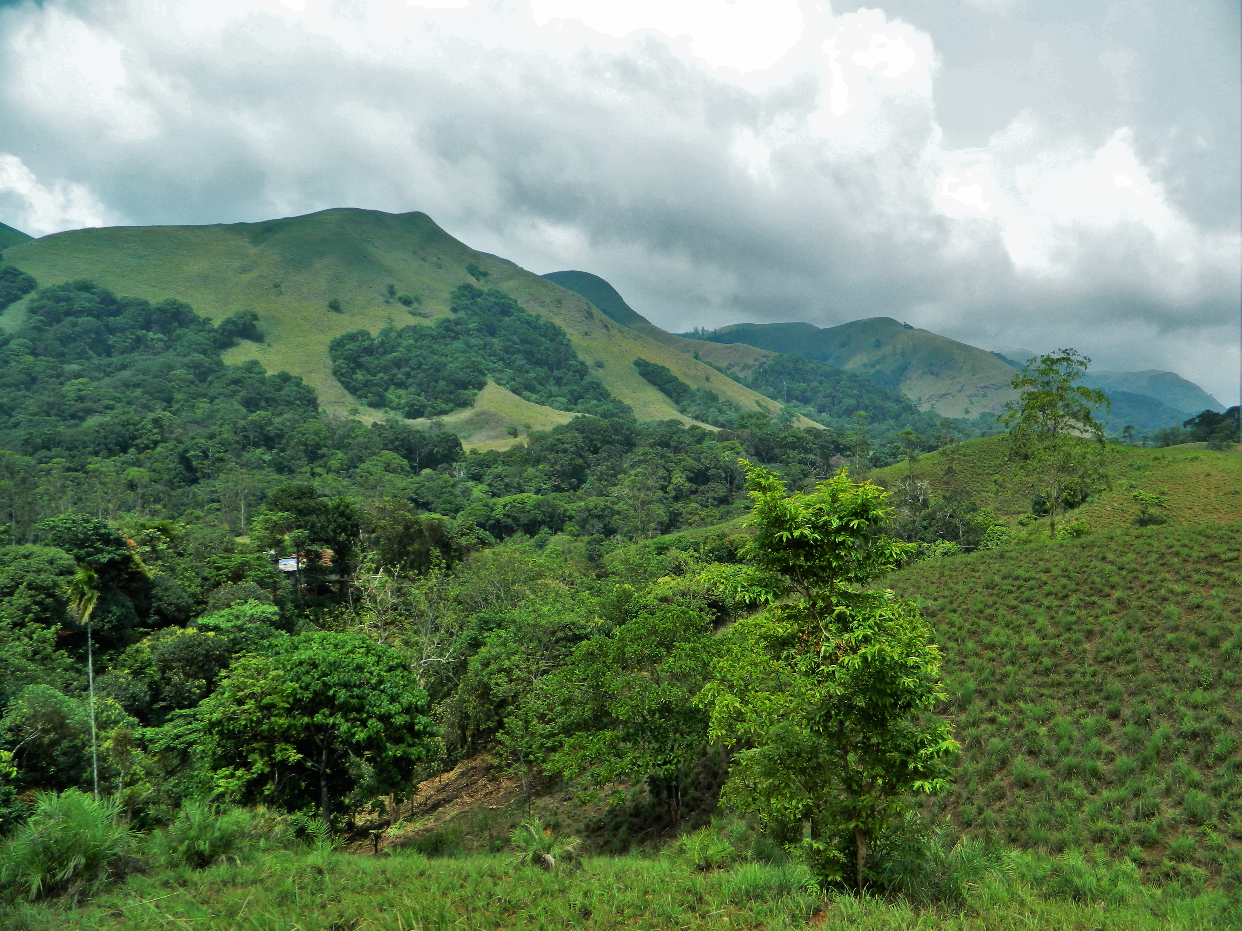
The Chinnar River originates in the Annaimalai Hills below a grassy pass between the hills Kumarikkal Mala (8,275 ft) and Kaladekatti Malai In Idukki District, Kerala state South India. The 18 km long Chinnar river defines the East-West Tamil Nadu/Kerala state boundary along the northern edge of the Chinnar Wildlife Sanctuary and the southern edge of the Indira Gandhi Wildlife Sanctuary. Several adult crocodiles were reported in the Chinnar river in 1992. Route The river first proceeds through a large shola then past the Muthuvar settlement of Olikkudi at . There is another small village #2 at . There are Kerala and Tamil Nadu border checkpoints on either side of the river where a SH 17 road bridge crosses the river at . 2 km east it is joined from the south by the Pambar River at Koottar where a comfortable tree house accommodation is available.Blue Yonder Holidays Pvt Ltd, Chinnar, the real treasure trove, retrieved 8/30/200Koottar Tree House. Here it cr ... [...More Info...] [...Related Items...] OR: [Wikipedia] [Google] [Baidu] |
Anamalai Hills
The Anamala or Anaimalai, also known as the Elephant Mountains, are a range of mountains in the southern Western Ghats of central Kerala (Idukki district, Ernakulam district, Palakkad district, Thrissur district) and span the border of western Tamil Nadu (Coimbatore district and Tiruppur district) in Southern India. The name ''anamala'' is derived from the Malayalam word ''aana and'' the Tamil language, Tamil word ''aanai'', meaning elephant, or from tribal languages. ''Mala'' or ''Malai'' means 'hill', and thus 'Elephant hill'. Anamudi Peak (8,842 feet (2,695 metres)) lies at the southern end of the range and is the highest peak in southern India. The Palakkad Gap is the mountain pass which divides it from the Nilgiri Mountains. The northern slopes of the hills in Tamil Nadu now have Coffee bean, coffee and tea plantations(especially around Valparai), as well as teak plantations of high economic value. The rest are mostly forests, of mainly two ecoregions-the South Western Gh ... [...More Info...] [...Related Items...] OR: [Wikipedia] [Google] [Baidu] |
Indira Gandhi National Park
Anaimalai Tiger Reserve, earlier known as Indira Gandhi Wildlife Sanctuary and National Park and as Anaimalai Wildlife Sanctuary, is a protected area in the Anaimalai Hills of Pollachi and Valparai taluks of Coimbatore District and Udumalaipettai taluk in Tiruppur District, Tamil Nadu, India. The Tamil Nadu Environment and Forests Department by a notification dated 27 June 2007, declared an extent of 958.59 km2 that encompassed the erstwhile IGWLS&NP or Anaimalai Wildlife Sanctuary, as Anaimalai Tiger Reserve under the Wildlife Protection Act, 1972. According to the National Tiger Conservation Authority, the Reserve presently includes a core area of 958.59 km2 and buffer/peripheral area of 521.28 km2 forming a total area of 1479.87 km2. Etymology The park is named after former Prime Minister of India Indira Gandhi who visited the park on 7 October 1961. The main tourist facilities are located in the northeast corner of the park at "Topslip", so named because ... [...More Info...] [...Related Items...] OR: [Wikipedia] [Google] [Baidu] |
Rivers Of Idukki District
A river is a natural flowing watercourse, usually freshwater, flowing towards an ocean, sea, lake or another river. In some cases, a river flows into the ground and becomes dry at the end of its course without reaching another body of water. Small rivers can be referred to using names such as creek, brook, rivulet, and rill. There are no official definitions for the generic term river as applied to geographic features, although in some countries or communities a stream is defined by its size. Many names for small rivers are specific to geographic location; examples are "run" in some parts of the United States, "burn" in Scotland and northeast England, and "beck" in northern England. Sometimes a river is defined as being larger than a creek, but not always: the language is vague. Rivers are part of the water cycle. Water generally collects in a river from precipitation through a drainage basin from surface runoff and other sources such as groundwater recharge, springs, a ... [...More Info...] [...Related Items...] OR: [Wikipedia] [Google] [Baidu] |
Rivers Of Tamil Nadu
A river is a natural flowing watercourse, usually freshwater, flowing towards an ocean, sea, lake or another river. In some cases, a river flows into the ground and becomes dry at the end of its course without reaching another body of water. Small rivers can be referred to using names such as creek, brook, rivulet, and rill. There are no official definitions for the generic term river as applied to geographic features, although in some countries or communities a stream is defined by its size. Many names for small rivers are specific to geographic location; examples are "run" in some parts of the United States, "burn" in Scotland and northeast England, and "beck" in northern England. Sometimes a river is defined as being larger than a creek, but not always: the language is vague. Rivers are part of the water cycle. Water generally collects in a river from precipitation through a drainage basin from surface runoff and other sources such as groundwater recharge, springs, a ... [...More Info...] [...Related Items...] OR: [Wikipedia] [Google] [Baidu] |
Manjampatti Valley
Manjampatti Valley is a protected area in the eastern end of Indira Gandhi Wildlife Sanctuary and National Park (IGWS&NP) in Tirupur District, Tamil Nadu, South India. It is a pristine drainage basin of shola and montane rain forest with high biodiversity recently threatened by illegal land clearing and cultivation. National Park Manjampatti Valley is the eastern core zone of the Indira Gandhi National Park (IGWS&NP) It is managed as an Ib-Wilderness Area: a large area of unmodified or slightly modified land, retaining its natural character and influence, without permanent or significant habitation, which is protected and managed so as to preserve its natural condition. The Tamil Nadu Forest Department has divided the valley into 3 administrative areas: Thalinji beat 4290 ha, Manjampatti beat 3741.75 ha and Keelanavayal beat 3058.75 ha. Total = 11,090.5 ha = To the east it adjoins the western ends of the Kodaikanal and Dindigul Forest Districts. These Forests will make u ... [...More Info...] [...Related Items...] OR: [Wikipedia] [Google] [Baidu] |
Pambar River (Kerala)
Pambar River originates near Anamudi in Idukki district of Kerala state in South India. Route It traverses Turner's Valley in Eravikulam National Park and flows into the Chinnar Wildlife Sanctuary through the Taliar Valley between Kanthalloor and Marayoor Villages and eastwards through the sanctuary. The Pambar, Kabani and Bhavani are the only rivers of the 44 in Kerala that flow eastwards. It is joined by seasonal rivulets and a few perennial streams originating from sholas in the upper reaches. The Pambar merges with the Chinnar River at Koottar.Blue Yonder Holidays Pvt Ltd, Chinnar, the real treasure trove, retrieved 8/30/200Koottar Tree House The Chinnar forms the interstate boundary along the northwest edge of the sanctuary and becomes the Amaravati River in Tamil Nadu, reaches the Amaravathi Reservoir and Dam and eventually joins the Kaveri River near Karur Karur () is a city in the Indian state of Tamil Nadu. Karur is the administrative headquarters of Karur d ... [...More Info...] [...Related Items...] OR: [Wikipedia] [Google] [Baidu] |
State Highway 17 (Tamil Nadu - Kerala, India)
Kerala State Highway 17, also called the ''Northern outlet road'' and ''Munnar - Udumalpet road'', is notable for passing between the Anaimalai Hills and the Palani Hills, through or near three important protected areas and providing opportunities for viewing wildlife in unspoiled forests. The total road length is about . Route SH 17 starts north from NH 49 (Aluva - Munnar Highway) at Munnar, running about 2 km alongside the Kannimala River, then to Rajamudi village - Anakkalpetty road and on to Eravikulam village. It passes near Eravikulam National Park and Anamudi, The tallest Indian peak south of the Himalayas and into Marayoor town, (km 42). It then passes through the centre of Chinnar Wildlife Sanctuary, past Chinnar Watchtower and continues to Chinnar Check post, (km 59). It crosses the state boundary on a highway bridge over the Chinnar River at . It enters Indira Gandhi Wildlife Sanctuary and National Park at Tamil Nadu check post and continues p ... [...More Info...] [...Related Items...] OR: [Wikipedia] [Google] [Baidu] |
Shola
Sholas are the local name for patches of stunted tropical montane forest found in valleys amid rolling grassland in the higher montane regions of South India, largely in Kerala, Karnataka and Tamilnadu. These patches of shola forest are found mainly in the valleys and are usually separated from one another by undulating montane grassland. The shola and grassland together form the shola-grassland complex or mosaic. Not all such high-elevation grasslands have sholas in their valleys, especially if they are isolated from other such meadows, such as the meadows found in the Idamalayar Reserve Forest in Ernakulam district of Kerala. The word 'Shola' is probably derived from the Tamil language word cõlai (சோலை) meaning grove. The shola-forest and grassland complex has been described as a climatic climax vegetation with forest regeneration and expansion restricted by climatic conditions such as frost or soil characteristics while others have suggested that it may have anthr ... [...More Info...] [...Related Items...] OR: [Wikipedia] [Google] [Baidu] |
Chinnar Wildlife Sanctuary
Chinnar Wildlife Sanctuary is located 18 km north of Marayoor on State Highway 17 in the Marayoor and Kanthalloor panchayats of Devikulam taluk in the Idukki district of Kerala state in South India. It is one of 18 wildlife sanctuaries among the protected areas of Kerala. It has earned the name for being the only rehabilitation centre for the Indian star tortoise in India. It is under the jurisdiction of and contiguous with Eravikulam National Park to the south. Indira Gandhi Wildlife Sanctuary is to the north and Kodaikanal Wildlife Sanctuary is to the east. It forms an integral part of the block of protected forests straddling the Kerala-Tamil Nadu border in the Anaimalai Hills. The Western Ghats, Anamalai Sub-Cluster, including all of Chinnar Wildlife Sanctuary, is under consideration by the UNESCO World Heritage Committee for selection as a World Heritage Site.UNESCO, World Heritage sites, Tentative lists, Western Ghats sub cluster, Niligiris. retrieved 4/20/200/ ... [...More Info...] [...Related Items...] OR: [Wikipedia] [Google] [Baidu] |


