|
Chinese Market Gardens (La Perouse)
The Chinese Market Gardens is a heritage-listed market gardens at 1-39 Bunnerong Road, La Perouse, City of Randwick, New South Wales, Australia. It is also known as Chinese Gardens La Perouse, Phillip Bay, Matraville and Randwick. The property is Crown land and is owned by NSW Department of Industry, a department of the Government of New South Wales. It was added to the New South Wales State Heritage Register on 13 August 1999. History Indigenous history Pre-1780s the local Aboriginal people in the area used the site for fishing and cultural activities - rock engravings, grinding grooves and middens remain in evidence. In 1789 Governor Arthur Phillip referred to "a long bay", which became known as Long Bay. Aboriginal people are believed to have inhabited the Sydney region for at least 20,000 years.Turbet, 2001. The population of Aboriginal people between Palm Beach and Botany Bay in 1788 has been estimated to have been 1500. Those living south of Port Jackson to Bota ... [...More Info...] [...Related Items...] OR: [Wikipedia] [Google] [Baidu] |
La Perouse, New South Wales
La Perouse is a suburb in south-eastern Sydney, in the state of New South Wales, Australia. The suburb of La Perouse is located about southeast of the Sydney central business district, in the City of Randwick. The La Perouse peninsula is the northern headland of Botany Bay. It is notable for its old military outpost at Bare Island and the Kamay Botany Bay National Park. Congwong Bay Beach, Little Congwong Beach, and the beach at Frenchmans Bay provide protected swimming areas in Botany Bay. La Perouse is one of few Sydney suburbs with a French name, others being Sans Souci and Vaucluse. Kurnell is located opposite, on the southern headland of Botany Bay. History La Perouse was known as "Gooriwal" to the Muruora-dial people of the area. The Gameygal or Kameygal clan of the Dharawal people probably lived between the mouth of the Cooks River and present-day La Perouse, including the La Perouse area. La Perouse was named after the French navigator Jean-François de Galau ... [...More Info...] [...Related Items...] OR: [Wikipedia] [Google] [Baidu] |
Maroubra, New South Wales
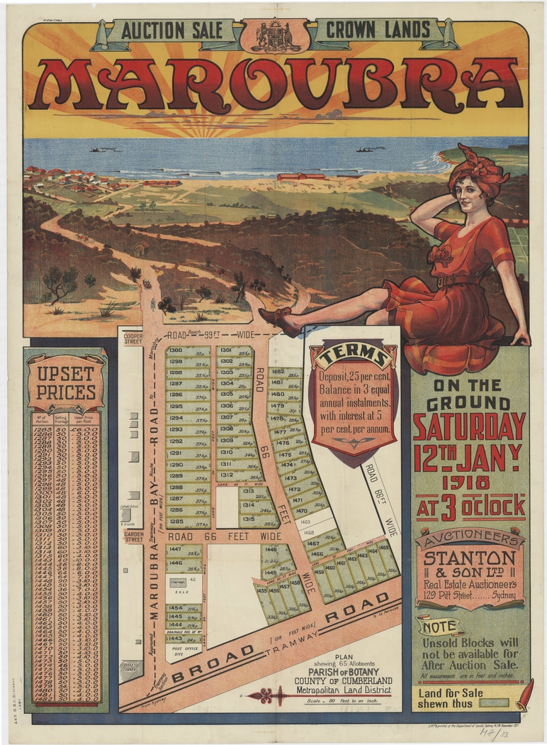
Maroubra is a beachside suburb in the Eastern Suburbs of Sydney, in the state of New South Wales, Australia. It is 10 kilometres south-east of the Sydney central business district in the local government area of the City of Randwick. Maroubra is the largest suburb within Randwick City Council by both area and population;. Maroubra Junction is a locality in the centre of the suburb. History 1800s Maroubra is a local Aboriginal word meaning ''place of thunder''. In 1861, the first house was built in the area by Humphrey McKeon. A number of other settlers arrived on the land in the 1870s to work on the wool scouring works located at the northern end of the bay. ''The Hereward'' The suburb first made headlines on 6 May 1898, when the ''Hereward'', a fully rigged iron ship weighing 1,513 tons was caught by the gale-force winds and shipwrecked at the northern end of Maroubra Beach while heading north toward Newcastle. The shipwreck remained on the beach for a number of years unt ... [...More Info...] [...Related Items...] OR: [Wikipedia] [Google] [Baidu] |
Sydney Cove
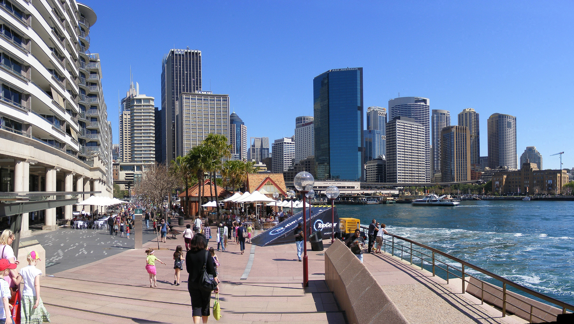
Sydney Cove (Eora: ) is a bay on the southern shore of Sydney Harbour, one of several harbours in Port Jackson, on the coast of Sydney, New South Wales. Sydney Cove is a focal point for community celebrations, due to its central Sydney location between the Sydney Opera House and the Sydney Harbour Bridge. It is also one of the main congregation points for Sydney New Year's Eve. History The Eora name for Sydney Cove was recorded by several early settlers of the First Fleet variously spelt as Warrane, War-ran, Warrang and Wee-rong. The spot is of great significance, as the first meeting place between Eora people and Europeans. Before colonisation of the area, Eora men speared fish from the shoreline, and women line-fished from their ' (canoes). Sydney Cove was named after the British Home Secretary, the 1st Baron Sydney (who was later created 1st Viscount Sydney in 1789). It was the site chosen by Captain Arthur Phillip, RN between 21 and 23 January 1788 for the British p ... [...More Info...] [...Related Items...] OR: [Wikipedia] [Google] [Baidu] |
Dictionary Of Sydney
The Dictionary of Sydney is a digital humanities project to produce an online, expert-written encyclopedia of all aspects of the history of Sydney. Description The Dictionary is a partnership between the City of Sydney, the University of Sydney, the State Library of New South Wales, the State Records Authority of New South Wales, and the University of Technology Sydney. It began in 2007 with Australian Research Council funding and launched on 5 November 2009. Geographically, the Dictionary of Sydney includes the whole Sydney basin and chronologically spans the years from the earliest human habitation to the present. It also invites historical contributions from disciplines such as archaeology, sociology, literary studies, historical geography and cultural studies. Heurist, developed by the University of Sydney was the underlying technology for the project. The Dictionary of Sydney won an Energy Australia National Trust Heritage Award for Interpretation and Presentation in Ap ... [...More Info...] [...Related Items...] OR: [Wikipedia] [Google] [Baidu] |
South Coast (New South Wales)
The South Coast refers to the narrow coastal belt from Shoalhaven district in the north to the border with Victoria in the south in the south-eastern part of the State of New South Wales, Australia. It is bordered to the west by the coastal escarpment of the Southern Tablelands, and is largely covered by a series of national parks, namely Jervis Bay National Park, Eurobodalla National Park, and Beowa National Park. To the east is the coastline of the Pacific Ocean, which is characterised by rolling farmlands, small towns and villages along a rocky coastline, interspersed by numerous beaches and lakes. The South Coast includes Shoalhaven district in the north and the Bega Valley in the more remote south as well as the Eurobodalla Shire and the Commonwealth Jervis Bay Territory which is adjacent to the City of Shoalhaven Local Government Area. Some definitions of the region include the Illawarra, but it is often seen as a separate and distinct region of New South Wales. Climate ... [...More Info...] [...Related Items...] OR: [Wikipedia] [Google] [Baidu] |
Nowra, New South Wales
Nowra is a city in the South Coast, New South Wales, South Coast region of New South Wales, Australia. It is located south-southwest of the state capital of Sydney (about as the crow flies). As of the 2021 census, Nowra has an estimated population of 22,584. Situated in the southern reaches of the Sydney basin, Nowra is the County seat, seat and commercial centre of the City of Shoalhaven. The region around Nowra is a farming community with a thriving dairy industry and a significant amount of state-owned forest land. It is also an increasingly popular retirement and leisure area for people from Canberra and Sydney. The naval air station HMAS Albatross (air station), HMAS ''Albatross'' is located about south-west of Nowra. History Prior to European arrival, the part of the Nowra region south of the Shoalhaven river was inhabited by the Wandi-Wandandian tribe of the Yuin nation, while the region north of Shoalhaven was inhabited by the Dharawal people, Dharawal people. The n ... [...More Info...] [...Related Items...] OR: [Wikipedia] [Google] [Baidu] |
First Fleet
The First Fleet was a fleet of 11 ships that brought the first European and African settlers to Australia. It was made up of two Royal Navy vessels, three store ships and six convict transports. On 13 May 1787 the fleet under the command of Captain Arthur Phillip, with over 1400 people (convicts, marines, sailors, civil officers and free settlers), left from Portsmouth, England and took a journey of over and over 250 days to eventually arrive in Botany Bay, New South Wales, where a penal colony would become the first European settlement in Australia. History Lord Sandwich, together with the President of the Royal Society, Sir Joseph Banks, the eminent scientist who had accompanied Lieutenant James Cook on his 1770 voyage, was advocating establishment of a British colony in Botany Bay, New South Wales. Banks accepted an offer of assistance from the American Loyalist James Matra in July 1783. Under Banks's guidance, he rapidly produced "A Proposal for Establishing a S ... [...More Info...] [...Related Items...] OR: [Wikipedia] [Google] [Baidu] |
Prince Of Wales Hospital (Sydney)
The Prince of Wales Hospital is a 440-bed major public teaching hospital located in Sydney's eastern suburb of Randwick, providing a full range of hospital services to the people of New South Wales, Australia. The hospital has strong ties to the University of New South Wales. The Prince of Wales Hospital shares the Randwick Hospitals' Campus site with the Royal Hospital for Women and the Sydney Children's Hospital, as well as the Prince of Wales Private Hospital. History The Prince of Wales Hospital had its origins in 1852 with the formation of the ''Society for Destitute Children'' which established the ''Asylum for Destitute Children'' with the first building opened on 21 March 1858 in Paddington. After an appeal for funds in 1870, the ''Catherine Hayes Hospital''—a separate facility located in Avoca Street, Randwick—opened, reputedly with plans approved by Florence Nightingale. In 1915, during the First World War the hospital was converted by the NSW Government into a ... [...More Info...] [...Related Items...] OR: [Wikipedia] [Google] [Baidu] |
University Of NSW
The University of New South Wales (UNSW), also known as UNSW Sydney, is a public university, public research university based in Sydney, New South Wales, Australia. It is one of the founding members of Group of Eight (Australian universities), Group of Eight, a coalition of Australian research-intensive universities. Established in 1949, UNSW is a research university, ranked 44th in the world in the 2021 ''QS World University Rankings'' and 67th in the world in the 2021 ''Times Higher Education World University Rankings''. It is one of the members of Universitas 21, a global network of research universities. It has international exchange and research partnerships with over 200 universities around the world. According to the 2021 QS World University Rankings by Subject, UNSW is ranked top 20 in the world for Law, Accounting and Finance, and 1st in Australia for Mathematics, Engineering and Technology. UNSW is also one of the leading Australian universities in Medicine, where t ... [...More Info...] [...Related Items...] OR: [Wikipedia] [Google] [Baidu] |
Randwick Racecourse
Royal Randwick Racecourse is a racecourse for horse racing located in the Eastern Suburbs (Sydney), Eastern Suburbs of Sydney, New South Wales. Randwick Racecourse is Crown Land leased to the Australian Turf Club and known to many Sydney racegoers as headquarters. The racecourse is located about six kilometres from the Sydney Central Business District in the suburb of Randwick, New South Wales, Randwick. The course proper has a circumference of 2224m with a home straight of 410m. On 14 October 2017, the inaugural running of The Everest was held at Royal Randwick. The Everest is the richest race in Australia and the richest turf race in the world with $15 million in prize money. Since 2014, Randwick hosts The Championships, a two-day season-ending meeting in April that offers over AUD$20 million in prize money. It features several Group One, Group 1 races such as the Australian Derby, Doncaster Handicap and Queen Elizabeth Stakes (ATC), Queen Elizabeth Stakes. Other an ... [...More Info...] [...Related Items...] OR: [Wikipedia] [Google] [Baidu] |
The Spot, New South Wales
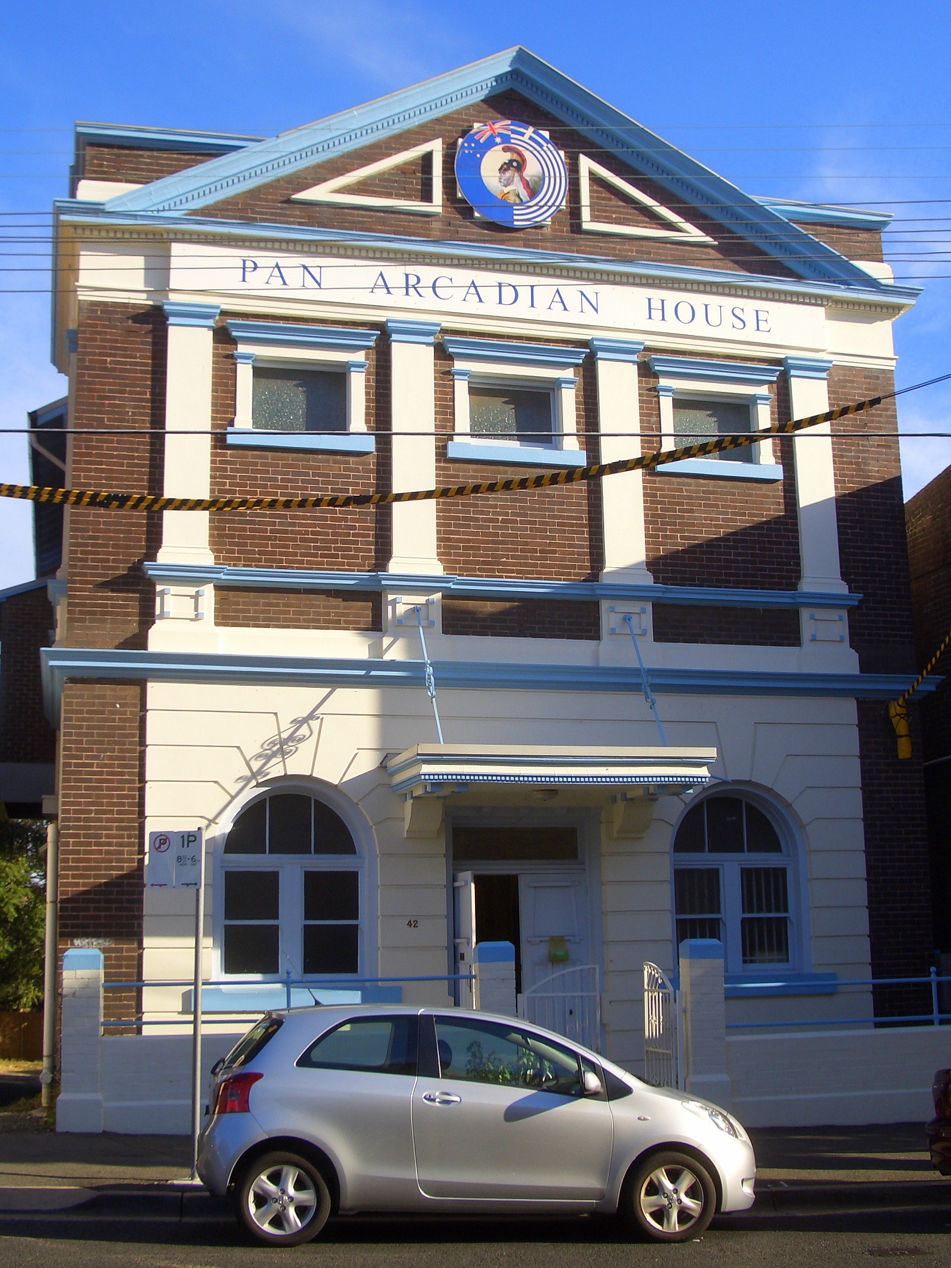
The Spot is a locality in south-eastern Sydney, New South Wales, Australia. The Spot is located in the south-eastern part of the suburb of Randwick, around the intersection of Perouse Road and St Pauls Street. It is a vibrant part of Randwick and consists of a collection of shops, restaurants, cafes and a cinema. The Spot is a heritage conservation area and has many heritage listed buildings, such as the Ritz Cinema and Pan Arcadian House, a 1930s Masonic Temple and most notably the facade of shops on the corner of Perouse Road and St Pauls Street which follows a curved pattern, necessary for the tram route which used to extend to Coogee Beach.Schedule 5, . The Royal Hotel and Randwick shopping centre are a short distance away. The area is well served by public transport with regular buses from the Sydney CBD and Bondi Junction. Name The Spot lies at the geographic centre of a residential suburb that some maps identify as “St Pauls”. The post office located at The Spo ... [...More Info...] [...Related Items...] OR: [Wikipedia] [Google] [Baidu] |
Coogee, New South Wales
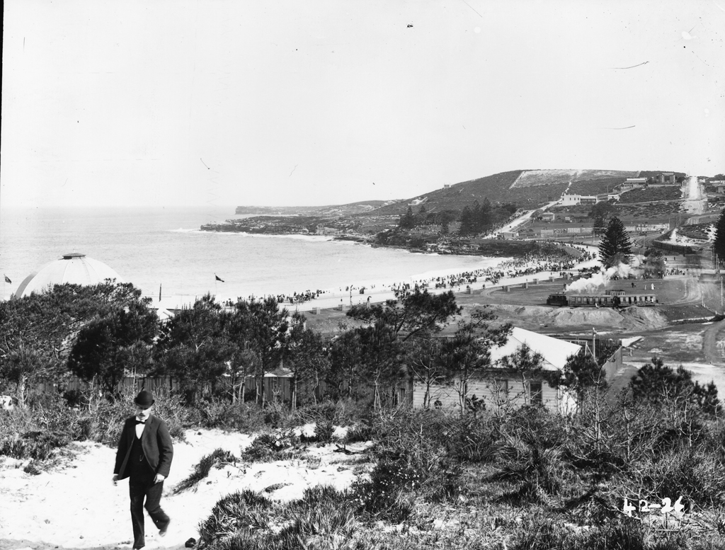
Coogee is a beachside suburb of local government area City of Randwick 8 kilometres south-east of the Sydney central business district, in the state of New South Wales, Australia. It is typically associated as being part of the Eastern Suburbs region. The Tasman Sea and Coogee Bay along with Coogee Beach lie towards the eastern side of the suburb. The boundaries of Coogee are formed mainly by Clovelly Road, Carrington Road and Rainbow Street, with arbitrary lines drawn to join these thoroughfares to the coast in the north-east and south-east corners. History Aboriginal The name Coogee is said to be taken from a local Aboriginal word ''koojah'' which means "smelly place". Another version is ''koo-chai'' or ''koo-jah'', both of which mean "the smell of the seaweed drying" in the Bidigal language, or "stinking seaweed", a reference to the smell of decaying kelp washed up on the beach. Early visitors to the area, from the 1820s onwards, were never able to confirm exactl ... [...More Info...] [...Related Items...] OR: [Wikipedia] [Google] [Baidu] |
